
Planning a journey to Ardanuç, Artvin? This comprehensive 2026 History & Culture guide brings together 10 verified landmarks, natural wonders, and cultural heritage sites with official visiting hours, GPS coordinates, public transit connections, and local gastronomy recommendations.
Quick Highlights & Discovery Route in Ardanuç, Artvin
- Gevhernik Castle (Historical Ardanuç Castle)
- Ferhatlı Castle (Ahıza Castle)
- Historical Iskender Pasha Mosque and Tombs (Adakale)
- Rabat Church & Monastery (Bulanık Village)
- Adakale Historical Bath and Fountain
- Geçitli (Garkloba) Village Historical Wooden Mosque
- Pucuko
- Borcka Iron Apple
Historical Landmarks, Architecture & Cultural Heritage in Ardanuç, Artvin
Ardanuç, Artvin (Artvin) preserves a multi-layered historical fabric shaped by centuries of Anatolian civilizations, including Roman, Byzantine, Seljuk, and Ottoman eras. Historic castles, stone bridges, caravanserais, civil mansions, and monumental structures reflect the strategic and cultural importance of Ardanuç, Artvin.
Walking through the historic quarters of Ardanuç, Artvin allows visitors to observe traditional masonry, timber-framed architecture, and restored heritage buildings up close.
- Architectural Details: Pay attention to carved stone portals, historic fountains, courtyard mansions, and defensive bastions across Ardanuç, Artvin.
- Best Visiting Hours: Early morning and late afternoon golden light offer the best conditions for architectural photography and crowd-free exploration.
- Cultural Etiquette & Preservation: Respect restoration zones and signage at registered historical monuments in Ardanuç, Artvin.
Top Verified History & Culture & Must-See Landmarks in Ardanuç, Artvin
1. Gevhernik Castle (Historical Ardanuç Castle)

Free Public Access • GPS: 41.1274, 42.0545
History and General Information / Local Legends and Folklore
Gevhernik Castle was built in the 5th century AD during the Georgian Bagratid Kingdom and was the capital and administrative center of the region for many years. The castle, which was annexed to the Ottoman lands in the 16th century during the reign of Suleiman the Magnificent, consists of two main parts: the inner and outer castle. According to popular rumor, there are secret water tunnels and vaulted cellars leading down to the Ardanuç Stream under the castle. The castle, which was used as the sanjak center of Çıldır Province during the Ottoman period, has been considered the most important lock of the Caucasus passages throughout history.
Geographical Structure, Altitude and Natural Features
The castle was built on a steep and steep andesite rocky mass in the Adakale area, at an altitude of approximately 880 meters above sea level. Surrounded by deep cliffs on three sides, the hill provides a strategic panoramic view overlooking the city.
Visiting Hours, Days and Entrance Fees
- Entrance Fee: Free.
- Visiting Hours and Days: Open 24 hours a day, 7 days a week; It is recommended to visit in daylight.
- Rules, Safety and Stroller/Disabled Access: Not suitable for strollers and wheelchairs due to steep rocks and stone steps; Sturdy walking shoes should be worn.
- Facilities and Facilities: There are fountains, historical coffee houses and information boards in the historical streets of Adakale.
Transportation, Public Transit Routes and Exact Location
- Address / Open Location: Adakale District, Kale Yolu Mevkii, Ardanuç / Artvin.
- Road Condition and Vehicle Suitability: It is 2.5 km away from Ardanuç district center, and you can reach the foot of the castle by passenger vehicle via an asphalt and cobblestone road.
- Real Public Transportation Information: It can be reached by neighborhood minibuses going from Ardanuç center to Adakale or by a 20-minute walk from the center.
- Parking Availability: There is a free parking area in Adakale square at the foot of the castle.
Contextual Experience Tips, Photography and Local Gastronomy
- Best Photography Points and Frames: Wide angle panoramic view from the historical stone towers of the castle, including the Ardanuç valley and Adakale historical wooden houses.
- Light and Shooting Hours: The golden hour when the valley turns red at sunset (17:30 - 19:00).
- Local Gastronomy Recommendations: Village tandoori bread and Ardanuç plateau cheese should be tried around Adakale.
Explore Full 5-Section Guide & Map for Gevhernik Castle (Historical Ardanuç Castle) →
2. Ferhatlı Castle (Ahıza Castle)

Free Public Access • GPS: 41.1429, 42.0112
History and General Information / Local Legends and Folklore
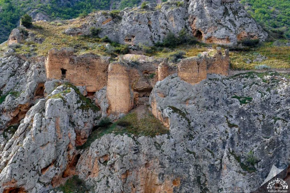
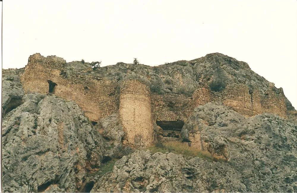
Ferhatlı Castle (historically known as Ahıza Castle), built on a steep main rock mass above the Ardanuç Suyu (Bulanık Stream) canyon, 5 kilometers west of the Ardanuç district center, is a well-established medieval fortification built by King Vahtang Gorgasal during the Iberian Kingdom in the 5th century. Famous traveler Evliya Çelebi refers to this magnificent structure as 'Harbe Castle' in his Seyahatname. Among the local people, the castle is considered to be the setting of the famous 'Ferhat and Şirin' epic, which lives on in Eastern Anatolia and Caucasian legends. According to the rumor, the sad love of Ferhat and Şirin, who pierced the steep rocks to meet their lovers, echoed in this valley, and the name of the castle was inherited from this legendary lover.
Geographical Structure, Altitude and Natural Features
It is located on the steep limestone cliffs of the Ardanuç Suyu valley, at an altitude of approximately 520 meters above sea level. It is surrounded by wild junipers, oak groves and steep canyon slopes; It offers a strategic field of view extending from the castle to the valley floor.
Visiting Hours, Days and Entrance Fees
- Entrance Fee: Seeing the historical castle from the outside and walking around it is completely free.
- Visiting Hours and Days (Mandatory): Open 7 days a week from sunrise to sunset; In winter months, attention should be paid to rocky paths.
- Rules, Security and Baby Stroller/Disabled Access: Since it is located on a steep and steep rock mass, the interior should not be entered uncontrolled for security reasons, and non-slip trekking shoes should be preferred for navigation. Since the ground is uneven, it is not suitable for baby strollers and wheelchairs.
- Facilities and Facilities: It is a historical untouched protected area; Basic needs should be met from Ardanuç district center, which is 5 km away.
Transportation, Public Transit Routes and Exact Location
- Address / Open Location: Ferhatlı Köyü Mevkii, Artvin-Ardanuç Highway 5th km, 08900 Ardanuç / Artvin.
- Road Condition and Vehicle Suitability: It is on the Artvin - Ardanuç highway, at the Ferhatlı village turnout; It can be easily reached by passenger vehicles via the asphalt road to the foothills of the castle.
- Real Public Transportation Information (Mandatory): District cooperative minibuses operating between Artvin Central Bus Terminal and Ardanuç Bus Terminal drop off passengers at the crossroads of the castle.
- Parking Availability: There are large pockets where vehicles can be parked at the roadside and at the beginning of the village road.
Contextual Experience Tips, Photography and Local Gastronomy
- Best Photography Points and Frames: Silhouette photos of the castle, which sits on the steep main rock like an eagle's nest, when viewed from the Artvin-Ardanuç highway, where it meets the canyon.
- Light and Shooting Times: Valley fog in the early morning and warm sunlight hitting the rocks in the afternoon.
- Visiting Time: Spring and autumn months; Seasons when the water on the valley floor flows vigorously and the air is cool are ideal.
- Local Gastronomy Recommendations: After the visit, the famous Ardanuç cağ döner kebab cooked on wood fire in Ardanuç center and baked lavash bread.
Explore Full 5-Section Guide & Map for Ferhatlı Castle (Ahıza Castle) →
3. Historical Iskender Pasha Mosque and Tombs (Adakale)

Free Public Access • GPS: 41.1261, 42.0618
History and General Information / Local Legends and Folklore
İskender Pasha Mosque was built in 1551 by Erzurum Beylerbeyi Çerkes İskender Pasha, following the Ottoman conquest of Ardanuç Castle. It is one of the first Ottoman monumental religious buildings in the region. Immediately in the graveyard of the mosque, there are historical stone mausoleums belonging to İskender Pasha's family, Hatice Hanım and Ottoman sanjak lords. The mosque is a rare representative of Ottoman classical architecture in the Eastern Black Sea region, with its cut stone workmanship and wooden ceiling decorations.
Geographical Structure, Altitude and Natural Features
It is located at an altitude of 850 meters above sea level, within the historical protected area of Adakale, among centuries-old plane trees and green gardens.
Visiting Hours, Days and Entrance Fees
- Entrance Fee: Free.
- Visiting Hours and Days: It is open for worship and visits 7 days a week, from morning adhan to night prayer.
- Rules, Security and Baby Stroller/Disabled Access: The mosque courtyard is level and suitable for disabled and stroller access. Attire appropriate to worship etiquette is required.
- Facilities and Facilities: There is a fountain, ablution room, WC and historical fountain.
Transportation, Public Transit Routes and Exact Location
- Address / Open Location: Adakale Mahallesi Camii Sokak, Ardanuç / Artvin.
- Road Condition and Vehicle Suitability: It is 2 km away from Ardanuç district center and is an asphalt and interlocking paved road; Suitable for passenger vehicles.
- Real Public Transportation Information: It is easily accessible by Adakale minibuses departing from the district center.
- Parking Availability: There is free parking for 20 vehicles in the mosque square.
Contextual Experience Tips, Photography and Local Gastronomy
- Spiritual Visit and Prayer Etiquette: Fatiha should be recited for the souls of Iskender Pasha and the veterans buried in the historical burial ground; The wooden pulpit and ceiling workmanship inside the mosque should be examined calmly.
- Documentary & Respectful Shooting: Tombstones and inscriptions with Ottoman stonework should be documented with dignity.
- Local Spiritual Tradition: On Fridays and holy nights, local people serve halva and Turkish delight.
Explore Full 5-Section Guide & Map for Historical Iskender Pasha Mosque and Tombs (Adakale) →
4. Rabat Church & Monastery (Bulanık Village)

Free Public Access • GPS: 41.0746, 42.1657
History and General Information / Local Legends and Folklore
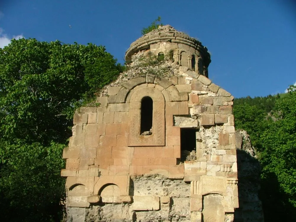
Rabat Church (Bulanık Monastery) is a magnificent monastery complex built during the medieval Bagratid Kingdom (10th century). It attracts attention with its cut stone architecture, dome structure and relief stone motifs on its facades. It is rumored among the local people that it is the center of the monks who protect the ancient trade routes in the region and that the monastery is famous for its rich library.
Geographical Structure, Altitude and Natural Features
It is located at an altitude of approximately 1150 meters above sea level, in Çamlık locality of Bulanık Village, on a forested slope and on a plain overlooking the valley floor. Its surroundings are covered with rich pine and fir forests.
Visiting Hours, Days and Entrance Fees
- Entrance Fee: Free.
- Visiting Hours and Days: Open 7 days a week during daylight hours.
- Rules, Safety and Stroller/Disabled Access: Climbing on historical ruins is prohibited; Since it involves walking on a path, it is not suitable for strollers and disabled chairs.
- Facilities and Facilities: It is a natural protected area; There are no commercial facilities, basic needs must be met from the village center.
Transportation, Public Transit Routes and Exact Location
- Address / Open Location: Bulanık Village, Çamlık Mahallesi, Ardanuç / Artvin.
- Road Condition and Vehicle Availability: It is 15 km away from Ardanuç town centre; There is a stabilized mountain road, you can drive with caution in dry weather, 4x4 vehicles are preferred.
- Real Public Transportation Information: Bulanık village cooperative vehicles depart from the district center on certain days of the week.
- Parking Availability: There is a free open car parking area at the path entrance near the church.
Contextual Experience Tips, Photography and Local Gastronomy
- Best Photography Spots and Frames: Detailed angles showing the forest valley through the surviving dome arches of the monastery and relief reliefs on the stone walls.
- Light and Shooting Hours: Early morning hours when the sun filters through the church window (08:30 - 10:30).
- Local Gastronomy Recommendations: Natural chestnuts and plateau honey produced in Bulanık village should be tasted.
Explore Full 5-Section Guide & Map for Rabat Church & Monastery (Bulanık Village) →
5. Adakale Historical Bath and Fountain
Free Public Access • GPS: 41.1271, 42.0562
History and General Information / Local Legends and Folklore
Located in the Adakale urban archaeological site, approximately 25 meters southeast of the İskender Pasha Mosque complex, the Historical Adakale Bath and Ottoman Fountain are the most important witnesses of the 18th century classical Ottoman period foundation water architecture in Ardanuç. The bathhouse was built with rubble stone and cut stone; It consists of dressing room, warm room, domed heat and furnace sections. The historical cut stone fountain and medieval cistern ruins located right next to the bath symbolize Ardanuç's deep-rooted cleanliness and water culture on the Silk Road. In local legends, it is said that the waters of the bath are fed by a healing spring water boiling from the rocks under Gevhernik Castle and that it revived the tired caravan passengers.
Geographical Structure, Altitude and Natural Features
It is located on the southern outskirts of Gevhernik Castle, at an altitude of approximately 570 meters above sea level. Its surroundings are adorned with historical castle walls, centuries-old cypress and mulberry trees, and archaeological excavation sites.
Visiting Hours, Days and Entrance Fees
- Entrance Fee: Visiting the historical bath and fountain is completely free.
- Visiting Hours and Days (Mandatory): Open 24 hours a day, 7 days a week; It is recommended to visit in daylight.
- Rules, Safety and Stroller/Disabled Access: It is an archaeological site; Historical walls and stone cavities should not be climbed. The outside area is level and can be examined by strollers and wheelchairs.
- Facilities and Facilities: The fountain, WC and resting benches in the courtyard of İskender Pasha Mosque can be used.
Transportation, Public Transit Routes and Exact Location
- Address / Open Location: Adakale District, Kale Street, Next to İskender Paşa Mosque, 08900 Ardanuç / Artvin.
- Road Condition and Vehicle Availability: It can be reached by any passenger vehicle in 3 minutes via the asphalt and cobblestone road from Ardanuç center to Adakale.
- Actual Public Transportation Information (Mandatory): It can be reached by minibuses departing from the district center towards Adakale or by a 15-minute walk.
- Parking Availability: There is a free car parking area in the square in front of the mosque and Turkish bath.
Contextual Experience Tips, Photography and Local Gastronomy
- Best Photography Points and Frames: Angles that combine the stone dome ruins of the historical bath with the majestic Gevhernik Castle walls behind it in the same frame.
- Light and Shooting Times: The golden light hitting the castle walls in the early morning and afternoon.
- Visiting Time: Spring, summer and autumn months; Ideal for historical outdoor excursions.
- Local Gastronomy Recommendations: Brewed tea and famous Ardanuç katmeri at the historical square cafe.
Explore Full 5-Section Guide & Map for Adakale Historical Bath and Fountain →
6. Geçitli (Garkloba) Village Historical Wooden Mosque
Free Public Access • GPS: 41.0388, 42.2410
History and General Information / Local Legends and Folklore
Geçitli Village Mosque is an original Black Sea village mosque built in the late 19th century Ottoman period with wooden bell technique and eye-catching carved motifs. The herbal root dyed wood carvings on the mihrab, pulpit and pavilion ceiling reflect the superior art of local wood craftsmen.
Geographical Structure, Altitude and Natural Features
It is in the center of the historical Geçitli Village settlement, surrounded by forests on the mountain slope, at an altitude of 1350 meters above sea level.
Visiting Hours, Days and Entrance Fees
- Entrance Fee: Free.
- Visiting Hours and Days: It is open to visitors 7 days a week during prayer times and daylight hours.
- Rules, Safety and Baby Stroller/Disabled Access: Must enter without shoes to protect the wooden floor and historical texture.
- Facilities and Facilities: There is an ablution facility, fountain and village square fountain.
Transportation, Public Transit Routes and Exact Location
- Address / Open Location: Geçitli Village Internal Road, Ardanuç / Artvin.
- Road Condition and Vehicle Suitability: It is 22 km away from Ardanuç center and is a winding asphalt and stabilized village road; You can drive with caution in passenger vehicles.
- Real Public Transportation Information: Geçitli village minibuses operate from Ardanuç center in the morning and evening.
- Parking Availability: Free parking is available in the village square.
Contextual Experience Tips, Photography and Local Gastronomy
- Spiritual Visit and Prayer Etiquette: Prayer should be performed in the historical wooden mosque and prayers should be made for the past of the village.
- Documentary & Respectful Shooting: Wooden ceiling carvings and madder painted pulpit details should be shot.
- Local Spiritual Tradition: The village people are famous for their hospitality and serve tea and plateau.
Explore Full 5-Section Guide & Map for Geçitli (Garkloba) Village Historical Wooden Mosque →
7. Hell Creek Canyon & Glass Terrace

Free Public Access • GPS: 41.1333, 42.0475
History and General Information / Local Legends and Folklore
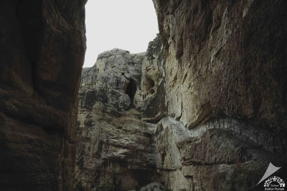
The Hell Creek Canyon, which is considered one of the deepest and most magnificent canyon valleys in the world, was formed by the branches of the Ardanuç Stream splitting the karstic limestone masses over millions of years. It is called "Hell Creek" by the local people due to the steep crevices of the valley floor that do not see the sun and the buzzing sounds made by the wind on the canyon walls. The canyon, which is a difficult crossing point of the historical Silk Road and Caucasian caravan routes, has served as a natural shelter and defense line throughout history with its steep cliffs.
Geographical Structure, Altitude and Natural Features
The canyon is located at an altitude of approximately 550 - 900 meters above sea level. The height of the canyon walls, whose width narrows to 1-2 meters at some points, exceeds 200 meters. The vertical canyon corridor formed by karst limestone and andesite rocks hosts wild goats, golden eagles and rare Caucasian plant species with its microclimate feature.
Visiting Hours, Days and Entrance Fees
- Entrance Fee: Canyon hiking trail is free; The glass observation deck and facility entrance are subject to a symbolic municipal tariff.
- Visiting Hours and Days: It is open to visitors 7 days a week between 08:30 - 19:30.
- Rules, Safety and Baby Stroller/Disabled Access: Trekking shoes with non-slip soles are mandatory due to the stony and rocky ground inside the canyon. In rainy weather, the narrow crevices of the canyon should not be entered due to the risk of rockfall; The glass terrace is suitable for disabled access, but the inside of the canyon is not suitable for strollers.
- Facilities and Facilities: There is a glass observation deck, cafeteria, viewing balconies, parking lot, WC and resting pergolas.
Transportation, Public Transit Routes and Exact Location
- Address / Open Location: Artvin - Ardanuç Highway 25th km, Çevre Deresi Mevkii, Ardanuç / Artvin.
- Road Condition and Vehicle Availability: It is 32 km from Artvin city center and 7 km from Ardanuç district center; It can be easily reached by passenger vehicle via a fully divided and hot asphalt road.
- Real Public Transportation Information: Ardanuç - Artvin district minibuses depart every hour from Artvin Bus Terminal and Ardanuç District Square and drop off passengers at the bridge stop at the canyon entrance.
- Parking Availability: There is a free parking area for 60 vehicles at the entrance of the canyon and around the observation terrace.
Contextual Experience Tips, Photography and Local Gastronomy
- Best Photography Points and Frames: Vertical angles showing the 200-meter deep cleft of the canyon from the glass observation deck, and perspective frames where the sky appears as a line in the narrow stone corridors at the canyon floor.
- Light and Shooting Hours: The hours between 11:30 - 14:00, when the sun's rays reach the canyon cleft directly perpendicular, are ideal for shooting.
- Local Gastronomy Recommendations: You should try the famous lamb cağ kebab, Ardanuç honey and local corn bread in Ardanuç town centre.
Explore Full 5-Section Guide & Map for Hell Creek Canyon & Glass Terrace →
8. Bilbilan Plateau & Traditional Plateau Market

Free Public Access • GPS: 41.0633, 42.3078
History and General Information / Local Legends and Folklore
Bilbilan Plateau is a historical trade and cultural center where plateauers, shepherds and merchants from the provinces of Artvin, Ardahan and Erzurum have met for centuries. The famous "Bilbilan Market", held every summer, is one of the oldest open-air highland markets in the region. There are many shepherd stories and migration legends in the region about the rich pastures and healing spring waters of the plateau.
Geographical Structure, Altitude and Natural Features
The altitude of the plateau is between 2400 - 2650 meters. It offers views of alpine meadows, colorful highland flowers, glacial ponds and the vast Taurus/Caucasus mountain ranges. Even in the summer months, a cool and refreshing plateau climate prevails.
Visiting Hours, Days and Entrance Fees
- Entrance Fee: Free.
- Visiting Hours and Days: Open 24 hours a day, 7 days a week; The historical market is usually held on Saturdays.
- Rules, Safety and Baby Stroller/Disabled Access: Due to the high altitude, warm clothes and a raincoat should be carried against sudden weather changes; It is suitable for camping and tenting.
- Facilities and Facilities: There are village grocery stores, plateau restaurants, fountains and masjids open during the plateau season.
Transportation, Public Transit Routes and Exact Location
- Address / Open Location: Bilbilan Yaylası Mevkii, Ardanuç / Artvin.
- Road Condition and Vehicle Availability: It is approximately 48 km away from Ardanuç town centre; It is a winding mountain and plateau road and is suitable for passenger vehicles in the summer months.
- Real Public Transportation Information: During the summer season, seasonal minibuses and market shuttles operate from the district center.
- Parking Availability: Unlimited free car parking is available on the plateau plain.
Contextual Experience Tips, Photography and Local Gastronomy
- Best Photography Spots and Frames: Authentic views of the sea of clouds and plateau houses from the plateau hills.
- Light and Shooting Hours: Golden hour light as the fog lifts in the early morning or at sunset.
- Local Gastronomy Recommendations: Bilbilan butter, fresh clotted cream, migration kuymak and roasted lamb should definitely be tried.
Explore Full 5-Section Guide & Map for Bilbilan Plateau & Traditional Plateau Market →
9. Ardanuç Culture House and Ethnography Mansion
Free Public Access • GPS: 41.1191, 42.0664
History and General Information / Local Legends and Folklore
Located in Adakale, the historical administrative center of Ardanuç, Ardanuç Culture House was opened to visitors in 2019 after the original restoration of a historical mansion, one of the most elegant examples of late 19th century Ottoman civil architecture. The mansion attracts attention with its traditional wooden frame, stone foundation and bay window structure; It exhibits the centuries-old life culture of the region, hand weavings, agricultural and livestock tools, copper kitchenware and traditional Ardanuç clothing. In the narratives of local elders, it is stated that the mansion was an important cultural hearth where local notables gathered, folk stories were told and meşk nights were organized in ancient times.
Geographical Structure, Altitude and Natural Features
It is located on the sheltered slope of the Adakale historical protected area, at an altitude of approximately 560 meters above sea level. It is surrounded by centuries-old mulberry and walnut trees, historical stone streets and traditional residential fabric.
Visiting Hours, Days and Entrance Fees
- Entrance Fee: Entrance to the Culture House and examining the ethnographic collection on display are completely free.
- Visiting Hours and Days (Mandatory): Open 6 days a week between 09:00 - 17:00, except Mondays; It operates on public holidays.
- Rules, Safety and Stroller/Disabled Access: Historic wooden floors and stairs must be preserved; You may be asked to wear overshoes. The ground floor is flat and suitable for strollers, and the upper living floor is accessed via a wooden staircase.
- Facilities and Facilities: There are exhibition rooms, authentic oriental room, information boards and a relaxation garden.
Transportation, Public Transit Routes and Exact Location
- Address / Open Location: Adakale Mahallesi, Tarih Konaklar Sokak No:12, 08900 Ardanuç / Artvin.
- Road Condition and Vehicle Suitability: It can be easily reached by all passenger vehicles via the 1.5 kilometer cobblestone and asphalt road from Ardanuç district center towards Adakale.
- Real Public Transportation Information (Mandatory): It can be reached by Adakale neighborhood shuttles departing from the district center or by a pleasant 15-minute walk from the center.
- Parking Availability: Free parking is available in front of the Culture House and in Adakale Square.
Contextual Experience Tips, Photography and Local Gastronomy
- Featured Rare Artifacts & Exhibition Tips: Traditional Ardanuç wooden churn and butter molds, madder-dyed hand-woven rugs, Ottoman-era copper trays and authentic bedchamber arrangement.
- Culture & Coffee Stops around the Museum: After the visit, you can drink samovar tea under the historical plane tree in Adakale square.
- Visiting Time: It is open to visitors in all four seasons; It offers a wonderful cultural route when combined with the historical texture of Adakale, especially in spring and summer.
- Local Gastronomy Recommendations: Adakale homemade mulberry fruit pulp, walnut kete and buttermilk.
Explore Full 5-Section Guide & Map for Ardanuç Culture House and Ethnography Mansion →
10. Aydınköy Söğüt Düzü Plateau and Pond
Free Public Access • GPS: 41.0405, 42.1131
History and General Information / Local Legends and Folklore
Söğüt Düzü Plateau and Natural Pond, lying within the borders of the historical Aydın Village (formerly Danzot) in the southeast of Ardanuç; It is known for its mirror-like pond in the middle of lush pine forests, cool waters and traditional karakucak wrestling. 'Aydın Village Söğüt Düzü Plateau Festival', held every year in the summer months, brings together thousands of people from all over Artvin and surrounding provinces. Canoeing and nature sports activities are held around the pond, and the serenity of the plateau attracts nature lovers. According to local narratives, it is said that the water of the pond comes by filtering from the melting snow in the mountains and the roots of centuries-old fir trees, and that the breeze blowing on the shore of the pond prolongs life.
Geographical Structure, Altitude and Natural Features
It is a flat plateau valley located at an altitude of approximately 1,600 meters above sea level. There is a natural plateau pond in the middle; It is surrounded by Scots pine, fir, mountain poplar and willow trees.
Visiting Hours, Days and Entrance Fees
- Entrance Fee: Entrance to the plateau and the pond surroundings is completely free.
- Visiting Hours and Days (Mandatory): Open 24 hours a day, 7 days a week; It can be visited uninterruptedly from spring to autumn, except for winter conditions.
- Rules, Safety and Stroller/Disabled Access: The pond should not be entered without permission or swimming should not be done. The walking paths around the pond are flat and can be visited with a stroller. Those who set up tent camps should pay attention to fire rules.
- Facilities and Facilities: There are picnic tables, fountains, rest areas and local stands set up during the festival period on the shore of the pond.
Transportation, Public Transit Routes and Exact Location
- Address / Open Location: Aydın Village (Danzot) Söğütdüzü Mevkii, 08900 Ardanuç / Artvin.
- Road Condition and Vehicle Availability: It is approximately 20 km away from Ardanuç town centre; It can be reached in 40 minutes by passenger or off-road vehicle via a stabilized mountain road.
- Actual Public Transportation Information (Mandatory): Aydın Village minibuses depart from Ardanuç district center; Direct shuttles to the plateau are organized on festival days.
- Parking Availability: There are large natural vehicle parking areas around the pond.
Contextual Experience Tips, Photography and Local Gastronomy
- Best Photo Spots and Frames: Canoe views on the pond, with symmetrical reflections of pine trees and sky hitting the clear surface of the pond.
- Light and Shooting Times: The mirror reflection moment in the early morning when the wind dies down and the sunset colors in the evening.
- Visiting Time: June - September; It is the most enjoyable period for camping and hiking.
- Local Gastronomy Recommendations: Danzot village cheese, plateau potatoes cooked on wood fire, genuine Karakovan honey and corn flour halva.
Explore Full 5-Section Guide & Map for Aydınköy Söğüt Düzü Plateau and Pond →
What to Eat in Ardanuç, Artvin? Registered Local Delicacies & Gastronomy
A trip to Ardanuç, Artvin is incomplete without tasting its officially registered geographical indication products and centuries-old Anatolian recipes:
1. Pucuko (Yemekler ve çorbalar)
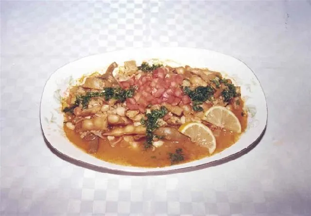
Puçuko is a geographically indicated value of ours, specific to the Artvin region and registered by the Turkish Patent and Trademark Office on 26.12.2017 (with registration number 303).
View Official Geographical Indication Dossier for Pucuko →
2. Borcka Iron Apple (İşlenmiş ve işlenmemiş meyve ve sebzeler ile mantarlar)
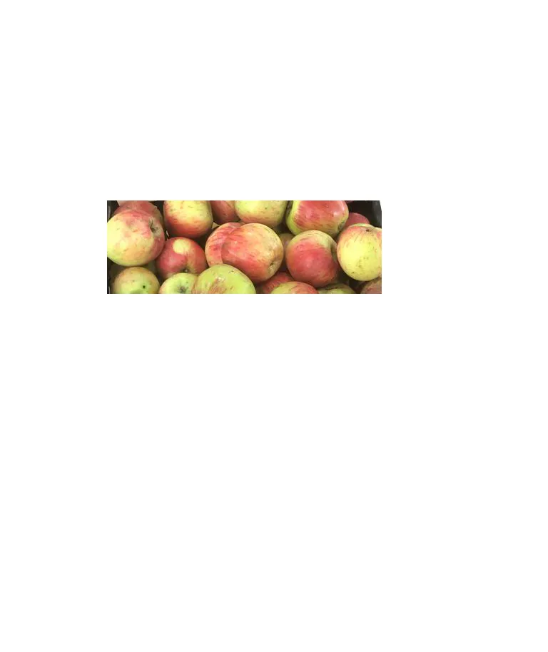
A registered apple grown in the Macahel Valley, with a texture as hard as a stone, juicy, and does not rot on the hanger throughout the winter.
History: UNESCO Biosphere Reserve The durable apple of the Macahel valley.
View Official Geographical Indication Dossier for Borcka Iron Apple →
3. Hopa Anchovy Bread (Fırıncılık ve pastacılık mamulleri, hamur işleri, tatlılar)
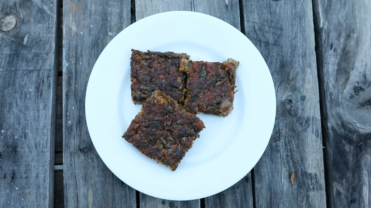
Fresh anchovy, corn flour, leek, chard and mint mixture fried like a pomegranate on a tray in a stone oven.
History: A century-old anchovy bread prepared by Black Sea fishermen after returning from the sea.
View Official Geographical Indication Dossier for Hopa Anchovy Bread →
4. Hatila Honey (Bal)
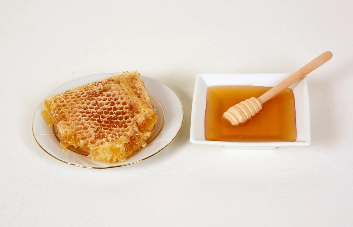
Hatila Honey is a geographically indicated value of ours with an official Origin Name, unique to the Artvin region and registered by the Turkish Patent and Trademark Office on 17.09.2021 (with registration number 893).
View Official Geographical Indication Dossier for Hatila Honey →
5. Arhavi Chestnut Honey (Bal)

Arhavi Chestnut Honey is a value with a geographical indication of its official Origin Name, unique to the Artvin region, registered by the Turkish Patent and Trademark Office on 10.11.2022 (with registration number 1252).
View Official Geographical Indication Dossier for Arhavi Chestnut Honey →
6. Arhavi Terminus (Fırıncılık ve pastacılık mamulleri, hamur işleri, tatlılar)

Arhavi Terminus is an official Geographically Indicated value specific to the Artvin region, registered by the Turkish Patent and Trademark Office on 05.05.2025 (with registration number 1732).
View Official Geographical Indication Dossier for Arhavi Terminus →
Practical Travel & Transit Planning for Ardanuç, Artvin (2026)
| Planning Category | Verified Local Information |
|---|---|
| Region & Administrative Center | Ardanuç, Artvin, Türkiye |
| Best Time to Visit | Spring (April–June) and Autumn (September–November) for ideal sightseeing weather; Summer for highlands and coastal routes. |
| Public Transit & Highway Access | Regular municipal buses and local minibus cooperatives (Dolmuş) depart daily from the Artvin Intercity Bus Terminal (Otogar) directly to Ardanuç. |
| Recommended Stay | 1 to 2 full days to explore the main historical landmarks, nature trails, and local culinary stops. |
Frequently Asked Questions About Visiting Ardanuç, Artvin
What are the must-see places to visit in Ardanuç, Artvin?
The top verified attractions in Ardanuç, Artvin include Gevhernik Castle (Historical Ardanuç Castle), Ferhatlı Castle (Ahıza Castle), Historical Iskender Pasha Mosque and Tombs (Adakale), Rabat Church & Monastery (Bulanık Village), Adakale Historical Bath and Fountain. Each location offers documented historical or natural heritage with clear road access.
How can I get to Ardanuç, Artvin by public transport or car?
You can reach Ardanuç, Artvin easily by car via Artvin's main provincial highways, or take regular municipal buses and district minibuses departing throughout the day from the Artvin central bus terminal (Otogar).
What are the famous local dishes and traditional foods to try in Ardanuç, Artvin?
When visiting Ardanuç, Artvin and Artvin, be sure to taste officially registered specialties such as Pucuko, Borcka Iron Apple, Hopa Anchovy Bread, Hatila Honey, Arhavi Chestnut Honey, prepared by local artisans and traditional restaurants.
Are the attractions in Ardanuç, Artvin suitable for families and day trips?
Yes. Most historic monuments, parks, museums, and promenade areas in Ardanuç, Artvin are family-friendly and well-suited for both weekend getaways and full-day cultural itineraries.
When is the best season to visit Ardanuç, Artvin?
Spring and autumn offer the most comfortable temperatures for walking tours and photography in Ardanuç, Artvin, while summer is popular for nature recreation, plateaus, and festivals.