
Planning a journey to Kemalpaşa, Artvin? This comprehensive 2026 Places to Visit guide brings together 10 verified landmarks, natural wonders, and cultural heritage sites with official visiting hours, GPS coordinates, public transit connections, and local gastronomy recommendations.
Quick Highlights & Discovery Route in Kemalpaşa, Artvin
- Makriyali Church and Castle Ruins
- Üçkardeş (Akdere) Waterfall & Valley
- Osmaniye Historical Stone Arch Bridge
- Kaya Village and Plateau Nature Route
- Sarp Village Historical Mosque and Border Observation Hill
- Sarp Border Gate & Zero Point Observation Area
- Pucuko
- Borcka Iron Apple
Natural Wonders, Valleys, Plateaus & Eco-Discovery in Kemalpaşa, Artvin
Kemalpaşa, Artvin (Artvin) captivates nature lovers with its unspoiled valleys, lush forests, high plateaus (yaylalar), canyons, and diverse flora. Each season transforms the landscapes of Kemalpaşa, Artvin, from vibrant spring blossoms to golden autumn foliage.
- Seasonal Highlights: Spring (April–June) brings rushing streams and wildflowers, while autumn (October–November) turns the forests around Kemalpaşa, Artvin into a photographer's paradise.
- Outdoor Preparedness: Wear layered clothing, carry sufficient drinking water, and download offline maps before venturing into rural trails in Kemalpaşa, Artvin.
- Eco-Conscious Travel: Protect the natural habitats of Kemalpaşa, Artvin by leaving zero waste and staying on marked paths.
Top Verified Places to Visit & Must-See Landmarks in Kemalpaşa, Artvin
1. Makriyali Church and Castle Ruins

Free Public Access • GPS: 41.4813, 41.5290
History and General Information / Local Legends and Folklore
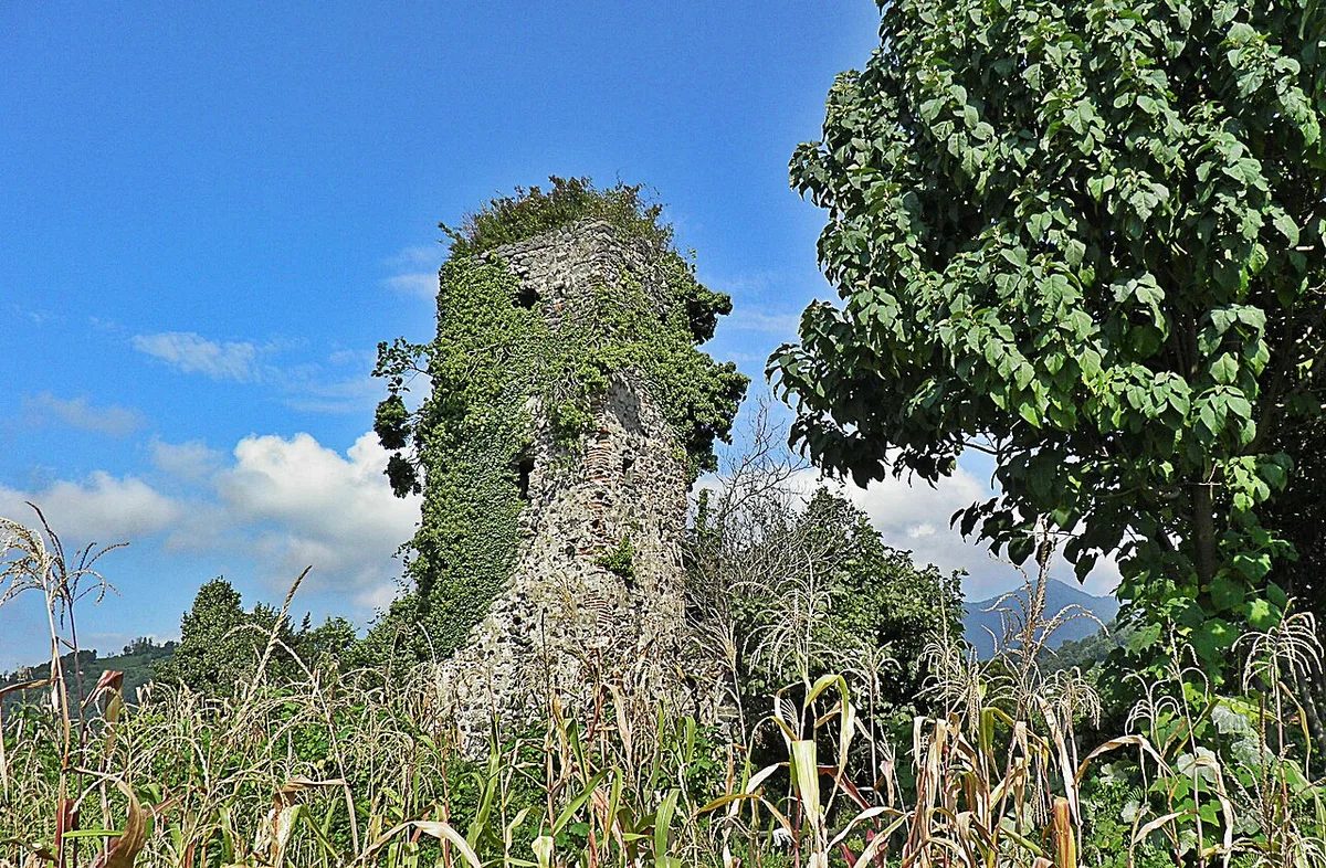
Ruins of Makriyali Church and Castle, rising on a dominant slope overlooking the Black Sea coast and valleys, in Makriyali (Noğedi), the old name of Kemalpaşa district center; It is the most established stone architectural monument of the region, dating back to the Middle Ages of the Georgian Kingdom and the Byzantine period (9th - 10th centuries). The apse walls, arch ruins and cut stone masonry of the castle walls of the single-nave basilical planned church have survived to the present day. According to local legends, it is said that there are watchtowers that serve as lighthouses in this castle, which protects the coastal caravan route and guides Black Sea sailors at night.
Geographical Structure, Altitude and Natural Features
It is located on a green hillside overlooking the Black Sea coast, at an altitude of approximately 120 meters above sea level. Its surroundings are covered with emerald green tea gardens, tangerine trees, chestnuts and wild ivy.
Visiting Hours, Days and Entrance Fees
- Entrance Fee: Visiting the historical church and castle ruins is completely free.
- Visiting Hours and Days (Mandatory): It is open to visitors 7 days a week from sunrise to sunset.
- Rules, Safety and Stroller/Disabled Access: It is an archaeological site; Historical stone walls should not be climbed and the stones should not be moved. The village road leading up to the hill is asphalt and comfortable shoes are recommended for the light path walking in the last section; It can be visited with assistance from a wheelchair.
- Facilities and Facilities: It is a historical untouched area; Basic needs can be obtained from Kemalpaşa district center, 1.5 km away.
Transportation, Public Transit Routes and Exact Location
- Address / Open Location: Noğedi Mahallesi, Tepe Sokak, 08700 Kemalpaşa / Artvin.
- Road Condition and Vehicle Availability: It can be reached in 5 minutes by any passenger vehicle via the asphalt road separated from Kemalpaşa center to the hill district.
- Real Public Transportation Information (Mandatory): It can be reached by walking from Kemalpaşa district center in 20 minutes or by taking the neighborhood minibuses to the hill turnoff.
- Parking Availability: There are open pockets on the roadside where vehicles can be parked.
Contextual Experience Tips, Photography and Local Gastronomy
- Best Photography Spots and Frames: Legendary deep angles that frame the endless blue of the Black Sea and tea gardens through the historical church apse arch.
- Light and Shooting Hours: The bright light of the morning and the shining lights hitting the sea at sunset.
- Visiting Time: Spring, summer and autumn months; The region is extremely lively during the tea harvest period.
- Local Gastronomy Recommendations: Fresh crispy anchovies, corn bread and Laz pastry at Kemalpaşa seaside restaurants after the visit.
Explore Full 5-Section Guide & Map for Makriyali Church and Castle Ruins →
2. Üçkardeş (Akdere) Waterfall & Valley
Free Public Access • GPS: 41.4936, 41.5292
History and General Information / Local Legends and Folklore
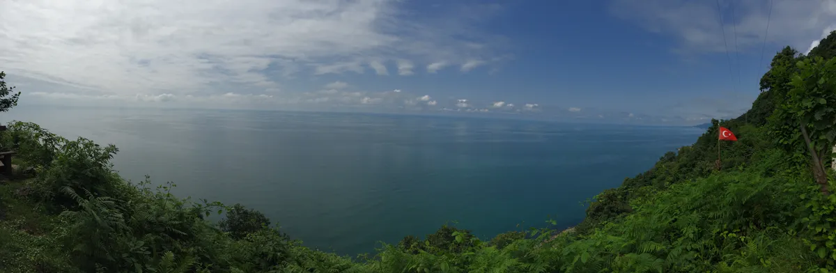
Üçkardeş Waterfall is a hidden waterfall that falls in three steps on the Akdere Stream. It is said among the local people that it symbolizes the brotherly union of three streams and water sources.
Geographical Structure, Altitude and Natural Features
It is located at an altitude of 280 meters above sea level, among rich subtropical vegetation and chestnut trees.
Visiting Hours, Days and Entrance Fees
- Entrance Fee: Free.
- Visiting Hours and Days: Open 7 days a week during daylight hours.
- Rules, Safety and Stroller/Disabled Access: Natural stream bottom; Be careful about slippery stones.
- Facilities and Facilities: There is a natural walking path.
Transportation, Public Transit Routes and Exact Location
- Address / Open Location: Akdere Village Road, Kemalpaşa / Artvin.
- Road Condition and Vehicle Availability: It is 5.5 km away from Kemalpaşa district center; It is an asphalt and concrete village road.
- Real Public Transportation Information: It can be reached by village minibuses or private vehicles.
- Parking Availability: There is an open parking area for 10 vehicles on the roadside.
Contextual Experience Tips, Photography and Local Gastronomy
- Best Photo Spots and Frames: Vertical angles showing three-stage water pouring.
- Light and Shooting Hours: Noon hours (11:30 - 14:30).
- Local Gastronomy Recommendations: Fresh highland honey and corn bread in the village.
Explore Full 5-Section Guide & Map for Üçkardeş (Akdere) Waterfall & Valley →
3. Osmaniye Historical Stone Arch Bridge

Free Public Access • GPS: 41.4723, 41.5400
History and General Information / Local Legends and Folklore
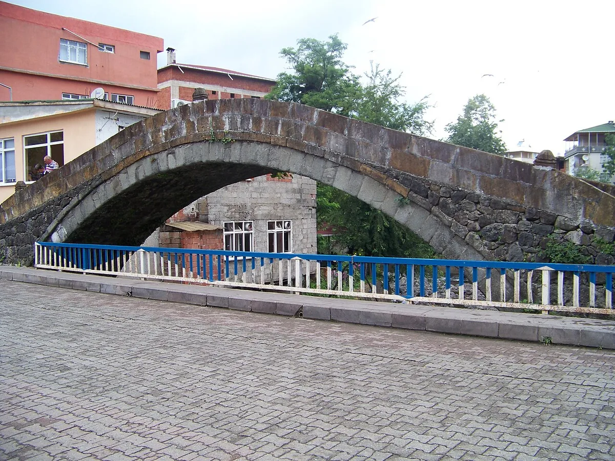
Osmaniye Arch Bridge is a single-eyed pointed arch stone bridge built over the Osmaniye Stream with 19th century Ottoman stone masonry. It has provided pedestrian and caravan transportation between the coast and mountain villages for centuries.
Geographical Structure, Altitude and Natural Features
It is located at an altitude of 140 meters above sea level, among lush green tea fields and hazelnut groves, on a clear stream bed.
Visiting Hours, Days and Entrance Fees
- Entrance Fee: Free.
- Visiting Hours and Days: Open 24 hours a day, 7 days a week.
- Rules, Safety and Stroller/Disabled Access: Pedestrian accessible; The historic stone surface can be slippery when wet.
- Facilities and Facilities: There is a village fountain and recreation area around the bridge.
Transportation, Public Transit Routes and Exact Location
- Address / Open Location: Inside Osmaniye Village, Kemalpaşa / Artvin.
- Road Condition and Vehicle Availability: It is 4 km away from Kemalpaşa town centre; It is a completely asphalt and concrete road.
- Real Public Transportation Information: It can be reached from Kemalpaşa center by Osmaniye village minibuses.
- Parking Availability: There is an open car park next to the bridge.
Contextual Experience Tips, Photography and Local Gastronomy
- Best Photography Spots and Frames: The perfect curve of the arch bridge from the streamside and the tea garden texture behind it.
- Light and Shooting Times: Early morning and late afternoon light.
- Local Gastronomy Recommendations: Fresh tea and homemade hazelnut bread in the village.
Explore Full 5-Section Guide & Map for Osmaniye Historical Stone Arch Bridge →
4. Kaya Village and Plateau Nature Route
Free Public Access • GPS: 41.5008, 41.5686
History and General Information / Local Legends and Folklore
Kaya Village and Plateau, located on the steep mountain slopes east of Kemalpaşa, parallel to the Georgian border line; It is known for its steep rock masses, traditional wooden houses and viewpoints overlooking the sea of clouds. The settlement, which takes its name from the majestic steep cliffs surrounding the village, has kept the Laz and Hemşin transhumance traditions alive for centuries. Local legends say that these rocks were the natural castles of border guards in ancient times and that the springs boiling from the rocks flowed warmly in winter and ice cold in summer.
Geographical Structure, Altitude and Natural Features
It is located on a steep mountain terrace at an altitude of approximately 550 meters above sea level. Its surroundings are covered with hornbeam, oak, Scots pine forests and wild mountain strawberries; It has a bird's eye view of the Black Sea coast.
Visiting Hours, Days and Entrance Fees
- Entrance Fee: Visiting the village and exploring the nature route is completely free.
- Visiting Hours and Days (Mandatory): It can be visited 7 days a week from sunrise to sunset.
- Rules, Safety and Stroller/Disabled Access: Driving with caution due to steep hillside roads; Trekking shoes are a must for rocky trails. It is not suitable for strollers and wheelchairs.
- Facilities and Facilities: It is a natural village environment; There are resting areas and village fountains, needs should be met from Kemalpaşa.
Transportation, Public Transit Routes and Exact Location
- Address / Open Location: Kaya Köyü Mevkii, Border Mountain Road, 08700 Kemalpaşa / Artvin.
- Road Condition and Vehicle Suitability: It can be reached via an 8-kilometer concrete and stabilized mountain road leaving Kemalpaşa center; Suitable for SUV type vehicles or passenger cars with careful driving.
- Actual Public Transportation Information (Mandatory): It can be reached by Kaya Village shuttles that depart from Kemalpaşa district center at certain hours.
- Parking Availability: There is a natural car parking area in the village square.
Contextual Experience Tips, Photography and Local Gastronomy
- Best Photo Spots and Frames: Panoramic shots that include the horizon of the Georgian coastline with the blue Black Sea below as seen from the rock peaks.
- Light and Shooting Hours: Early morning and sunset golden hour.
- Visiting Time: June - October; This is the period when the weather is clearest.
- Local Gastronomy Recommendations: Village-made roasted kale, buttermilk and roasted corn.
Explore Full 5-Section Guide & Map for Kaya Village and Plateau Nature Route →
5. Sarp Village Historical Mosque and Border Observation Hill
Free Public Access • GPS: 41.5170, 41.5450
History and General Information / Local Legends and Folklore
Sarp Village Historical Mosque, located on the hillside just above the historical Sarp Border Gate separating Turkey and Georgia, is the rarest spiritual symbol of the 19th century Ottoman period stone and wooden architecture along the border. The mosque on the Turkish side of the historical Sarp village, which was divided into two by the Moscow and Kars treaties of 1921; It offers a fascinating tranquility with its wooden carved decorations, root-painted ceiling core and windows overlooking the Black Sea. It is said among the local people that the call to prayer sounds of the border village merge with the waves of the Black Sea and that it is the symbol of the patriotism of the villagers who have been worshiping on this hill for centuries.
Geographical Structure, Altitude and Natural Features
It is located on a steep hillside, at an altitude of approximately 140 meters above sea level. In front of it lies the deep blue Black Sea, below it lies the Sarp border gate and the Georgian coast; The backside is covered with dense forests.
Visiting Hours, Days and Entrance Fees
- Entrance Fee: Visiting and praying in the historical mosque is completely free.
- Visiting Hours and Days (Mandatory): It is open 7 days a week, from morning adhan to night prayer.
- Rules, Safety and Stroller/Disabled Access: You can enter the mosque without shoes; Attention should be paid to the rules of decency. The mosque courtyard is flat and can be easily entered with baby strollers and wheelchairs.
- Facilities and Facilities: There is a fountain, ablution room, WC and a relaxation courtyard with a Black Sea view.
Transportation, Public Transit Routes and Exact Location
- Address / Open Location: Sarp Village Cami District, Border Gate Above, 08700 Kemalpaşa / Artvin.
- Road Condition and Vehicle Availability: Sarp Border Gate can be easily reached by any passenger vehicle via the 1.5 kilometer concrete village road that separates from the main highway to the village.
- Actual Public Transportation Information (Mandatory): You can take minibuses from Hopa and Kemalpaşa to Sarp Border Gate to arrive at the border gate and go to the village with a short taxi or walk.
- Parking Availability: There is a free car parking area in front of the mosque courtyard.
Spiritual Visiting Etiquette and Commemoration Guidelines
- Spiritual Visit and Prayer Etiquette: One should worship quietly in the silence of the border, perform the two-rakat tahiyyatu'l-masjid prayer and pray for the unity and well-being of the homeland.
- Documentary & Respectful Shooting: The border gate and the vast sea view visible from the mosque windows and the woodwork in the interior can be photographed with dignity.
- Important Commemoration Days: It is the spiritual meeting center of the border residents during Friday prayers and holy days.
- Local Spiritual Tradition: After the prayer, Black Sea hazelnuts, hard candy and strong tea are served to the congregation in the mosque courtyard.
Explore Full 5-Section Guide & Map for Sarp Village Historical Mosque and Border Observation Hill →
6. Sarp Border Gate & Zero Point Observation Area
Free Public Access • GPS: 41.5218, 41.5512
History and General Information / Local Legends and Folklore
Sarp Border Gate is the busiest international land border crossing point between Türkiye and Georgia. The border gate, opened in 1988, is the modern gate of the historical Silk Road opening to the Caucasus, Russia and Central Asia. At the zero point of the border, the waves of the Black Sea meet with the border line.
Geographical Structure, Altitude and Natural Features
It is located at sea level, in the coastal strait where steep mountains meet the sea.
Visiting Hours, Days and Entrance Fees
- Entrance Fee: The viewing and shopping area is free; International departures are subject to passport/ID and fees.
- Visiting Hours and Days: Provides uninterrupted service 24 hours a day, 7 days a week.
- Rules, Security and Stroller/Disabled Access: Photography rules in customs and security areas must be observed; Flat-footed facilities are suitable for disabled access.
- Facilities and Facilities: Duty-free shops, currency exchange offices, restaurants, cafeterias, parking and WC are available.
Transportation, Public Transit Routes and Exact Location
- Address / Open Location: Sarp Village, Kemalpaşa / Artvin.
- Road Condition and Vehicle Suitability: It is the last point of the Black Sea Coastal Road (D010) in Türkiye; It is a divided hot asphalt road.
- Real Public Transportation Information: Sarp minibuses operate every 15 minutes from Hopa and Kemalpaşa centre.
- Parking Availability: There are ample paid and free parking lots before the customs area.
Contextual Experience Tips, Photography and Local Gastronomy
- Best Photo Spots and Frames: Souvenir photos showing the Black Sea and Georgian coastal towers right next to the border stone.
- Light and Shooting Hours: Daytime and evening border lighting.
- Local Gastronomy Recommendations: Georgian pita (Hachapuri) and Turkish tea in restaurants around the border.
Explore Full 5-Section Guide & Map for Sarp Border Gate & Zero Point Observation Area →
7. Kemalpaşa Public Beach & Coastal Promenade
Free Public Access • GPS: 41.4735, 41.5351
History and General Information / Local Legends and Folklore
Kemalpaşa Beach is the longest and most popular natural pebble beach located on Türkiye's easternmost coastline on the Black Sea. The district, a few kilometers from the Georgian border, is known by its historical name Makriyali. It is a lively seaside center where locals and tourists meet the sea in the summer months.
Geographical Structure, Altitude and Natural Features
It is a wide beach strip at sea level, approximately 2.5 km long, a mixture of natural pebbles and fine sand. Sea water is extremely clear and clean.
Visiting Hours, Days and Entrance Fees
- Entrance Fee: Free.
- Visiting Hours and Days: Open 24 hours a day during summer months.
- Rules, Safety and Stroller/Disabled Access: The walking path along the promenade is level and suitable for strollers and disabled access; Lifeguard towers are available.
- Facilities and Facilities: There are changing cabins, showers, sun lounger/umbrella rental, beach cafes, children's playground and parking lot.
Transportation, Public Transit Routes and Exact Location
- Address / Open Location: Sahil Caddesi, Kemalpaşa / Artvin.
- Road Condition and Vehicle Suitability: It is on the Black Sea Coastal Road (D010); It can be reached directly by all vehicles.
- Real Public Transportation Information: Hopa - Kemalpaşa - Sarp minibuses operate regularly along the coast.
- Parking Availability: There is a free municipal parking lot for 150 vehicles along the beach.
Contextual Experience Tips, Photography and Local Gastronomy
- Best Photo Spots and Frames: View of the Black Sea and Georgian mountains at sunset from the beach promenade.
- Light and Shooting Hours: Evening sunset hours (18:30 - 20:00).
- Local Gastronomy Recommendations: Fresh haddock pancakes, corn bread and homemade Laz pastry at beach cafes.
Explore Full 5-Section Guide & Map for Kemalpaşa Public Beach & Coastal Promenade →
8. Köprücü Village and Valley Nature Walking Area
Free Public Access • GPS: 41.4730, 41.5492
History and General Information / Local Legends and Folklore
Köprücü Village and Valley, located in the inner valleys of Kemalpaşa; It is one of the purest corners of the Eastern Black Sea nature with its lush green tea gardens laid out step by step on steep slopes, gurgling mountain streams and centuries-old chestnut trees. The name of the village comes from the historical wooden and stone bridges that have been built over the streams in the valley for centuries. The valley, where local people make their living from tea farming, beekeeping and gardening, is a discovery route for Black Sea coastal walkers. According to local narratives, it is said that those who drink the water of the springs in the valley never experience stomach discomfort and the clarity of the stream symbolizes the peace in the valley.
Geographical Structure, Altitude and Natural Features
It stretches along a narrow, green valley at an altitude of approximately 180 meters above sea level. Alder trees, wild figs, chestnuts and lush green tea fields decorate the valley floor.
Visiting Hours, Days and Entrance Fees
- Entrance Fee: Visiting the valley and walking on the village roads is completely free.
- Visiting Hours and Days (Mandatory): Open 24 hours a day, 7 days a week.
- Rules, Safety and Baby Stroller/Disabled Access: Tea gardens should not be entered without permission and garbage should not be left. The village road is concrete paved and suitable for walking; Sneakers are recommended for the paths inside the valley.
- Facilities and Facilities: There is a village coffeehouse, rest benches and natural spring fountains.
Transportation, Public Transit Routes and Exact Location
- Address / Open Location: Köprücü Köyü Vadisi, 08700 Kemalpaşa / Artvin.
- Road Condition and Vehicle Availability: It is 6 km away from Kemalpaşa district center; It can be reached in 10 minutes by all passenger vehicles through the asphalt and concrete covered valley.
- Actual Public Transportation Information (Mandatory): It can be reached by Köprücü village minibuses departing from Kemalpaşa district center.
- Parking Availability: Free car parking is available in the village square and in front of the mosque.
Contextual Experience Tips, Photography and Local Gastronomy
- Best Photo Spots and Frames: Green landscapes with a stream winding through cascading tea gardens and misty mountain ranges rising in the background.
- Light and Shooting Times: Early morning moments when dewdrops sparkle on the tea leaves and soft light in the afternoon.
- Visiting Time: May to October; Tea picking season is very colorful for nature photography.
- Local Gastronomy Recommendations: Freshly brewed local tea in the village, baked corn bread and minci cheese.
Explore Full 5-Section Guide & Map for Köprücü Village and Valley Nature Walking Area →
9. Steep Coast & Border Coastal Cliffs
Free Public Access • GPS: 41.5178, 41.5486
History and General Information / Local Legends and Folklore
Sarp Coast is the cliff cliffs and natural sandy strip at the extreme point of Türkiye, where the mountains descend steeply to the sea. This unique geography, where the sea and the border line intersect, hosts interesting rock formations created by the rough waves of the Black Sea.
Geographical Structure, Altitude and Natural Features
It is at sea level, with steep cliffs and a pebble beach.
Visiting Hours, Days and Entrance Fees
- Entrance Fee: Free.
- Visiting Hours and Days: Open 24 hours a day, 7 days a week.
- Rules, Security and Stroller/Disabled Access: Border security rules must be followed; You can walk along the coastline.
- Facilities and Facilities: There are resting benches and beach cafes.
Transportation, Public Transit Routes and Exact Location
- Address / Open Location: Sarp Village Sahil Yolu, Kemalpaşa / Artvin.
- Road Condition and Vehicle Suitability: It is on the coastal road; Accessible by all means.
- Real Public Transportation Information: Sarp minibuses go to the beach.
- Parking Availability: There are parking areas by the beach.
Contextual Experience Tips, Photography and Local Gastronomy
- Best Photography Spots and Frames: Moments when the waves hit the border cliffs and the Black Sea horizon.
- Light and Shooting Times: Sunset hours.
- Local Gastronomy Recommendations: Tea and fresh fried fish on the beach.
Explore Full 5-Section Guide & Map for Steep Coast & Border Coastal Cliffs →
10. Kemalpaşa City Square & Atatürk Park
Free Public Access • GPS: 41.4871, 41.5321
History and General Information / Local Legends and Folklore
Kemalpaşa City Square is the main meeting point located in the heart of the district, connecting the seaside promenade and the market center. It is a recreation area for the people of the district and passengers with its tea gardens, Atatürk Monument and park.
Geographical Structure, Altitude and Natural Features
It is located in a flat area adjacent to the coastal road, at an altitude of 10 meters above sea level.
Visiting Hours, Days and Entrance Fees
- Entrance Fee: Free.
- Visiting Hours and Days: Open 24 hours a day, 7 days a week.
- Rules, Safety and Stroller/Disabled Access: Level ground; It is 100% disabled and stroller accessible.
- Facilities and Facilities: There are resting benches, tea gardens, bakeries, restaurants and WC.
Transportation, Public Transit Routes and Exact Location
- Address / Open Location: Atatürk Caddesi, Merkez Mahallesi, Kemalpaşa / Artvin.
- Road Condition and Vehicle Availability: It is in the district center and can be accessed by all vehicles.
- Real Public Transportation Information: It is the central stopping point of Sarp and Hopa minibuses.
- Parking Availability: There are municipal parking lots around the square.
Contextual Experience Tips, Photography and Local Gastronomy
- Best Photo Spots and Frames: Square park and sea view in the background.
- Light and Shooting Hours: Dusk and sunset hours.
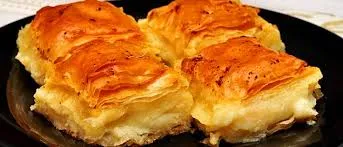
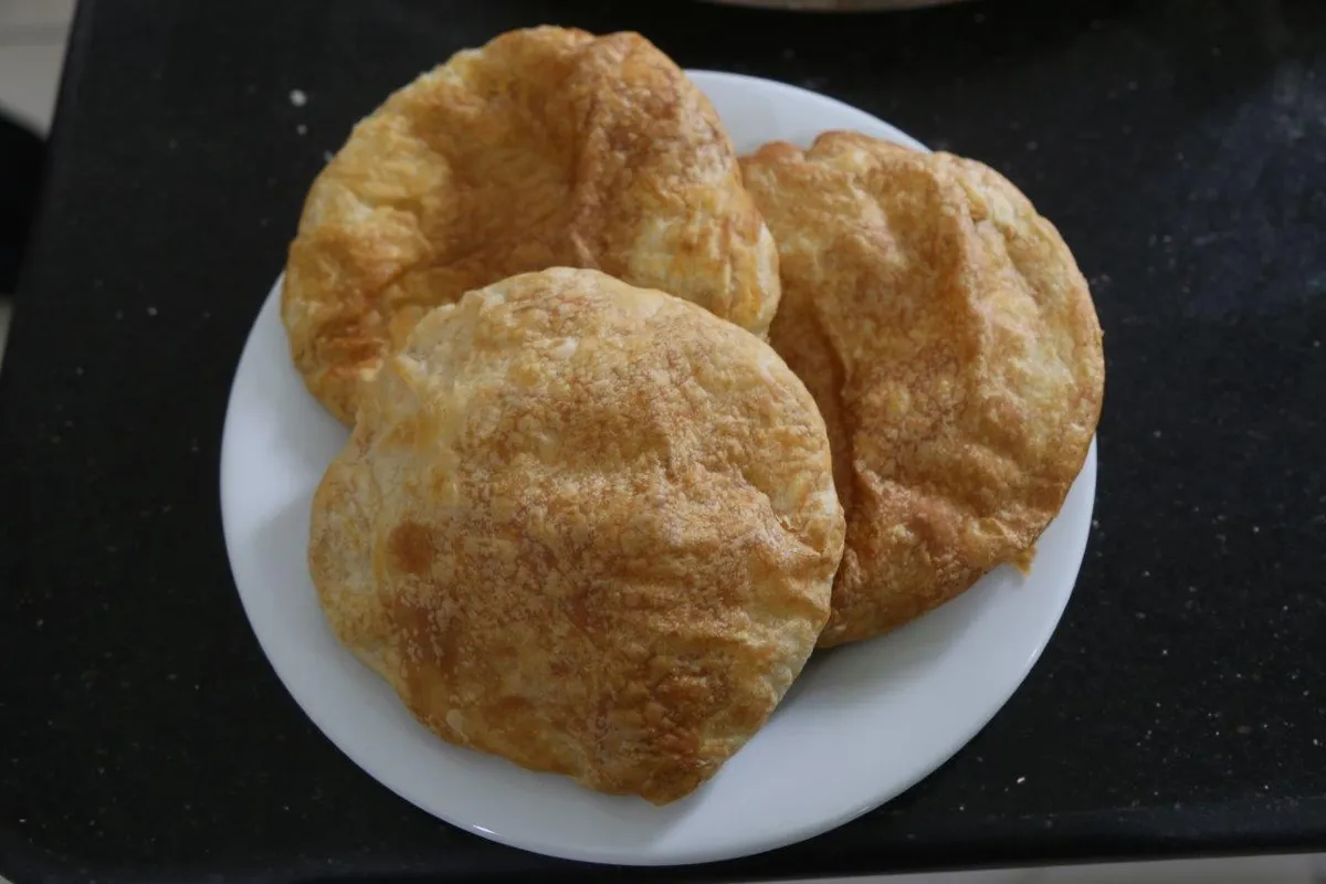
- Local Gastronomy Recommendations: Hot Kemalpaşa pita and stone oven simit in Meydan bakeries.
Explore Full 5-Section Guide & Map for Kemalpaşa City Square & Atatürk Park →
What to Eat in Kemalpaşa, Artvin? Registered Local Delicacies & Gastronomy
A trip to Kemalpaşa, Artvin is incomplete without tasting its officially registered geographical indication products and centuries-old Anatolian recipes:
1. Pucuko (Yemekler ve çorbalar)
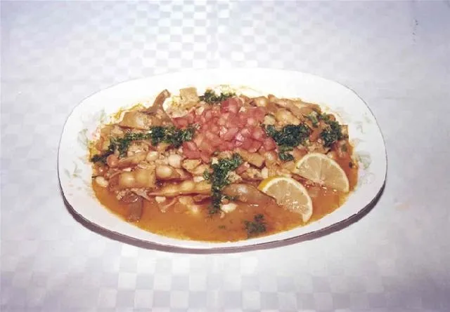
Puçuko is a geographically indicated value of ours, specific to the Artvin region and registered by the Turkish Patent and Trademark Office on 26.12.2017 (with registration number 303).
View Official Geographical Indication Dossier for Pucuko →
2. Borcka Iron Apple (İşlenmiş ve işlenmemiş meyve ve sebzeler ile mantarlar)
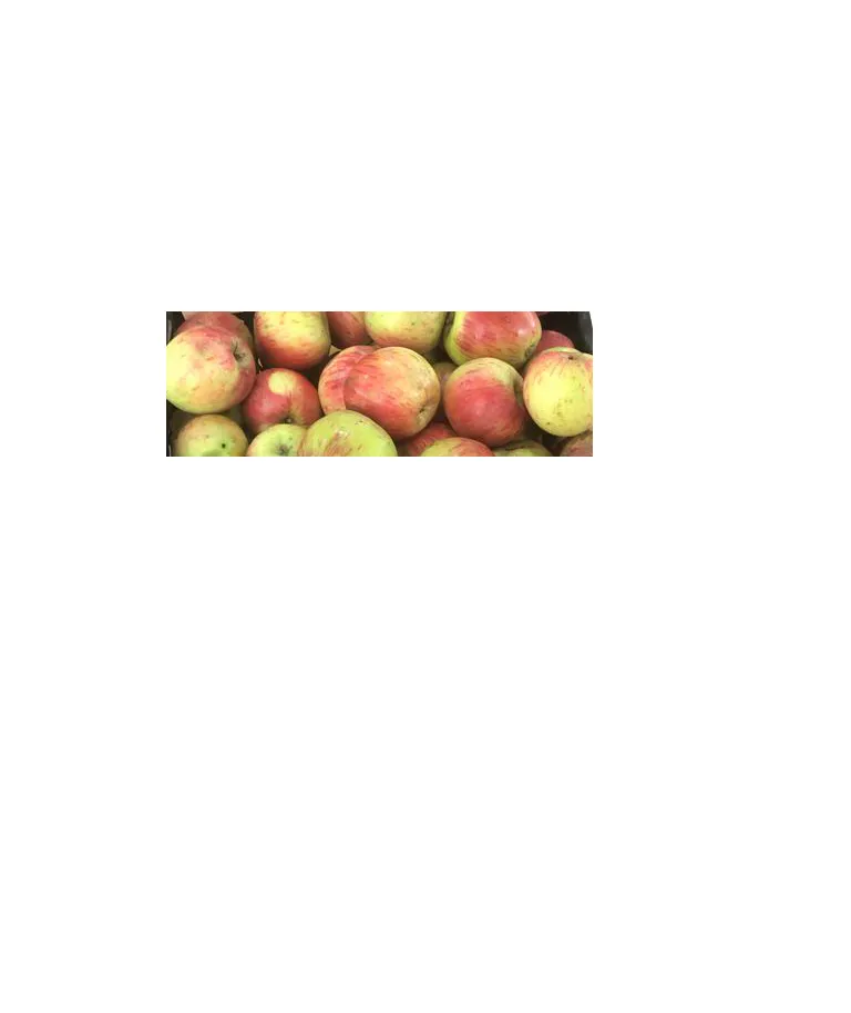
A registered apple grown in the Macahel Valley, with a texture as hard as a stone, juicy, and does not rot on the hanger throughout the winter.
History: UNESCO Biosphere Reserve The durable apple of the Macahel valley.
View Official Geographical Indication Dossier for Borcka Iron Apple →
3. Hopa Anchovy Bread (Fırıncılık ve pastacılık mamulleri, hamur işleri, tatlılar)
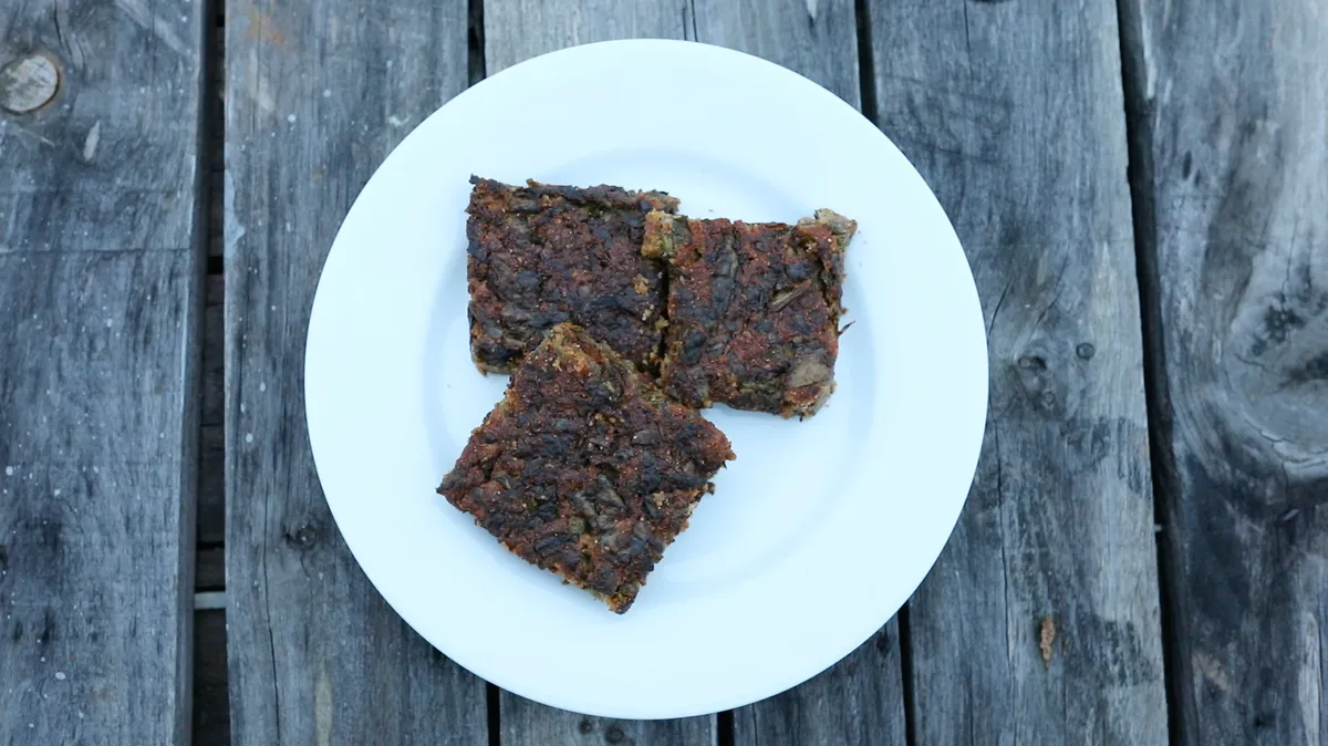
Fresh anchovy, corn flour, leek, chard and mint mixture fried like a pomegranate on a tray in a stone oven.
History: A century-old anchovy bread prepared by Black Sea fishermen after returning from the sea.
View Official Geographical Indication Dossier for Hopa Anchovy Bread →
4. Hatila Honey (Bal)
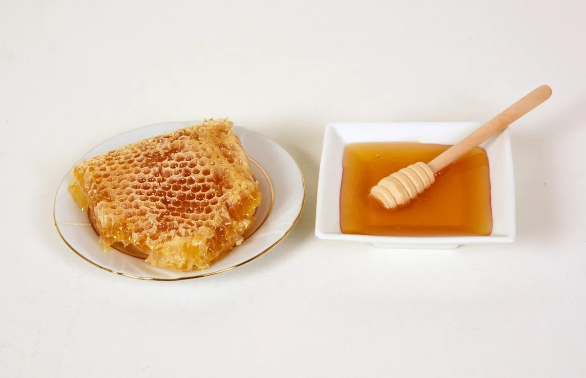
Hatila Honey is a geographically indicated value of ours with an official Origin Name, unique to the Artvin region and registered by the Turkish Patent and Trademark Office on 17.09.2021 (with registration number 893).
View Official Geographical Indication Dossier for Hatila Honey →
5. Arhavi Chestnut Honey (Bal)
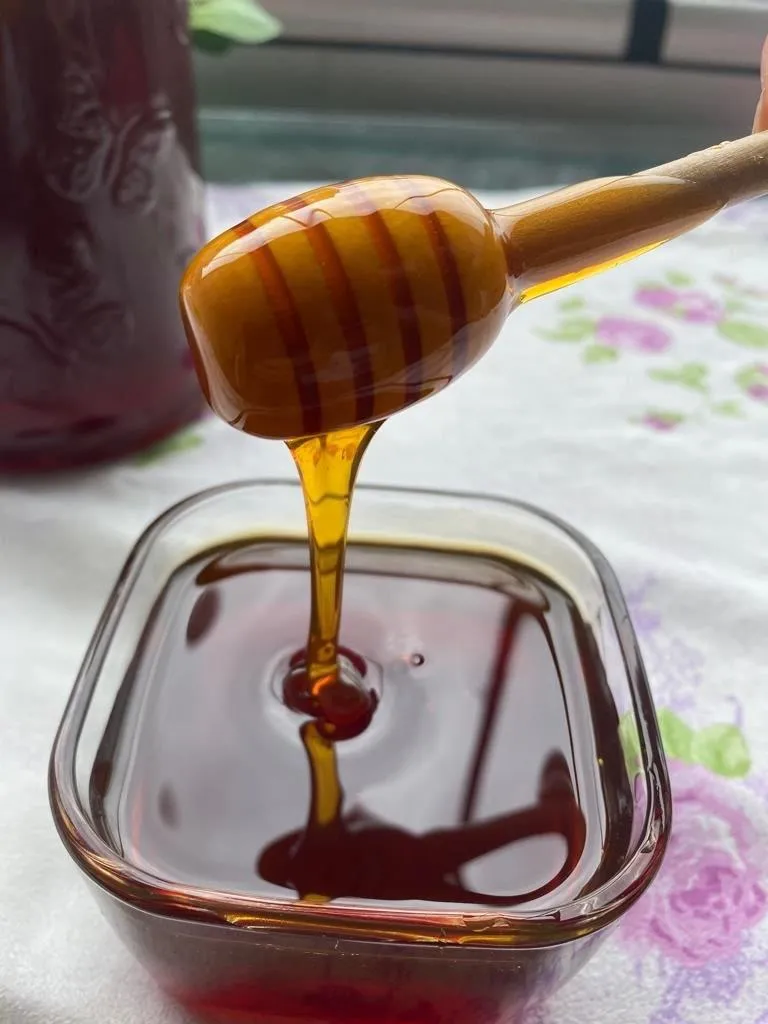
Arhavi Chestnut Honey is a value with a geographical indication of its official Origin Name, unique to the Artvin region, registered by the Turkish Patent and Trademark Office on 10.11.2022 (with registration number 1252).
View Official Geographical Indication Dossier for Arhavi Chestnut Honey →
6. Arhavi Terminus (Fırıncılık ve pastacılık mamulleri, hamur işleri, tatlılar)
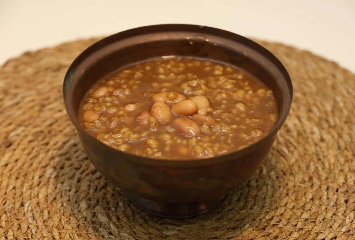
Arhavi Terminus is an official Geographically Indicated value specific to the Artvin region, registered by the Turkish Patent and Trademark Office on 05.05.2025 (with registration number 1732).
View Official Geographical Indication Dossier for Arhavi Terminus →
Practical Travel & Transit Planning for Kemalpaşa, Artvin (2026)
| Planning Category | Verified Local Information |
|---|---|
| Region & Administrative Center | Kemalpaşa, Artvin, Türkiye |
| Best Time to Visit | Spring (April–June) and Autumn (September–November) for ideal sightseeing weather; Summer for highlands and coastal routes. |
| Public Transit & Highway Access | Regular municipal buses and local minibus cooperatives (Dolmuş) depart daily from the Artvin Intercity Bus Terminal (Otogar) directly to Kemalpaşa. |
| Recommended Stay | 1 to 2 full days to explore the main historical landmarks, nature trails, and local culinary stops. |
Frequently Asked Questions About Visiting Kemalpaşa, Artvin
What are the must-see places to visit in Kemalpaşa, Artvin?
The top verified attractions in Kemalpaşa, Artvin include Makriyali Church and Castle Ruins, Üçkardeş (Akdere) Waterfall & Valley, Osmaniye Historical Stone Arch Bridge, Kaya Village and Plateau Nature Route, Sarp Village Historical Mosque and Border Observation Hill. Each location offers documented historical or natural heritage with clear road access.
How can I get to Kemalpaşa, Artvin by public transport or car?
You can reach Kemalpaşa, Artvin easily by car via Artvin's main provincial highways, or take regular municipal buses and district minibuses departing throughout the day from the Artvin central bus terminal (Otogar).
What are the famous local dishes and traditional foods to try in Kemalpaşa, Artvin?
When visiting Kemalpaşa, Artvin and Artvin, be sure to taste officially registered specialties such as Pucuko, Borcka Iron Apple, Hopa Anchovy Bread, Hatila Honey, Arhavi Chestnut Honey, prepared by local artisans and traditional restaurants.
Are the attractions in Kemalpaşa, Artvin suitable for families and day trips?
Yes. Most historic monuments, parks, museums, and promenade areas in Kemalpaşa, Artvin are family-friendly and well-suited for both weekend getaways and full-day cultural itineraries.
When is the best season to visit Kemalpaşa, Artvin?
Spring and autumn offer the most comfortable temperatures for walking tours and photography in Kemalpaşa, Artvin, while summer is popular for nature recreation, plateaus, and festivals.