
Planning a journey to Şavşat, Artvin? This comprehensive 2026 Sacred & Spiritual Heritage guide brings together 10 verified landmarks, natural wonders, and cultural heritage sites with official visiting hours, GPS coordinates, public transit connections, and local gastronomy recommendations.
Quick Highlights & Discovery Route in Şavşat, Artvin
- Veliköy Historical Wooden Mosque and Snow Wrestling Area
- Sahara Plateau & Traditional Festival Area (National Park)
- Tibeti (Cevizli) Monastery Church (A.D. 899)
- Şavşat Castle (Satlel Castle / Söğütlü)
- Şavşat Papart Valley & Old Rainforests
- Arsiyan Plateau & Floating Islands Lakes Region (2600m)
- Pucuko
- Borcka Iron Apple
Sacred Sites, Historic Mosques, Shrines & Spiritual Heritage in Şavşat, Artvin
Şavşat, Artvin (Artvin) is home to deeply revered spiritual landmarks, including historic Grand Mosques (Ulu Camiler), Seljuk and Ottoman tombs (türbeler), dervish lodges, monasteries, and churches that testify to centuries of faith and architectural mastery.
- Dress Code & Modesty: Modest attire covering shoulders and knees is required when entering historic mosques and shrines in Şavşat, Artvin; women should carry a headscarf.
- Visiting Etiquette: Maintain silence during prayer times, remove shoes where indicated at mosque entrances, and avoid flash photography inside sacred interiors.
- Architectural Craftsmanship: Admire hand-carved wooden minbars, calligraphy panels, glazed tile mihrabs, and stone dome acoustics.
Top Verified Sacred & Spiritual Heritage & Must-See Landmarks in Şavşat, Artvin
1. Veliköy Historical Wooden Mosque and Snow Wrestling Area
Free Public Access • GPS: 41.3125, 42.4322
History and General Information / Local Legends and Folklore
Located in the heart of Şavşat, Veliköy (historically known as Veli) is one of the most unique cultural and sports villages of Artvin, with its Historical Wooden Mosque built with the nailless bell technique of the 19th century Ottoman period and the Turkey-wide famous 'Traditional Veliköy Karakucak Wrestling Festival on Snow'. The mosque was built by interlocking centuries-old chestnut tree logs; It is an eye-catching work of art with its painted geometric ceiling core, carved wooden pulpit and women's gallery with wooden railings. The village square, where wrestlers wearing kispets wrestle on meters of snow during the winter months, is a centuries-old tradition of winter bravery.
Geographical Structure, Altitude and Natural Features
It is located on a wide valley slope surrounded by forests, at an altitude of approximately 1,450 meters above sea level. It is surrounded by Scots pines, spruces, apple orchards and wooden Şavşat architecture houses.
Visiting Hours, Days and Entrance Fees
- Entrance Fee: Visiting the historical mosque and visiting the festival area is completely free.
- Visiting Hours and Days (Mandatory): It is open for worship and visits 7 days a week, from morning adhan to night prayer.
- Rules, Safety and Stroller/Disabled Access: You can enter the mosque without shoes; The historical wooden texture must be respected. The mosque courtyard is flat and can be accessed by strollers and wheelchairs.
- Facilities and Facilities: There is a fountain, ablution room, WC, festival square and village guest house.
Transportation, Public Transit Routes and Exact Location
- Address / Open Location: Veliköy Village Mosque Square, 08700 Şavşat / Artvin.
- Road Condition and Vehicle Availability: Take the Veliköy turnoff via the asphalt road from Şavşat center towards Karagöl; It can be reached in 12 minutes by a completely asphalt road.
- Actual Public Transportation Information (Mandatory): Veliköy minibuses departing from Şavşat district bus station and stop directly in front of the mosque.
- Parking Availability: There is a large and free car parking area in the mosque and village square.
Spiritual Visiting Etiquette and Commemoration Guidelines
- Spiritual Visit and Prayer Etiquette: Worship should be done in silence, two rakats of tahiyyatu'l-masjid prayer should be performed and prayers should be made in the spiritual tranquility of the village.
- Documentary & Respectful Shooting: The painted motifs on the wooden ceiling and the snowy valley view seen from the mosque windows can be photographed in silent mode.
- Important Commemoration Days: Friday prayers, religious holidays and the traditional Snow Wrestling Festival period held every year in February.
- Local Spiritual Tradition: After the prayer, hot meat pilaf, kete and buttermilk are served to the congregation and guests in the mosque courtyard.
Explore Full 5-Section Guide & Map for Veliköy Historical Wooden Mosque and Snow Wrestling Area →
2. Sahara Plateau & Traditional Festival Area (National Park)

Free Public Access • GPS: 41.2288, 42.4447
History and General Information / Local Legends and Folklore
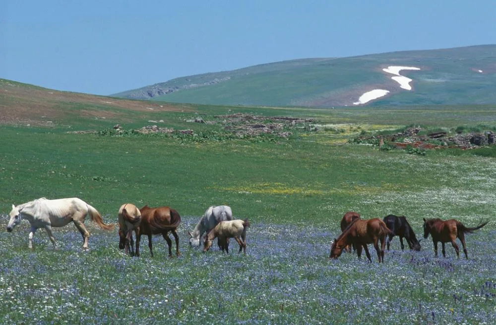
Sahara Plateau is the most enthusiastic plateau meeting point of the Eastern Black Sea region with the Traditional Sahara Beetroot Festivals, which are held every year in July and have been going on for more than half a century. It has been the resting place of historical caravans and nomads between Ardahan and Artvin for centuries.
Geographical Structure, Altitude and Natural Features
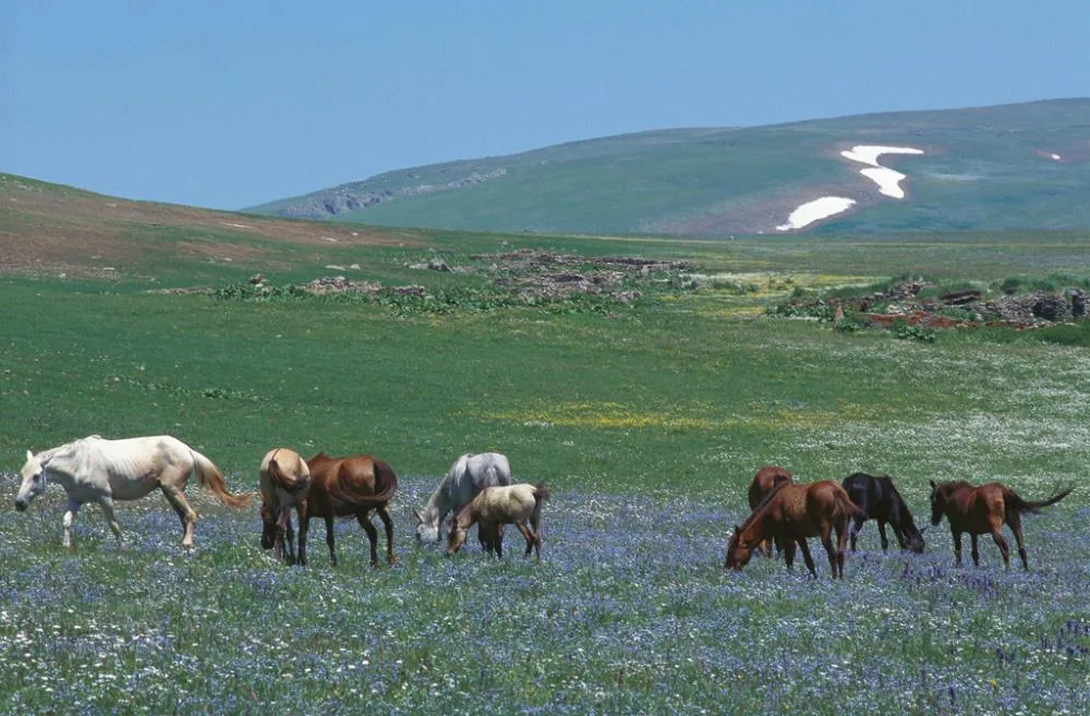
It is located at an altitude of 1850 - 2100 meters above sea level. It offers vast alpine meadows, Scots pine and spruce forests, cold water springs and vast mountain silhouettes.
Visiting Hours, Days and Entrance Fees
- Entrance Fee: Free (vehicle entrance fee may apply during the festival period).
- Visiting Hours and Days: Open 24 hours a day, 7 days a week.
- Rules, Safety and Stroller/Disabled Access: Wide flat plateau land; It is extremely suitable for tent and caravan camping.
- Facilities and Facilities: Plateau restaurants, recreational facilities, prayer room, fountains, festival arena and WC are available.
Transportation, Public Transit Routes and Exact Location
- Address / Open Location: Şavşat - Ardahan Highway 17. km, Sahara Mevkii, Şavşat / Artvin.
- Road Condition and Vehicle Availability: It is 17 km from Şavşat district center and 30 km from Ardahan city center; It is a hot asphalt road on the main highway; It can be reached by all vehicles.
- Real Public Transportation Information: All intercity and district buses operating between Şavşat and Ardahan pass in front of the plateau facilities.
- Parking Availability: There is free parking for hundreds of vehicles on the plateau plain.
Contextual Experience Tips, Photography and Local Gastronomy
- Best Photography Spots and Frames: Panorama of the Yalnızçam Mountains rising from the plateau plain behind the Scots pine forests and authentic wooden plateau houses.
- Light and Shooting Hours: Early morning and sunset hours.
- Local Gastronomy Recommendations: Roast lamb, Şavşat gorcola cheese, corn bread and samovar tea in plateau restaurants.
Explore Full 5-Section Guide & Map for Sahara Plateau & Traditional Festival Area (National Park) →
3. Tibeti (Cevizli) Monastery Church (A.D. 899)

Free Public Access • GPS: 41.3044, 42.3893
History and General Information / Local Legends and Folklore
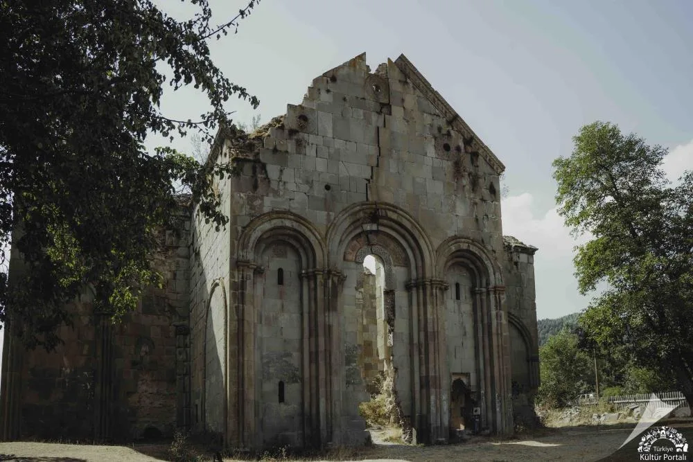
Tibeti Church is the most magnificent episcopal cathedral of the region, built by Georgian Bagratli Prince Ashot Koukhi between 899-914 AD. It was the religious, cultural and manuscript reproduction center of the region during the Middle Ages. Dış cephelerinde yer alan koç heykelleri, havari kabartmaları ve kubbe kasnağındaki taş oymalar eşsiz bir sanat mirasıdır.
Geographical Structure, Altitude and Natural Features
Deniz seviyesinden 1150 metre rakımda, Cevizli Köyü'nün kalbinde, ceviz ağaçları ve yeşil çayırlar arasında yer alır.
Visiting Hours, Days and Entrance Fees
- Entrance Fee: Free.
- Visiting Hours and Days: Open 7 days a week during daylight hours.
- Kurallar, Güvenlik ve Bebek Arabası/Engelli Erişimi: Tarihi taş kabartmalar özenle korunmalıdır; Since it is located in the Düzayak village square, it is suitable for disabled access.
- Facilities and Facilities: There is a village coffeehouse, fountain and information signs.
Transportation, Public Transit Routes and Exact Location
- Address / Open Location: Cevizli Village Center, Şavşat / Artvin.
- Road Condition and Vehicle Availability: It is 14 km away from Şavşat town centre; It is a completely asphalt road; It can be easily reached by all passenger vehicles.
- Real Public Transportation Information: Transportation is provided by Cevizli village minibuses departing from Şavşat center.
- Otopark Durumu: Kilise meydanında 20 araçlık açık park yeri vardır.
Contextual Experience Tips, Photography and Local Gastronomy
- Öne Çıkan Eserler: Kubbe kasnağındaki Aşot Koukhi rölyefi, koç heykeli kabartmaları ve pencerelerdeki geometrik taş süslemeler.
- Işık ve Çekim Saatleri: Sabah saatlerinde doğu cephesine vuran parlak güneş ışığı.
- Yöresel Gastronomi Tavsiyeleri: Cevizli köyünün meşhur taze cevizleri ve doğal dut pekmezi.
Explore Full 5-Section Guide & Map for Tibeti (Cevizli) Monastery Church (A.D. 899) →
4. Şavşat Castle (Satlel Castle / Söğütlü)

Free Public Access • GPS: 41.2592, 42.3270
History and General Information / Local Legends and Folklore
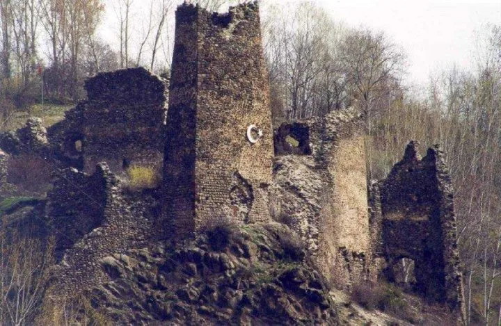
Şavşat Castle (Satlel Castle) was built in the 9th century AD during the Georgian Bagratid Kingdom for the defense of the region and the security of trade routes. It was conquered by the Ottomans in the 16th century and used as a sanjak center. During archaeological excavations inside the castle, chapels, cisterns, wine cellars and Ottoman period building layers were unearthed.
Geographical Structure, Altitude and Natural Features
It is located at an altitude of 950 meters above sea level, on a strategic rock ridge where the Şavşat Stream valley and two rivers meet.
Visiting Hours, Days and Entrance Fees
- Entrance Fee: Free.
- Visiting Hours and Days: It is open to visitors 7 days a week during daylight hours (08:30 - 19:30).
- Rules, Safety and Stroller/Disabled Access: Wooden walkways and steps have been installed; Sturdy sports shoes should be worn.
- Facilities and Facilities: The archaeological excavation area has a walking track, observation balcony, information boards and parking area.
Transportation, Public Transit Routes and Exact Location
- Address / Open Location: Söğütlü District, Şavşat Castle Location, Şavşat / Artvin.
- Road Condition and Vehicle Suitability: It is 3 km away from Şavşat town center and is an asphalt road; accessible by all vehicles.
- Real Public Transportation Information: It can be reached from Şavşat center by Söğütlü minibuses or by a 25-minute walk.
- Parking Availability: There is free parking for 30 vehicles at the foot of the castle.
Contextual Experience Tips, Photography and Local Gastronomy
- Best Photography Points and Frames: View of the valley folds, historical stone bridge and wooden Şavşat houses on the opposite slopes from the castle bastions.
- Light and Shooting Hours: Morning sun and sunset hours.
- Local Gastronomy Recommendations: Fresh Şavşat plateau cheese and hot kete around Söğütlü.
Explore Full 5-Section Guide & Map for Şavşat Castle (Satlel Castle / Söğütlü) →
5. Şavşat Papart Valley & Old Rainforests

Free Public Access • GPS: 41.4776, 42.1352
History and General Information / Local Legends and Folklore
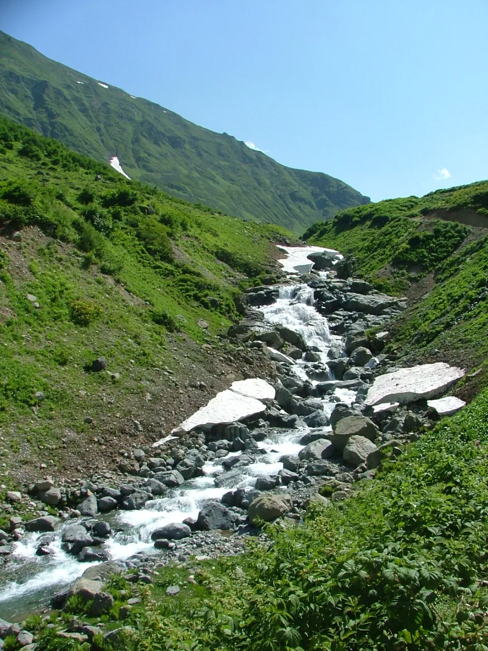
Papart Valley, stretching between Şavşat and Meydancık, is one of the most untouched natural ecosystems of Türkiye with its untouched monumental trees, deep canyon cleft and rich wildlife. Papart Creek, flowing through centuries-old hornbeam, spruce and boxwood forests, is the homeland of red-spotted trout.
Geographical Structure, Altitude and Natural Features
Its altitude is between 1200 - 2400 meters. It is surrounded by high humidity, rich undergrowth flora and steep canyon walls.
Visiting Hours, Days and Entrance Fees
- Entrance Fee: Free.
- Visiting Hours and Days: Open 7 days a week.
- Rules, Safety and Stroller/Disabled Access: It is a natural protected area; Suitable for hiking and photography.
- Facilities and Facilities: Nature walking paths and rest points are available.
Transportation, Public Transit Routes and Exact Location
- Address / Open Location: Papart Valley Road, Meydancık Mevkii, Şavşat / Artvin.
- Road Condition and Vehicle Availability: It is 40 km away from Şavşat town centre; stabilized forest road; high vehicle is recommended.
- Real Public Transportation Information: It can be reached by Meydancık minibuses or private land tours.
- Parking Availability: Vehicles can be parked in suitable pockets on the roadside.
Contextual Experience Tips, Photography and Local Gastronomy
- Best Photo Spots and Frames: Giant mossy monumental trees, wooden bridges over the valley and waterfall streams.
- Light and Shooting Times: Light beams hitting the forest in the morning hours.
- Local Gastronomy Recommendations: Papart chestnut and plateau honey.
Explore Full 5-Section Guide & Map for Şavşat Papart Valley & Old Rainforests →
6. Arsiyan Plateau & Floating Islands Lakes Region (2600m)

Free Public Access • GPS: 41.4204, 42.4861
History and General Information / Local Legends and Folklore
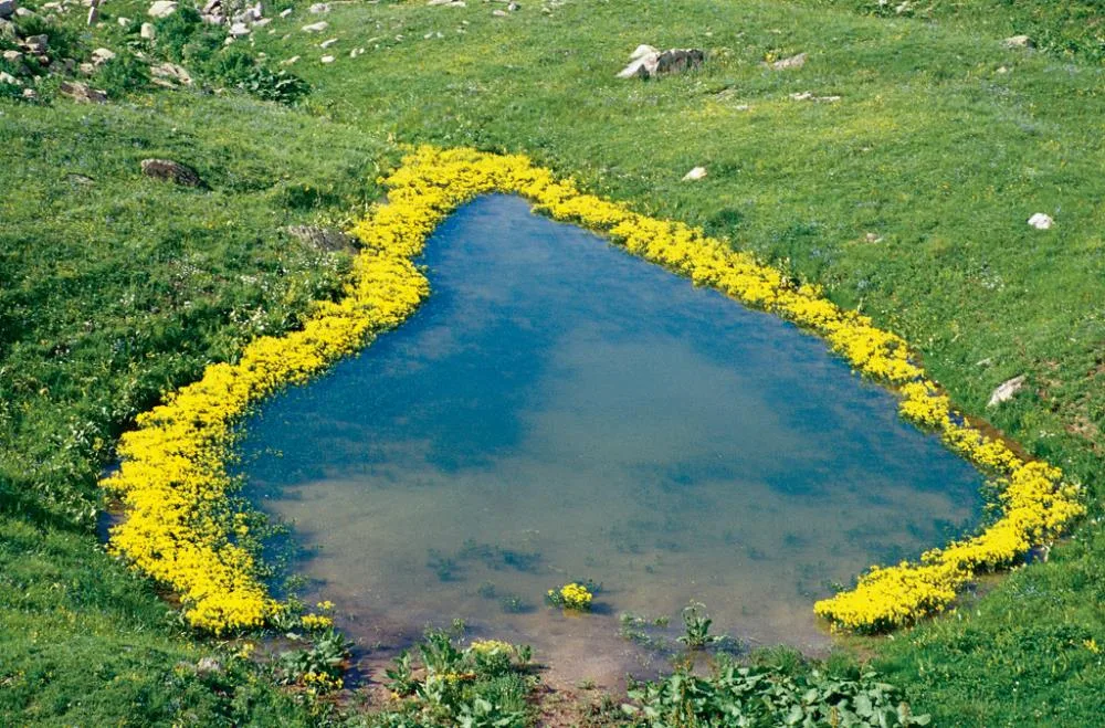
Arsiyan Plateau is a unique lake region rising on the Georgian border and containing more than 20 large and small glacial crater lakes. Some of these lakes feature "Floating Islands" of natural reeds and peat that move with the wind on the water. Local legends say that Arsiyan is the land of mysterious lakes where fairy girls bathe and giants live.
Geographical Structure, Altitude and Natural Features
Its altitude is between 2600 - 3000 meters. It is a belt of glacial valleys, peat bogs, floating islands, crater lakes and endemic Caucasian mountain flowers.
Visiting Hours, Days and Entrance Fees
- Entrance Fee: Free.
- Visiting Hours and Days: It is suitable for visiting between July and September.
- Rules, Safety and Stroller/Disabled Access: It is high mountain terrain; Trekking with a guide is recommended; Warm clothing and sturdy mountain boots are a must.
- Facilities and Facilities: It is a virgin nature area; There are no facilities; Tent camping is possible.
Transportation, Public Transit Routes and Exact Location
- Address / Open Location: Above Ilıca and Pınarlı Villages, Arsiyan Plateau Location, Şavşat / Artvin.
- Road Condition and Vehicle Availability: It is 45 km away from Şavşat town centre; stabilized high mountain road; 4x4 off-road vehicle is mandatory.
- Real Public Transportation Information: It can be reached by private tours and safari vehicles.
- Parking Availability: There is unlimited outdoor parking in the plateau camping area.
Contextual Experience Tips, Photography and Local Gastronomy
- Best Photo Spots and Frames: Floating islands above the lakes and views of the snowy Arsiyan peak in the background.
- Light and Shooting Times: First light of the morning and afternoon sun.
- Local Gastronomy Recommendations: Highland tea and local dried meat accompanied by a campfire.
Explore Full 5-Section Guide & Map for Arsiyan Plateau & Floating Islands Lakes Region (2600m) →
7. Şavşat Karagöl Nature Park (Sahara National Park)

Ticketed / MuseumPass Check • GPS: 41.3087, 42.4834
History and General Information / Local Legends and Folklore
Şavşat Karagöl is a postcard landslide set lake, located within the borders of the Karagöl-Sahara National Park, with dense spruce and Scots pine forests surrounding it. It is the symbol of Şavşat, one of Türkiye's first "Cittaslow" (Slow City) districts. Local people believe that the legendary red-scaled trout swimming in the depths of the lake and the emerald color of the centuries-old pines reflected in the lake soothe the soul.
Geographical Structure, Altitude and Natural Features
It is located at an altitude of approximately 1630 meters above sea level. The lake surface area is approximately 5 hectares. Its surroundings are home to rich biodiversity, otters, lynxes, red-spotted trout and migratory wild ducks.
Visiting Hours, Days and Entrance Fees
- Entrance Fee: National Parks are subject to entrance tariff (symbolic fee per person and vehicle).
- Visiting Hours and Days: Open 7 days a week between 07:30 - 20:00.
- Rules, Safety and Stroller/Disabled Access: The wooden docks and walking paths around the lake are disabled and stroller accessible; It is forbidden to enter the lake; You can take a boat tour on the lake.
- Facilities and Facilities: There is a wooden lake restaurant, cafeteria, observation balcony, tent and caravan camping area, prayer room, WC and parking lot.
Transportation, Public Transit Routes and Exact Location
- Address / Open Location: Meşeli Köyü Mevkii, Karagöl Sahara National Park, Şavşat / Artvin.
- Road Condition and Vehicle Availability: It is 25 km from Şavşat town center and 92 km from Artvin city centre; It is a completely asphalt and concrete road; It can be easily reached by all passenger vehicles.
- Real Public Transportation Information: Karagöl minibuses depart from Şavşat Town Square every hour during the summer months.
- Parking Availability: There is a large parking area for 120 vehicles at the entrance gate.
Contextual Experience Tips, Photography and Local Gastronomy
- Best Photo Spots and Frames: Boats gliding over the lake from the wooden pier and wooden lakeside bridges with perfect mirror reflections of the Scots pine forests behind.
- Light and Shooting Times: Early morning foggy mirror reflection (07:30 - 09:30) or late afternoon golden time zone.
- Local Gastronomy Recommendations: Casserole trout, Şavşat kete, kuymak and fresh plateau honey in the wooden restaurant by the lake.
Explore Full 5-Section Guide & Map for Şavşat Karagöl Nature Park (Sahara National Park) →
8. Maden (Bazgiret) Historical Wooden Village

Free Public Access • GPS: 41.3819, 42.1423
History and General Information / Local Legends and Folklore
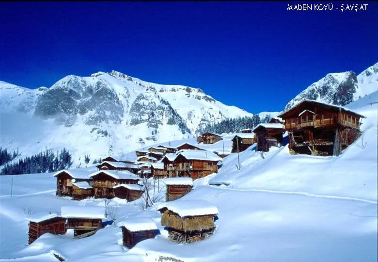
Maden Village (historically known as Bazgiret) is a living open-air museum where traditional wooden Black Sea architecture and serender culture have been preserved to this day with centuries-old houses built without hammering a single nail. The village, which remained intact thanks to the steep geography of the valley, has been the subject of documentaries with its traditional lifestyle.
Geographical Structure, Altitude and Natural Features
It is located at an altitude of 1850 meters above sea level, among green meadows and beech forests on steep slopes.
Visiting Hours, Days and Entrance Fees
- Entrance Fee: Free.
- Visiting Hours and Days: Open 7 days a week during daylight hours.
- Rules, Safety and Stroller/Disabled Access: Village walks are paths and stone streets; The privacy of local people and nature must be respected.
- Facilities and Amenities: Village house hospitality, guesthouses and fountains are available.
Transportation, Public Transit Routes and Exact Location
- Address / Open Location: Maden (Bazgiret) Village, Şavşat / Artvin.
- Road Condition and Vehicle Availability: It is 36 km away from Şavşat town centre; stabilized mountain road; It can be reached by off-road vehicle or careful passenger vehicle.
- Real Public Transportation Information: You can go there with village shuttles or private tours that depart on certain days.
- Parking Availability: There is an open car park at the village entrance.
Contextual Experience Tips, Photography and Local Gastronomy
- Best Photo Spots and Frames: Centuries-old wooden serenders, fenced pastures and wooden village houses among the fog.
- Light and Shooting Times: Early morning and late afternoon light.
- Local Gastronomy Recommendations: Freshly baked village bread, melted cheese and plateau milk.
Explore Full 5-Section Guide & Map for Maden (Bazgiret) Historical Wooden Village →
9. Lake Rutav and Nilüfer Wetland
Free Public Access • GPS: 41.2919, 42.5159
History and General Information / Local Legends and Folklore
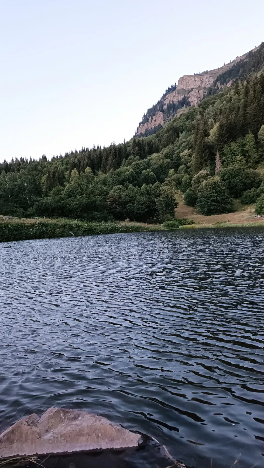
Rutav Lake, shining like a hidden pearl within the forest texture right next to the famous Balık Lake, within the borders of Şavşat's Pınarlı Village; It is one of the most fairy-tale nature corners of Şavşat, with yellow and white natural lotus flowers covering its surface, centuries-old pine forests surrounding it and still waters. The lake, which is much more untouched and quiet compared to Karagöl, is a shelter for migratory water birds and mountain fauna. In local legends, it is believed that the water lilies blooming in the middle of the lake are the crown of the lake fairies and that eternal peace fills the hearts of those who look at the lake in the morning fog.
Geographical Structure, Altitude and Natural Features
It is a natural landslide-set lake located at an altitude of approximately 1,820 meters above sea level. It is surrounded by Scots pine, spruce forests and rich wetland flora.
Visiting Hours, Days and Entrance Fees
- Entrance Fee: Entrance to the lake and walking around it is completely free.
- Visiting Hours and Days (Mandatory): Open 24 hours a day, 7 days a week; Since the lake surface freezes over during the winter months, it is recommended to visit from spring to autumn.
- Rules, Safety and Stroller/Disabled Access: Plucking water lilies and entering the lake is prohibited. The forest path around the lake is slightly rugged and should be walked carefully; You can approach the lakeside with a baby stroller.
- Facilities and Facilities: It is a natural protected area; There is a wooden pier, rest benches and a lake observation deck.
Transportation, Public Transit Routes and Exact Location
- Address / Open Location: Pınarlı Köyü Rutav Mevkii, 08790 Şavşat / Artvin.
- Road Condition and Vehicle Availability: It can be reached in 35 minutes by passenger or SUV vehicles via the stabilized and forest road from Şavşat center towards Balık Lake.
- Real Public Transportation Information (Mandatory): You can come to the village with the Pınarlı village minibuses departing from Şavşat district center and walk to the lake via the forest path.
- Parking Availability: There is a natural car parking area on the side of the forest road near the lake.
Contextual Experience Tips, Photography and Local Gastronomy
- Best Photo Spots and Frames: The symmetry of the pine trees reflecting among the lotus flowers and the morning mist compositions hitting the lake surface.
- Light and Shooting Hours: 09:00 - 12:00 in the morning when the water lilies open towards the sun and the golden hour in the evening.
- Visiting Time: The most fascinating period is between the end of June and the end of August, when the water lilies bloom.
- Local Gastronomy Recommendations: Pınarlı village cheese, homemade kete with walnuts and thermos tea while having a picnic by the lake.
Explore Full 5-Section Guide & Map for Lake Rutav and Nilüfer Wetland →
10. Tamara Chambers and Rock Shelters (Queen Tamara Monastery)
Free Public Access • GPS: 41.2936, 42.4934
History and General Information / Local Legends and Folklore
Tamara Rooms consist of mysterious monk cells, shelters and places of worship carved into steep rocks during the reign of the famous Queen Tamara (1184-1213), who brought the golden age of the Georgian Kingdom to life. According to local narratives, Queen Tamara visited this valley during her Caucasian campaigns, and the impregnable rock shelters were used both as a retreat cell and as a strategic castle observation point. These rock cells, where monks have been disconnected from the world for centuries, are the most fascinating hidden treasure of Şavşat.
Geographical Structure, Altitude and Natural Features
It was carved vertically into the deep canyon walls near the Suatan Waterfall, at an altitude of approximately 1,750 meters above sea level. Its surroundings are covered with untouched spruce and Scots pine forests.
Visiting Hours, Days and Entrance Fees
- Entrance Fee: Free.
- Visiting Hours and Days: It can be visited in daylight 7 days a week.
- Rules, Safety and Stroller/Disabled Access: Includes steep canyon trail and steep rock stairs; definitely requires hiking equipment and caution; Not suitable for children.
- Facilities and Facilities: It is in a natural protected area and has an untouched, untouched structure.
Transportation, Public Transit Routes and Exact Location
- Address / Open Location: Suatan Canyon Mevkii, Dereiçi Village, Şavşat / Artvin.
- Road Condition and Vehicle Availability: It is 18 km away from Şavşat town centre; After Dereiçi village, the forest trekking track begins.
- Real Public Transportation Information: It can be reached from Şavşat center by Dereiçi village minibuses or guided hiking tours.
- Parking Availability: There is an open parking area at the starting point of the hiking trail.
Contextual Experience Tips, Photography and Local Gastronomy
- Best Photo Spots and Frames: Dramatic perspectives from the Suatan Valley cliff showing the window cavities of the rock chambers.
- Light and Shooting Hours: Noon hours when the sun falls vertically on the canyon (12:00 - 15:00).
- Local Gastronomy Recommendations: Şavşat kete, baked beans in casserole and local Şavşat gruyere.
Explore Full 5-Section Guide & Map for Tamara Chambers and Rock Shelters (Queen Tamara Monastery) →
What to Eat in Şavşat, Artvin? Registered Local Delicacies & Gastronomy
A trip to Şavşat, Artvin is incomplete without tasting its officially registered geographical indication products and centuries-old Anatolian recipes:
1. Pucuko (Yemekler ve çorbalar)
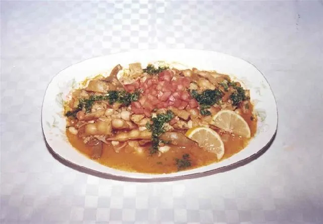
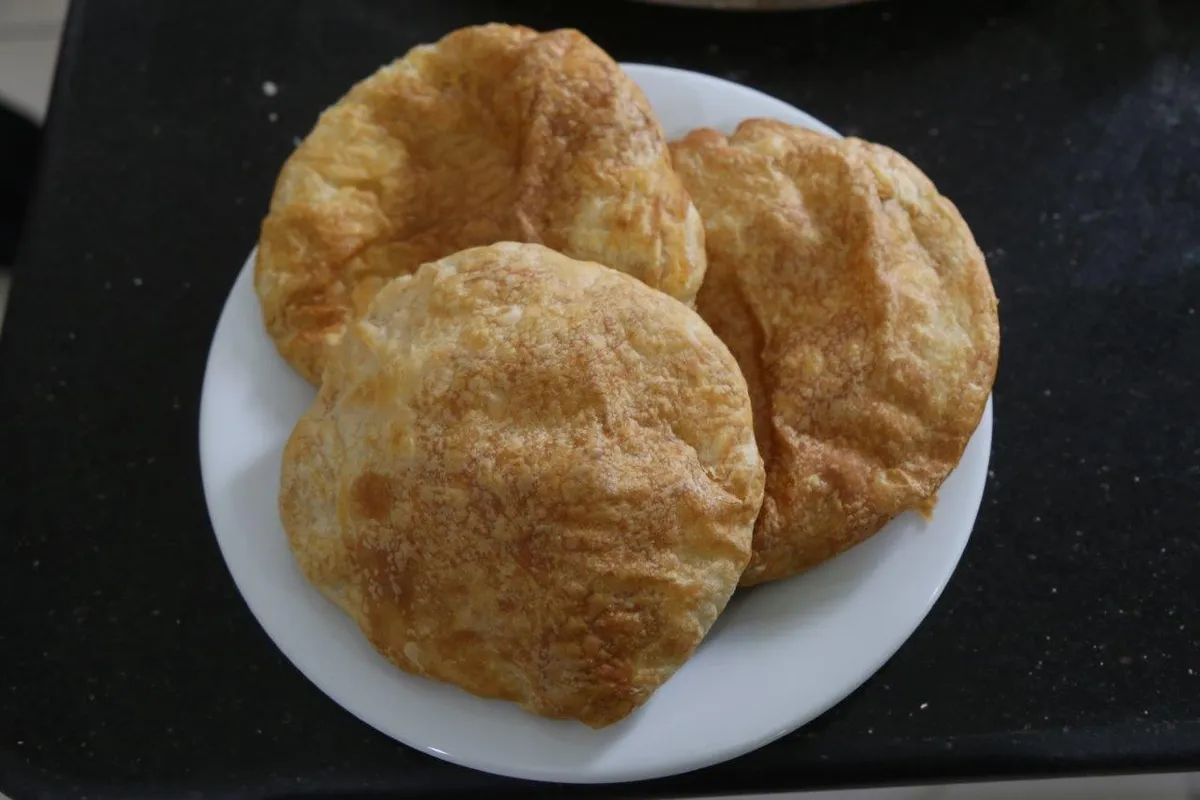
Puçuko is a geographically indicated value of ours, specific to the Artvin region and registered by the Turkish Patent and Trademark Office on 26.12.2017 (with registration number 303).
View Official Geographical Indication Dossier for Pucuko →
2. Borcka Iron Apple (İşlenmiş ve işlenmemiş meyve ve sebzeler ile mantarlar)
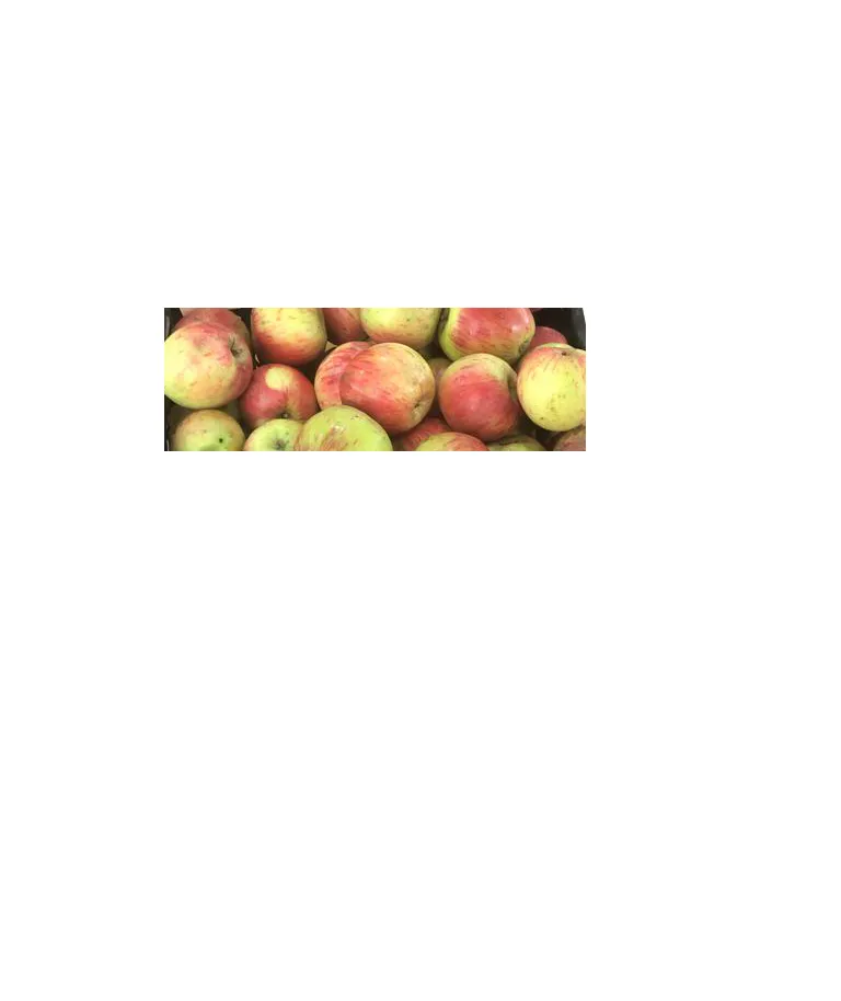
A registered apple grown in the Macahel Valley, with a texture as hard as a stone, juicy, and does not rot on the hanger throughout the winter.
History: UNESCO Biosphere Reserve The durable apple of the Macahel valley.
View Official Geographical Indication Dossier for Borcka Iron Apple →
3. Hopa Anchovy Bread (Fırıncılık ve pastacılık mamulleri, hamur işleri, tatlılar)
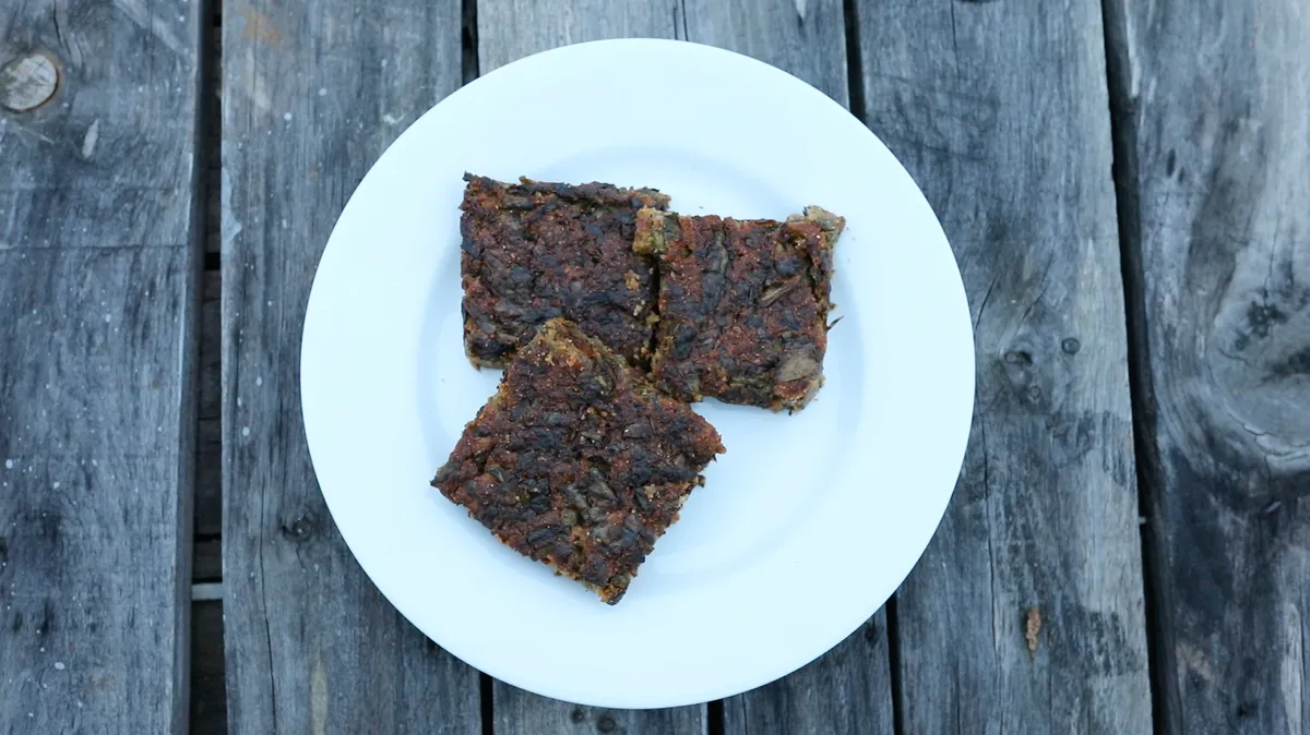
Fresh anchovy, corn flour, leek, chard and mint mixture fried like a pomegranate on a tray in a stone oven.
History: A century-old anchovy bread prepared by Black Sea fishermen after returning from the sea.
View Official Geographical Indication Dossier for Hopa Anchovy Bread →
4. Hatila Honey (Bal)
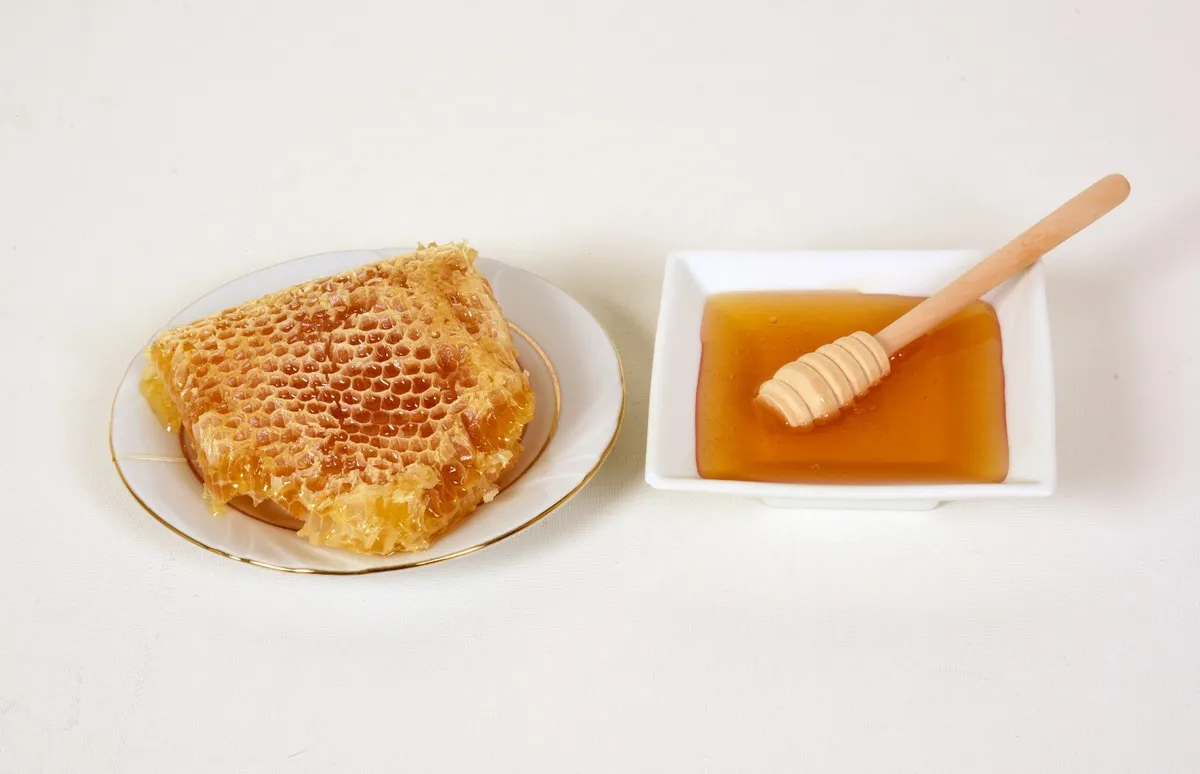
Hatila Honey is a geographically indicated value of ours with an official Origin Name, unique to the Artvin region and registered by the Turkish Patent and Trademark Office on 17.09.2021 (with registration number 893).
View Official Geographical Indication Dossier for Hatila Honey →
5. Arhavi Chestnut Honey (Bal)
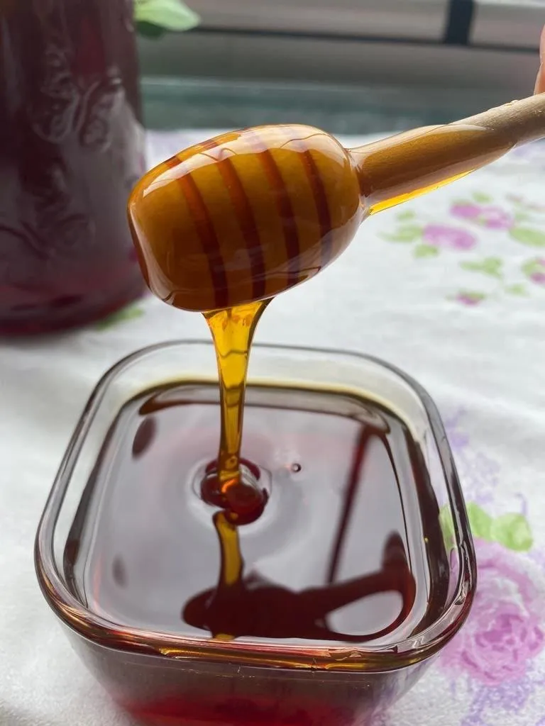
Arhavi Chestnut Honey is a value with a geographical indication of its official Origin Name, unique to the Artvin region, registered by the Turkish Patent and Trademark Office on 10.11.2022 (with registration number 1252).
View Official Geographical Indication Dossier for Arhavi Chestnut Honey →
6. Arhavi Terminus (Fırıncılık ve pastacılık mamulleri, hamur işleri, tatlılar)
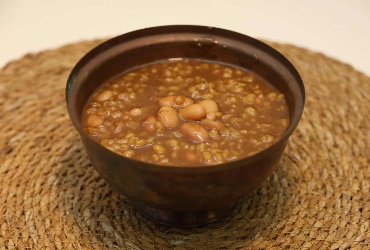
Arhavi Terminus is an official Geographically Indicated value specific to the Artvin region, registered by the Turkish Patent and Trademark Office on 05.05.2025 (with registration number 1732).
View Official Geographical Indication Dossier for Arhavi Terminus →
Practical Travel & Transit Planning for Şavşat, Artvin (2026)
| Planning Category | Verified Local Information |
|---|---|
| Region & Administrative Center | Şavşat, Artvin, Türkiye |
| Best Time to Visit | Spring (April–June) and Autumn (September–November) for ideal sightseeing weather; Summer for highlands and coastal routes. |
| Public Transit & Highway Access | Regular municipal buses and local minibus cooperatives (Dolmuş) depart daily from the Artvin Intercity Bus Terminal (Otogar) directly to Şavşat. |
| Recommended Stay | 1 to 2 full days to explore the main historical landmarks, nature trails, and local culinary stops. |
Frequently Asked Questions About Visiting Şavşat, Artvin
What are the must-see places to visit in Şavşat, Artvin?
The top verified attractions in Şavşat, Artvin include Veliköy Historical Wooden Mosque and Snow Wrestling Area, Sahara Plateau & Traditional Festival Area (National Park), Tibeti (Cevizli) Monastery Church (A.D. 899), Şavşat Castle (Satlel Castle / Söğütlü), Şavşat Papart Valley & Old Rainforests. Each location offers documented historical or natural heritage with clear road access.
How can I get to Şavşat, Artvin by public transport or car?
You can reach Şavşat, Artvin easily by car via Artvin's main provincial highways, or take regular municipal buses and district minibuses departing throughout the day from the Artvin central bus terminal (Otogar).
What are the famous local dishes and traditional foods to try in Şavşat, Artvin?
When visiting Şavşat, Artvin and Artvin, be sure to taste officially registered specialties such as Pucuko, Borcka Iron Apple, Hopa Anchovy Bread, Hatila Honey, Arhavi Chestnut Honey, prepared by local artisans and traditional restaurants.
Are the attractions in Şavşat, Artvin suitable for families and day trips?
Yes. Most historic monuments, parks, museums, and promenade areas in Şavşat, Artvin are family-friendly and well-suited for both weekend getaways and full-day cultural itineraries.
When is the best season to visit Şavşat, Artvin?
Spring and autumn offer the most comfortable temperatures for walking tours and photography in Şavşat, Artvin, while summer is popular for nature recreation, plateaus, and festivals.