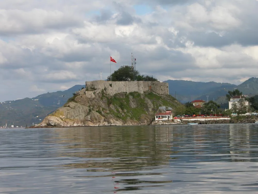

Planning a journey to Tirebolu, Giresun? This comprehensive 2026 Nature & Travel guide brings together 10 verified landmarks, natural wonders, and cultural heritage sites with official visiting hours, GPS coordinates, public transit connections, and local gastronomy recommendations.
Quick Highlights & Discovery Route in Tirebolu, Giresun
- Harşit Valley and Stream Delta
- Aslancık Dam Lake and Canyon Valley
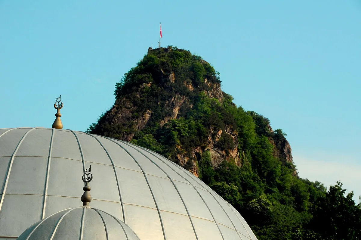
- Historical Bedrama (Bedreme) Castle and Harşit Valley Viewing Summit
- Historical Tirebolu Castle (Saint Jean Castle - 1300 BC Sea Walls)
- Historical Selimağa Fountain (1842 Kethüdzâde Emin Ağa Charity)
- Çeçen Hill and Işıklı Observation Area
- Giresun Kadayıf Dessert with Hazelnut Paste
- Tamzara Weaving
Natural Wonders, Valleys, Plateaus & Eco-Discovery in Tirebolu, Giresun
Tirebolu, Giresun (Giresun) captivates nature lovers with its unspoiled valleys, lush forests, high plateaus (yaylalar), canyons, and diverse flora. Each season transforms the landscapes of Tirebolu, Giresun, from vibrant spring blossoms to golden autumn foliage.
- Seasonal Highlights: Spring (April–June) brings rushing streams and wildflowers, while autumn (October–November) turns the forests around Tirebolu, Giresun into a photographer's paradise.
- Outdoor Preparedness: Wear layered clothing, carry sufficient drinking water, and download offline maps before venturing into rural trails in Tirebolu, Giresun.
- Eco-Conscious Travel: Protect the natural habitats of Tirebolu, Giresun by leaving zero waste and staying on marked paths.
Top Verified Nature & Travel & Must-See Landmarks in Tirebolu, Giresun
1. Harşit Valley and Stream Delta
Free Public Access • GPS: 40.8083, 38.9170
History and General Information / Local Legends and Folklore
Harşit Valley is a huge and historical valley cleft shaped over thousands of years by the majestic Harşit Stream, which rises from the Eastern Black Sea mountains and flows into the Black Sea on the shores of Tirebolu. It is a strategic national struggle line where the advance of the Russian armies on the Caucasus Front during World War I was stopped and the Turkish army carried out the epic Harşit Defense. There are ruins of military trenches, watchtowers and historical bridges of the period on the rocks in the valley.
Geographical Structure, Altitude and Natural Features
Its exact altitude starts from 40 meters on the valley floor and rises to 600 meters on the canyon slopes. Harşit Stream, flowing through deep limestone and andesite canyon walls, has a rich aquatic ecosystem. Its surroundings are covered with hornbeam, alder, chestnut and hazelnut gardens.
Visiting Hours, Days and Entrance Fees
- Entrance Fee: Valley viewing and sightseeing areas are completely free.
- Visiting Hours and Days (Mandatory): Open 24 hours a day, 7 days a week; It is recommended to travel through the canyon during daylight hours (08:00 - 18:30).
- Rules, Security and Baby Stroller/Disabled Access: Since Harşit Stream is current and deep, entering the stream is dangerous and prohibited. The viewing areas along the valley path are flat and suitable for strollers.
- Facilities and Facilities: There are local countryside restaurants, riverside tea gardens, trout facilities and rest points throughout the valley.
Transportation, Public Transit Routes and Exact Location
- Address / Open Location: Harşit Valley Road (D877), Tirebolu - Doğankent Road, Tirebolu / Giresun.
- Road Condition and Vehicle Suitability: The D877 highway, extending from the Tirebolu coast towards Gümüşhane and Torul, is completely asphalt; It can be passed comfortably by all types of passenger vehicles.
- Actual Public Transportation Information (Mandatory): All district minibuses and buses operating from Tirebolu Bus Terminal towards Doğankent, Kürtün and Torul operate throughout the valley.
- Parking Availability: There are ample free parking areas at roadside rest facilities and bridgeheads.
Contextual Experience Tips, Photography and Local Gastronomy
- Best Photography Spots and Frames: Frames showing the meanders of the Harşit Stream and the deep folds of the valley from the foothills of the historical Bedrama Castle.
- Light and Shooting Times: Curtains of fog in the early morning and soft sunlight hitting the valley in the afternoon.
- Local Gastronomy Recommendations: Fresh trout in butter, cornbread and local roasted pickles should be tasted at the riverside facilities.
Explore Full 5-Section Guide & Map for Harşit Valley and Stream Delta →
2. Aslancık Dam Lake and Canyon Valley
Free Public Access • GPS: 40.9101, 38.8468
History and General Information / Local Legends and Folklore
Aslancık Dam Lake is an enormous valley lake formed by cutting the river bed with a dam in the Aslancık Village location in the central part of the Harşit Valley. This artificial water body, surrounded by steep and steep canyon cliffs, is one of the most impressive nature routes in the region, with its emerald green waters and lush green slopes rising on both sides. Local residents tell of centuries-old wooden water mills and traditional transhumance memories throughout the valley.
Geographical Structure, Altitude and Natural Features
Its exact altitude is 120 meters. It is located on the karst and volcanic canyon floor of the Harşit River. The lake is surrounded by alder, larch and wild laurel trees. It hosts freshwater creatures such as mirror carp and trout.
Visiting Hours, Days and Entrance Fees
- Entrance Fee: Observation terraces and lake views are completely free.
- Visiting Hours and Days (Mandatory): Can be visited freely in daylight, 7 days a week; It is recommended between 08:30 - 18:30.
- Rules, Safety and Stroller/Disabled Access: Swimming in the dam lake and landing on uncontrolled shores is prohibited. The roadside viewing areas are accessible by passenger vehicles.
- Facilities and Facilities: There are roadside viewing pockets, recreational facilities and rural tea gardens.
Transportation, Public Transit Routes and Exact Location
- Address / Open Location: Aslancık Village, Baraj Mevkii, Tirebolu / Giresun.
- Road Condition and Vehicle Availability: It is 12 km away from the center of Tirebolu; It can be reached without any problems by all passenger vehicles via the Harşit Valley asphalt road (D877).
- Real Public Transportation Information (Mandatory): Tirebolu-Doğankent line district minibuses pass by the dam road.
- Parking Availability: There are free outdoor parking areas in viewing areas and in front of the facility.
Contextual Experience Tips, Photography and Local Gastronomy
- Best Photo Spots and Frames: The emerald green water surface and steep cliffs extending over the dam body into the valley.
- Light and Shooting Times: Light steam and reflections rising on the water surface in the early morning hours.
- Local Gastronomy Recommendations: Fresh Harşit trout and plateau casserole baked in the oven are recommended.
Explore Full 5-Section Guide & Map for Aslancık Dam Lake and Canyon Valley →
3. Historical Bedrama (Bedreme) Castle and Harşit Valley Viewing Summit

Free Public Access • GPS: 40.9536, 38.8713
History and General Information / Local Legends and Folklore
Rising on a 400-meter-high steep monolith cliff overlooking the Harşit Stream valley within the borders of Tirebolu's Örenkaya Village, Bedrama Castle is a legendary eagle's nest built in the 8th century BC to control the ancient mine and Silk Road strait. The castle, which was a garrison for the Roman, Genoese and Trebizond Empires, has cisterns carved into the bedrock, watchtower foundations and steps. It is a 1st Degree Archaeological Site.
Geographical Structure, Altitude and Natural Features
The altitude is 420 meters. It is in the volcanic andesite monolith hill mass rising vertically from the bottom of Harşit canyon.
Visiting Hours, Days and Entrance Fees
- Entrance Fee: Free.
- Visiting Hours and Days: It can be visited in daylight.
- Rules, Safety and Stroller/Disabled Access: Includes steep mountain climbing; Trekking boots and sportswear are mandatory.
- Facilities and Facilities: It is an archaeological protected area.
Transportation, Public Transit Routes and Exact Location
- Address / Open Location: Örenkaya Köyü Mevkii, Harşit Vadisi Ridge, 28500 Tirebolu / Giresun.
- Road Condition and Vehicle Suitability: You can reach the foot of the castle through the village, which is separated from the Tirebolu-Doğankent highway.
- Real Public Transportation Information: It can be reached by Örenkaya minibuses.
- Parking Availability: There is a car park on the roadside.
Contextual Experience Tips, Photography and Local Gastronomy
- Best Photography Spots and Frames: The huge canyon panorama where the Harşit Stream curves from the eagle's nest bastions at 400 meters and reaches the Black Sea.
- Light and Shooting Times: Early morning fog and sunset.
- Local Gastronomy Recommendations: Buttermilk and corn bread can be tasted in the village.
4. Historical Tirebolu Castle (Saint Jean Castle - 1300 BC Sea Walls)

Free Public Access • GPS: 41.0078, 38.8207
History and General Information / Local Legends and Folklore
Tirebolu Castle (anciently known as Saint Jean Castle), which was founded as a maritime trade colony castle by the Miletians in the 1300s BC on the natural andesite rocky peninsula extending into the Black Sea in the center of Tirebolu district, is the most magnificent of the three castles that give the district the name 'Tripolis' (Three Cities). The castle was used during the Roman, Byzantine, Trabzon Empire and Ottoman periods; It is the most photogenic sea acropolis of the Black Sea with its city walls beaten by sea waves, arched monumental entrance gate, mosque inside the castle and Ottoman tombstones.
Geographical Structure, Altitude and Natural Features
The altitude is 30 meters. It is surrounded by the sea, on a steep limestone-andesite cliff headland extending into the Black Sea.
Visiting Hours, Days and Entrance Fees
- Entrance Fee: Free and open to the public.
- Visiting Hours and Days: Open 24 hours a day, 7 days a week (illuminated at night).
- Rules, Safety and Stroller/Disabled Access: The walkway is cobblestone; One should be careful around the city walls.
- Facilities and Facilities: Observation terraces, rest benches, countryside tea house and lighting are available.
Transportation, Public Transit Routes and Exact Location
- Address / Open Location: Kale Mahallesi, Peninsula Mevkii, 28500 Tirebolu / Giresun.
- Road Condition and Vehicle Availability: You can walk from Tirebolu town center in 2 minutes.
- Real Public Transportation Information: City minibuses drop off passengers at the foot of the castle.
- Parking Availability: There is a car park at the entrance of the castle.
Contextual Experience Tips, Photography and Local Gastronomy
- Best Photography Spots and Frames: Turkish flag waving on the castle walls, sparkling Black Sea waves hitting the walls and the sunset silhouette.
- Light and Shooting Hours: Evening golden hour and night lighting.
- Local Gastronomy Recommendations: You should drink Tirebolu 42 tea from a samovar and eat hazelnut paste in the Kale rural tea garden.
5. Historical Selimağa Fountain (1842 Kethüdzâde Emin Ağa Charity)

Free Public Access • GPS: 41.0091, 38.8149
History and General Information / Local Legends and Folklore
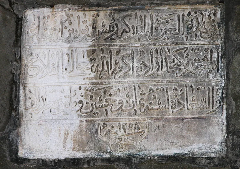
The historical fountain, built in Tirebolu district center in 1842 by Kethüdzâde Emin Ağa as a charity for Selimağa, was built of cut andesite stone with a square plan and two facades. It is one of the registered masterpieces of Ottoman water architecture with its inscriptions, pointed arch niches and stone decorations.
Geographical Structure, Altitude and Natural Features
The altitude is 10 meters. The historical district center has a bazaar structure.
Visiting Hours, Days and Entrance Fees
- Entrance Fee: Free.
- Visiting Hours and Days: Open 24 hours.
- Rules, Safety and Stroller/Disabled Access: Flat-footed; easily accessible.
- Facilities and Facilities: Natural spring water flows.
Transportation, Public Transit Routes and Exact Location
- Address / Open Location: Çarşı Mahallesi, Selimağa Sokak, 28500 Tirebolu / Giresun.
- Road Condition and Vehicle Availability: It can be reached by walking in Tirebolu centre.
- Real Public Transportation Information: It can be reached by city vehicles.
- Parking Availability: Surrounding city car parks can be used.
Contextual Experience Tips, Photography and Local Gastronomy
- Best Photography Spots and Frames: Ottoman inscription in thuluth calligraphy dated 1842 and stone arch details.
- Light and Shooting Hours: Morning hours.
- Local Gastronomy Recommendations: Drink water from the fountain and buy hazelnuts from the market.
6. Çeçen Hill and Işıklı Observation Area
Free Public Access • GPS: 40.9442, 38.8677
History and General Information / Local Legends and Folklore
Çeçen Hill is a famous viewing spot located on a high hill overlooking the coastline and the Black Sea to the west of Tirebolu district center. It has been used as a coastal observation and lighthouse point throughout history, and has been a strategic elevation that guides sailors. According to the narrations about the hill among the local people, it is stated that in clear weather, the entire coastline from Görele cape in the east to Espiye beaches in the west can be clearly observed.
Geographical Structure, Altitude and Natural Features
Its exact altitude is 160 meters. Rising with a gentle slope from the Black Sea coast, the hill is covered with dense hazelnut gardens, linden and chestnut trees. When viewed from the top, Tirebolu Castle, bays, beaches and the endless horizon of the Black Sea are laid out under your feet.
Visiting Hours, Days and Entrance Fees
- Entrance Fee: The visit is completely free.
- Visiting Hours and Days (Mandatory): Open 24 hours a day, 7 days a week; The most enjoyable viewing hours are between 08:00 and 20:00.
- Rules, Safety and Stroller/Disabled Access: The road up the hill is paved; Walking on the hill plain is comfortable. It is essential to keep the environment clean.
- Facilities and Facilities: Observation benches, resting pergolas and photo points are available.
Transportation, Public Transit Routes and Exact Location
- Address / Open Location: Çeçen Tepe Mevkii, Işıklı District, Tirebolu / Giresun.
- Road Condition and Vehicle Suitability: You can go up the hill in 5 minutes with all passenger vehicles via the asphalt street branching from the Tirebolu coastal road to the hill.
- Real Public Transportation Information (Mandatory): You can go from Tirebolu district center to the foothills with Işıklı minibuses.
- Parking Availability: There are car parking pockets on the hill.
Contextual Experience Tips, Photography and Local Gastronomy
- Best Photography Spots and Frames: Wide angle panoramic view from the summit, including Tirebolu Castle, the peninsula and the coastal bays.
- Light and Shooting Hours: Sunset golden hour; Moments when the sun sets over the Black Sea.
- Local Gastronomy Recommendations: While climbing the hill, it is recommended that you take hot minced meat pita and brewed tea from the Tirebolu bakery and relax with the view.
Explore Full 5-Section Guide & Map for Çeçen Hill and Işıklı Observation Area →
7. Historical Yeniköy District and Greek Stone Mansions (Urban Site)
Free Public Access • GPS: 40.9937, 38.8025
History and General Information / Local Legends and Folklore
Tirebolu Yeniköy District is a registered urban protected area with two and three-storey cut stone mansions built by families who got rich from the Black Sea hazelnut and silk trade in the 19th century. It is a unique open-air museum of Ottoman-Greek civil architecture with its stone mansions lined up in steps on the steep slopes overlooking the Black Sea, wrought iron balconies, wooden ceiling hubs and narrow cobblestone streets.
Geographical Structure, Altitude and Natural Features
The altitude is 35 meters. It is a hillside terrace settlement overlooking the sea.
Visiting Hours, Days and Entrance Fees
- Entrance Fee: Street tours are free.
- Visiting Hours and Days: Open 24 hours.
- Rules, Safety and Stroller/Disabled Access: Streets are paved; Comfortable walking shoes should be worn.
- Facilities and Facilities: Boutique hostels, art workshops and relaxation cafes are available.
Transportation, Public Transit Routes and Exact Location
- Address / Open Location: Yeniköy Mahallesi, 28500 Tirebolu / Giresun.
- Road Condition and Vehicle Availability: It takes 3 minutes to walk from Tirebolu town center.
- Real Public Transportation Information: City minibuses pass through the neighborhood entrance.
- Parking Availability: There are parking pockets at the entrance of the neighborhood.
Contextual Experience Tips, Photography and Local Gastronomy
- Best Photo Spots and Frames: The wrought iron bay windows of the yellow cut stone mansions and the deep blue Black Sea visible through them.
- Light and Shooting Hours: Morning hours and afternoon sun.
- Local Gastronomy Recommendations: Freshly brewed Tirebolu tea and hazelnut cookies in historical street cafes.
8. Körliman Bay and Tirebolu Coastal Park
Free Public Access • GPS: 41.0070, 38.8404
History and General Information / Local Legends and Folklore
Körliman Bay is a sheltered sea recess surrounded by the historical sea walls and castle of Tirebolu. This bay, which was a natural harbor where sailors from Miletus took refuge from the stormy Black Sea waters in ancient times, has become the city's most popular coastal park and walking promenade with the coastal arrangements made during the Republic period. It is one of the symbolic sights of Tirebolu with its sheltered structure against the waves and calm waters where fishing boats glide.
Geographical Structure, Altitude and Natural Features
Its altitude is at sea level (0 m). It has a natural crescent-shaped coastline. The seaside park is decorated with palms, plane trees and colorful seasonal flowers.
Visiting Hours, Days and Entrance Fees
- Entrance Fee: Entrance to the seaside park and the promenade is completely free.
- Visiting Hours and Days (Mandatory): Open 24 hours a day, 7 days a week.
- Rules, Safety and Stroller/Disabled Access: The beach park is completely flat and very suitable for stroller and wheelchair use.
- Facilities and Facilities: There are coastal promenade walking and cycling tracks, tea gardens, children's playground, outdoor cafes, rest benches and WC.
Transportation, Public Transit Routes and Exact Location
- Address / Open Location: Körliman Mahallesi, Sahil Caddesi, Tirebolu / Giresun.
- Road Condition and Vehicle Suitability: On the Black Sea Coastal Road, adjacent to the town centre; It can be easily reached by all vehicles.
- Actual Public Transportation Information (Mandatory): Intercity coastal buses and all minibuses within Tirebolu district pass through the main street next to the bay.
- Parking Availability: There are large free outdoor parking pockets along the Kordon.
Contextual Experience Tips, Photography and Local Gastronomy
- Best Photography Points and Frames: Panoramic frame that includes the promontory of the historical Tirebolu Castle, which extends to the sea, across Körliman.
- Light and Shooting Times: Sunset in the evening; golden sparkles on the sea.
- Local Gastronomy Recommendations: You should drink the famous brewed Tirebolu 42 tea and taste the hazelnut cookies at the beach cafes.
Explore Full 5-Section Guide & Map for Körliman Bay and Tirebolu Coastal Park →
9. Geographically Registered Tirebolu 42 Tea, Hazelnut and Gastronomy Route
Free Public Access • GPS: 40.9818, 38.7688
History and General Information / Local Legends and Folklore
'Tirebolu 42 Tea', named to keep the memory of the 42nd Giresun Volunteer Regiment in the War of Independence alive and protected by the Geographical Indication Registration by the Turkish Patent and Trademark Office, is Türkiye's highest quality and aromatic tea, specially produced from only the top two and a half fresh leaves of the tea plant. Tirebolu is a complete culinary capital with its famous Giresun plump hazelnuts, crispy Tirebolu closed pita, buttered haddock pancakes and kale wraps at seaside restaurants.
Geographical Structure, Altitude and Natural Features
The altitude is 10 meters. It is located on the Black Sea Coastal Road and the Tirebolu district center market promenade.
Visiting Hours, Days and Entrance Fees
- Entrance Fee: Bazaar and factory sales centers are free.
- Visiting Hours and Days: Open 7 days a week between 08:00 - 23:00.
- Rules, Safety and Stroller/Disabled Access: Market and beach cafes are flat; It is suitable for disabled access.
- Facilities and Facilities: Tirebolu has 42 tea sales and tasting centres, historical stone ovens, hazelnut shops and seaside fish restaurants.
Transportation, Public Transit Routes and Exact Location
- Address / Open Location: Çarşı Mahallesi ve Sahil Boulevard, 28500 Tirebolu / Giresun.
- Road Condition and Vehicle Suitability: Located on the Black Sea Coastal Road; It can be reached directly by all kinds of vehicles.
- Real Public Transport Information: All intercity and district buses on the Black Sea coast line stop.
- Parking Availability: There is a large open parking area in the bazaar and beach embankment area.
Contextual Experience Tips, Photography and Local Gastronomy
- Best Photography Points and Frames: Steaming amber-coloured Tirebolu 42 tea in a slim-waisted glass cup, with a view of Tirebolu Castle and a bowl of fresh hazelnuts.
- Light and Shooting Hours: Breakfast and afternoon tea time.
- Local Gastronomy Recommendations: Genuine Tirebolu 42 tea, freshly baked Tirebolu pita with buttered minced meat and hazelnut paste should definitely be purchased.
10. Beygirkumu Natural Coastal Beach (Thin Golden Beach)
Free Public Access • GPS: 41.0020, 38.8050
History and General Information / Local Legends and Folklore
Beygirkumu Beach, located west of Tirebolu district centre, is a registered public beach with the finest and highest quality natural golden sand in the Eastern Black Sea Region. It is the most famous summer holiday center of the region with its shallow and clean sea fed by alluviums of the Black Sea waters and its healing sand believed to be enriched with mineral water minerals.
Geographical Structure, Altitude and Natural Features
Altitude is 2 meters. It is located on a wide alluvial golden sandy strip.
Visiting Hours, Days and Entrance Fees
- Entrance Fee: Entrance to the beach is free (sunbed and umbrella rental is charged).
- Visiting Hours and Days: Open 24 hours (swimming opportunity in the summer season).
- Rules, Safety and Stroller/Disabled Access: The beach is flat; It is suitable for disabled access.
- Facilities and Facilities: Changing cabins, shower, cafeteria, lifeguard and WC are available.
Transportation, Public Transit Routes and Exact Location
- Address / Open Location: Beygirkumu Mevkii, Sahil Yolu, 28500 Tirebolu / Giresun.
- Road Condition and Vehicle Suitability: It is next to the Black Sea Coastal Road; It can be reached directly by any vehicle.
- Real Public Transportation Information: Tirebolu-Giresun minibuses stop in front of the beach.
- Parking Availability: There is ample free car parking in the beach area.
Contextual Experience Tips, Photography and Local Gastronomy
- Best Photo Spots and Frames: The endless golden beach and the turquoise Black Sea waves crashing onto the shore.
- Light and Shooting Times: Clear sea and sunset in the morning.
- Local Gastronomy Recommendations: Cold buttermilk and Tirebolu pita should be consumed in beach cafes.
Explore Full 5-Section Guide & Map for Beygirkumu Natural Coastal Beach (Thin Golden Beach) →
What to Eat in Tirebolu, Giresun? Registered Local Delicacies & Gastronomy
A trip to Tirebolu, Giresun is incomplete without tasting its officially registered geographical indication products and centuries-old Anatolian recipes:
1. Giresun Kadayıf Dessert with Hazelnut Paste (Fırıncılık ve pastacılık mamulleri, hamur işleri, tatlılar)
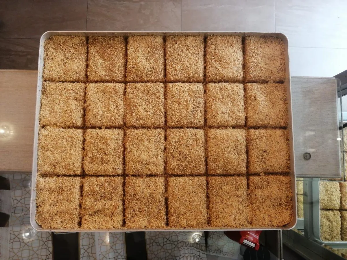
Giresun Hazelnut Paste Kadayıf Dessert is a geographically indicated value of ours, unique to the Giresun region and registered by the Turkish Patent and Trademark Office on 23.03.2023 (with registration number 1345).
View Official Geographical Indication Dossier for Giresun Kadayıf Dessert with Hazelnut Paste →
2. Tamzara Weaving (Dokumalar)
Tamzara Weaving is a geographically indicated value of ours, unique to the Giresun region and registered by the Turkish Patent and Trademark Office on 30.09.2019 (with registration number 460).
View Official Geographical Indication Dossier for Tamzara Weaving →
3. Alucra Capricorn Kebab (Yemekler ve çorbalar)
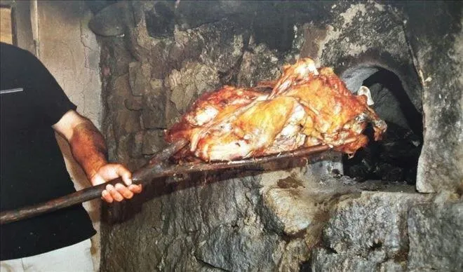
The suckling baby kids are roasted like pomegranates in ovens and served on copper trays.
History: A centuries-old kebab festival held in the spring months in the Alucra plateaus.
View Official Geographical Indication Dossier for Alucra Capricorn Kebab →
4. Çavuşlu Bread (Fırıncılık ve pastacılık mamulleri, hamur işleri, tatlılar)
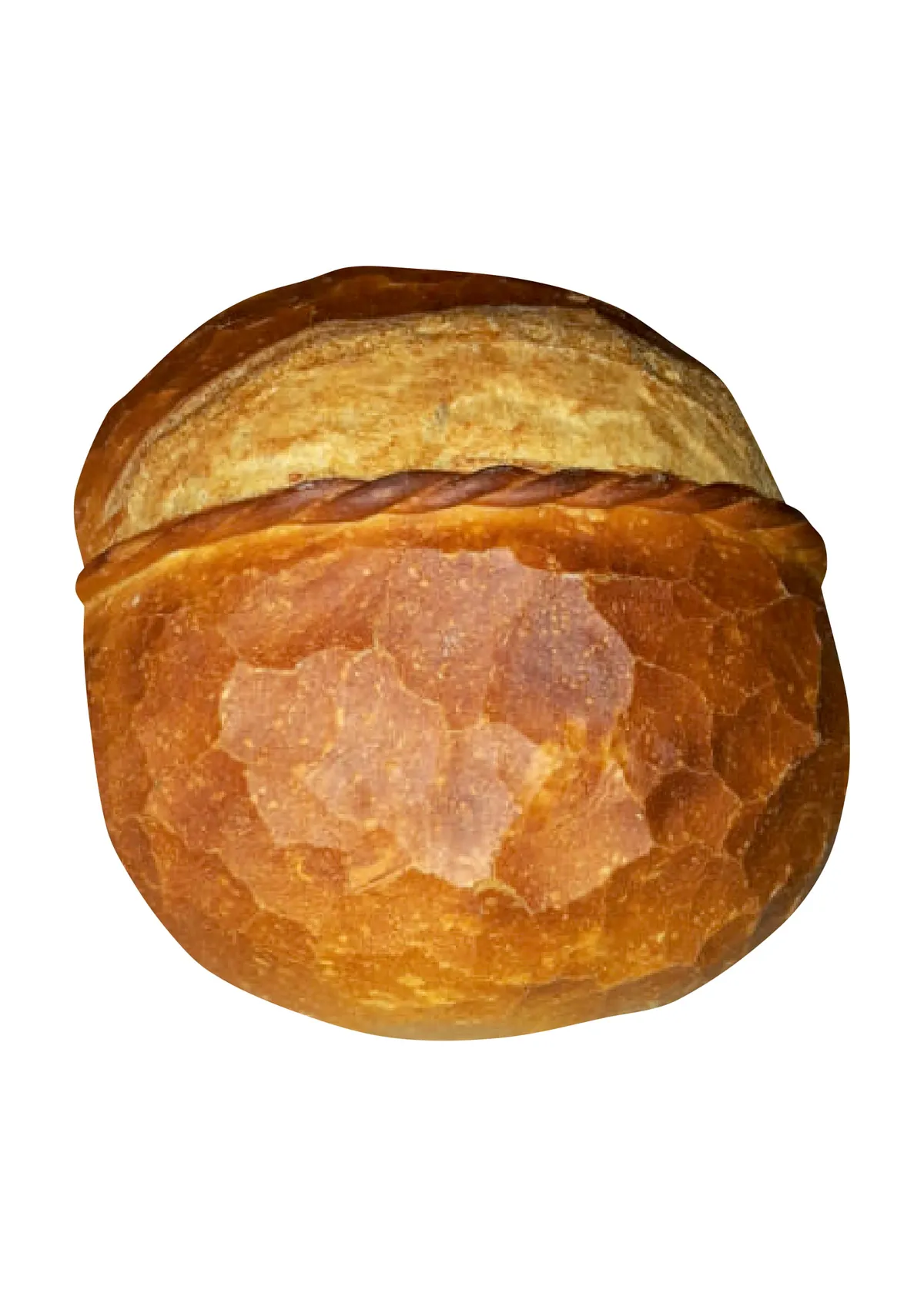
Çavuşlu Bread is a geographically indicated value of ours, unique to the Giresun region and registered by the Turkish Patent and Trademark Office on 09.12.2020 (with registration number 623).
View Official Geographical Indication Dossier for Çavuşlu Bread →
5. Çamoluk Sugar Dried Beans (İşlenmiş ve işlenmemiş meyve ve sebzeler ile mantarlar)

Round, snow-white, quick-cooking and sweet-flavored beans grown in the Kelkit Valley.
History: Gourmet pulses grown in Giresun's valley on the border of Central Anatolia.
View Official Geographical Indication Dossier for Çamoluk Sugar Dried Beans →
6. Giresun Kalınkara Hazelnut /Giresun Karası (İşlenmiş ve işlenmemiş meyve ve sebzeler ile mantarlar)

Giresun Kalınkara Hazelnuts /Giresun Karası is a geographically indicated value of ours with an official Origin Name, specific to the Giresun region, registered by the Turkish Patent and Trademark Office on 18.09.2019 (with registration number 456).
View Official Geographical Indication Dossier for Giresun Kalınkara Hazelnut /Giresun Karası →
Practical Travel & Transit Planning for Tirebolu, Giresun (2026)
| Planning Category | Verified Local Information |
|---|---|
| Region & Administrative Center | Tirebolu, Giresun, Türkiye |
| Best Time to Visit | Spring (April–June) and Autumn (September–November) for ideal sightseeing weather; Summer for highlands and coastal routes. |
| Public Transit & Highway Access | Regular municipal buses and local minibus cooperatives (Dolmuş) depart daily from the Giresun Intercity Bus Terminal (Otogar) directly to Tirebolu. |
| Recommended Stay | 1 to 2 full days to explore the main historical landmarks, nature trails, and local culinary stops. |
Frequently Asked Questions About Visiting Tirebolu, Giresun
What are the must-see places to visit in Tirebolu, Giresun?
The top verified attractions in Tirebolu, Giresun include Harşit Valley and Stream Delta, Aslancık Dam Lake and Canyon Valley, Historical Bedrama (Bedreme) Castle and Harşit Valley Viewing Summit, Historical Tirebolu Castle (Saint Jean Castle - 1300 BC Sea Walls), Historical Selimağa Fountain (1842 Kethüdzâde Emin Ağa Charity). Each location offers documented historical or natural heritage with clear road access.
How can I get to Tirebolu, Giresun by public transport or car?
You can reach Tirebolu, Giresun easily by car via Giresun's main provincial highways, or take regular municipal buses and district minibuses departing throughout the day from the Giresun central bus terminal (Otogar).
What are the famous local dishes and traditional foods to try in Tirebolu, Giresun?
When visiting Tirebolu, Giresun and Giresun, be sure to taste officially registered specialties such as Giresun Kadayıf Dessert with Hazelnut Paste, Tamzara Weaving, Alucra Capricorn Kebab, Çavuşlu Bread, Çamoluk Sugar Dried Beans, prepared by local artisans and traditional restaurants.
Are the attractions in Tirebolu, Giresun suitable for families and day trips?
Yes. Most historic monuments, parks, museums, and promenade areas in Tirebolu, Giresun are family-friendly and well-suited for both weekend getaways and full-day cultural itineraries.
When is the best season to visit Tirebolu, Giresun?
Spring and autumn offer the most comfortable temperatures for walking tours and photography in Tirebolu, Giresun, while summer is popular for nature recreation, plateaus, and festivals.