
Planning a journey to Karakoyunlu, Iğdır? This comprehensive 2026 Ancient Cities guide brings together 10 verified landmarks, natural wonders, and cultural heritage sites with official visiting hours, GPS coordinates, public transit connections, and local gastronomy recommendations.
Quick Highlights & Discovery Route in Karakoyunlu, Iğdır
- Historical Taşburun Village Koç Head Cemetery and Mosque
- Zülfikar Village Nature Area and Gardens
- Historical Ram Head Tombstones Open Air Museum
- Cennetabat Village Nature Trail and Orchards
- Historical Karakoyunlu Ram Head Tombstones Open Air Museum
- Kerimbeyli Village Historical Mound and Aras Coast
- Iğdır Taş Meatball Dinner
- Iğdır Bozbaş Dinner
Ancient Cities, Archaeological Ruins & Open-Air Heritage in Karakoyunlu, Iğdır
Karakoyunlu, Iğdır (Iğdır) sits along ancient trade, military, and cultural corridors of Anatolia. Archaeological mounds, rock-cut tombs, necropolises, ancient theaters, and classical settlements around Karakoyunlu, Iğdır shed light on thousands of years of human settlement.
- MuseumPass & Entry Info: Check MuseumPass Türkiye (Müzekart) validity and seasonal visiting hours before visiting official archaeological sites in Karakoyunlu, Iğdır.
- Footwear & Sun Protection: Wear non-slip walking shoes, a hat, and carry water when exploring uneven stone streets and hillside ruins.
- Archaeological Context: Combine your visit to the ruins of Karakoyunlu, Iğdır with the local archaeological museum in Iğdır to see excavated artifacts and inscriptions.
Top Verified Ancient Cities & Must-See Landmarks in Karakoyunlu, Iğdır
1. Historical Taşburun Village Koç Head Cemetery and Mosque
Free Public Access • GPS: 39.9480, 44.0969
Historical Taşburun Village Koç Başlı Cemetery and Mosque
History and General Information / Local Legends and Folklore
- Located in the historical Taşburun Village of Karakoyunlu district, the cemetery is a registered open-air cultural heritage that keeps alive the ram-headed tombstone tradition of the Karakoyunlu and Akkoyunlu Turkmen states, which ruled the region in the 14th and 15th centuries.
- Ram-headed stones erected on the graves of Turkmen warriors, alpine warriors and tribal chiefs; It symbolizes courage, bravery and fertility.
- The historical mosque and centuries-old cemetery of the village are a spiritual stop that the people of Serhat have visited with prayers for centuries.
Geographical Structure, Altitude and Natural Features
- It is located on flat and fertile plain land with an altitude of 840 meters.
- It is surrounded by centuries-old poplars and mulberry trees.
Visiting Hours, Days and Entrance Fees
- Entrance Fee: It is a historical and spiritual protected area and entrance is completely free.
- Visiting Hours and Days: It is open to visitors all day long, 7 days a week.
- Rules and Security: Historical ram-headed statues should not be touched and cemetery etiquette should be observed.
- Facilities and Facilities: Mosque ablution room, fountain, benches and WC are available.
Transportation, Public Transit Routes and Exact Location
- Address / Open Location: Taşburun Village Center, 76900 Karakoyunlu / Iğdır.
- Road Condition: It is on the Iğdır-Nakhichevan highway, 8 km away from Karakoyunlu; It is easily reached by divided asphalt road.
- Actual Public Transportation Information: All Aralik/Dilucu minibuses departing from Iğdır Bus Terminal and Karakoyunlu pass through Taşburun.
- Parking Availability: There are parking spaces for 25 vehicles in front of the mosque and cemetery.
Spiritual Visiting Etiquette and Commemoration Guidelines
- Sword, shield, dagger and quiver reliefs on ram-headed stones are the peak examples of Turkmen art in sculpture.
- When visiting Taşburun, you should buy hot kete from the village oven and consume it with tea.
Explore Full 5-Section Guide & Map for Historical Taşburun Village Koç Head Cemetery and Mosque →
2. Zülfikar Village Nature Area and Gardens
Free Public Access • GPS: 39.9922, 44.1465
History and General Information / Local Legends and Folklore
Zülfikar Village Nature Area and Gardens is a lush green oasis village with the most generous orchards of Iğdır's famous microclimate climate and irrigated by water springs fed by the snow of Mount Ararat. Gardens filled with the famous geographically indicated Iğdır Şalağı (oval table apricot), juicy peaches, figs and centuries-old walnut trees; It offers a visual feast by blooming pink-white in spring. According to local legend, Zülfikar Village is named after Hz. It is rumored that Ali took his sword, which symbolizes justice, and that the village springs are frozen even in the summer heat because they filter through the underground glaciers of Mount Ararat.
Geographical Structure, Altitude and Natural Features
It is located at the foothills of Mount Ararat, at an altitude of approximately 890 meters. It is surrounded by lush orchards, clear water channels and green groves.
Visiting Hours, Days and Entrance Fees
- Entrance Fee: Visiting the village and garden paths is completely free.
- Visiting Hours and Days: It can be visited freely in daylight, 7 days a week; Spring flowering and summer harvest periods are the most beautiful months.
- Rules, Security and Baby Stroller/Disabled Access: Private gardens should not be entered without permission and fruit branches should not be broken. Village roads are flat and suitable for strollers and disabled chairs.
- Facilities and Facilities: There is a village coffee house, traditional fountains and a village grocery store.
Transportation, Public Transit Routes and Exact Location
- Address / Open Location: Zülfikar Köyü Yolu, Karakoyunlu / Iğdır.
- Road Condition and Vehicle Availability: It is 4 km away from Karakoyunlu district center; It can be easily reached by all passenger vehicles via the asphalt road.
- Real Public Transportation Information: It can be reached in 5 minutes by village shuttles or taxis departing from Karakoyunlu center.
- Parking Availability: Free open parking is available in the village square.
Contextual Experience Tips, Photography and Local Gastronomy
- Best Photo Spots and Frames: Postcard-perfect view of the snow-capped Mount Ararat peak rising from among blooming white apricot branches.
- Light and Shooting Times: Clear light in the early morning and sunset in the evening.
- Local Gastronomy Recommendations: Freshly picked Iğdır şalağı apricots, apricot jam and tandoori buns.
Explore Full 5-Section Guide & Map for Zülfikar Village Nature Area and Gardens →
3. Historical Ram Head Tombstones Open Air Museum
Free Public Access • GPS: 39.9760, 44.1740
History and General Information / Local Legends and Folklore
The Historical Ram Head Tombstones Open Air Museum is the most unique cultural heritage of the Karakoyunlu and Akkoyunlu Turkmen states, which ruled the Eastern Anatolia and Azerbaijan geography in the 14th and 15th centuries. In the Turkmen tradition, these ram statues carved from a single piece of stone were erected on the graves of brave, brave, heroic warriors and brave men who were martyred at a young age; It symbolizes power, abundance and eternal loyalty. Sword, shield, bow, dagger, spear, loom and reed motifs carved in relief on the bodies of the rams immortalize the profession and bravery of the tomb owner. According to local legend, it is believed that these ram-headed stones protect graves at night and bear witness to those who have been wronged.
Geographical Structure, Altitude and Natural Features
It is located in the Iğdır Plain, in the Karakoyunlu district center, at an altitude of approximately 860 meters. It is an open-air park surrounded by centuries-old mulberry trees and green grass areas.
Visiting Hours, Days and Entrance Fees
- Entrance Fee: Entrance to the open air museum is completely free.
- Visiting Hours and Days: It can be visited freely in daylight, 7 days a week.
- Rules, Safety and Stroller/Disabled Access: Historical stone carvings should not be climbed on or destroyed. The parking area is completely flat and very suitable for stroller and disabled chair access.
- Facilities and Facilities: There are information boards, walking paths, rest benches and lighting.
Transportation, Public Transit Routes and Exact Location
- Address / Open Location: Merkez Mahallesi, Koçlar Park, Karakoyunlu / Iğdır.
- Road Condition and Vehicle Suitability: It is located on the side of the main street in Karakoyunlu district center; It can be reached in 1 minute from the Iğdır-Nakhchivan highway; It can be reached by all vehicles.
- Real Public Transportation Information: Karakoyunlu minibuses depart from Iğdır city center every 15 minutes and drop off directly in front of the park.
- Parking Availability: There are free car parking areas in front of the museum park.
Contextual Experience Tips, Photography and Local Gastronomy
- Best Photography Spots and Frames: Detail shots of the sword and shield reliefs on the body of the ram-headed statues and the silhouette of Mount Ararat rising in the background.
- Light and Shooting Times: Clear light in the early morning and sunset in the evening.
- Local Gastronomy Recommendations: Iğdır stone meatballs, apricot dessert and kitlama sweet tea in the town centre.
Explore Full 5-Section Guide & Map for Historical Ram Head Tombstones Open Air Museum →
4. Cennetabat Village Nature Trail and Orchards
Free Public Access • GPS: 40.0032, 44.2828
Cennetabat Village Nature Trail and Orchards
History and General Information / Local Legends and Folklore
- Cennetabat Village of Karakoyunlu, adjacent to the Aras River, is an authentic border village founded by the Avşar tribe of the Oghuzs, taking its name from the heavenly greenery and abundance of its gardens.
- The village, where registered Iğdır Şalak apricot, apple, peach and mulberry orchards have been grown for centuries, keeps the traditional agricultural culture alive.
Geographical Structure, Altitude and Natural Features
- Its altitude is 835 meters; It has extremely fertile soil fed by the alluviums of the Aras River.
- Apricot gardens blooming in pure white and pink in the spring, filling the plain with a fascinating scent.
Visiting Hours, Days and Entrance Fees
- Entrance Fee: It is a rural settlement open to the public and entrance is completely free.
- Visiting Hours and Days: It is open for nature walks 7 days a week.
- Rules and Safety: Orchards should not be damaged; Environmental cleanliness must be observed on field roads.
- Facilities and Amenities: There is a village fountain, grocery store and rest shades.
Transportation, Public Transit Routes and Exact Location
- Address / Open Location: Cennetabat Village, 76900 Karakoyunlu / Iğdır.
- Road Condition: It is 10 km away from Karakoyunlu district center; It can be reached in 12 minutes by the asphalt village highway.
- Real Public Transportation Information: Transportation is provided by Cennetabat village minibuses departing from Karakoyunlu center.
- Parking Availability: There is an open parking area for 20 vehicles at the village entrance.
Contextual Experience Tips, Photography and Local Gastronomy
- The framing of snowy Mount Ararat rising into the sky behind blooming apricot and fruit trees produces postcard-worthy nature photographs.
- Juicy shalak apricots freshly plucked from their branches and katmer cooked in the village tandoor should definitely be tasted.
Explore Full 5-Section Guide & Map for Cennetabat Village Nature Trail and Orchards →
5. Historical Karakoyunlu Ram Head Tombstones Open Air Museum
Free Public Access • GPS: 39.9719, 44.1725
History and General Information / Local Legends and Folklore
Historical Ram Head Tombstones, belonging to the period of the Karakoyunlu Turkmen State, which ruled in Eastern Anatolia and the Caucasus in the 14th and 15th centuries, are unique ethnographic monuments in which the Turkish tombstone tradition and the Eurasian steppe kurgan culture are blended with Islam.
Architectural Structure and Details
They are in the form of ram statues carved from a single piece of basalt and tuff stone. Symbols such as swords, shields, bows, arrows, daggers, reeds, combs and spears are engraved in relief on the body and back of the rams; These motifs symbolize the bravery, hunting or craftsmanship of the person lying there.
Spiritual Visiting Etiquette and Commemoration Guidelines
Walking among the majestic ram-headed stones lined up against the view of Mount Ararat in the open-air museum makes you vividly feel the thousand-year-old alpine and saintly spirit carried from Central Asia to the Caucasus and Anatolian plateaus.
Practical Visiting Tips & Transportation / Check-in
It is located in the Karakoyunlu district center, 15 km away from Iğdır city center. It is on the main highway, entrance is free and can be visited every day of the week.
Surrounding Routes & Local Gastronomy Discovery
Mount Ararat National Park and Karasu Wetland in Aralik district can be combined with the bird watching route. After the visit, you should try kete, buttered omaç and Iğdır eggplant jam prepared in local bakeries.
- Address / Open Location: Historical Karakoyunlu Ram Head Tombstones Open Air Museum Location, Karakoyunlu, Iğdır, Türkiye
Explore Full 5-Section Guide & Map for Historical Karakoyunlu Ram Head Tombstones Open Air Museum →
6. Kerimbeyli Village Historical Mound and Aras Coast
Free Public Access • GPS: 39.9946, 44.3967
Kerimbeyli Village Historical Mound and Aras Coast
History and General Information / Local Legends and Folklore
- The historical mound located in Kerimbeyli Village of Karakoyunlu district is an ancient settlement hill that has been inhabited uninterruptedly in the Aras River valley since the Bronze Age and Iron Age.
- Terracotta ceramic pieces and stone tools found on the surface indicate that the region was at the crossroads of ancient trade routes between the Caucasus and Anatolia.
Geographical Structure, Altitude and Natural Features
- The mound, with an altitude of 830 meters, rises slightly above the Aras River floodplain.
- Surrounded by riverside reeds and fertile agricultural lands; It is a frequent destination for water birds.
Visiting Hours, Days and Entrance Fees
- Entrance Fee: It is an archaeological site and the visit is completely free.
- Visiting Hours and Days: It can be examined in daylight 7 days a week.
- Rules and Security: The archaeological remains on the mound surface should not be damaged or excavated.
- Facilities and Facilities: There is a village fountain and a grocery store in Kerimbeyli village.
Transportation, Public Transit Routes and Exact Location
- Address / Open Location: Inside Kerimbeyli Village, 76900 Karakoyunlu / Iğdır.
- Road Condition: It is 9 km away from Karakoyunlu district center; It can be easily reached by passenger vehicles via the asphalt village highway.
- Real Public Transportation Information: It takes 10 minutes by village minibuses or taxi from Karakoyunlu.
- Parking Availability: There is an open parking area for 20 vehicles in the village square.
Featured Rare Artifacts & Archaeological Tips
- From the top of the mound, the bends of the Aras River and the Armenian plains on the opposite bank can be clearly observed.
- Homemade noodles and fresh apricot jam should be tasted during your visit to the village.
Explore Full 5-Section Guide & Map for Kerimbeyli Village Historical Mound and Aras Coast →
7. Mürşitali Village Natural Apricot Gardens and Springs
Free Public Access • GPS: 40.0265, 44.1380
Mürşitali Village Natural Apricot Gardens and Springs
History and General Information / Local Legends and Folklore
- Mürşitali Village, one of the greenest settlements of Karakoyunlu, is famous for its natural gardens where Iğdır's famous chalak apricot grows in the highest quality and juicy.
- According to local narratives, it is said that those who drink water from the spring under the grand plane trees of the village have a long life and a beautiful voice.
Geographical Structure, Altitude and Natural Features
- Its altitude is 845 meters; It is located on a gently sloping valley floor overlooking the Aras Valley.
- It is covered with centuries-old mulberry, walnut and apricot gardens; Clear underground water sources boil as springs.
Visiting Hours, Days and Entrance Fees
- Entrance Fee: It is a rural area open to the public and entrance is completely free.
- Visiting Hours and Days: It can be visited all day long, 7 days a week.
- Rules and Security: Orchards should not be entered without permission and branches should not be broken.
- Facilities and Facilities: There is a village fountain, village coffee house and shaded recreation areas.
Transportation, Public Transit Routes and Exact Location
- Address / Open Location: Mürşitali Köyü, 76900 Karakoyunlu / Iğdır.
- Road Condition: It is 6 km away from Karakoyunlu district center; It can be reached in 8 minutes by passenger vehicles via the asphalt village highway.
- Real Public Transportation Information: Transportation is provided by village minibuses departing from Karakoyunlu.
- Parking Availability: There is open parking space for 15 vehicles in the village square.
Contextual Experience Tips, Photography and Local Gastronomy
- The greenery rising from the gardens and the frame of Mount Ararat in the background reflect the pastoral Iğdır culture in its simplest form.
- Sun-dried natural apricot pulp and kete should be tasted at Mürşitali.
Explore Full 5-Section Guide & Map for Mürşitali Village Natural Apricot Gardens and Springs →
8. Karakoyunlu Martyrs Monument and Park
Free Public Access • GPS: 39.9707, 44.1822
History and General Information / Local Legends and Folklore
Karakoyunlu Martyrs' Monument and Park was erected in memory of the local national detachment heroes and our homeland martyrs who bravely resisted to protect the Karakoyunlu plain, their women and children against the atrocities committed in the region after World War I in 1919-1920. The resistance shown by these heroes, who held the borders until the Turkish army reached the region, played a decisive role in saving Iğdır from enemy occupation. It is said with gratitude among the local people that the Karakoyunlu plain was watered with the blood of the martyrs and that thanks to their courage, these fertile lands remained the eternal Turkish homeland.
Geographical Structure, Altitude and Natural Features
It is located in the Karakoyunlu district center, at an altitude of approximately 845 meters, on the side of the Iğdır-Nakhichevan highway. Fruit gardens, pine trees and green parkland surround it. The majestic conical silhouette of Mount Ararat is visible from the front.
Visiting Hours, Days and Entrance Fees
- Entrance Fee: Visiting the monument and park area is completely free.
- Visiting Hours and Days (Mandatory): Open to the public 24 hours a day, 7 days a week.
- Rules, Safety and Stroller/Disabled Access: Moral respect must be shown at the Martyrs' memorial site. Thanks to its smooth parquet walkways, it is fully wheelchair and stroller accessible.
- Facilities and Facilities: Martyrs' monument base, ceremony area, benches, fountain and district center facilities are available in the immediate vicinity.
Transportation, Public Transit Routes and Exact Location
- Address / Open Location: Ergenekon District, On Nakhchivan Street, Karakoyunlu / Iğdır.
- Road Condition and Vehicle Availability: It is 14 km away from Iğdır city center; Iğdır-Dilucu border gate is on the dual divided state highway; It can be reached comfortably by passenger vehicles.
- Actual Public Transportation Information (Mandatory): Karakoyunlu and Aral minibuses depart from Iğdır center every 15 minutes and stop in front of the monument park.
- Parking Availability: There is a large and free car parking area around the park.
Spiritual Visiting Etiquette and Commemoration Guidelines
- Spiritual Visitation and Prayer Etiquette: Visitors should stand with dignity in front of the monument plinth; Fatiha and prayers should be sent to the souls of our ancestors who were martyred in the defense of Karakoyunlu.
- Documentary & Respectful Shooting: The inscriptions and Turkish flag reliefs on the martyrs' monument should be photographed respectfully; Casual attitudes should be avoided.
- Important Commemoration Days: Ceremonies are held with the participation of the district protocol and schools on 14 November, the Liberation of Iğdır, and 18 March, Martyrs' Day.
- Local Spiritual Tradition: On commemoration days, halva and tea are offered to visitors and prayers are asked for the holy souls of our martyrs.
Explore Full 5-Section Guide & Map for Karakoyunlu Martyrs Monument and Park →
9. Bulakbaşı Karasu Recreation Area and Wetland
Free Public Access • GPS: 39.9322, 44.2541
Bulakbaşı Karasu Recreation Area and Wetland
History and General Information / Local Legends and Folklore
- Bulakbaşı, where the ice-cold snow waters filtered from the volcanic mass of Mount Ararat come to the surface in the form of huge natural springs (bulaks) in the plain, is the blooming oasis of Iğdır in the desert.
- These ancient springs, where caravans and frontier tribes have been supplying water for centuries, are referred to as the tears of Mount Ararat in local legends.
- The wetland is the rarest biological oasis in Turkey, where endangered otters and water monkeys live naturally.
Geographical Structure, Altitude and Natural Features
- Its altitude is 850 meters; The calm and clear channels formed by the springs surround the plain like a natural labyrinth.
- Otters and hundreds of water birds can be observed swimming among reeds, water hyacinths, water lilies and duckweeds; The majestic silhouette of Mount Ararat rises in the background.
Visiting Hours, Days and Entrance Fees
- Entrance Fee: It is a nature and recreation area open to the public and entrance is completely free.
- Visiting Hours and Days: Open 24 hours a day, 7 days a week.
- Rules and Safety: Garbage should not be thrown into the habitats of otters and birds; Water channels should not be entered.
- Facilities and Facilities: Wooden picnic tables, walking paths, natural spring fountains and recreation areas are available.
Transportation, Public Transit Routes and Exact Location
- Address / Open Location: Bulakbaşı Köyü Karasu Mevkii, 76900 Karakoyunlu / Iğdır.
- Road Condition: It is 12 km away from Karakoyunlu district center; It can be easily reached in 15 minutes by passenger vehicles via the asphalt village highway.
- Real Public Transportation Information: Transportation is provided by Bulakbaşı village minibuses or district taxis departing from Iğdır and Karakoyunlu.
- Parking Availability: There is an open parking area for 40 vehicles at the entrance of the recreation area.
Contextual Experience Tips, Photography and Local Gastronomy
- The view of Mount Ararat reflected in the clear water channels covered with water lilies produces the most fascinating nature photographs of Turkey.
- You should taste the famous Iğdır eggplant jam and fresh lavash accompanied by tea brewed in ice-cold spring water next to the springs.
Explore Full 5-Section Guide & Map for Bulakbaşı Karasu Recreation Area and Wetland →
10. Karakoyunlu Environmental Mound and Archaeological Area
Free Public Access • GPS: 39.9680, 44.1620
History and General Information / Local Legends and Folklore
Karakoyunlu Çevre Mound is an ancient archaeological settlement hill that was inhabited uninterruptedly during the Early Bronze Age (Kura-Aras culture) dating back to 3000 BC and then during the Urartu Kingdom. During the surface research carried out on the mound located at the junction of the fertile agricultural lands of the Sürmeli Plain and the Aras waterways; Terracotta ceramics, obsidian arrowheads, stone mills and ancient adobe building foundations have been identified. Local narratives say that the mound was a trade center where caravans stopped in ancient times and that the soil hides thousands of years of craft stories.
Geographical Structure, Altitude and Natural Features
It is a natural cultural hill rising at an altitude of approximately 865 meters on the bottom of the plain. It is surrounded by flat lowland fields and willow trees.
Visiting Hours, Days and Entrance Fees
- Entrance Fee: It is an open-air protected area and entrance is completely free.
- Visiting Hours and Days: It can be visited in daylight 7 days a week.
- Rules, Safety and Stroller/Disabled Access: Archaeological layers should not be damaged or excavated. The climb up the hill is slightly sloping and can be partially walked with a stroller.
- Facilities and Facilities: There is a natural viewing hill; It is very close to the town centre.
Transportation, Public Transit Routes and Exact Location
- Address / Open Location: Höyük Mevkii, Karakoyunlu / Iğdır.
- Road Condition and Vehicle Availability: It is 2 km away from Karakoyunlu district center; It can be reached by any passenger vehicle via an asphalt and stabilized road.
- Real Public Transportation Information: Take the Karakoyunlu district minibuses to the crossroads and walk for 5 minutes.
- Parking Availability: There is a free open car parking area at the foot of the mound.
Contextual Experience Tips, Photography and Local Gastronomy
- Best Photography Spots and Frames: Wide-angle photos from the mound overlooking the plain and bordering mountain ranges.
- Light and Shooting Hours: Morning sun and sunset hours.
- Local Gastronomy Recommendations: Homemade noodles and Iğdır lavash in the town center.
Explore Full 5-Section Guide & Map for Karakoyunlu Environmental Mound and Archaeological Area →
What to Eat in Karakoyunlu, Iğdır? Registered Local Delicacies & Gastronomy
A trip to Karakoyunlu, Iğdır is incomplete without tasting its officially registered geographical indication products and centuries-old Anatolian recipes:
1. Iğdır Taş Meatball Dinner (Yemekler ve çorbalar)

Iğdır Stone Meatball Meal is a geographically indicated value specific to the Iğdır region, registered by the Turkish Patent and Trademark Office on 14.12.2017 (with registration number 276).
View Official Geographical Indication Dossier for Iğdır Taş Meatball Dinner →
2. Iğdır Bozbaş Dinner (Yemekler ve çorbalar)
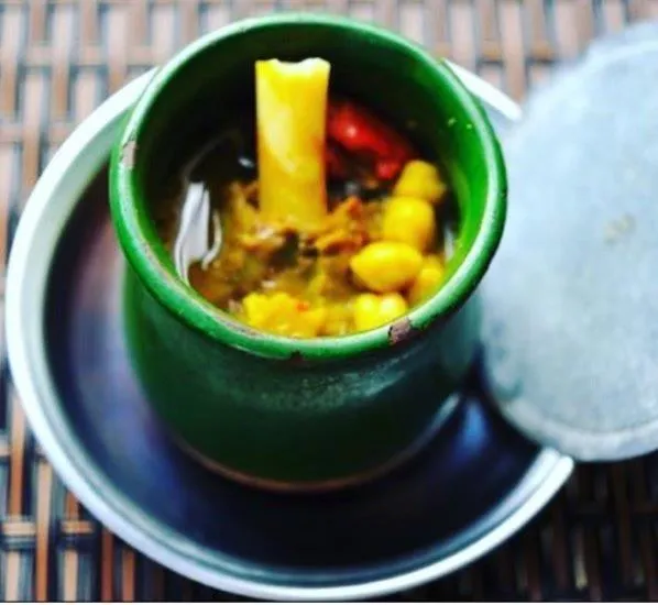
A dish cooked with lamb shank meat, chickpeas, tail fat and yellow root (turmeric) in special earthenware casseroles (piti pot).
History: A centuries-old Caucasian banquet dish in which lavash is chopped into water and the meat is crushed with a mallet and eaten.
View Official Geographical Indication Dossier for Iğdır Bozbaş Dinner →
3. Iğdır Omaç Vaccine Soup (Yemekler ve çorbalar)
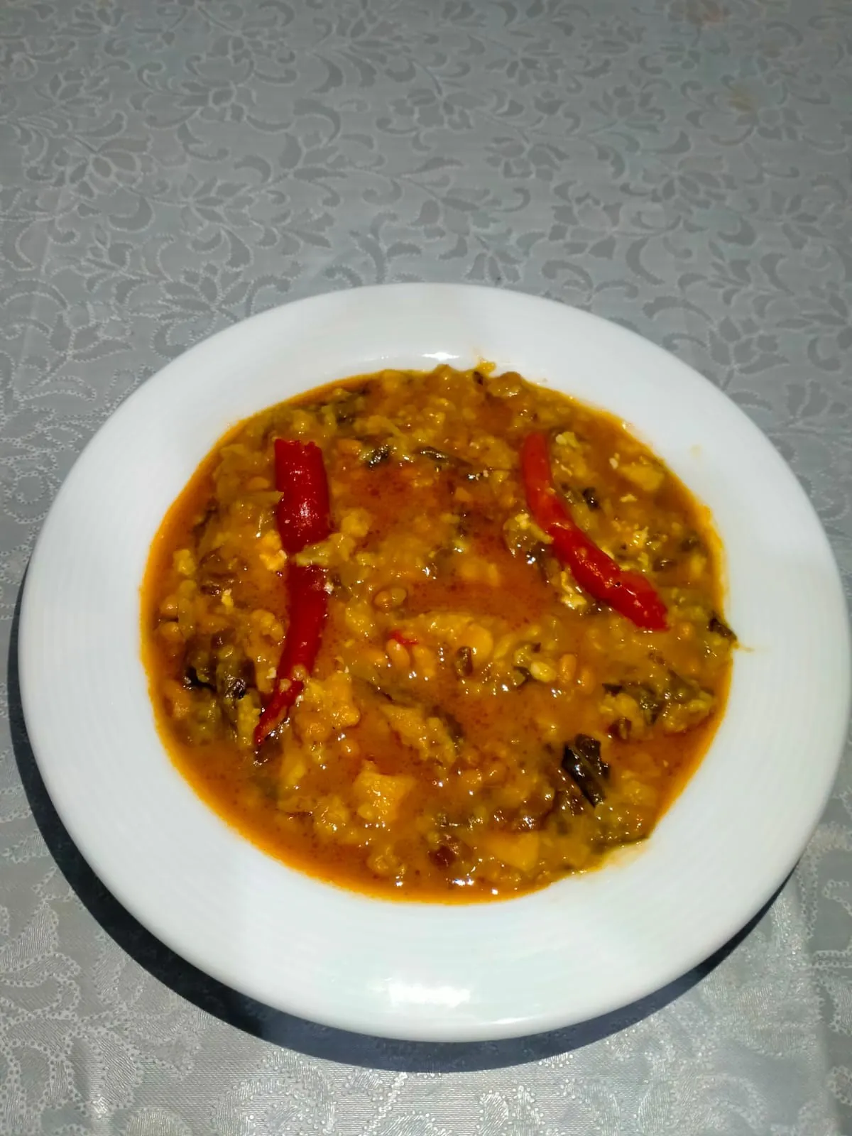
Iğdır Omaç Vaccine Soup is a geographically indicated value of ours, unique to the Iğdır region and registered by the Turkish Patent and Trademark Office on 26.08.2021 (with registration number 876).
View Official Geographical Indication Dossier for Iğdır Omaç Vaccine Soup →
4. Iğdır White Grape / Miskalı (İşlenmiş ve işlenmemiş meyve ve sebzeler ile mantarlar)
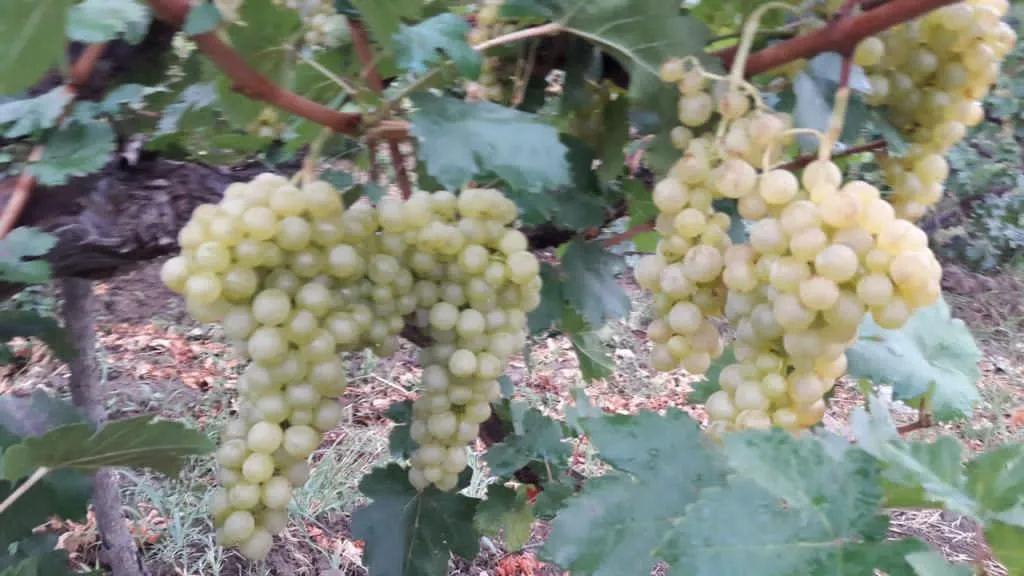
Iğdır White Grape / Miskalı is a geographically indicated value of ours, unique to the Iğdır region and registered by the Turkish Patent and Trademark Office on 09.08.2021 (with registration number 829).
View Official Geographical Indication Dossier for Iğdır White Grape / Miskalı →
5. Iğdır Eggplant Jam (İşlenmiş ve işlenmemiş meyve ve sebzeler ile mantarlar)
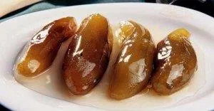
Iğdır Eggplant Jam is a geographically indicated value of ours, unique to the Iğdır region and registered by the Turkish Patent and Trademark Office on 20.12.2021 (with registration number 975).
View Official Geographical Indication Dossier for Iğdır Eggplant Jam →
6. Iğdır Apricot (İşlenmiş ve işlenmemiş meyve ve sebzeler ile mantarlar)
Registered fresh apricot, ripe early in the Aras Valley sun, for table use, oval shaped, red cheeked, sweet and fragrant.
History: Heritage of Aras Valley apricot gardens on the Silk Road.
View Official Geographical Indication Dossier for Iğdır Apricot →
Practical Travel & Transit Planning for Karakoyunlu, Iğdır (2026)
| Planning Category | Verified Local Information |
|---|---|
| Region & Administrative Center | Karakoyunlu, Iğdır, Türkiye |
| Best Time to Visit | Spring (April–June) and Autumn (September–November) for ideal sightseeing weather; Summer for highlands and coastal routes. |
| Public Transit & Highway Access | Regular municipal buses and local minibus cooperatives (Dolmuş) depart daily from the Iğdır Intercity Bus Terminal (Otogar) directly to Karakoyunlu. |
| Recommended Stay | 1 to 2 full days to explore the main historical landmarks, nature trails, and local culinary stops. |
Frequently Asked Questions About Visiting Karakoyunlu, Iğdır
What are the must-see places to visit in Karakoyunlu, Iğdır?
The top verified attractions in Karakoyunlu, Iğdır include Historical Taşburun Village Koç Head Cemetery and Mosque, Zülfikar Village Nature Area and Gardens, Historical Ram Head Tombstones Open Air Museum, Cennetabat Village Nature Trail and Orchards, Historical Karakoyunlu Ram Head Tombstones Open Air Museum. Each location offers documented historical or natural heritage with clear road access.
How can I get to Karakoyunlu, Iğdır by public transport or car?
You can reach Karakoyunlu, Iğdır easily by car via Iğdır's main provincial highways, or take regular municipal buses and district minibuses departing throughout the day from the Iğdır central bus terminal (Otogar).
What are the famous local dishes and traditional foods to try in Karakoyunlu, Iğdır?
When visiting Karakoyunlu, Iğdır and Iğdır, be sure to taste officially registered specialties such as Iğdır Taş Meatball Dinner, Iğdır Bozbaş Dinner, Iğdır Omaç Vaccine Soup, Iğdır White Grape / Miskalı, Iğdır Eggplant Jam, prepared by local artisans and traditional restaurants.
Are the attractions in Karakoyunlu, Iğdır suitable for families and day trips?
Yes. Most historic monuments, parks, museums, and promenade areas in Karakoyunlu, Iğdır are family-friendly and well-suited for both weekend getaways and full-day cultural itineraries.
When is the best season to visit Karakoyunlu, Iğdır?
Spring and autumn offer the most comfortable temperatures for walking tours and photography in Karakoyunlu, Iğdır, while summer is popular for nature recreation, plateaus, and festivals.