
Planning a journey to Iğdır? This comprehensive 2026 History & Culture guide brings together 10 verified landmarks, natural wonders, and cultural heritage sites with official visiting hours, GPS coordinates, public transit connections, and local gastronomy recommendations.
Quick Highlights & Discovery Route in Iğdır
- Historical Ejder Caravanserai (Harmanöven Caravanserai)
- Historical Iğdır Harmanöven Caravanserai (Ejder Inn)
- Zübeyde Hanım Boulevard and Iğdır City Square
- Historical Çakırtaş Tomb
- Historical Karakale (Sürmeli Castle) and Ruins
- Historical Iğdır Grand Mosque
- Iğdır Taş Meatball Dinner
- Iğdır Bozbaş Dinner
Historical Landmarks, Architecture & Cultural Heritage in Iğdır
Iğdır (Iğdır) preserves a multi-layered historical fabric shaped by centuries of Anatolian civilizations, including Roman, Byzantine, Seljuk, and Ottoman eras. Historic castles, stone bridges, caravanserais, civil mansions, and monumental structures reflect the strategic and cultural importance of Iğdır.
Walking through the historic quarters of Iğdır allows visitors to observe traditional masonry, timber-framed architecture, and restored heritage buildings up close.
- Architectural Details: Pay attention to carved stone portals, historic fountains, courtyard mansions, and defensive bastions across Iğdır.
- Best Visiting Hours: Early morning and late afternoon golden light offer the best conditions for architectural photography and crowd-free exploration.
- Cultural Etiquette & Preservation: Respect restoration zones and signage at registered historical monuments in Iğdır.
Top Verified History & Culture & Must-See Landmarks in Iğdır
1. Historical Ejder Caravanserai (Harmanöven Caravanserai)

Free Public Access • GPS: 39.8037, 43.8404
Historical Ejder Caravanserai (Harmanöven Caravanserai)
History and General Information / Local Legends and Folklore
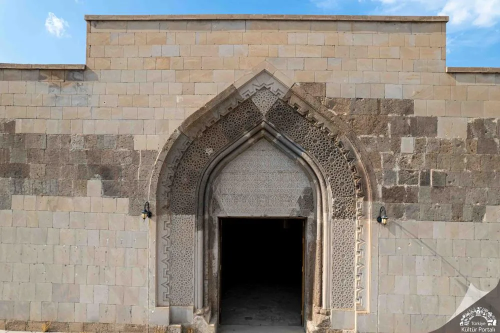
- The caravanserai, built by Şerafettin Ejder Bey during the Anatolian Seljuk period at the end of the 12th century and the beginning of the 13th century, is the gateway of the ancient Silk Road to the Caucasus and Iran.
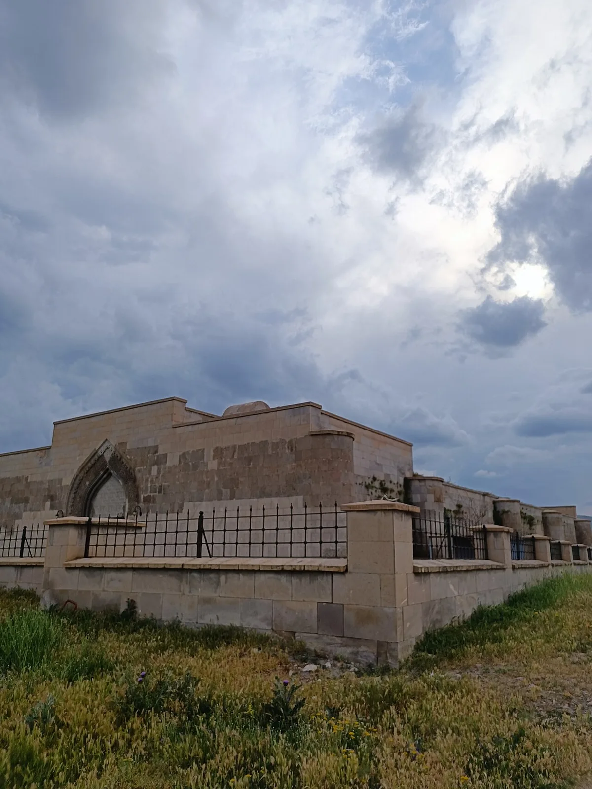
- Located on the Batumi-Tabriz caravan route, the building is the purest representative of the Seljuk monumental caravanserai architecture in Eastern Anatolia, with its magnificent muqarnas crown gate and geometric stone decorations.
- It is rumored in local legends that Ejder Bey had this castle-like shelter built to protect the caravans from bandits, and that merchants taking shelter from blizzards and storms were given free food and shelter for three days during the winter months.
Geographical Structure, Altitude and Natural Features
- It is located at the threshold of Harmanöven Plateau on the northwestern foothills of Mount Ararat, at an altitude of approximately 1250 meters above sea level.
- Built from dark basalt volcanic stone blocks, the inn is surrounded by volcanic lava plateaus and mountain steppe flora.
Visiting Hours, Days and Entrance Fees
- Entrance Fee: Entrance to the historical caravanserai and its courtyard is completely free.
- Visiting Hours and Days: It is open to visitors 7 days a week from sunrise to sunset.
- Rules, Safety and Stroller/Disabled Access: The restoration has been completed and there is a smooth stone pavement on the main hall floor; It can be entered with disabled cars and strollers.
- Facilities and Facilities: Information boards, landscaping and recreation areas are available.
Transportation, Public Transit Routes and Exact Location
- Address / Open Location: Harmanöven Village Location, Center / Iğdır.
- Road Condition and Vehicle Availability: It is approximately 32 km away from Iğdır city centre; The village road is asphalted and can be easily reached by any passenger vehicle.
- Real Public Transportation Information: Harmanöven village minibuses operate from Iğdır central village garage at certain hours.
- Parking Availability: There is a large and free parking area in front of the caravanserai.
Contextual Experience Tips, Photography and Local Gastronomy
- Best Photography Spots and Frames: Framing the vaulted main corridor of the caravanserai from under the arch of the monumental Seljuk crown gate and the silhouette of Mount Ararat rising outside.
- Light and Shooting Hours: Early morning (08:30 - 10:30) and late afternoon golden hour.
- Local Gastronomy Recommendations: Iğdır style bozbaş (piti) kebab, stone meatballs, eggplant jam and famous şalak apricot should be tasted.
Explore Full 5-Section Guide & Map for Historical Ejder Caravanserai (Harmanöven Caravanserai) →
2. Historical Iğdır Harmanöven Caravanserai (Ejder Inn)

Free Public Access • GPS: 39.8038, 43.8400
History and General Information / Local Legends and Folklore
Historical Harmanöven Caravanserai (Ejder Inn), located on the northern foothills of Mount Ararat, along the Sürmeli Pit and the Tabriz-Batumi Silk Road route, was built by Şerafeddin Ejder Bey during the Seljuk period at the end of the 12th century. It is the most protected range of caravan traffic between the Caucasus and Iran.
Architectural Structure and Details
It is a closed hall type with a rectangular plan with an east-west axis. It was built from dark colored volcanic basalt stones specific to the region. The monumental crown gate dazzles with the geometric borders of the Seljuk stone decoration art, its muqarnas ornament and rich Rumi decorations. The chipped stone columns and barrel vaults that divide the interior into three naves have perfect statics.
Spiritual Visiting Etiquette and Commemoration Guidelines
While walking through the cool stone corridors of the caravanserai, it is possible to feel the footprints of the merchants, dervishes and caravanners who stayed here for centuries. Rising in front of the magnificent silhouette of Mount Ararat, the caravanserai is the petrified symbol of the ancient hospitality of the east.
Practical Visiting Tips & Transportation / Check-in
It is near the village of Harmanöven, approximately 30 km away from Iğdır city center. Access is provided by asphalt road. It is open to visitors throughout the year; Morning and afternoon light is recommended to photograph the reliefs of the crown gate.
Surrounding Routes & Local Gastronomy Discovery
Tuzluca Salt Caves and Karakoyunlu Ram's Head Tombs should be combined with the Open Air Museum. After the trip, you should taste the registered Iğdır bozbaşı (piti), stone meatballs and the world-famous Iğdır apricot in season in the center of Iğdır.
- Address / Open Location: Historical Iğdır Harmanöven Caravanserai (Ejder Hanı) Location, Center, Iğdır, Türkiye
Explore Full 5-Section Guide & Map for Historical Iğdır Harmanöven Caravanserai (Ejder Inn) →
3. Zübeyde Hanım Boulevard and Iğdır City Square
Free Public Access • GPS: 39.9225, 44.0450
Zübeyde Hanım Boulevard and Iğdır City Square
History and General Information / Local Legends and Folklore
- Zübeyde Hanım Boulevard and City Square, the heart of Iğdır city centre, are the main backbone of the city's modern social, commercial and cultural life.
- The boulevard, which symbolizes the value the Republic attaches to women and education, is the daily meeting place of official holiday celebrations, Nevruz festivities and serhat people.
Geographical Structure, Altitude and Natural Features
- It extends as a wide pedestrian axis in Iğdır city center, with an altitude of 858 meters.
- It is shaded by centuries-old plane, acacia and linden trees and offers a cool and pleasant walking environment in the summer months.
Visiting Hours, Days and Entrance Fees
- Entrance Fee: It is a public city boulevard and square and entrance is completely free.
- Visiting Hours and Days: It is active 24 hours a day, 7 days a week.
- Rules and Security: Pedestrian road order and environmental cleanliness must be respected.
- Facilities and Facilities: Cafes and restaurants, benches, rest areas, historical fountains, shops and WC facilities are available.
Transportation, Public Transit Routes and Exact Location
- Address / Open Location: Bağlar Mahallesi, Zübeyde Hanım Bulvarı, 76000 Merkez / Iğdır.
- Road Condition: It is right in the heart of Iğdır city centre; It can be easily reached from all directions on foot and by vehicle.
- Real Public Transportation Information: All city public buses and district minibuses in Iğdır pass through the stops around this boulevard.
- Parking Availability: There is parking space in municipal multi-storey and open car parks around the boulevard.
Contextual Experience Tips, Photography and Local Gastronomy
- The green corridor and evening lighting along the boulevard provide a modern border city atmosphere.
- The famous Iğdır bozbaşı (piti), stone meatballs and eggplant jam desserts should definitely be tasted in the historical restaurants on the boulevard.
Explore Full 5-Section Guide & Map for Zübeyde Hanım Boulevard and Iğdır City Square →
4. Historical Çakırtaş Tomb
Free Public Access • GPS: 40.0203, 44.0712
History and General Information / Local Legends and Folklore
Historical Çakırtaş Tomb is a monumental mausoleum structure that continues the Seljuk and Karakoyunlu architectural tradition, dating back to the end of the 14th century and the beginning of the 15th century, within the borders of Çakırtaş Village in the Central district of Iğdır. The tomb, built of cut basalt and limestone with an octagonal body and a pyramidal cone roof, belongs to one of the regional lords of the period. According to local legends, it is believed that this tomb is the tomb of a benevolent ruler who protects the Silk Road merchants and the people of the region, and the geometric reliefs on the stones of the tomb are talismans for the safe passage of caravans.
Geographical Structure, Altitude and Natural Features
It is located in the eastern part of the Iğdır Plain, on the plain close to the Aras River basin, at an altitude of approximately 860 meters. It offers an elegant historical silhouette between the majestically rising Mount Ararat in the background and the lush orchards on the plain.
Visiting Hours, Days and Entrance Fees
- Entrance Fee: Visiting the historical tomb is completely free.
- Visiting Hours and Days (Mandatory): It can be visited freely during daylight hours, 7 days a week.
- Rules, Safety and Stroller/Disabled Access: Historical stone walls should not be written on or damaged. Thanks to the flat plain land, the area around the tomb can be easily navigated with a wheelchair or stroller.
- Facilities and Facilities: It is an open-air cultural asset and there is a mosque, grocery store and fountain in the village center.
Transportation, Public Transit Routes and Exact Location
- Address / Open Location: Çakırtaş Köyü Mevkii, Center / Iğdır.
- Road Condition and Vehicle Availability: It is approximately 9 km away from Iğdır city centre; It can be reached comfortably by passenger vehicles via the asphalt village road.
- Real Public Transportation Information (Mandatory): You can reach the village in 10 minutes by village minibuses operating from Iğdır Bus Terminal or by taxi from the center.
- Parking Availability: There is an open area right next to the tomb where vehicles can park free of charge.
Contextual Experience Tips, Photography and Local Gastronomy
- Best Photography Spots and Frames: Perspective photographs showing the snowy Mount Ararat peak behind the octagonal dome are one of the most iconic shots of Turkey.
- Light and Shooting Hours: In the early morning hours, when Mount Ararat is clearly visible, the stone texture of the tomb and the snowy peak of the mountain capture a wonderful contrast.
- Local Gastronomy Recommendations: In Iğdır, the famous stone meatballs, bozbaş (piti kebab), kaysava dessert and dried Iğdır apricots should definitely be tasted.
Explore Full 5-Section Guide & Map for Historical Çakırtaş Tomb →
5. Historical Karakale (Sürmeli Castle) and Ruins
Free Public Access • GPS: 40.0448, 43.8321
Historical Karakale (Sürmeli Castle) and Ruins
History and General Information / Local Legends and Folklore
- Karakale (Sürmeli Castle), built on a steep rocky ridge on the banks of the Aras River, near the Melekli Town of Iğdır city center, is the most established ancient border castle that supervised the Aras Valley from the Urartu period to the Seljuk and Ottoman periods.
- The castle, which is referred to as the capital and lock of the 'Sürmeli Pit' in medieval sources, has witnessed history with its huge walls, rock cisterns and watchtowers that protected the crossing point of the Silk Road merchants and armies.
- According to legend, the secret rock passages under the castle extend from under the Aras River to the opposite shore.
Geographical Structure, Altitude and Natural Features
- It rises on steep volcanic rocks with an altitude of 880 meters; The Aras River flows right underneath it.
- It is surrounded by Melekli's famous apricot vineyards and Aras reeds; It has a panoramic view overlooking the Armenian border and Alagöz Mountain.
Visiting Hours, Days and Entrance Fees
- Entrance Fee: It is a first degree archaeological site and entrance is completely free.
- Visiting Hours and Days: It can be visited 7 days a week in daylight.
- Rules and Safety: Walk carefully on steep rocky slopes; Stone wall ruins should not be climbed.
- Facilities and Facilities: There are cafes, restaurants and parking facilities in Melekli town centre.
Transportation, Public Transit Routes and Exact Location
- Address / Open Location: North of Melekli Town, Aras Coast, 76000 Center / Iğdır.
- Road Condition: 10 km from Iğdır city center; You can easily reach the foot of the castle by passenger vehicles via the asphalt and stabilized road via Melekli.
- Real Public Transportation Information: Melekli municipal buses and minibuses depart from Iğdır Municipality Square every 10 minutes and you can reach the town with a short taxi ride.
- Parking Availability: There is an open parking space for 25 vehicles at the foot of the castle.
Featured Rare Artifacts & Archaeological Tips
- The valley folds formed by thousands of years old basalt city walls and the Aras River offer unique historical views, especially at sunset.
- After the visit, the registered Melekli shalak apricots and the herbed kete cooked in a stone oven in Melekli town should definitely be tasted.
Explore Full 5-Section Guide & Map for Historical Karakale (Sürmeli Castle) and Ruins →
6. Historical Iğdır Grand Mosque
Free Public Access • GPS: 39.9241, 44.0452
History and General Information / Local Legends and Folklore
Iğdır Ulu Mosque, rising in the heart of the city, is one of the most monumental and magnificent places of worship of classical Turkish-Islamic architecture in Eastern Anatolia. The mosque, which draws attention with its large dome, double minarets, turquoise tiles and marble crown gate, is the spiritual symbol and meeting center of Iğdır. The calligraphy in the interior of the mosque, the stained glass windows and the gilded decorations on the core of the dome offer an eye-catching aesthetic. The Grand Mosque, where local people gather in the courtyard for weddings, holidays and spiritual occasions, is the center of brotherhood and tolerance.
Geographical Structure, Altitude and Natural Features
It is located in Iğdır city center, near Cumhuriyet Square, at an altitude of approximately 858 meters. It has a large mosque courtyard shaded by plane trees and pine trees.
Visiting Hours, Days and Entrance Fees
- Entrance Fee: The Grand Mosque is open for worship and visits and entrance is completely free.
- Visiting Hours and Days: It is open to visitors 7 days a week from morning adhan to night prayer.
- Rules, Security and Baby Stroller/Disabled Access: Dress code appropriate to mosque etiquette must be observed. The mosque courtyard and main entrance are level and very suitable for disabled chair and stroller access.
- Facilities and Facilities: There is a fountain, ablution room, library, women's lounge and courtyard resting benches.
Transportation, Public Transit Routes and Exact Location
- Address / Open Location: Cumhuriyet Mahallesi, Ulu Cami Caddesi, Merkez / Iğdır.
- Road Conditions and Vehicle Availability: It is in the heart of the city centre; It can be easily reached by all kinds of passenger vehicles.
- Real Public Transportation Information: All public transportation vehicles in Iğdır city pass through the Ulu Cami stop.
- Parking Availability: Municipal parking lots around the mosque and in the square can be used.
Spiritual Visiting Etiquette and Commemoration Guidelines
- Spiritual Visit and Prayer Etiquette: One should worship in awe under the spacious dome and rest peacefully under the plane trees in the courtyard.
- Documentary & Respectful Shooting: Marble mihrab and pulpit carvings, turquoise tile bands and decorations inside the dome.
- Important Commemoration Days: Fridays, Ramadan, Laylat al-Qadr and Kandils.
- Local Spiritual Tradition: Serving lokma, halva and kitlama tea in the mosque courtyard after the prayer.
Explore Full 5-Section Guide & Map for Historical Iğdır Grand Mosque →
7. Iğdır Garrison Martyrdom and Martyrs' Monument
Free Public Access • GPS: 39.9298, 44.0579
History and General Information / Local Legends and Folklore
Iğdır Garrison Martyrdom is the eternal resting place of our heroic Turkish soldiers, police, gendarmerie and customs enforcement officers who sacrificed their lives for the independence of the homeland, border security and internal peace in Iğdır, the easternmost border city of Türkiye, which borders three countries (Armenia, Nakhchivan/Azerbaijan and Iran). The Martyrs' Monument rising within the Asri Cemetery area is the symbol of national loyalty of the border tribes with its marble base and waving red flag. In the narrations told among the people of Iğdır, it is remembered with respect and gratitude that the souls of the Mehmetçiks who were martyred while guarding against the snowy peaks of Mount Ararat await these border lands forever.
Geographical Structure, Altitude and Natural Features
It is located at an altitude of approximately 850 meters in the Asri Mezarlık area, east of Iğdır city center. In the microclimate area of Sürmeli Pit, cypress trees, roses and acacia trees surrounding the martyrs' graves create a peaceful and respectful spiritual atmosphere.
Visiting Hours, Days and Entrance Fees
- Entrance Fee: Visiting the Martyrs' Cemetery is completely free.
- Visiting Hours and Days (Mandatory): It is open to visitors 24 hours a day, 7 days a week.
- Rules, Safety and Stroller/Disabled Access: Moral decorum and silence must be maintained at the Martyrs' Memorial site. Smooth marble paths are completely suitable for wheelchair and stroller passage.
- Facilities and Facilities: Martyrdom memorial ceremony platform, flag poles, fountain, seating benches and cemetery mosque are available.
Transportation, Public Transit Routes and Exact Location
- Address / Open Location: Karaağaç District, Asri Cemetery Inside Şehitlik Mevkii, Center / Iğdır.
- Road Condition and Vehicle Availability: It is approximately 2.5 km away from Iğdır Governorship and City Square; It can be easily reached by passenger vehicles via the divided asphalt road within the city.
- Actual Public Transportation Information (Mandatory): Public minibuses departing from the city center towards Karaağaç and Doğubayazıt stop at the main gate of the cemetery.
- Parking Availability: There is free outdoor parking for approximately 40 vehicles at the entrance of the cemetery.
Spiritual Visiting Etiquette and Commemoration Guidelines
- Spiritual Visit and Prayer Etiquette: Visitors should stand at the graves of martyrs with decorum; Surahs Fatiha, Yasin and Ihlas should be gifted to the souls of our martyrs who lost their lives on the borders of our country.
- Documentary & Respectful Shooting: The glorious verses on the tombstones and the martyr's tags should be documented with dignity; Casual selfies should be avoided.
- Important Commemoration Days: Mevlit is performed with the participation of the provincial protocol and citizens on 14 November, the Liberation of Iğdır, 18 March, Martyrs' Day and the eve of religious holidays.
- Local Spiritual Tradition: During grave visits, halva, Turkish delight and condolence candy are distributed and prayers are sent to the souls of our martyrs.
Explore Full 5-Section Guide & Map for Iğdır Garrison Martyrdom and Martyrs' Monument →
8. Historical Kültepe Mound and Archaeological Site (Melekli)
Free Public Access • GPS: 39.9120, 44.1150
History and General Information / Local Legends and Folklore
Kültepe Mound is a multi-layered ancient archaeological settlement located within the borders of Melekli Town in the center of Iğdır, dating back to 3000 BC, dating back to the Early Bronze Age Kura-Aras culture and the Urartian Kingdom period. In the mound, which is one of the oldest agricultural and mining centers of the Sürmeli Plain; ancient adobe palace foundations, huge grain jars, obsidian tools, metal weapons and painted ceramics have been found. Local legend tells that Melekli Kültepe was the capital of the Sürmeli pit in ancient times and that thousands of years old grain warehouses were hidden in the cellars under the hill.
Geographical Structure, Altitude and Natural Features
It is a natural cultural hill rising at an altitude of approximately 875 meters in the east of Iğdır Plain. It is surrounded by rich apricot gardens and the slopes of Mount Ararat.
Visiting Hours, Days and Entrance Fees
- Entrance Fee: It is an open-air protected area and entrance is completely free.
- Visiting Hours and Days: It can be visited in daylight 7 days a week.
- Rules, Safety and Stroller/Disabled Access: Archaeological layers should not be damaged or excavated. Walking up the hill is via a slightly inclined path.
- Facilities and Facilities: There is a natural viewing area; There is a tea garden and a bakery in Melekli town.
Transportation, Public Transit Routes and Exact Location
- Address / Open Location: Melekli Beldesi Mevkii, Center / Iğdır.
- Road Condition and Vehicle Availability: It is 7 km away from Iğdır city centre; It is easily accessible by all vehicles thanks to the double highway and town asphalt.
- Real Public Transportation Information: It can be reached directly from Iğdır center by Melekli minibuses, which depart every 10 minutes.
- Parking Availability: There is a free open car parking area at the foot of the mound.
Contextual Experience Tips, Photography and Local Gastronomy
- Best Photography Spots and Frames: Wide angle shots overlooking the mound, looking out over the Melekli vineyards and the snow-covered northern face of the massive Mount Ararat.
- Light and Shooting Times: Early morning and late afternoon sun.
- Local Gastronomy Recommendations: Warm walnut buns and fresh apricot juice from Melekli bakeries.
Explore Full 5-Section Guide & Map for Historical Kültepe Mound and Archaeological Site (Melekli) →
9. İrem Vineyards and Şalak Apricot Gardens (Melekli)
Free Public Access • GPS: 39.9434, 44.1134
History and General Information / Local Legends and Folklore
İrem Vineyards is the living embodiment of the legend of İrem Vineyards in the Iğdır Plain, which is mentioned in the Holy Quran and in ancient Eastern tales as "the unprecedented paradise on earth with its vineyards and high columns". This vast green oasis at the foot of Mount Ararat, where cotton, figs, pomegranates and especially the famous geographically marked "Iğdır Şağıl" apricots are grown, thanks to the warm Mediterranean air offered by the microclimate climate; It has been giving life to the city for centuries. According to local narratives, it is believed that after the Flood, Prophet Noah came down from the mountain and planted the first vine and fruit saplings in these lands.
Geographical Structure, Altitude and Natural Features
It is located on the northern slopes of Mount Ararat, at an altitude of approximately 860 meters. It is covered with hundreds of thousands of fruit trees, water channels, willow paths and a rich bird population.
Visiting Hours, Days and Entrance Fees
- Entrance Fee: Visiting the vineyard roads and nature trails is completely free.
- Visiting Hours and Days: It can be visited freely in daylight 7 days a week; The months of spring bloom (April) and summer harvest (June-July) are fascinating.
- Rules, Safety and Stroller/Disabled Access: Gardens and fruit branches should not be damaged. The vineyard paths are flat and suitable for strollers and disabled chairs.
- Facilities and Facilities: Recreation areas, village grocery store and natural water resources are available.
Transportation, Public Transit Routes and Exact Location
- Address / Open Location: Melekli Town İrem Bağları Location, Center / Iğdır.
- Road Condition and Vehicle Availability: It is 8 km away from the center of Iğdır; It can be easily reached by all kinds of passenger vehicles on the asphalt road.
- Real Public Transportation Information: You can reach the entrance of the vineyards by Iğdır-Melekli minibuses.
- Parking Availability: There are free parking areas along the vineyard roads and in the town square.
Contextual Experience Tips, Photography and Local Gastronomy
- Best Photography Spots and Frames: The majestic peaks of Mount Ararat rising among the lush apricot gardens and the pure white flower tunnels in spring.
- Light and Shooting Times: Cool clear light in the early morning and sunset in the evening.
- Local Gastronomy Recommendations: Freshly picked juicy Iğdır shalağı apricots, apricot jam and tandoori lavash.
Explore Full 5-Section Guide & Map for İrem Vineyards and Şalak Apricot Gardens (Melekli) →
10. Mount Ararat National Park, Iğdır Northern Slopes and Korhan Plateau
Free Public Access • GPS: 39.7912, 44.2126
History and General Information / Local Legends and Folklore
Mount Ararat National Park Northern Slopes and Korhan Plateau is the northern climbing and plateau route of the 5,137-meter Mount Ararat, the roof of Türkiye, overlooking Iğdır. Korhan Plateau, which exceeds 2,000 meters, is a favorite center of mountaineers and nature lovers with its historical Korhan Castle ruins, basalt volcanic lava flows and deep glacial valleys. Local legend tells that the deep Ahura (Newborn) Gorge on the northern slope of Mount Ararat was split open when a glacier broke off during the great earthquake in 1840, and the secrets of Noah's Ark remained hidden in the depths of these glaciers.
Geographical Structure, Altitude and Natural Features
It is a volcanic mountain slope extending between 1,900 and 3,200 meters altitude. It is covered with andesite lava plateaus, wild junipers, rich alpine meadows and mountain springs.
Visiting Hours, Days and Entrance Fees
- Entrance Fee: Entrance to the national park slopes and plateau is completely free.
- Visiting Hours and Days: It can be visited in daylight 7 days a week; June-September are ideal for nature walks and plateaus.
- Rules, Safety and Baby Stroller/Disabled Access: Clothing suitable for high mountain conditions should be worn and marked routes should not be followed. The mountainous and stony terrain is not suitable for disabled chairs and strollers.
- Facilities and Facilities: Natural plateau fountains and tent camping areas are available; There are no commercial facilities.
Transportation, Public Transit Routes and Exact Location
- Address / Open Location: Korhan Mevkii, Northern Slope of Mount Ararat, Center / Iğdır.
- Road Condition and Vehicle Availability: It is 24 km away from the center of Iğdır; a stabilized mountain road is followed; 4x4 or lower high vehicles are recommended.
- Real Public Transportation Information: It can be reached by mountain transfer vehicles departing from Iğdır center during the plateau season.
- Parking Availability: There is a free open car parking area on the plateau plain.
Contextual Experience Tips, Photography and Local Gastronomy
- Best Photography Spots and Frames: The huge view of the 5,137-meter Mount Ararat summit glacier rising steeply into the sky from the Korhan Plateau and the panorama of the Iğdır Plain.
- Light and Shooting Hours: The first pink lights hitting the eternal glaciers at the summit at sunrise in the morning.
- Local Gastronomy Recommendations: Thyme tea brewed in the mountain air, Iğdır tulum cheese and lavash bread.
What to Eat in Iğdır? Registered Local Delicacies & Gastronomy
A trip to Iğdır is incomplete without tasting its officially registered geographical indication products and centuries-old Anatolian recipes:
1. Iğdır Taş Meatball Dinner (Yemekler ve çorbalar)

Iğdır Stone Meatball Meal is a geographically indicated value specific to the Iğdır region, registered by the Turkish Patent and Trademark Office on 14.12.2017 (with registration number 276).
View Official Geographical Indication Dossier for Iğdır Taş Meatball Dinner →
2. Iğdır Bozbaş Dinner (Yemekler ve çorbalar)
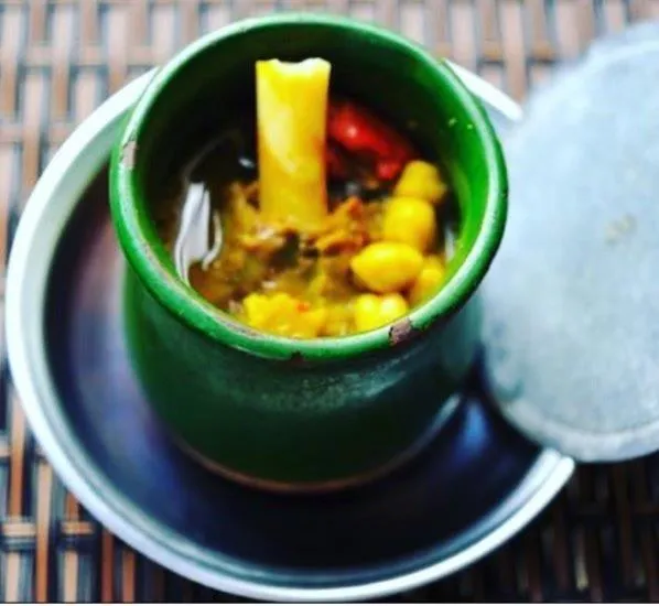
A dish cooked with lamb shank meat, chickpeas, tail fat and yellow root (turmeric) in special earthenware casseroles (piti pot).
History: A centuries-old Caucasian banquet dish in which lavash is chopped into water and the meat is crushed with a mallet and eaten.
View Official Geographical Indication Dossier for Iğdır Bozbaş Dinner →
3. Iğdır Omaç Vaccine Soup (Yemekler ve çorbalar)
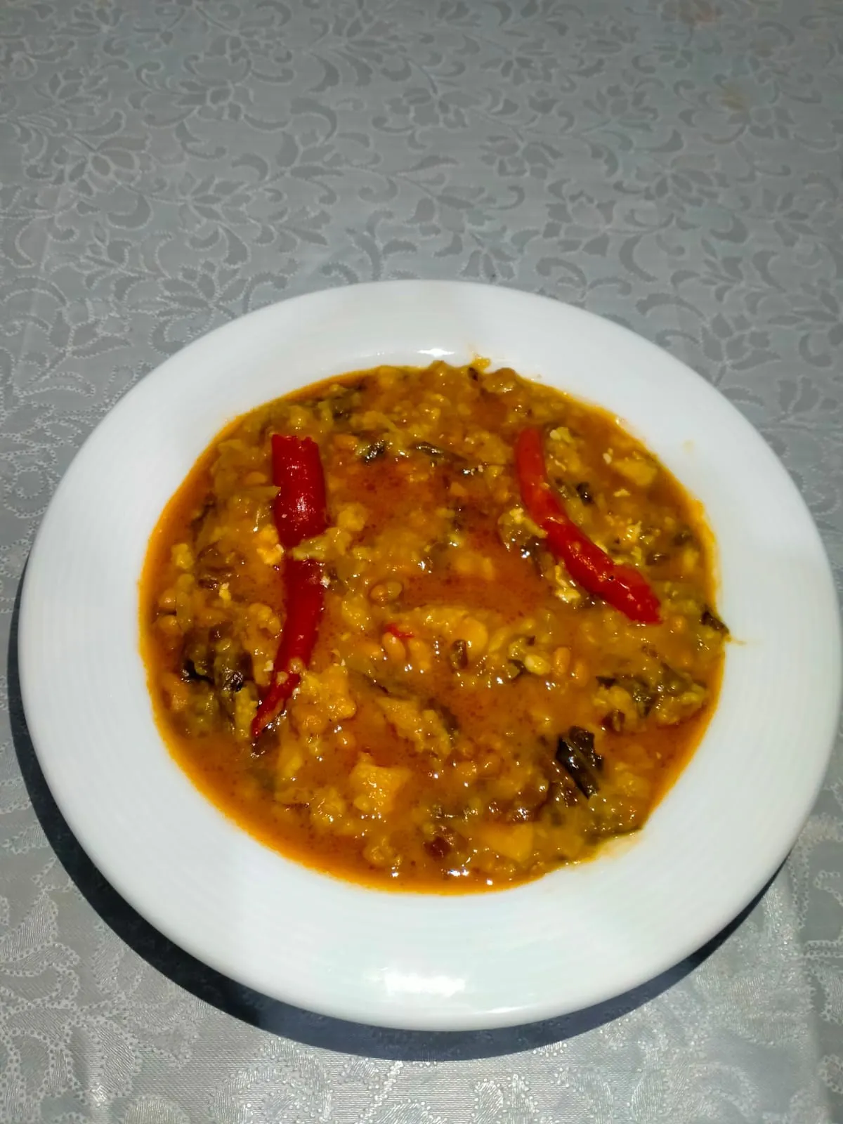
Iğdır Omaç Vaccine Soup is a geographically indicated value of ours, unique to the Iğdır region and registered by the Turkish Patent and Trademark Office on 26.08.2021 (with registration number 876).
View Official Geographical Indication Dossier for Iğdır Omaç Vaccine Soup →
4. Iğdır White Grape / Miskalı (İşlenmiş ve işlenmemiş meyve ve sebzeler ile mantarlar)
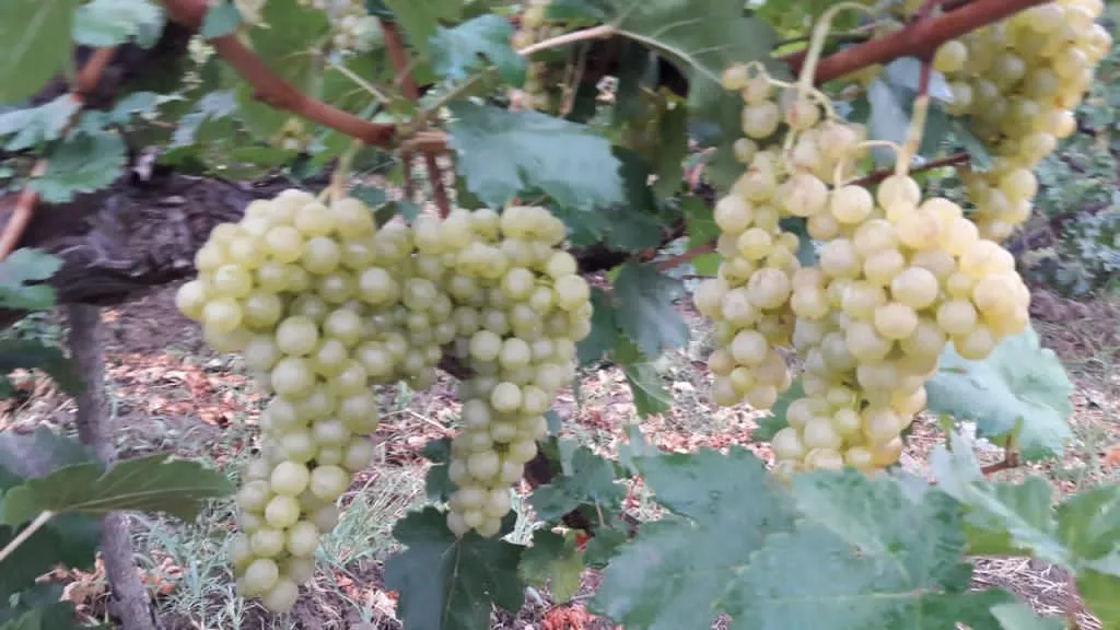
Iğdır White Grape / Miskalı is a geographically indicated value of ours, unique to the Iğdır region and registered by the Turkish Patent and Trademark Office on 09.08.2021 (with registration number 829).
View Official Geographical Indication Dossier for Iğdır White Grape / Miskalı →
5. Iğdır Eggplant Jam (İşlenmiş ve işlenmemiş meyve ve sebzeler ile mantarlar)
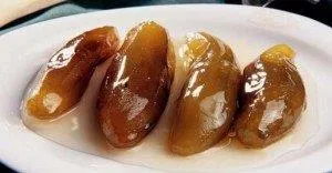
Iğdır Eggplant Jam is a geographically indicated value of ours, unique to the Iğdır region and registered by the Turkish Patent and Trademark Office on 20.12.2021 (with registration number 975).
View Official Geographical Indication Dossier for Iğdır Eggplant Jam →
6. Iğdır Apricot (İşlenmiş ve işlenmemiş meyve ve sebzeler ile mantarlar)
Registered fresh apricot, ripe early in the Aras Valley sun, for table use, oval shaped, red cheeked, sweet and fragrant.
History: Heritage of Aras Valley apricot gardens on the Silk Road.
View Official Geographical Indication Dossier for Iğdır Apricot →
Practical Travel & Transit Planning for Iğdır (2026)
| Planning Category | Verified Local Information |
|---|---|
| Region & Administrative Center | Iğdır, Türkiye |
| Best Time to Visit | Spring (April–June) and Autumn (September–November) for ideal sightseeing weather; Summer for highlands and coastal routes. |
| Public Transit & Highway Access | Regular municipal buses and local minibus cooperatives (Dolmuş) depart daily from the Iğdır Intercity Bus Terminal (Otogar) directly to Merkez. |
| Recommended Stay | 1 to 2 full days to explore the main historical landmarks, nature trails, and local culinary stops. |
Frequently Asked Questions About Visiting Iğdır
What are the must-see places to visit in Iğdır?
The top verified attractions in Iğdır include Historical Ejder Caravanserai (Harmanöven Caravanserai), Historical Iğdır Harmanöven Caravanserai (Ejder Inn), Zübeyde Hanım Boulevard and Iğdır City Square, Historical Çakırtaş Tomb, Historical Karakale (Sürmeli Castle) and Ruins. Each location offers documented historical or natural heritage with clear road access.
How can I get to Iğdır by public transport or car?
You can reach Iğdır easily by car via Iğdır's main provincial highways, or take regular municipal buses and district minibuses departing throughout the day from the Iğdır central bus terminal (Otogar).
What are the famous local dishes and traditional foods to try in Iğdır?
When visiting Iğdır and Iğdır, be sure to taste officially registered specialties such as Iğdır Taş Meatball Dinner, Iğdır Bozbaş Dinner, Iğdır Omaç Vaccine Soup, Iğdır White Grape / Miskalı, Iğdır Eggplant Jam, prepared by local artisans and traditional restaurants.
Are the attractions in Iğdır suitable for families and day trips?
Yes. Most historic monuments, parks, museums, and promenade areas in Iğdır are family-friendly and well-suited for both weekend getaways and full-day cultural itineraries.
When is the best season to visit Iğdır?
Spring and autumn offer the most comfortable temperatures for walking tours and photography in Iğdır, while summer is popular for nature recreation, plateaus, and festivals.