Planning a journey to Tuzluca, Iğdır? This comprehensive 2026 Paragliding & Air Sports guide brings together 10 verified landmarks, natural wonders, and cultural heritage sites with official visiting hours, GPS coordinates, public transit connections, and local gastronomy recommendations.
Quick Highlights & Discovery Route in Tuzluca, Iğdır
- Tuzluca Historical Salt Caves and Therapy Center
- Historical Ejder Caravanserai (Harmanöven Caravanserai)
- Aras River Bird Sanctuary and Wetland
- Tuzluca Rainbow Hills
- Historical Gaziler (Köroğlu) Castle and Aras Strait
- Historical Tekelti Mountain and Castle
- Iğdır Taş Meatball Dinner
- Iğdır Bozbaş Dinner
Paragliding & Aerial Adventure Guide in Tuzluca, Iğdır: Wind, Topography & Scenic Views
Tuzluca, Iğdır (Iğdır) stands out not only for its historical heritage and natural landscapes, but also for its topography suitable for outdoor and aerial nature sports. Rising ridgelines, valley breezes, and panoramic vistas make Tuzluca, Iğdır an appealing destination for tandem paragliding and aerial photography enthusiasts.
Flights organized in and around Tuzluca, Iğdır depend on seasonal thermal currents and stable wind corridors. Prior to takeoff, licensed tandem pilots evaluate wind speed, direction, and visibility conditions to ensure a safe and unforgettable flight experience.
- Flight Preparation & Gear: Wear sturdy closed-toe sports shoes, a windproof jacket, and UV sunglasses before heading to the launch zone in Tuzluca, Iğdır.
- Safety & Licensing: Always fly with certified tandem pilots holding official Turkish Aeronautical Association (THK) or federation licenses, including full harness and reserve parachute checks.
- Best Flight Hours: Morning hours offer calmer laminar air for first-time flyers, while mid-afternoon thermal currents allow longer panoramic flights over Tuzluca, Iğdır.
Top Verified Paragliding & Air Sports & Must-See Landmarks in Tuzluca, Iğdır
1. Tuzluca Historical Salt Caves and Therapy Center

Ticketed / MuseumPass Check • GPS: 40.0511, 43.6661
History and General Information / Local Legends and Folklore
Tuzluca Historical Salt Caves is a huge underground salt city of 55 acres, whose roots date back to the Hittite period and where rock salt has been extracted uninterruptedly for thousands of years. The cave offers a fascinating atmosphere with its giant underground tunnels extending for kilometers, salt columns and illuminated galleries; Today, it is Türkiye's most important "halotherapy" (salt therapy) health tourism center. It has been proven that cave air provides natural healing for asthma, bronchitis, COPD and respiratory diseases, thanks to its content of microscopic salt ions. According to local legend, it is said that these salt galleries were the first salt deposits discovered by the Prophet Noah after the Flood and that they added abundance to the tables.
Geographical Structure, Altitude and Natural Features
It is located within the Tuzluca mountain mass, at an altitude of approximately 1,050 meters. It consists of layers of white and crystallized rock salt with 99 percent purity; The underground temperature is a constant 16 degrees in summer and winter.
Visiting Hours, Days and Entrance Fees
- Entrance Fee: District Governorship and Special Provincial Administration are subject to symbolic ticket tariff (is_free: false).
- Visiting Hours and Days: It is open to visitors 7 days a week between 08:30 - 18:00.
- Rules, Safety and Baby Stroller/Disabled Access: Since it is slightly cool inside the cave, a cardigan should be taken according to the season; It should not be run in galleries. The main galleries are completely flat and covered with asphalt/wood and are very accessible for strollers and disabled chairs.
- Facilities and Facilities: There is an underground conference hall, salt therapy rest rooms, cafeteria, gift salt lamp section, WC and ample parking.
Transportation, Public Transit Routes and Exact Location
- Address / Open Location: Tuzluca District Exit, Kars Road 1st km, Tuzluca / Iğdır.
- Road Condition and Vehicle Availability: It is 1 km from Tuzluca town centre, 40 km from Iğdır city centre, and 85 km from Kars; It is next to the main highway and can be easily reached by any vehicle.
- Real Public Transportation Information: Iğdır-Kars and Iğdır-Tuzluca minibuses drop off directly at the cave entrance.
- Parking Availability: There is a large free parking area in front of the cave entrance.
Contextual Experience Tips, Photography and Local Gastronomy
- Best Photo Spots and Frames: The perspective depth of giant salt pillars illuminated with colored lights and the shimmer of crystal rock salt walls.
- Light and Shooting Hours: Constant underground artistic lighting is available at all hours of the day.
- Local Gastronomy Recommendations: Tea at the cave cafe and Iğdır kete and honey at the Tuzluca exit.
Explore Full 5-Section Guide & Map for Tuzluca Historical Salt Caves and Therapy Center →
2. Historical Ejder Caravanserai (Harmanöven Caravanserai)

Free Public Access • GPS: 39.8037, 43.8404
Historical Ejder Caravanserai (Harmanöven Caravanserai)
History and General Information / Local Legends and Folklore
- The caravanserai, built by Şerafettin Ejder Bey during the Anatolian Seljuk period at the end of the 12th century and the beginning of the 13th century, is the gateway of the ancient Silk Road to the Caucasus and Iran.
- Located on the Batumi-Tabriz caravan route, the building is the purest representative of the Seljuk monumental caravanserai architecture in Eastern Anatolia, with its magnificent muqarnas crown gate and geometric stone decorations.
- It is rumored in local legends that Ejder Bey had this castle-like shelter built to protect the caravans from bandits, and that merchants taking shelter from blizzards and storms were given free food and shelter for three days during the winter months.
Geographical Structure, Altitude and Natural Features
- It is located at the threshold of Harmanöven Plateau on the northwestern foothills of Mount Ararat, at an altitude of approximately 1250 meters above sea level.
- Built from dark basalt volcanic stone blocks, the inn is surrounded by volcanic lava plateaus and mountain steppe flora.
Visiting Hours, Days and Entrance Fees
- Entrance Fee: Entrance to the historical caravanserai and its courtyard is completely free.
- Visiting Hours and Days: It is open to visitors 7 days a week from sunrise to sunset.
- Rules, Safety and Stroller/Disabled Access: The restoration has been completed and there is a smooth stone pavement on the main hall floor; It can be entered with disabled cars and strollers.
- Facilities and Facilities: Information boards, landscaping and recreation areas are available.
Transportation, Public Transit Routes and Exact Location
- Address / Open Location: Harmanöven Village Location, Center / Iğdır.
- Road Condition and Vehicle Availability: It is approximately 32 km away from Iğdır city centre; The village road is asphalted and can be easily reached by any passenger vehicle.
- Real Public Transportation Information: Harmanöven village minibuses operate from Iğdır central village garage at certain hours.
- Parking Availability: There is a large and free parking area in front of the caravanserai.
Contextual Experience Tips, Photography and Local Gastronomy
- Best Photography Spots and Frames: Framing the vaulted main corridor of the caravanserai from under the arch of the monumental Seljuk crown gate and the silhouette of Mount Ararat rising outside.
- Light and Shooting Hours: Early morning (08:30 - 10:30) and late afternoon golden hour.
- Local Gastronomy Recommendations: Iğdır style bozbaş (piti) kebab, stone meatballs, eggplant jam and famous şalak apricot should be tasted.
Explore Full 5-Section Guide & Map for Historical Ejder Caravanserai (Harmanöven Caravanserai) →
3. Aras River Bird Sanctuary and Wetland
Free Public Access • GPS: 39.9150, 44.5850
History and General Information / Local Legends and Folklore
Aras River Bird Sanctuary and Wetland is an internationally important biodiversity hotspot located on the African-Eurasian bird migration route, where more than 300 bird species stay, breed and circle. The reeds of this delta where the Aras River flows, drawing the borders of Türkiye, Nakhchivan, Armenia and Iran; It is home to endangered species such as white pelican, black stork, moor pochard, flamingo and paddy. Local legend tells that the waters of Aras are a sacred river that carries the snow from the mountains to the Caspian Sea, and that migratory birds cannot cross the Caucasus without resting in these waters.
Geographical Structure, Altitude and Natural Features
It is located in the Aras River flood plain, at an altitude of approximately 810 meters. It is surrounded by extensive reed groves, willow groves, sand islands and micro-climate wetland flora.
Visiting Hours, Days and Entrance Fees
- Entrance Fee: Visiting the wetland and bird watching spots is completely free.
- Visiting Hours and Days: Open to visitors 7 days a week during daylight hours; Spring (March-May) and autumn (September-November), which are the migration periods, are the richest months.
- Rules, Safety and Stroller/Disabled Access: Be quiet and use binoculars or a telephoto lens to avoid scaring the birds; Garbage should not be thrown into the reeds. The coastal plains can be visited with baby strollers and disabled chairs.
- Facilities and Facilities: There is a bird observation tower, information boards and viewing benches.
Transportation, Public Transit Routes and Exact Location
- Address / Open Location: Along the Aras River, Dilucu Route, December / Iğdır.
- Road Condition and Vehicle Availability: Aralik is 12 km away from the town centre; It can be easily reached by all kinds of passenger vehicles via the asphalt road on the Nakhchivan highway.
- Real Public Transportation Information: You can get off near the observation point with Iğdır-Dilucu border minibuses.
- Parking Availability: There is a free open car parking area next to the observation tower.
Contextual Experience Tips, Photography and Local Gastronomy
- Best Photo Spots and Frames: The snowy peaks of Mount Ararat rising behind flocks of pelicans and storks soaring over the reeds.
- Light and Shooting Hours: Sunrise hours and sunset silhouettes when bird activity peaks.
- Local Gastronomy Recommendations: Famous Iğdır bozbaşı (piti kebab) and open ayran in the Aralik town center.
Explore Full 5-Section Guide & Map for Aras River Bird Sanctuary and Wetland →
4. Tuzluca Rainbow Hills
Free Public Access • GPS: 40.0733, 43.6630
History and General Information / Local Legends and Folklore
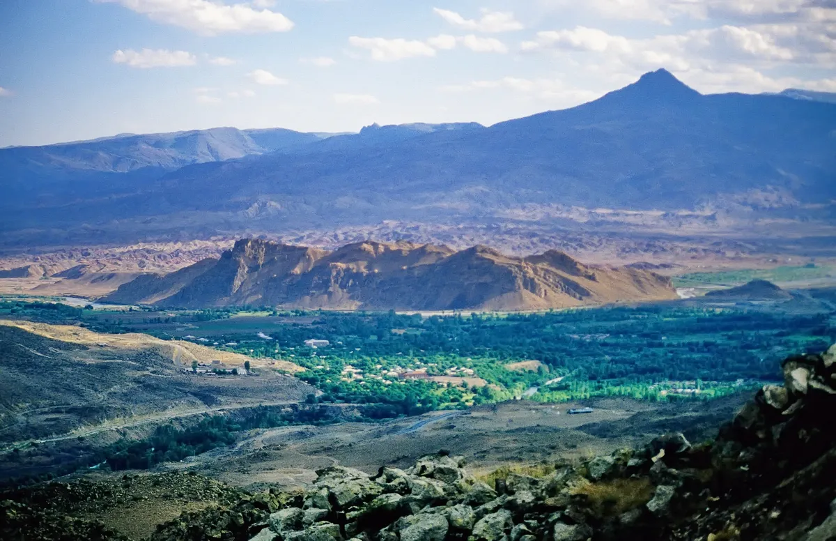
Tuzluca Rainbow Hills is a supernatural geological picture that was formed millions of years ago during the Miocene and Pliocene periods as a result of different mineral, iron oxide, manganese and lime sediments being layered on top of each other and eroded by wind and water. These hills resemble the Vinicunca hills in Peru and the Zhangye Danxia hills in China; It offers a dazzling riot of colors in which red, brown, yellow, orange, white and gray color tones curl into horizontal stripes. Local legend tells that the rainbow in the sky comes down to the earth, rests on these hills of Tuzluca and leaves its colors on the ground.
Geographical Structure, Altitude and Natural Features
It is located on the slopes of the Aras Valley, at an altitude of approximately 950 to 1,200 meters. The undulating badlands topography, consisting of barren clay, gypsum and sandstone layers, prevails.
Visiting Hours, Days and Entrance Fees
- Entrance Fee: Visiting the hills and viewing areas is completely free.
- Visiting Hours and Days: It can be visited freely in daylight, 7 days a week.
- Rules, Safety and Stroller/Disabled Access: Clay slopes can be slippery and sticky on wet days; Non-slip sports shoes should be worn. Viewpoints can be seen from the roadside; The paths are not suitable for strollers.
- Facilities and Facilities: There are vehicle parking areas and viewing areas on the side of the highway.
Transportation, Public Transit Routes and Exact Location
- Address / Open Location: On Iğdır-Kars Highway, Tuzluca / Iğdır.
- Road Condition and Vehicle Availability: It is 5 km away from Tuzluca town centre; passes right next to the hills along the main asphalt highway; It can be reached by all kinds of passenger vehicles.
- Real Public Transportation Information: All buses and minibuses operating between Iğdır-Kağızman-Kars pass through the Gökkuşağı Hills route.
- Parking Availability: Parking can be done in large free viewing pockets on the side of the road.
Contextual Experience Tips, Photography and Local Gastronomy
- Best Photo Spots and Frames: Wide-angle shots and drone shots, where colorful mineral strips wave from the roadside ridge to the horizon.
- Light and Shooting Hours: The golden hours before sunset and morning light, when the sun makes mineral colors most vivid.
- Local Gastronomy Recommendations: Fresh tandoori bread and local cheeses in Tuzluca center after the trip.
Explore Full 5-Section Guide & Map for Tuzluca Rainbow Hills →
5. Historical Gaziler (Köroğlu) Castle and Aras Strait
Free Public Access • GPS: 40.1175, 43.6525
Historical Gaziler (Köroğlu) Castle and Aras Strait
History and General Information / Local Legends and Folklore
- The castle, built on a steep rocky ridge overlooking the Aras River gorge, near Gaziler (formerly Pernavut) Village, 27 km west of Tuzluca district centre, has been a strategic defense fortress since the Bronze Age and Iron Age.
- The building, which is known as the castle of the epic hero Köroğlu in folk narratives, has become legendary as the shelter of brave men and border veterans who went to the mountains against injustice.
- The city walls and rock-carved cisterns that watch over the deep canyon passage of the Aras River have survived to the present day.
Geographical Structure, Altitude and Natural Features
- It is built on a steep limestone cliff with an altitude of 1,050 meters.
- The Aras River flows gurgling from the canyon floor; The slopes are covered with juniper and wild almond bushes.
Visiting Hours, Days and Entrance Fees
- Entrance Fee: It is a historical site and the visit is completely free.
- Visiting Hours and Days: It can be visited in daylight 7 days a week.
- Rules and Safety: You should walk carefully on cliff edges and choose non-slip shoes.
- Facilities and Facilities: There is a village fountain and a grocery store in Gaziler village.
Transportation, Public Transit Routes and Exact Location
- Address / Open Location: Gaziler Köyü Kale Mevkii, 76950 Tuzluca / Iğdır.
- Road Condition: It is located on the 27th kilometer of the Tuzluca-Kars highway; It can be easily reached by passenger vehicles via asphalt highway.
- Real Public Transportation Information: Transportation is possible with Gaziler village minibuses departing from Tuzluca.
- Parking Availability: There is an open parking space for 15 vehicles on the roadside at the foot of the castle.
Contextual Experience Tips, Photography and Local Gastronomy
- The deep canyon cleft of the Aras Strait and the railway bridge from the rock bastions of the castle offer wonderful documentary shots.
- You should taste the mountain thyme tea and oven kete brewed over a wood fire in Gaziler village.
Explore Full 5-Section Guide & Map for Historical Gaziler (Köroğlu) Castle and Aras Strait →
6. Historical Tekelti Mountain and Castle
Free Public Access • GPS: 40.0315, 43.5519
History and General Information / Local Legends and Folklore
Tekelti Mountain (2,560 m) is a volcanic natural monument that rises alone in the middle of the Iğdır Plain, like a giant dog tooth or pyramid stuck in the sky. At its summit, there are historical castle ruins, watchtowers and rock cisterns from the Urartian and medieval Bagratid period. With its steep and steep walls, it is one of the most popular climbing walls in Türkiye for mountaineering and rock climbing enthusiasts. Local legend tells that Mount Tekelti was a huge piece of rock that broke off from Mount Ararat during Noah's Flood, and that the castle at its peak guarded the caravan routes for centuries.
Geographical Structure, Altitude and Natural Features
It is a monolithic volcanic neck formation with a peak altitude of 2,560 meters. It is surrounded by bare steep andesite cliffs and valley steppes.
Visiting Hours, Days and Entrance Fees
- Entrance Fee: Visiting the mountain and castle foothills is completely free.
- Visiting Hours and Days: It can be visited in daylight 7 days a week; Peak climbing is suitable for experienced climbers in the summer months.
- Rules, Safety and Stroller/Disabled Access: Mountain climbing requires professional rock climbing equipment; Sturdy shoes should be worn for walking in the foothills. The mountain terrain is not stroller or disabled accessible.
- Facilities and Facilities: There are natural climbing routes and break areas on the foothills.
Transportation, Public Transit Routes and Exact Location
- Address / Open Location: Tekelti Köyü Mevkii, Tuzluca / Iğdır.
- Road Condition and Vehicle Availability: It is 12 km away from Tuzluca center; It can be reached by passenger vehicle up to the foothills via the stabilized mountain road.
- Real Public Transportation Information: You can reach the foot of the mountain with the village shuttles departing from Tuzluca center.
- Parking Availability: There is a free parking area at the entrance of the village at the foothills.
Contextual Experience Tips, Photography and Local Gastronomy
- Best Photography Spots and Frames: Wide angle compositions of the pointed pyramidal silhouette of Tekelti Mountain stretching straight into the sky from the Aras Valley.
- Light and Shooting Times: The first sunlight hitting the sharp peak of the mountain in the early morning hours and the sunset silhouette.
- Local Gastronomy Recommendations: Freshly milked milk cream in the village, tandoori lavash and honey.
Explore Full 5-Section Guide & Map for Historical Tekelti Mountain and Castle →
7. Üçkaya Dam Lake and Nature Trail
Free Public Access • GPS: 39.9558, 43.6592
Üçkaya Dam Lake and Nature Trail
History and General Information / Local Legends and Folklore
- Üçkaya Dam Lake, built on the Gaziler Stream, one of the branches of the Aras River, is a wetland paradise that comes to life in the arid steppe climate of Eastern Anatolia.
- According to local narratives, it was believed that the three magnificent volcanic rocks surrounding the valley were sentinels protecting the region in ancient times; For this reason, it was named 'Üçkaya'.
- The turquoise colored calm lake surface is a stopping point for migratory birds and the most spacious nature escape route for the people of Tuzluca.
Geographical Structure, Altitude and Natural Features
- It is located in the canyon valley, approximately 1150 meters above sea level.
- Volcanic hills adorned with colorful clay and salt layers are surrounded by willow groves and rich water bird fauna.
Visiting Hours, Days and Entrance Fees
- Entrance Fee: Entrance to the pond shore and nature area is completely free.
- Visiting Hours and Days: Open to the public 7 days a week from sunrise to sunset.
- Rules, Safety and Baby Stroller/Disabled Access: Swimming in the dam lake is dangerous and prohibited due to mud and underwater currents. The coastline is a path and slightly rugged.
- Facilities and Facilities: There are resting pergolas, picnic tables, angling spots and fountains.
Transportation, Public Transit Routes and Exact Location
- Address / Open Location: Üçkaya Köyü Mevkii, Gaziler Vadisi, Tuzluca / Iğdır.
- Road Condition and Vehicle Availability: It is 14 km away from Tuzluca town center and 52 km away from Iğdır center; It can be easily reached by passenger vehicle on the asphalt and hard ground stabilized road.
- Real Public Transportation Information: You can reach the pond crossroads from Tuzluca center with Üçkaya and Gaziler village minibuses.
- Parking Availability: There are large and free parking areas around the pond.
Contextual Experience Tips, Photography and Local Gastronomy
- Best Photo Spots and Frames: Contrast landscape shot from the pond's overlook overlooking the turquoise water mirror and red rainbow hills in the background.
- Light and Shooting Hours: Afternoon golden hour (16:30 - 18:30) and sunset.
- Local Gastronomy Recommendations: Picnic experience by the lake with salty buttered lavash bread, kashar cheese and samovar tea.
Explore Full 5-Section Guide & Map for Üçkaya Dam Lake and Nature Trail →
8. Tuzluca City Park and Cumhuriyet Square
Free Public Access • GPS: 40.0434, 43.6618
Tuzluca City Park and Cumhuriyet Square
History and General Information / Local Legends and Folklore
- Located in the heart of Tuzluca, famous for its historical rock salt mines that have been operated for thousands of years since the Hittites and Urartians, City Park and Cumhuriyet Square symbolize the rich salt heritage of the district and the history of the republic.
- The rock salt statues and the Atatürk monument in the square are the common gathering point of the people of Tuzluca and the tourists visiting the salt caves.
Geographical Structure, Altitude and Natural Features
- It is established on an airy slope plain with an altitude of 1,080 meters.
- The park area is equipped with pine, acacia and flower beds and receives the fresh wind of the Aras Valley.
Visiting Hours, Days and Entrance Fees
- Entrance Fee: It is a public city square and entrance is completely free.
- Visiting Hours and Days: Open 24 hours a day, 7 days a week.
- Rules and Security: Attention should be paid to parking order and environmental cleanliness.
- Facilities and Facilities: Municipal tea garden, children's playground, seating benches, rock salt sales stands and WC are available.
Transportation, Public Transit Routes and Exact Location
- Address / Open Location: Cumhuriyet Mahallesi, Opposite the Government Office, 76950 Tuzluca / Iğdır.
- Road Condition: It is located at the Iğdır-Kars and Iğdır-Doğubeyazıt highway junction; It is extremely easily accessible by all vehicles.
- Real Public Transportation Information: Tuzluca minibuses depart from Iğdır Bus Terminal every 15 minutes and drop off directly at the square.
- Parking Availability: There is free municipal parking for 40 vehicles around the square.
Contextual Experience Tips, Photography and Local Gastronomy
- Souvenir photographs can be taken in front of the statues made of rock salt blocks in the square.
- Healing natural rock salt lamps, table salt and hot Tuzluca lavash should be purchased from the shops around the square.
Explore Full 5-Section Guide & Map for Tuzluca City Park and Cumhuriyet Square →
9. Aras Valley Tuzluca Canyon and Nature Trail
Free Public Access • GPS: 40.0413, 43.6639
History and General Information / Local Legends and Folklore
Aras Valley Tuzluca Canyon is a deep and fascinating river canyon formed by the Aras River breaking through red sedimentary rocks and volcanic plateaus for millions of years. Red cliffs appearing on the canyon slopes, natural cave cavities and winding river waters offer nature lovers a unique rafting, hiking and bird watching route. Local legend tells that the Aras River flows roaringly in this canyon, and the red rocks along the canyon turn red with the blood of ancient warriors.
Geographical Structure, Altitude and Natural Features
It is located in the Aras River bed, at an altitude of approximately 920 meters. Red sandstone and clay cliffs, willow groves along the river and a rich water bird fauna dominate.
Visiting Hours, Days and Entrance Fees
- Entrance Fee: Visiting the canyon and nature trails is completely free.
- Visiting Hours and Days: It can be visited freely in daylight 7 days a week.
- Rules, Safety and Baby Stroller/Disabled Access: Pay attention to the current in the river bed and stay away from steep canyon cliffs. The coastal road is partially smooth and you can cruise along the canyon by vehicle.
- Facilities and Facilities: Natural viewing terraces and riverside break points are available.
Transportation, Public Transit Routes and Exact Location
- Address / Open Location: Aras Valley Canyon Line, Tuzluca / Iğdır.
- Road Condition and Vehicle Availability: It is 6 km away from Tuzluca center; The Iğdır-Kars highway follows the canyon; It can be driven without any problems by all passenger vehicles.
- Real Public Transportation Information: Iğdır-Tuzluca and Kars buses pass through the canyon route.
- Parking Availability: There are free parking spaces open along the road.
Contextual Experience Tips, Photography and Local Gastronomy
- Best Photo Spots and Frames: Wide angle panorama of the Aras River winding through the red canyon cliffs and the Rainbow Hills behind.
- Light and Shooting Hours: Golden hours when the canyon cliffs turn red in the afternoon sun.
- Local Gastronomy Recommendations: Samovar tea by the river and Tuzluca village bread and tulum cheese.
Explore Full 5-Section Guide & Map for Aras Valley Tuzluca Canyon and Nature Trail →
10. Tuzluca Lalazar Bridge and Aras Valley
Free Public Access • GPS: 40.0624, 43.6639
History and General Information / Local Legends and Folklore
Tuzluca Lalazar Bridge and Aras Valley is a well-established stone bridge ruins and nature trail built of cut stone to enable the canyon passage of the historical Silk Road and caravan routes, over the deep canyon valleys connecting to the Aras River basin. The surrounding canyon walls, decorated with red, yellow and brown volcanic sedimentary layers, are like a fairytale-like open-air nature museum. In the legends among the local people, it is said that this place is called 'Lalazar' (Tulip Garden / Red Garden) due to the red canyon rocks shining like garnet and that the bridge is a sacred stopping point that allows caravans to reach the Aras River safely.
Geographical Structure, Altitude and Natural Features
It is located in the northwest of Tuzluca district, at an altitude of approximately 910 meters, at the intersection of the Aras River valley. Colorful rainbow sedimentary hills along the canyon, steep rock walls and spring waters filtering through the valley create a unique geological landscape.
Visiting Hours, Days and Entrance Fees
- Entrance Fee: Visiting the canyon and the bridge ruins is completely free.
- Visiting Hours and Days (Mandatory): Open 7 days a week for hiking and photography during daylight hours.
- Rules, Safety and Baby Stroller/Disabled Access: While walking in the canyon, be careful about slippery gravel surfaces; Baby strollers and wheelchairs should not be entered into the canyon.
- Facilities and Facilities: It is a natural canyon area and 5 km away from Tuzluca town centre; Cafes and rest areas in the town center can be used.
Transportation, Public Transit Routes and Exact Location
- Address / Open Location: Lalazar Mevkii, Aras Canyon, Tuzluca / Iğdır.
- Road Condition and Vehicle Availability: It is 5 km from Tuzluca town center and approximately 42 km from Iğdır centre; It can be easily reached by passenger vehicles via the stabilized road.
- Real Public Transportation Information (Mandatory): You can reach the town center by Tuzluca minibuses departing from Iğdır Bus Terminal; From here, you can reach the canyon entrance in 10 minutes by local taxi.
- Parking Availability: Vehicles can be parked free of charge in the flat area at the entrance of the canyon.
Contextual Experience Tips, Photography and Local Gastronomy
- Best Photography Spots and Frames: Wide-angle photographs should be taken that frame the stone bridge and the Aras valley through the colorful sedimentary canyon walls.
- Light and Shooting Hours: The oblique lights of the setting sun in the afternoon create fascinating frames by reviving the red and yellow color layers of the canyon.
- Local Gastronomy Recommendations: After shopping for the famous rock salt lamp in Tuzluca, you should try Aras fish pan, lavash bread and local cheeses.
Explore Full 5-Section Guide & Map for Tuzluca Lalazar Bridge and Aras Valley →
What to Eat in Tuzluca, Iğdır? Registered Local Delicacies & Gastronomy
A trip to Tuzluca, Iğdır is incomplete without tasting its officially registered geographical indication products and centuries-old Anatolian recipes:
1. Iğdır Taş Meatball Dinner (Yemekler ve çorbalar)

Iğdır Stone Meatball Meal is a geographically indicated value specific to the Iğdır region, registered by the Turkish Patent and Trademark Office on 14.12.2017 (with registration number 276).
View Official Geographical Indication Dossier for Iğdır Taş Meatball Dinner →
2. Iğdır Bozbaş Dinner (Yemekler ve çorbalar)
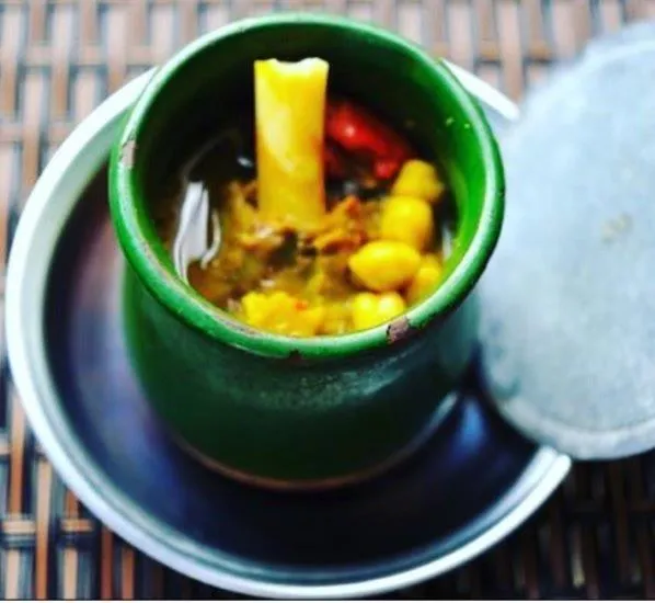
A dish cooked with lamb shank meat, chickpeas, tail fat and yellow root (turmeric) in special earthenware casseroles (piti pot).
History: A centuries-old Caucasian banquet dish in which lavash is chopped into water and the meat is crushed with a mallet and eaten.
View Official Geographical Indication Dossier for Iğdır Bozbaş Dinner →
3. Iğdır Omaç Vaccine Soup (Yemekler ve çorbalar)
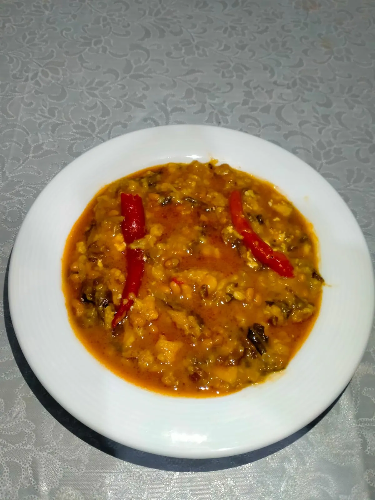
Iğdır Omaç Vaccine Soup is a geographically indicated value of ours, unique to the Iğdır region and registered by the Turkish Patent and Trademark Office on 26.08.2021 (with registration number 876).
View Official Geographical Indication Dossier for Iğdır Omaç Vaccine Soup →
4. Iğdır White Grape / Miskalı (İşlenmiş ve işlenmemiş meyve ve sebzeler ile mantarlar)
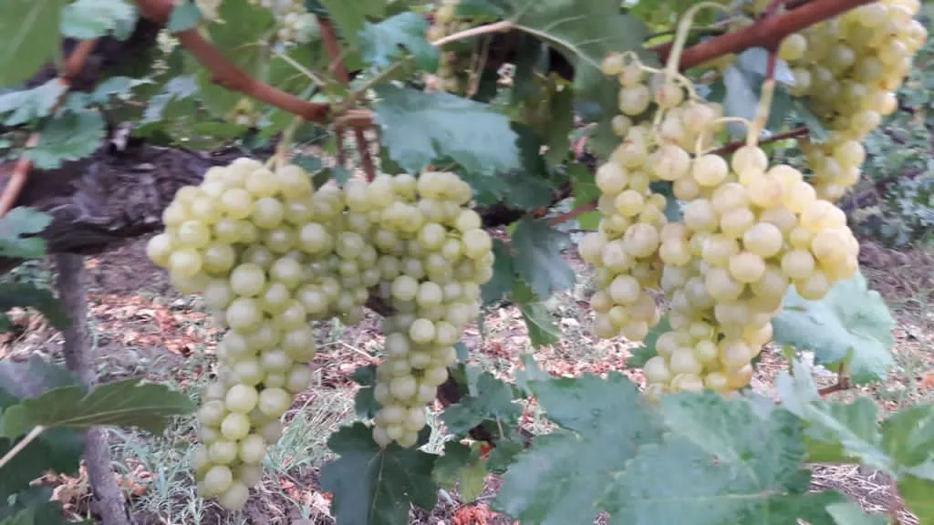
Iğdır White Grape / Miskalı is a geographically indicated value of ours, unique to the Iğdır region and registered by the Turkish Patent and Trademark Office on 09.08.2021 (with registration number 829).
View Official Geographical Indication Dossier for Iğdır White Grape / Miskalı →
5. Iğdır Eggplant Jam (İşlenmiş ve işlenmemiş meyve ve sebzeler ile mantarlar)
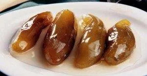
Iğdır Eggplant Jam is a geographically indicated value of ours, unique to the Iğdır region and registered by the Turkish Patent and Trademark Office on 20.12.2021 (with registration number 975).
View Official Geographical Indication Dossier for Iğdır Eggplant Jam →
6. Iğdır Apricot (İşlenmiş ve işlenmemiş meyve ve sebzeler ile mantarlar)
Registered fresh apricot, ripe early in the Aras Valley sun, for table use, oval shaped, red cheeked, sweet and fragrant.
History: Heritage of Aras Valley apricot gardens on the Silk Road.
View Official Geographical Indication Dossier for Iğdır Apricot →
Practical Travel & Transit Planning for Tuzluca, Iğdır (2026)
| Planning Category | Verified Local Information |
|---|---|
| Region & Administrative Center | Tuzluca, Iğdır, Türkiye |
| Best Time to Visit | Spring (April–June) and Autumn (September–November) for ideal sightseeing weather; Summer for highlands and coastal routes. |
| Public Transit & Highway Access | Regular municipal buses and local minibus cooperatives (Dolmuş) depart daily from the Iğdır Intercity Bus Terminal (Otogar) directly to Tuzluca. |
| Recommended Stay | 1 to 2 full days to explore the main historical landmarks, nature trails, and local culinary stops. |
Frequently Asked Questions About Visiting Tuzluca, Iğdır
What are the must-see places to visit in Tuzluca, Iğdır?
The top verified attractions in Tuzluca, Iğdır include Tuzluca Historical Salt Caves and Therapy Center, Historical Ejder Caravanserai (Harmanöven Caravanserai), Aras River Bird Sanctuary and Wetland, Tuzluca Rainbow Hills, Historical Gaziler (Köroğlu) Castle and Aras Strait. Each location offers documented historical or natural heritage with clear road access.
How can I get to Tuzluca, Iğdır by public transport or car?
You can reach Tuzluca, Iğdır easily by car via Iğdır's main provincial highways, or take regular municipal buses and district minibuses departing throughout the day from the Iğdır central bus terminal (Otogar).
What are the famous local dishes and traditional foods to try in Tuzluca, Iğdır?
When visiting Tuzluca, Iğdır and Iğdır, be sure to taste officially registered specialties such as Iğdır Taş Meatball Dinner, Iğdır Bozbaş Dinner, Iğdır Omaç Vaccine Soup, Iğdır White Grape / Miskalı, Iğdır Eggplant Jam, prepared by local artisans and traditional restaurants.
Are the attractions in Tuzluca, Iğdır suitable for families and day trips?
Yes. Most historic monuments, parks, museums, and promenade areas in Tuzluca, Iğdır are family-friendly and well-suited for both weekend getaways and full-day cultural itineraries.
When is the best season to visit Tuzluca, Iğdır?
Spring and autumn offer the most comfortable temperatures for walking tours and photography in Tuzluca, Iğdır, while summer is popular for nature recreation, plateaus, and festivals.