
Planning a journey to Dargeçit, Mardin? This comprehensive 2026 Places to Visit guide brings together 10 verified landmarks, natural wonders, and cultural heritage sites with official visiting hours, GPS coordinates, public transit connections, and local gastronomy recommendations.
Quick Highlights & Discovery Route in Dargeçit, Mardin
- Ilısu Dam Lake and Tigris Canyon Observation Area
- Derinsu Natural Water Source and Cave
- Hell Creek Canyon and Valley Nature Trail
- Dargeçit Historical Stone Bridge
- Historical Mor Kuryakos Assyrian Church (Dargeçit)
- Guide Historical Stone Houses and Ancient Caves
- Mardin Kibe
- Midyat Pickle / Midyat Pickle
Natural Wonders, Valleys, Plateaus & Eco-Discovery in Dargeçit, Mardin
Dargeçit, Mardin (Mardin) captivates nature lovers with its unspoiled valleys, lush forests, high plateaus (yaylalar), canyons, and diverse flora. Each season transforms the landscapes of Dargeçit, Mardin, from vibrant spring blossoms to golden autumn foliage.
- Seasonal Highlights: Spring (April–June) brings rushing streams and wildflowers, while autumn (October–November) turns the forests around Dargeçit, Mardin into a photographer's paradise.
- Outdoor Preparedness: Wear layered clothing, carry sufficient drinking water, and download offline maps before venturing into rural trails in Dargeçit, Mardin.
- Eco-Conscious Travel: Protect the natural habitats of Dargeçit, Mardin by leaving zero waste and staying on marked paths.
Top Verified Places to Visit & Must-See Landmarks in Dargeçit, Mardin
1. Ilısu Dam Lake and Tigris Canyon Observation Area

Free Public Access • GPS: 37.5257, 41.8403
History and General Information / Local Legends and Folklore
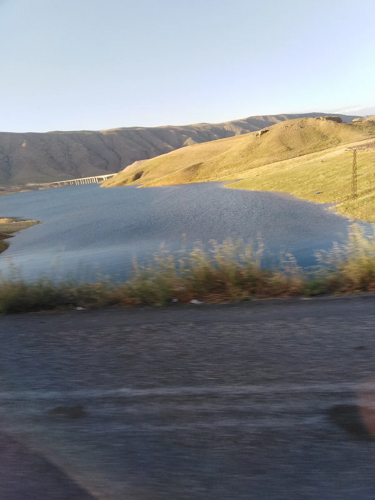
Ilısu Dam Lake (Prof. Dr. Veysel Eroğlu Dam) is Türkiye's second largest reservoir volume, built on the ancient Tigris River, which has given life to Mesopotamia for thousands of years. The turquoise blue giant lake mirror formed between the steep canyon rocks of Dargeçit; It offers one of the Southeast's most stunning canyon panoramas, with Tigris fjords, steep rocky gorges, and waterfowl soaring over the lake.
Geographical Structure, Altitude and Natural Features
The viewing area is located on a steep rocky terrace above the canyon, at an altitude of 530 meters.
Visiting Hours, Days and Entrance Fees
- Entrance Fee: Entrance to the viewing area is completely free.
- Visiting Hours and Days (Mandatory): It can be visited during daylight hours.
- Rules, Safety and Stroller/Disabled Access: Steep canyon cliffs should not be approached and caution should be exercised.
- Facilities and Facilities: There is a natural viewing terrace, wooden seating benches and a parking area.
Transportation, Public Transit Routes and Exact Location
- Address / Open Location: Ilısu Dam Beach, 47700 Dargeçit / Mardin.
- Road Condition and Vehicle Availability: It is 14 km away from Dargeçit district center; It can be reached in 18 minutes by passenger vehicles via the asphalt highway.
- Actual Public Transportation Information (Mandatory): It can be reached by private vehicle or taxi from Dargeçit center.
- Parking Availability: There is an open parking lot for 40 vehicles at the viewing point.
Contextual Experience Tips, Photography and Local Gastronomy
- Best Photo Spots and Frames: Deep blue reservoir fjords winding through steep canyon walls and sunset reflections.
- Light and Shooting Hours: Early morning and sunset golden hour.
- Visiting Time: Spring and summer months.
- Local Gastronomy Recommendations: Samovar tea, Dargeçit lavash and walnuts fresh from the oven should be consumed at the viewing point.
Explore Full 5-Section Guide & Map for Ilısu Dam Lake and Tigris Canyon Observation Area →
2. Derinsu Natural Water Source and Cave
Free Public Access • GPS: 37.4725, 41.7619
History and General Information / Local Legends and Folklore
Derinsu Cave and Natural Water Source is the exit point of an icy underground river gushing out of the limestone karst mass around Derinsu village, southeast of Dargeçit. The interior of the cave is decorated with stalactites and stalagmites that have formed over thousands of years. It is rumored among the local people that this water is good for skin diseases and that the cave corridors were used as shelter centuries ago.
Geographical Structure, Altitude and Natural Features
Its altitude is 680 meters. Located in the karst valley descending towards the Tigris River basin, the spring creates an oasis-like cool and lush micro ecosystem in the dry Mesopotamian summer.
Visiting Hours, Days and Entrance Fees
- Entrance Fee: Free.
- Visiting Hours and Days: It is open to visitors 7 days a week during daylight hours.
- Rules, Security and Baby Stroller/Disabled Access: Since the water level inside the cave varies depending on the season, be careful about the slippery bottom and use a flashlight and water-resistant shoes.
- Facilities and Facilities: There are natural picnic areas, shady willow trees and natural water springs.
Transportation, Public Transit Routes and Exact Location
- Address / Open Location: Derinsu Mahallesi, Dargeçit / Mardin.
- Road Condition and Vehicle Availability: It is 11 km away from the center of Dargeçit; The last 1 kilometer is a stabilized mountain road, it can be descended slowly by passenger vehicle.
- Real Public Transportation Information: Derinsu village minibuses depart from Dargeçit center.
- Parking Availability: There is an open dirt parking area near the water source.
Contextual Experience Tips, Photography and Local Gastronomy
- Best Photography Spots and Frames: The small pond formed by the clear water gushing from the mouth of the cave and the reflected green willow branches offer the most beautiful shots.
- Gastronomy: It is a local tradition to have a picnic at the spring with local watermelon cheese and fresh tandoori bread.
Explore Full 5-Section Guide & Map for Derinsu Natural Water Source and Cave →
3. Hell Creek Canyon and Valley Nature Trail
Free Public Access • GPS: 37.4109, 41.4195
History and General Information / Local Legends and Folklore
The Hell Creek Canyon, stretching on the border of Dargeçit and İdil, is the wildest natural wonder of the region, with steep vertical limestone cliffs reaching hundreds of meters high and a clear mountain stream flowing from its base. The canyon takes its name from its deep and impassable steep gorges; It is a hidden route for hiking, rock climbing and mountaineering enthusiasts with its natural rock caves, endemic wild goats, eagle nests and rich vegetation.
Geographical Structure, Altitude and Natural Features
The canyon floor is a deep valley cleft between steep limestone rock cliffs at an altitude of 650 meters.
Visiting Hours, Days and Entrance Fees
- Entrance Fee: Entrance to the canyon is completely free.
- Visiting Hours and Days (Mandatory): It can be visited during daylight hours.
- Rules, Safety and Stroller/Disabled Access: It is a challenging canyon course; technical walking shoes are a must; You should not enter the canyon alone or without a guide.
- Facilities and Facilities: It is a natural untouched wild canyon area.
Transportation, Public Transit Routes and Exact Location
- Address / Open Location: Çevre Deresi Mevkii, 47700 Dargeçit / Mardin.
- Road Condition and Vehicle Availability: It is 9 km away from the center of Dargeçit; The canyon entrance is reached via a stabilized mountain road.
- Real Public Transportation Information (Mandatory): You can go to the canyon entrance by private vehicle or taxi.
- Parking Availability: There is an open parking area for 20 vehicles at the entrance of the canyon.
Contextual Experience Tips, Photography and Local Gastronomy
- Best Photo Spots and Frames: Sky splits and stream waterfalls through hundreds of meters of vertical canyon walls.
- Light and Shooting Hours: At noon, when light enters the canyon floor.
- Visiting Time: Spring months (April-May).
- Local Gastronomy Recommendations: After the canyon walk, sheet pan and buttermilk should be consumed in Dargeçit market.
Explore Full 5-Section Guide & Map for Hell Creek Canyon and Valley Nature Trail →
4. Dargeçit Historical Stone Bridge
Free Public Access • GPS: 37.5479, 41.7159
History and General Information / Local Legends and Folklore
Dargeçit Historical Stone Bridge is a single-arched monumental stone structure built during the Ottoman period on the deep stream bed at the entrance of the district. The bridge, which has connected the Tur Abdin mountain villages and the trade routes along the Tigris River for centuries, reflects the power of the local architecture with its yellow limestone cut stones. Bahar taşkınlarında suların köprü gözünden coşkuyla akması asırlardır ilçe sakinlerinin seyir geleneğidir.
Geographical Structure, Altitude and Natural Features
Rakımı 730 metre olan dere vadisi tabanında yer alır. Etrafı doğal kireçtaşı kayaçları ve su boyu çınar ile kavak ağaçlarıyla çevrilidir.
Visiting Hours, Days and Entrance Fees
- Entrance Fee: Free.
- Visiting Hours and Days: Open 24 hours a day, 7 days a week.
- Kurallar, Güvenlik ve Bebek Arabası/Engelli Erişimi: Köprü korkulukları alçak olduğundan kenarlarda dikkatli olunmalıdır.
- Tesis ve Olanaklar: Köprü civarında yürüyüş patikası ve dere kenarı dinlenme noktaları bulunur.
Transportation, Public Transit Routes and Exact Location
- Adres / Açık Konum: Bahçebaşı Mevkii, İlçe Girişi, Dargeçit / Mardin.
- Yol Durumu ve Araç Uygunluğu: Dargeçit ana giriş karayolu kenarındadır; It is easily accessible by any vehicle.
- Gerçek Toplu Taşıma Bilgileri: Mardin-Dargeçit ve Midyat-Dargeçit minibüsleri köprü yakınındaki kavşaktan geçer.
- Parking Availability: There are secure car parking pockets on the roadside.
Contextual Experience Tips, Photography and Local Gastronomy
- Best Photography Spots and Frames: The angle that frames the arch of the bridge and the water flowing under it from the streamside path gives great photographs.
- Ziyaret Zamanı: Nisan ve mayıs aylarında derede su debisi en yüksek seviyedeyken ziyaret edilmesi tavsiye edilir.
Explore Full 5-Section Guide & Map for Dargeçit Historical Stone Bridge →
5. Historical Mor Kuryakos Assyrian Church (Dargeçit)
Free Public Access • GPS: 37.5451, 41.7233
History and General Information / Local Legends and Folklore
Mor Kuryakos Church, located in the Dargeçit district center, is a historical place of worship that keeps the multicultural Assyrian heritage of the district alive with its bell tower built of cut stone, barrel vaulted prayer hall, stone-carved choir area and courtyard. The church, which has been the religious and social center of the Assyrian community living in the region for centuries, bears the elegance of traditional Mesopotamian stonemasonry.
Geographical Structure, Altitude and Natural Features
The church is located in the center of the historical Dargeçit streets, at an altitude of 910 meters.
Visiting Hours, Days and Entrance Fees
- Entrance Fee: Free.
- Visiting Hours and Days (Mandatory): Can be visited during daylight hours.
- Rules, Safety and Stroller/Disabled Access: Respectful dress for religious shrines is the rule. The courtyard is paved with smooth stones.
- Facilities and Facilities: There is a church courtyard, historical bell tower and seating benches.
Transportation, Public Transit Routes and Exact Location
- Address / Open Location: Bahçebaşı Mahallesi Church Street, 47700 Dargeçit / Mardin.
- Road Condition and Vehicle Availability: Dargeçit is in the district center; You can reach its door by any vehicle.
- Actual Public Transportation Information (Mandatory): All points in the town center can be reached within 5 minutes on foot.
- Parking Availability: Free parking spaces are available on the streets near the church.
Spiritual Visiting Etiquette and Commemoration Guidelines
- Spiritual Visit and Prayer Etiquette: Silence should be maintained under the historical stone arches and visitors should be visited with respect.
- Documentary & Respectful Shooting: The cut stone bell tower and Syriac relief inscriptions can be photographed with dignity.
- Important Commemoration Days: Assyrian festival and commemoration days.
- Local Spiritual Tradition: It is a tradition to offer Assyrian cookies with mahlep to visitors.
Explore Full 5-Section Guide & Map for Historical Mor Kuryakos Assyrian Church (Dargeçit) →
6. Guide Historical Stone Houses and Ancient Caves
Free Public Access • GPS: 37.5477, 41.7099
History and General Information / Local Legends and Folklore
Rehber (historically known as Xelîla) is one of the oldest settlements in Dargeçit. Hundreds of natural and man-made ancient caves (Ştira Caves and Êmetrûn locality) located on the outskirts of the town have been used as shelters and shelters since the Neolithic and Bronze ages. The multi-storey historical yellow stone houses rising at the top of the village are unique examples of terraced settlements of Mesopotamian civil stonemasonry. There are underground spring waters in the region that are believed to be healing.
Geographical Structure, Altitude and Natural Features
At an altitude of 820 meters, leaning on rocky slopes in steps, the settlement is in a position overlooking the Tigris Basin. Fig, olive and vineyard terraces lie on its slopes.
Visiting Hours, Days and Entrance Fees
- Entrance Fee: Free.
- Visiting Hours and Days: Open 7 days a week from sunrise to sunset.
- Rules, Safety and Stroller/Disabled Access: There is a slippery floor warning at cave entrances; Comfortable walking shoes should be worn.
- Facilities and Amenities: There are coffee houses, grocery stores, mosques and fountains in the town centre.
Transportation, Public Transit Routes and Exact Location
- Address / Open Location: Rehber Mahallesi, Dargeçit / Mardin.
- Road Condition and Vehicle Suitability: It is 7 km away from Dargeçit center and connected by double and asphalt road.
- Real Public Transportation Information: Regular municipal and cooperative minibuses operate between Dargeçit and Rehber throughout the day.
- Parking Availability: There is ample free parking in the town square.
Contextual Experience Tips, Photography and Local Gastronomy
- Best Photography Spots and Frames: When looking up from the lower valley of the village, the angle where the cave cavities and stone houses are lined up on top of each other offers a unique frame.
- Local Gastronomy Recommendations: Rehber's local dried figs and fruit pulp are among the most famous flavors of the region.
Explore Full 5-Section Guide & Map for Guide Historical Stone Houses and Ancient Caves →
7. Deyr Slibo (Cross) Monastery
Free Public Access • GPS: 37.5615, 41.6088
History and General Information / Local Legends and Folklore
Deyr Slibo Monastery (Syriac Dayro d-Ṣlibo / Monastery of the Cross) is located in the village of Çatalçam (Dayro d-Slibo) at the eastern end of the Tur Abdin region. Rumored to have been founded by Mor Aho in the 6th century, the monastery took its name from a sacred piece of the True Cross that Mor Aho is believed to have brought from Constantinople. The monastery, which underwent major restorations in 774 and 1034, was the retreat and science center of Tur Abdin Assyrian monks for centuries. It remains standing with its thick stone walls, vaulted prayer hall and centuries-old inscriptions.
Geographical Structure, Altitude and Natural Features
It is located at the foot of Mount Eloyo, at an altitude of 850 meters. It is surrounded by oak groves and vineyards with stone terraces. Dry mountain winds prevail in summer.
Visiting Hours, Days and Entrance Fees
- Entrance Fee: Free; Voluntary donations are accepted.
- Visiting Hours and Days: It can be visited 7 days a week between 09:00 - 18:00, accompanied by a guide.
- Rules, Safety and Stroller/Disabled Access: Religious temple rules and dress etiquette must be taken into consideration. The stone courtyard floor is partially wheelchair accessible.
- Facilities and Facilities: There is a fountain in the village and a recreation area in the monastery courtyard.
Transportation, Public Transit Routes and Exact Location
- Address / Open Location: Çatalçam Mahallesi, Dargeçit / Mardin.
- Road Condition and Vehicle Availability: It is approximately 18 km away from Dargeçit town center; The road is asphalt and can be easily reached by all passenger vehicles.
- Real Public Transportation Information: Çatalçam village minibuses depart from Dargeçit district bus station in the morning and at noon.
- Parking Availability: There is a free parking area in the village square in front of the monastery.
Contextual Experience Tips, Photography and Local Gastronomy
- Spiritual Visit and Prayer Etiquette: Tur Abdin should be visited in silence in accordance with the ancient monastery tradition and the historical story should be heard from the monastery priest.
- Photography and Framing: The arched entrance of the monastery and the mountain silhouette in the background provide fascinating shots in the soft light of the afternoon.
Explore Full 5-Section Guide & Map for Deyr Slibo (Cross) Monastery →
8. Mor Sabo Historical Church (Alayurt)
Free Public Access • GPS: 37.5604, 41.6573
History and General Information / Local Legends and Folklore
Mor Sabo Church is located in the historical Alayurt (Arbaye) village of Dargeçit. The temple, which is considered to have been built in the 7th century, is one of the strongest stone structures of the Assyrian heritage in the Tur Abdin countryside. Its thick walls made of chipped limestone, its half-domed apse and the geometric cross reliefs above the door carry the elegance of stonemasonry of the period to the present day. According to the rumors of the village people, Mor Sabo was remembered as a guardian who protected the region from plague and locust invasions.
Geographical Structure, Altitude and Natural Features
The village, with an altitude of 880 meters, is located in a sheltered valley among high limestone hills. It is surrounded by oak trees and wild almond groves.
Visiting Hours, Days and Entrance Fees
- Entrance Fee: Free.
- Visiting Hours and Days: It can be visited 7 days a week between 09:00 - 17:00.
- Rules, Security and Stroller/Disabled Access: The church key is kept by the village headman or the family in charge. Stone stairs should be descended with caution.
- Facilities and Facilities: There is a village fountain and square rest benches.
Transportation, Public Transit Routes and Exact Location
- Address / Open Location: Alayurt Mahallesi, Dargeçit / Mardin.
- Road Condition and Vehicle Availability: It is 14 km away from the center of Dargeçit; The stabilized and asphalt connected village road is suitable for passenger vehicles.
- Real Public Transportation Information: Round-trip minibuses operate from Dargeçit district center to the village in the morning.
- Parking Availability: There is a car parking area in the village square.
Contextual Experience Tips, Photography and Local Gastronomy
- Spiritual Visit and Prayer Etiquette: Assyrian religious architecture should be examined in awe in the historical church and chat with the centuries-old residents of the village.
- Gastronomy Recommendation: Locally produced sheep cheese and tandoori bread are served.
Explore Full 5-Section Guide & Map for Mor Sabo Historical Church (Alayurt) →
9. Mor Aho Historical Church
Free Public Access • GPS: 37.5445, 41.7233
History and General Information / Local Legends and Folklore
Mor Aho Church was built in the center of Çatalçam village in memory of the 6th century Assyrian saint Mor Aho. Built with a barrel vault from local yellow limestone, the temple embodies the simple and monumental lines of Tur Abdin early Christian architecture. For centuries, the village people believed that the village springs never dried up thanks to the blessings of Mor Aho's prayer. The building attracts attention with its stone relief cross motifs and carved column capitals.
Geographical Structure, Altitude and Natural Features
It is located in the Dargeçit mountainous plateaus, at an altitude of 860 meters. It is located in a historical square surrounded by the traditional two-storey stone houses of the village.
Visiting Hours, Days and Entrance Fees
- Entrance Fee: Free.
- Visiting Hours and Days: Open 7 days a week between 09:00 - 17:30.
- Rules, Security and Baby Stroller/Disabled Access: The rule of silence inside the place of worship must be observed and stone thresholds must not be stepped on.
- Facilities and Facilities: WC is available near the village grocery store, fountain and mosque.
Transportation, Public Transit Routes and Exact Location
- Address / Open Location: Çatalçam Köyiçi, Dargeçit / Mardin.
- Road Condition and Vehicle Availability: You can reach the village by passenger car without any problems via the asphalt district road leaving Dargeçit.
- Real Public Transportation Information: You can go directly to the village center with Çatalçam minibuses departing from Dargeçit center.
- Parking Availability: There is free parking around the church.
Contextual Experience Tips, Photography and Local Gastronomy
- Spiritual Visit and Prayer Etiquette: One should meditate respectfully in front of the historical altar and examine the handicraft in stone carving.
- Local Gastronomy Recommendations: Local Assyrian pastry (kılıçe) and wild thyme tea should be tasted in the village.
Explore Full 5-Section Guide & Map for Mor Aho Historical Church →
10. Boncuklu Tarla Neolithic Archaeological Excavation Site (11,000 BC)
Free Public Access • GPS: 37.5294, 41.8324
History and General Information / Local Legends and Folklore
Boncuklu Tarla is one of the most ancient settlements and belief centers in human history, located within the borders of Dargeçit's Ilısu District and dating back to 11,000 to 8,000 BC (Pre-Pottery Neolithic Period). In the area that is contemporary with Göbeklitepe and some of its layers are even older than Göbeklitepe; Monumental public temple structures, T-shaped stelae, stone-based residences and more than 100 thousand pierced beads made of colored stones, bones and seashells, which gave the area its name, were found. It is a world-class archaeological treasure, documenting the transition of human beings from hunter-gatherers to settled villages, their belief rituals and the first culture of aesthetic decoration.
Geographical Structure, Altitude and Natural Features
The excavation site is located at an altitude of 510 meters, on a limestone slope overlooking the Tigris River valley.
Visiting Hours, Days and Entrance Fees
- Entrance Fee: It is an open-air excavation area and is free.
- Visiting Hours and Days (Mandatory): It can be visited during daylight hours.
- Rules, Safety and Stroller/Disabled Access: Archaeological trenches and protective roofs should not be entered; The finds should not be touched.
- Facilities and Facilities: The excavation house has information boards and travel paths.
Transportation, Public Transit Routes and Exact Location
- Address / Open Location: Ilısu Mahallesi Boncuklu Tarla Mevkii, 47700 Dargeçit / Mardin.
- Road Condition and Vehicle Availability: It is 12 km away from the center of Dargeçit; It can be reached in 15 minutes by asphalt road.
- Real Public Transportation Information (Mandatory): Transportation is provided from Dargeçit to Ilısu village minibuses or private vehicles.
- Parking Availability: There is an open parking space for 30 vehicles at the foot of the excavation area.
Contextual Experience Tips, Photography and Local Gastronomy
- Best Photography Spots and Frames: 12 thousand years old monumental circular planned temple foundations and Tigris Valley view.
- Light and Shooting Times: Early morning hours.
- Visiting Time: Spring and autumn months.
- Local Gastronomy Recommendations: You should try hot lavash bread, fresh Tigris fish and herbed cheese in Ilısu village.
What to Eat in Dargeçit, Mardin? Registered Local Delicacies & Gastronomy
A trip to Dargeçit, Mardin is incomplete without tasting its officially registered geographical indication products and centuries-old Anatolian recipes:
1. Mardin Kibe (Yemekler ve çorbalar)

Mardin Kibe is an official Geographically Indicated value specific to the Mardin region, registered by the Turkish Patent and Trademark Office on 23.12.2009 (with registration number 122).
View Official Geographical Indication Dossier for Mardin Kibe →
2. Midyat Pickle / Midyat Pickle (İşlenmiş ve işlenmemiş meyve ve sebzeler ile mantarlar)

Midyat Pickle / Midyat Pickle is a geographically indicated value specific to the Mardin region, registered by the Turkish Patent and Trademark Office on 01.06.2022 (with registration number 1131).
View Official Geographical Indication Dossier for Midyat Pickle / Midyat Pickle →
3. Mardin Stone (Diğer ürünler)
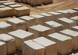
Mardin Stone is a precious stone with an official Origin Name and geographical indication, unique to the Mardin region and registered by the Turkish Patent and Trademark Office on 15.04.2011 (with registration number 145).
View Official Geographical Indication Dossier for Mardin Stone →
4. Mardin İmlebbes (Çikolata, şekerleme ve türevi ürünler)

Mardin İmlebbes is a geographical indication of ours, specific to the Mardin region, registered by the Turkish Patent and Trademark Office on 23.12.2009 (with registration number 124).
View Official Geographical Indication Dossier for Mardin İmlebbes →
5. Mardin İncasiyye (Yemekler ve çorbalar)

Mardin İncasiyye is an official Geographically Indicated value specific to the Mardin region, registered by the Turkish Patent and Trademark Office on 08.08.2024 (with registration number 1627).
View Official Geographical Indication Dossier for Mardin İncasiyye →
6. Mardin Bulgur (Diğer ürünler)
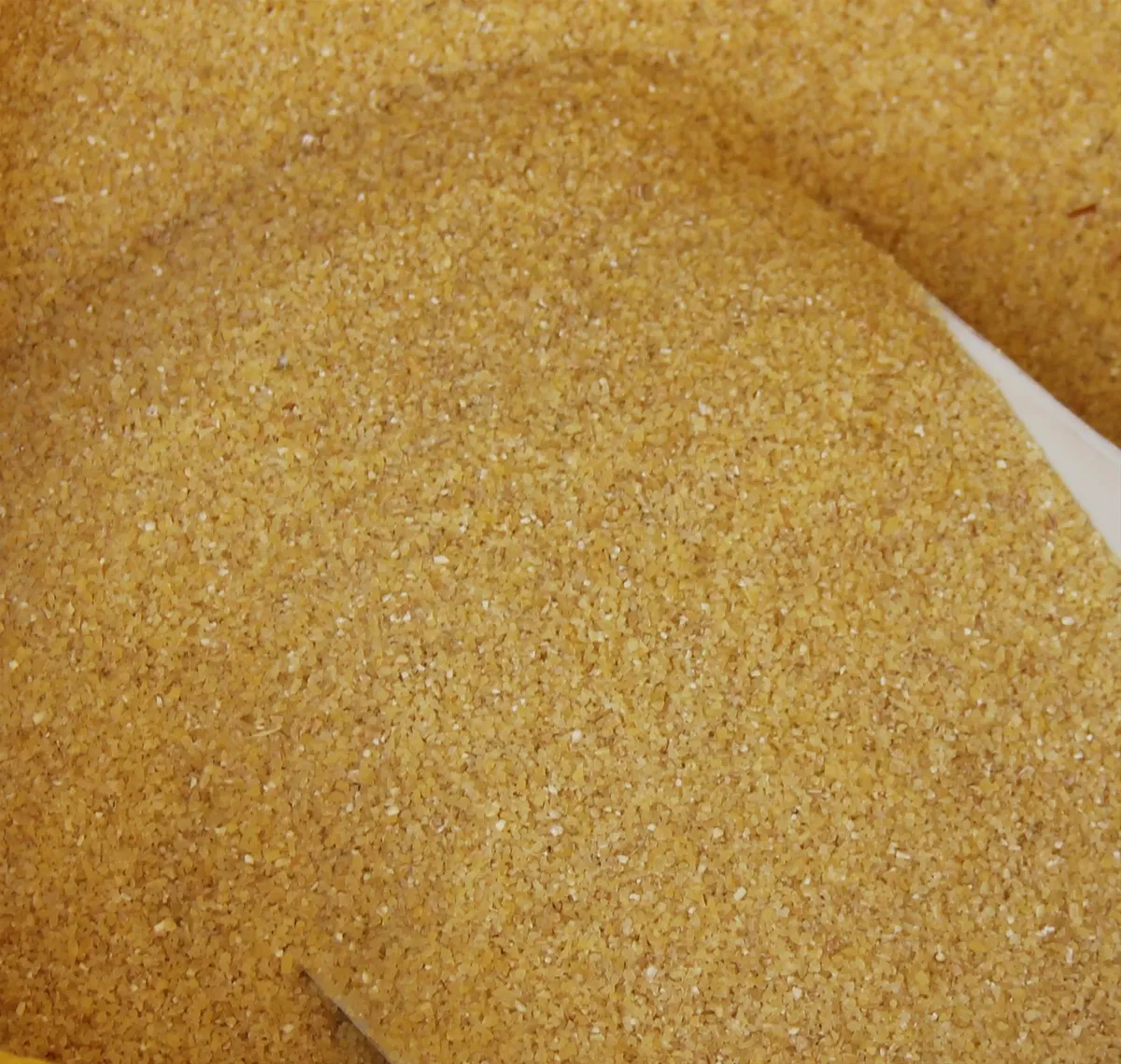
Mardin Bulgur is a value with a geographical indication of its official Origin Name, specific to the Mardin region, registered by the Turkish Patent and Trademark Office on 16.10.2019 (with registration number 463).
View Official Geographical Indication Dossier for Mardin Bulgur →
Practical Travel & Transit Planning for Dargeçit, Mardin (2026)
| Planning Category | Verified Local Information |
|---|---|
| Region & Administrative Center | Dargeçit, Mardin, Türkiye |
| Best Time to Visit | Spring (April–June) and Autumn (September–November) for ideal sightseeing weather; Summer for highlands and coastal routes. |
| Public Transit & Highway Access | Regular municipal buses and local minibus cooperatives (Dolmuş) depart daily from the Mardin Intercity Bus Terminal (Otogar) directly to Dargeçit. |
| Recommended Stay | 1 to 2 full days to explore the main historical landmarks, nature trails, and local culinary stops. |
Frequently Asked Questions About Visiting Dargeçit, Mardin
What are the must-see places to visit in Dargeçit, Mardin?
The top verified attractions in Dargeçit, Mardin include Ilısu Dam Lake and Tigris Canyon Observation Area, Derinsu Natural Water Source and Cave, Hell Creek Canyon and Valley Nature Trail, Dargeçit Historical Stone Bridge, Historical Mor Kuryakos Assyrian Church (Dargeçit). Each location offers documented historical or natural heritage with clear road access.
How can I get to Dargeçit, Mardin by public transport or car?
You can reach Dargeçit, Mardin easily by car via Mardin's main provincial highways, or take regular municipal buses and district minibuses departing throughout the day from the Mardin central bus terminal (Otogar).
What are the famous local dishes and traditional foods to try in Dargeçit, Mardin?
When visiting Dargeçit, Mardin and Mardin, be sure to taste officially registered specialties such as Mardin Kibe, Midyat Pickle / Midyat Pickle, Mardin Stone, Mardin İmlebbes, Mardin İncasiyye, prepared by local artisans and traditional restaurants.
Are the attractions in Dargeçit, Mardin suitable for families and day trips?
Yes. Most historic monuments, parks, museums, and promenade areas in Dargeçit, Mardin are family-friendly and well-suited for both weekend getaways and full-day cultural itineraries.
When is the best season to visit Dargeçit, Mardin?
Spring and autumn offer the most comfortable temperatures for walking tours and photography in Dargeçit, Mardin, while summer is popular for nature recreation, plateaus, and festivals.