Planning a journey to Bulanık, Muş? This comprehensive 2026 Ancient Cities guide brings together 10 verified landmarks, natural wonders, and cultural heritage sites with official visiting hours, GPS coordinates, public transit connections, and local gastronomy recommendations.
Quick Highlights & Discovery Route in Bulanık, Muş
- Haçlı (Bulanık) Lake and Wetland
- Esenlik Mosque and Historical Çilehane
- Bilican Mountains and Plateaus
- Gümüşpınar (Pulur) Mound and Rock Ruins
- Blurry Town Square and Clock Tower Park
- Mollakent Mosque
- Muş Chorti Pickle
- Muş Çorti Vaccine (Dish)
Ancient Cities, Archaeological Ruins & Open-Air Heritage in Bulanık, Muş
Bulanık, Muş (Muş) sits along ancient trade, military, and cultural corridors of Anatolia. Archaeological mounds, rock-cut tombs, necropolises, ancient theaters, and classical settlements around Bulanık, Muş shed light on thousands of years of human settlement.
- MuseumPass & Entry Info: Check MuseumPass Türkiye (Müzekart) validity and seasonal visiting hours before visiting official archaeological sites in Bulanık, Muş.
- Footwear & Sun Protection: Wear non-slip walking shoes, a hat, and carry water when exploring uneven stone streets and hillside ruins.
- Archaeological Context: Combine your visit to the ruins of Bulanık, Muş with the local archaeological museum in Muş to see excavated artifacts and inscriptions.
Top Verified Ancient Cities & Must-See Landmarks in Bulanık, Muş
1. Haçlı (Bulanık) Lake and Wetland

Free Public Access • GPS: 39.0247, 42.2966
History and General Information / Local Legends and Folklore
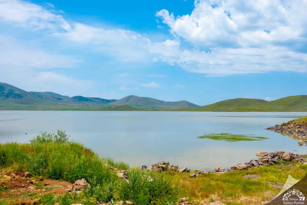
Haçlı Lake (Bulanık Lake) is a volcanic lava set lake of approximately 10 square kilometers, formed as a result of the lava erupted from the volcanic Bilican Mountains in the south, blocking the front of the valley. The name of the lake comes from the historical village of Haçlı (Kızılkaya) on the southern shore. According to legend, the lake gave life to the plain with its fresh water, which has been considered sacred since ancient times; In the freezing cold of winter, the lake surface was completely covered with meters of ice, and local people traveled on the lake with horse-drawn sleighs. The lake is the most critical breeding and accommodation haven in Eastern Anatolia for the endangered demolition crane (Grus virgo), shepherd shepherd and horntail ducks.
Geographical Structure, Altitude and Natural Features
The altitude is approximately 1583 meters; It is a freshwater lake with an average depth of around 7 meters. It is surrounded by large reed fields, wet meadows and volcanic tuff slopes. Mirror carp grows abundantly in the lake.
Visiting Hours, Days and Entrance Fees
- Entrance Fee: The pond shore, recreation areas and bird watching points are completely FREE.
- Visiting Hours and Days (Mandatory): Open 7 days a week from sunrise to sunset.
- Rules, Safety and Stroller/Disabled Access: Lakeside hiking trails and picnic areas are suitable for stroller use. Swimming in the lake and hunting in the reeds are prohibited due to conservation laws. You should not go out on the lake unsafely when it freezes over in winter.
- Facilities and Facilities: There is a municipal recreation park, camellias, picnic tables, bird observation points and WC by the lake.
Transportation, Public Transit Routes and Exact Location
- Address / Open Location: Kızılkaya Köyü Mevkii, 49500 Bulanık / Muş.
- Road Condition and Vehicle Availability: It is 8 km away from Bulanık district center; You can easily reach the lake shore via the asphalt district road by passenger car.
- Actual Public Transportation Information (Mandatory): Kızılkaya and Erentepe village minibuses departing from Bulanık district center and pass by the lake shore; It can be reached from the center in 10 minutes by taxi.
- Parking Availability: There is ample free car parking in the lakeside recreation area.
Contextual Experience Tips, Photography and Local Gastronomy
- Best Photography Spots and Frames: Shore angles where the snowy reflection of the Bilican Mountains falls on the lake mirror, spiny cranes swimming among the reeds and the frozen lake surface in winter.
- Light and Shooting Hours: Early morning hours (06:30 - 09:00) are the perfect light for bird watching and still water reflections.
- Local Gastronomy Recommendations: Freshly caught pan-fried carp, Bulanık village tandoori bread and sheep cheese should be tasted by the lake.
Explore Full 5-Section Guide & Map for Haçlı (Bulanık) Lake and Wetland →
2. Esenlik Mosque and Historical Çilehane
Free Public Access • GPS: 39.0115, 42.0985
History and General Information / Local Legends and Folklore
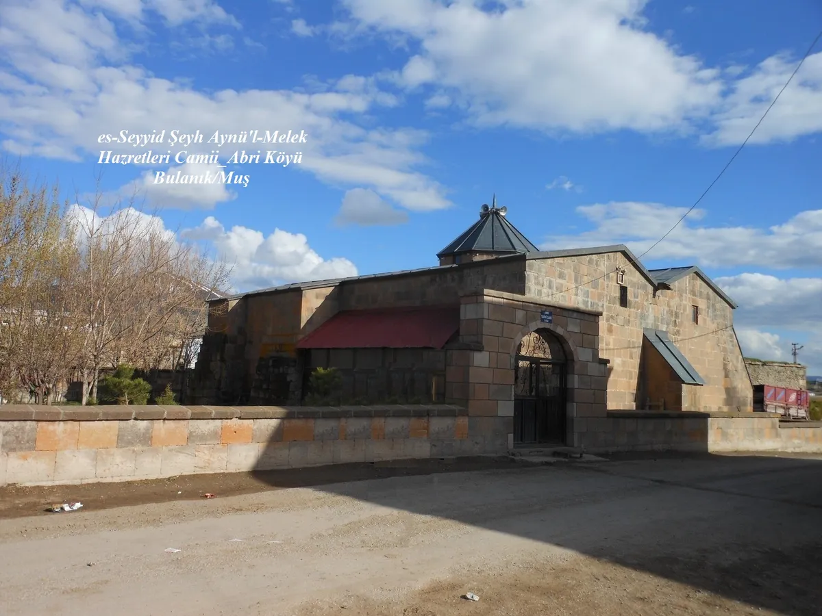
Esenlik Mosque (Sheikh Abdülmelik Mosque), built by Sheikh Abdülmelik in 1194 during the Seljuk period, is one of the oldest and most original stone temples in Eastern Anatolia. The most distinctive architectural character of the mosque is that it was built with cut blocks carved from the volcanic red and ash-colored Ahlat stone (tuff stone) of the region. Right next to the mosque, which has a single dome, four windows and double crown doors, there is a historical vaulted "chilehane" (grave room) where the Sufi masters of the period spent for forty days in self-improvement and seclusion.
Geographical Structure, Altitude and Natural Features
The altitude is approximately 1510 meters; It is located in the center of Esenlik (formerly Abri) village, at the foot of large plateau meadows and volcanic hills.
Visiting Hours, Days and Entrance Fees
- Entrance Fee: The historical mosque and the chapel are open to worship and visit and are FREE.
- Visiting Hours and Days (Mandatory): It is open 7 days a week from morning prayer until after night prayer (05:00 - 21:00).
- Rules, Security and Baby Stroller/Disabled Access: The mosque courtyard has a flat surface and is suitable for wheelchair and stroller access. Çilehane steps are narrow; Appropriate reverence and silence for the spiritual space should be maintained.
- Facilities and Facilities: In the courtyard of the mosque, there is an ablution room, a fountain, a women's gathering place and a village recreation fountain.
Transportation, Public Transit Routes and Exact Location
- Address / Open Location: Esenlik Village Village Road, 49500 Bulanık / Muş.
- Road Condition and Vehicle Availability: It is approximately 24 km from Bulanık district center and 80 km from Muş center; It can be easily reached by passenger vehicle via the completely asphalt village road.
- Real Public Transportation Information (Mandatory): Esenlik Village minibuses, which make regular trips every day from Bulanık Bus Terminal, carry passengers to the mosque square.
- Parking Availability: Free car parking is available in the mosque square.
Spiritual Visiting Etiquette and Commemoration Guidelines
- Spiritual Visit and Prayer Etiquette: A two-rakat tahiyyatu'l-masjid prayer should be performed under the more than 800-year-old Seljuk dome, and the Fatiha should be presented to the souls of Sheikh Abdülmelik and the spiritual leaders buried in the ascetic.
- Documentary & Respectful Shooting: Seljuk geometric reliefs and double crown door details on the Ahlat stone should be photographed with dignified simplicity.
- Important Commemoration Days: Prayers and blessings performed with the village people on Fridays and holy nights keep a deep-rooted tradition alive.
- Local Spiritual Tradition: Offerings of traditional village pastries and milk halva baked in village ovens and distributed to the community should be accepted.
Explore Full 5-Section Guide & Map for Esenlik Mosque and Historical Çilehane →
3. Bilican Mountains and Plateaus
Free Public Access • GPS: 38.9667, 42.1667
History and General Information / Local Legends and Folklore
Rising majestically between Bulanık and Malazgirt districts, Bilican Mountains (its peak is approximately 2,950 meters) is the mountain range that hosts the richest transhumance and nomadic shepherd culture in Eastern Anatolia. There are centuries-old stone sheepfolds and plateau camps at the foot of the mountains, where plateau festivals, horse races and fertility prayers have been held since ancient times. According to local legend, it is believed that the crater ponds and ice-cold springs at the peaks of Bilican Mountain are protected by sky fairies.
Geographical Structure, Altitude and Natural Features
The plateaus, which extend between an average altitude of 2,100 - 2,950 meters, are covered with lush green meadows during the summer months, thanks to their rich volcanic soil. Thyme, astragalus, mountain tea and endemic species are abundant in the region. There are small glacial lakes and karst springs on the high slopes of the mountain.
Visiting Hours, Days and Entrance Fees
- Entrance Fee: Entrance to the plateau and mountaineering area is completely free.
- Visiting Hours and Days: Open 7 days a week; Since it is covered with heavy snow in winter, the most suitable months to visit are June - September.
- Rules, Safety and Stroller/Disabled Access: Since it is a high altitude mountainous terrain, windbreakers/warm clothes and hiking boots are essential against weather changes. Not suitable for wheelchairs or strollers.
- Facilities and Facilities: In summer, there are shepherd tents in the plateau camps; there are no organized commercial facilities; Campers must come with supplies.
Transportation, Public Transit Routes and Exact Location
- Address / Open Location: Bilican Mountain Range, Yayla Yolu Mevkii, Bulanık / Muş.
- Road Condition and Vehicle Availability: It is 18 km away from Bulanık district center; The foothills are asphalted up to the villages, the road to the plateaus is a stabilized mountain road; SUVs or tall vehicles are recommended.
- Real Public Transportation Information: Village minibuses operate from Bulanık to the surrounding plateau villages 1-2 times a day.
- Parking Availability: Free parking is possible in unlimited open areas on the plateau plains.
Contextual Experience Tips, Photography and Local Gastronomy
- Best Photography Spots and Frames: Panoramic skyline and herds of grazing sheep overlooking Bulanık Plain and Lake Haçlı from the summit slopes.
- Light and Shooting Hours: The fog covering the mountain slopes in the early morning hours and the red glow hitting the snowy peaks at sunset.
- Local Gastronomy Recommendations: Fresh sheep yoghurt, tulum cheese and highland flower honey obtained from the plateau nomads should be tasted.
Explore Full 5-Section Guide & Map for Bilican Mountains and Plateaus →
4. Gümüşpınar (Pulur) Mound and Rock Ruins
Free Public Access • GPS: 39.0634, 42.3792
History and General Information / Local Legends and Folklore
Gümüşpınar Mound (historically known as Pulur) is a well-established archaeological center bearing the characteristic traces of the Eastern Anatolian Karaz culture (Early Transcaucasian). At the foot of the mound, which bears traces of ancient communities engaged in bronze casting and animal husbandry since 3000 BC, there are natural silver springs that have been flowing uninterruptedly for centuries. According to local narratives, it is said that this water gives strength and health to those who drink it.
Geographical Structure, Altitude and Natural Features
Its altitude is 1,490 meters. Rising from the flat plain floor, the mound is located in a green area surrounded by spring waters and poplar trees.
Visiting Hours, Days and Entrance Fees
- Entrance Fee: Free.
- Visiting Hours and Days: It can be visited in daylight 7 days a week.
- Rules, Safety and Stroller/Disabled Access: Archaeological fabric must be protected; It is suitable for walking.
- Facilities and Facilities: There is a village fountain and recreation area.
Transportation, Public Transit Routes and Exact Location
- Address / Open Location: Gümüşpınar Village, Bulanık / Muş.
- Road Condition and Vehicle Availability: It is 14 km away from the center of Bulanık; It can be reached via a stabilized and asphalt village road.
- Real Public Transportation Information: Village shuttles depart from Bulanık bus station.
- Parking Availability: Parking can be done near Pınarbaşı.
Contextual Experience Tips, Photography and Local Gastronomy
- Best Photography Spots and Frames: The spring at the foot of the mound and the centuries-old willow trees in the surrounding area provide natural village photographs.
- Gastronomy: Mush kashar and tandoori bread, made from freshly milked sheep's milk in the village, should be tasted.
Explore Full 5-Section Guide & Map for Gümüşpınar (Pulur) Mound and Rock Ruins →
5. Blurry Town Square and Clock Tower Park
Free Public Access • GPS: 39.0949, 42.2761
History and General Information / Local Legends and Folklore
Bulanık City Square and Clock Tower Park are the center of the social, cultural and commercial life of the district. It is the meeting point of the city with its monumental clock tower, fountain pools and green recreation areas built from cut Ahlat stone in accordance with the local architecture. The historical teahouses and shops around the square provide you with the warmth of Eastern Anatolian hospitality.
Geographical Structure, Altitude and Natural Features
Its altitude is 1,505 meters. It is located on a flat area in the district center; It is shaded by acacia and pine trees.
Visiting Hours, Days and Entrance Fees
- Entrance Fee: Free.
- Visiting Hours and Days: Open 24 hours a day, 7 days a week.
- Rules, Security and Baby Stroller/Disabled Access: The square has a completely flat surface and is suitable for strollers and disabled citizens.
- Facilities and Facilities: Rest benches, fountains, cafes, patisseries and municipal facilities are available.
Transportation, Public Transit Routes and Exact Location
- Address / Open Location: İnönü Mahallesi, Akşam Caddesi, Bulanık / Muş.
- Road Condition and Vehicle Availability: Located in the town centre; It is easily accessible by all kinds of vehicles.
- Real Public Transport Information: All minibuses in the blurred city pass through the square.
- Parking Availability: There are municipal parking lots around the square.
Contextual Experience Tips, Photography and Local Gastronomy
- Best Photography Spots and Frames: Souvenir photos can be taken in front of the clock tower and by the fountain pool.
- Gastronomy: You should try Bulanık buns and brewed illegal tea, freshly baked in the bakeries in the square.
Explore Full 5-Section Guide & Map for Blurry Town Square and Clock Tower Park →
6. Mollakent Mosque
Free Public Access • GPS: 38.9545, 42.0682
History and General Information / Local Legends and Folklore
Mollakent Mosque was built by Sheikh Ibrahim during the Seljuk period in 1290 and is the main place of worship of the most influential religious and scientific center of the period in the region. Built with cut blocks of red and brown Ahlat stone, the building exhibits a unique Seljuk architectural character with its square plan, vaulted ceiling cover and four domes. According to local rumors, Mollakent has been known as the "land of scholars" of Eastern Anatolia for centuries; The teachers and fiqh scholars trained in this mosque spread knowledge throughout the region.
Geographical Structure, Altitude and Natural Features
The altitude is approximately 1520 meters; It is located in the heart of the historical Mollakent village, built on a high plateau, surrounded by centuries-old walnut trees and historical stone buildings.
Visiting Hours, Days and Entrance Fees
- Entrance Fee: The historical mosque is open for worship and entrance is completely FREE.
- Visiting Hours and Days (Mandatory): It is open 7 days a week from morning adhan until after night prayer (05:00 - 21:30).
- Rules, Security and Stroller/Disabled Access: The mosque courtyard is flat and suitable for strollers and disabled visitors. One should enter the mosque without shoes and pay attention to worship etiquette.
- Facilities and Facilities: In the courtyard of the mosque, there is an ablution room, a fountain, a women's gathering place and a village conversation gazebo.
Transportation, Public Transit Routes and Exact Location
- Address / Open Location: Mollakent Village Merkez Mevkii, 49500 Bulanık / Muş.
- Road Condition and Vehicle Availability: It is 34 km away from Bulanık district center; It can be easily reached by passenger vehicle via the asphalt village road.
- Real Public Transportation Information (Mandatory): Mollakent village minibuses, which run regularly every day from Bulanık Bus Terminal, come to the front of the mosque.
- Parking Availability: Free car parking is available in the village square in front of the mosque.
Spiritual Visiting Etiquette and Commemoration Guidelines
- Spiritual Visit and Prayer Etiquette: The Holy Quran should be recited under the shadow of the historical stone walls, and prayers should be made for the souls of Sheikh Ibrahim and the scholars who have studied here for centuries.
- Documentary & Respectful Shooting: The four-domed exterior silhouette and stone altar details, which reflect the timeless color of the Ahlat stone, should be photographed from dignified angles.
- Important Commemoration Days: Friday prayers performed with the congregation from surrounding villages on Fridays offer a deep spiritual unity.
- Local Spiritual Tradition: Hot fresh milk, churned butter and tandoori kete offered by the village residents to the guests should not be rejected.
Explore Full 5-Section Guide & Map for Mollakent Mosque →
7. Mollakent Madrasa
Free Public Access • GPS: 38.9543, 42.0677
History and General Information / Local Legends and Folklore
Mollakent Madrasa, built in 1321 by Sheikh Ibrahim right next to the mosque, is the most important monument of the educational architecture of the late Seljuk period and the Ilkhanid period in Muş. The madrasa built with cut stone workmanship from Ahlat stone; It consists of a main classroom hall, two large student rooms and vaulted passages. The madrasah, where tafsir, hadith, logic and astronomy courses were given for hundreds of years, was considered one of the most respected centers of science in Eastern Anatolia. The building, which has survived to this day with its solid stone walls, is a cultural heritage that embodies the ancient educational history of the region.
Geographical Structure, Altitude and Natural Features
The altitude is approximately 1525 meters; It is located on the northern slope of Mollakent village, on an open and airy hill ridge, approximately 50 meters above the mosque.
Visiting Hours, Days and Entrance Fees
- Entrance Fee: Entrance to the historical madrasa is completely FREE.
- Visiting Hours and Days (Mandatory): It is open to visitors 7 days a week from sunrise to sunset.
- Rules, Security and Baby Stroller/Disabled Access: The entrance door and main hall of the madrasa have flat floors and are suitable for wheelchair and stroller access; Historical stone arches and vaults should not be damaged.
- Facilities and Facilities: There are information boards, a fountain in the village square and recreation areas.
Transportation, Public Transit Routes and Exact Location
- Address / Open Location: Mollakent Village Medrese Mevkii, 49500 Bulanık / Muş.
- Road Condition and Vehicle Availability: From Bulanık center, you can reach the village square via a 34 km asphalt road; The madrasa is right next to the mosque.
- Real Public Transportation Information (Mandatory): Mollakent village minibuses departing from Bulanık district bus terminal and carry passengers up to 50 meters from the madrasa.
- Parking Availability: There is a free parking area in the village square.
Contextual Experience Tips, Photography and Local Gastronomy
- Best Photography Spots and Frames: The barrel-vaulted stone ceiling arches of the madrasa, the crown gate made of solid Ahlat stone, and the beams of light filtering through the window grates.
- Light and Shooting Hours: Early morning hours (08:30 - 10:30) provide in-depth shots with the angled sunlight hitting the stone corridors of the madrasah.
- Local Gastronomy Recommendations: Organic walnut flour halva and tandoori kadasi made by local women in the village should be tasted.
Explore Full 5-Section Guide & Map for Mollakent Madrasa →
8. Sheikh Omer Sahubi Tomb and Historical Grave
Free Public Access • GPS: 38.9546, 42.0682
History and General Information / Local Legends and Folklore
Sheikh Ömer Sahubi Tomb and Historical Grave is a spiritual shrine located on the southern slope of Mollakent village, dating back to the Seljuk and Principality periods. Sheikh Ömer Sahubi, who is buried in the tomb, is considered one of the Khorasan saints who spread Islam and Sufi morality to the region. The stone-vaulted ascetic cell located next to the tomb is a mystical place where dervishes retreated. The large historical cemetery extending around the tomb is; It is almost like an "open-air stone museum" with dozens of historical Ahlat stone sarcophagi and shahide tombstones bearing Seljuk Thuluth calligraphy, Rumi motifs and lamp reliefs.
Geographical Structure, Altitude and Natural Features
The altitude is approximately 1515 meters; It is a peaceful spiritual area on a gently sloping ridge, surrounded by wild almond trees and wildflowers.
Visiting Hours, Days and Entrance Fees
- Entrance Fee: Visiting the tomb and historical grave is completely FREE.
- Visiting Hours and Days (Mandatory): It is open to visitors 7 days a week from sunrise to sunset (06:00 - 19:30).
- Rules, Safety and Stroller/Disabled Access: Inner paths are dirt and grass; The tomb gate can be reached by wheelchair. Historical tombstones should not be stepped on, and superstitious acts such as tying a cloth to the tomb's coffer or lighting a candle should be avoided.
- Facilities and Facilities: There are shady resting benches and a fountain around the tomb.
Transportation, Public Transit Routes and Exact Location
- Address / Open Location: Mollakent Village Güney Yamacı Hazire Mevkii, 49500 Bulanık / Muş.
- Road Condition and Vehicle Availability: You can reach the village via a 34 km asphalt road from Bulanık center; The tomb can be reached via a short stabilized road from the village.
- Real Public Transportation Information (Mandatory): Mollakent village minibuses departing from Bulanık bring passengers up to 100 meters from the tomb.
- Parking Availability: Free car parking is available in the open area at the entrance of the tomb.
Spiritual Visiting Etiquette and Commemoration Guidelines
- Spiritual Visit and Prayer Etiquette: One should stand at the threshold of the tomb with decency and greet him/her, read the Holy Quran and donate it to all the believers lying in the grave, especially Sheikh Ömer Sahubi.
- Documentary & Respectful Shooting: Fine geometric stonework and oil lamp motifs on the tombstones of the Seljuk period should be photographed with respectful framing.
- Important Commemoration Days: There is a heavy influx of visitors on Thursday afternoons, Fridays and religious holidays.
- Local Spiritual Tradition: The blessings of halva and lokma distributed by those who visit the shrine to the surrounding villages should be shared.
Explore Full 5-Section Guide & Map for Sheikh Omer Sahubi Tomb and Historical Grave →
9. Erentepe (Liz) Archaeological Mound and Martyrdom
Free Public Access • GPS: 39.0136, 42.0567
History and General Information / Local Legends and Folklore
Erentepe Mound (historically known as Liz Mound) is one of the most established settlement hills in Eastern Anatolia, which was inhabited continuously from the Early Bronze Age (3000 BC) until the Middle Ages. During the archaeological surveys conducted on the mound surrounded by the Liz Stream in a curve, ceramic pieces and traces of stone foundations from the Urartian, Hellenistic and Seljuk periods were found. At the top of the mound is the Erentepe Martyrdom, built in memory of our martyrs who died for the sake of the country.
Geographical Structure, Altitude and Natural Features
Its altitude is 1,540 meters. It rises like a natural hill with a height of 20 meters in the middle of the wide Liz Plain. It is surrounded by wheat fields and willows along Liz Creek.
Visiting Hours, Days and Entrance Fees
- Entrance Fee: Free.
- Visiting Hours and Days: It can be visited in daylight 7 days a week.
- Rules, Safety and Stroller/Disabled Access: Must be treated with respect at the Martyrs' Memorial site. The path leading up to the hill is suitable for walking.
- Facilities and Amenities: The fountains, mosques and grocery stores in Erentepe town center can be used.
Transportation, Public Transit Routes and Exact Location
- Address / Open Location: Erentepe Town, Bulanık / Muş.
- Road Condition and Vehicle Availability: Bulanık is 16 km away from the town centre; It can be reached by a completely asphalt road via the Muş-Bulanık highway.
- Real Public Transportation Information: Erentepe municipal minibuses departing from Muş and Bulanık come to the foot of the mound.
- Parking Availability: There is a free parking area at the entrance of the Martyrs' Road.
Contextual Experience Tips, Photography and Local Gastronomy
- Spiritual Visit and Prayer Etiquette: Fatiha is recited to the souls of our martyrs in front of the martyrdom monument at the summit; One can contemplate the view overlooking the plain.
- Photography and Framing: Panoramic photographs should be taken from the top of the mound overlooking the Liz Plain and the Bilican Mountains in the distance.
Explore Full 5-Section Guide & Map for Erentepe (Liz) Archaeological Mound and Martyrdom →
10. Sarıpınar Nature Trail and Healing Springs
Free Public Access • GPS: 39.2050, 42.1430
History and General Information / Local Legends and Folklore
Sarıpınar Town is a natural healing center where yellow sedimentary sulfur and mineral waters boil among the rocks at the foothills of the Bilican Mountains. The springs, which have been visited by the local people for centuries with the belief that they are good for stomach, kidney and rheumatism disorders, combine with the plateau trails around them and offer a peaceful nature getaway.
Geographical Structure, Altitude and Natural Features
Its altitude is 1,620 meters. It has a cool highland atmosphere at the foot of the mountain, covered with lush green meadows and mountain thyme.
Visiting Hours, Days and Entrance Fees
- Entrance Fee: Free.
- Visiting Hours and Days: Open 24 hours a day, 7 days a week.
- Rules, Safety and Stroller/Disabled Access: Water sources must be kept clean; Suitable for families.
- Facilities and Facilities: Natural water fountains, tea garden and resting benches are available.
Transportation, Public Transit Routes and Exact Location
- Address / Open Location: Sarıpınar Town, Bulanık / Muş.
- Road Condition and Vehicle Availability: It is 18 km away from Bulanık district center; The road is completely asphalt and can be easily reached by passenger vehicle.
- Real Public Transportation Information: Sarıpınar town minibuses operate regularly from Bulanık center.
- Parking Availability: There is a free parking area in the town square.
Contextual Experience Tips, Photography and Local Gastronomy
- Best Photography Spots and Frames: The plateau view extending from the head of Pınar to the peaks of the Bilican Mountains is very clear in the early morning hours.
- Gastronomy: Fresh butter and filtered honey from animals fed with thyme in the plateau should be tasted.
Explore Full 5-Section Guide & Map for Sarıpınar Nature Trail and Healing Springs →
What to Eat in Bulanık, Muş? Registered Local Delicacies & Gastronomy
A trip to Bulanık, Muş is incomplete without tasting its officially registered geographical indication products and centuries-old Anatolian recipes:
1. Muş Chorti Pickle (İşlenmiş ve işlenmemiş meyve ve sebzeler ile mantarlar)
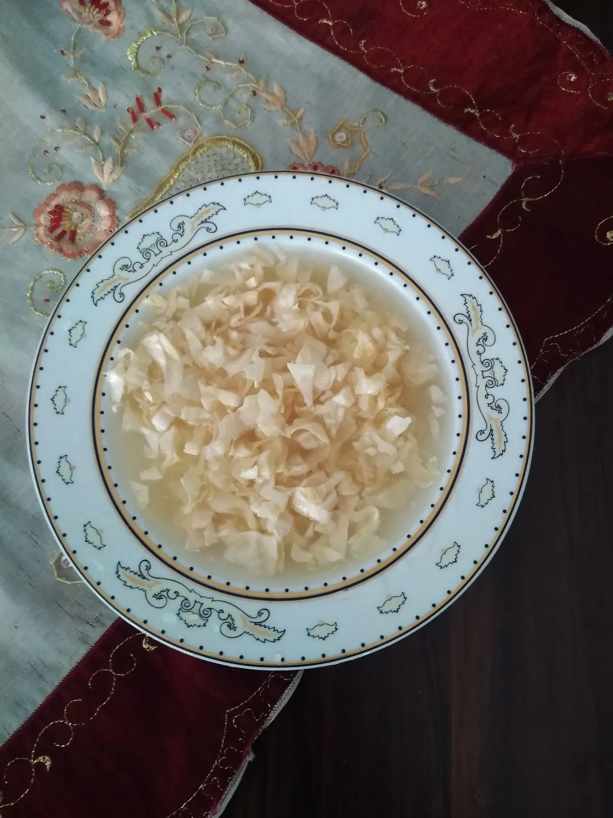
Muş Çorti Pickle is a geographically indicated value specific to the Muş region and registered by the Turkish Patent and Trademark Office on 25.12.2017 (with registration number 294).
View Official Geographical Indication Dossier for Muş Chorti Pickle →
2. Muş Çorti Vaccine (Dish) (Yemekler ve çorbalar)
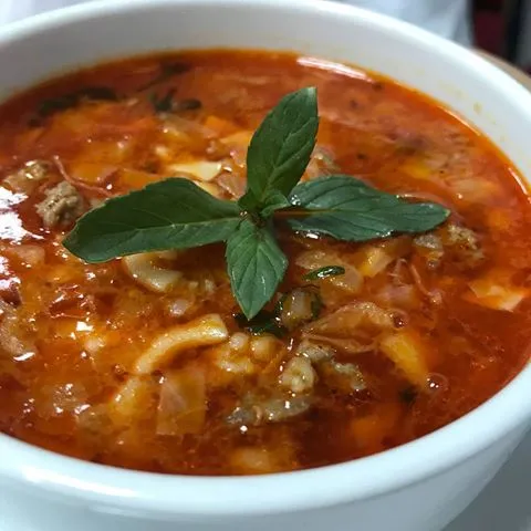
Cooking finely chopped and sour sauerkraut (chorti) with lamb meat on the bone and pounded wheat.
History: A sour healing vaccine that provides immunity in the freezing Muş winter.
View Official Geographical Indication Dossier for Muş Çorti Vaccine (Dish) →
3. Mus Old Cheddar (Peynirler)
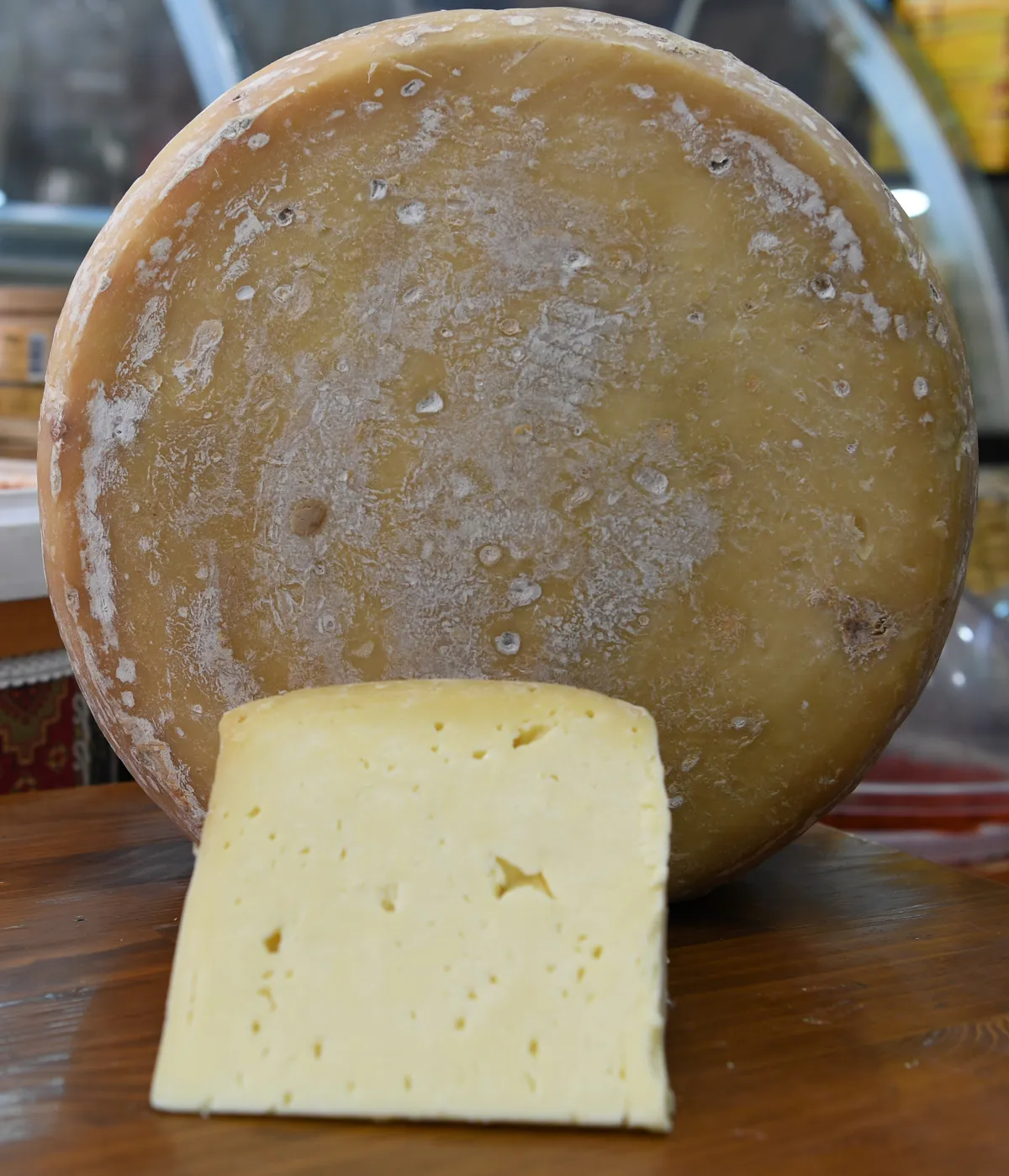
Muş Old Kashar is a geographically indicated value specific to the Muş region, registered by the Turkish Patent and Trademark Office on 22.06.2023 (with registration number 1393).
View Official Geographical Indication Dossier for Mus Old Cheddar →
4. Mus Meatballs (Yemekler ve çorbalar)
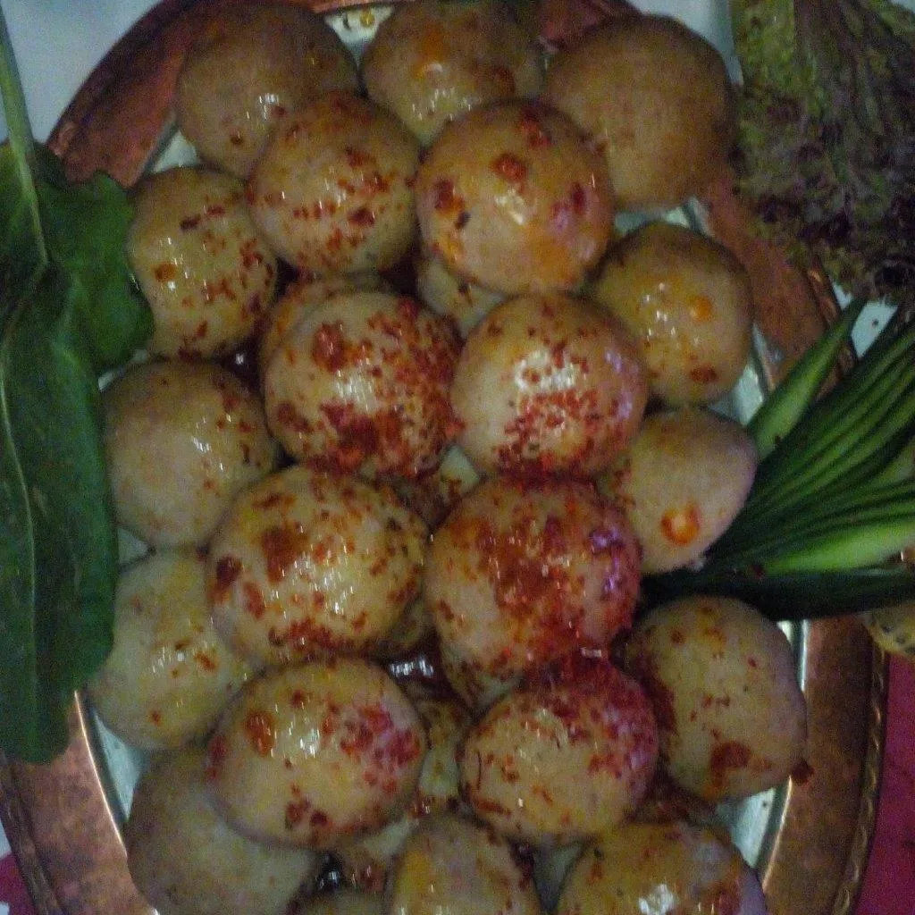
Product Story & History:
Muş Meatballs is a rich Eastern Anatolian culinary classic registered by the Turkish Patent and Trademark Office as Geographic Mark with registration number 544.
Distinctive Features & Material Profile:
Lean beef is pounded on a stone with a pestle until it reaches a paste consistency and kneaded with fine bulgur; It is stuffed with minced meat with walnuts and onions and boiled.
View Official Geographical Indication Dossier for Mus Meatballs →
Practical Travel & Transit Planning for Bulanık, Muş (2026)
| Planning Category | Verified Local Information |
|---|---|
| Region & Administrative Center | Bulanık, Muş, Türkiye |
| Best Time to Visit | Spring (April–June) and Autumn (September–November) for ideal sightseeing weather; Summer for highlands and coastal routes. |
| Public Transit & Highway Access | Regular municipal buses and local minibus cooperatives (Dolmuş) depart daily from the Muş Intercity Bus Terminal (Otogar) directly to Bulanık. |
| Recommended Stay | 1 to 2 full days to explore the main historical landmarks, nature trails, and local culinary stops. |
Frequently Asked Questions About Visiting Bulanık, Muş
What are the must-see places to visit in Bulanık, Muş?
The top verified attractions in Bulanık, Muş include Haçlı (Bulanık) Lake and Wetland, Esenlik Mosque and Historical Çilehane, Bilican Mountains and Plateaus, Gümüşpınar (Pulur) Mound and Rock Ruins, Blurry Town Square and Clock Tower Park. Each location offers documented historical or natural heritage with clear road access.
How can I get to Bulanık, Muş by public transport or car?
You can reach Bulanık, Muş easily by car via Muş's main provincial highways, or take regular municipal buses and district minibuses departing throughout the day from the Muş central bus terminal (Otogar).
What are the famous local dishes and traditional foods to try in Bulanık, Muş?
When visiting Bulanık, Muş and Muş, be sure to taste officially registered specialties such as Muş Chorti Pickle, Muş Çorti Vaccine (Dish), Mus Old Cheddar, Mus Meatballs, prepared by local artisans and traditional restaurants.
Are the attractions in Bulanık, Muş suitable for families and day trips?
Yes. Most historic monuments, parks, museums, and promenade areas in Bulanık, Muş are family-friendly and well-suited for both weekend getaways and full-day cultural itineraries.
When is the best season to visit Bulanık, Muş?
Spring and autumn offer the most comfortable temperatures for walking tours and photography in Bulanık, Muş, while summer is popular for nature recreation, plateaus, and festivals.