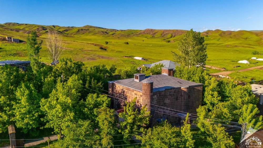

Planning a journey to Korkut, Muş? This comprehensive 2026 History & Culture guide brings together 10 verified landmarks, natural wonders, and cultural heritage sites with official visiting hours, GPS coordinates, public transit connections, and local gastronomy recommendations.
Quick Highlights & Discovery Route in Korkut, Muş
- Yünören Historical Mosque
- Historical Korkut Tomb and Seljuk Tombstones
- Kızıltaş Village Historical Rock Tombs and Ruins
- Alazlı (Tırmêt) Archaeological Mound and Ancient Settlement
- Karakale Historical Lookout Fortress and Ruins
- Korkut Central Grand Mosque and Dede Korkut Square
- Muş Chorti Pickle
- Muş Çorti Vaccine (Dish)
Historical Landmarks, Architecture & Cultural Heritage in Korkut, Muş
Korkut, Muş (Muş) preserves a multi-layered historical fabric shaped by centuries of Anatolian civilizations, including Roman, Byzantine, Seljuk, and Ottoman eras. Historic castles, stone bridges, caravanserais, civil mansions, and monumental structures reflect the strategic and cultural importance of Korkut, Muş.
Walking through the historic quarters of Korkut, Muş allows visitors to observe traditional masonry, timber-framed architecture, and restored heritage buildings up close.
- Architectural Details: Pay attention to carved stone portals, historic fountains, courtyard mansions, and defensive bastions across Korkut, Muş.
- Best Visiting Hours: Early morning and late afternoon golden light offer the best conditions for architectural photography and crowd-free exploration.
- Cultural Etiquette & Preservation: Respect restoration zones and signage at registered historical monuments in Korkut, Muş.
Top Verified History & Culture & Must-See Landmarks in Korkut, Muş
1. Yünören Historical Mosque

Free Public Access • GPS: 38.7184, 42.0257
History and General Information / Local Legends and Folklore
Yünören Mosque, built in 1150 during the Seljuk period, is the oldest monumental stone structure in Korkut district. Later, it underwent extensive restoration during the Akkoyunlu State, which dominated the region in the 15th century. The two-line historical inscription on the monumental entrance gate on the north facade of the mosque, which was built with smooth cut stone in a rectangular plan; It is one of the rarest examples of Seljuk Thuluth calligraphy, Rumi reliefs and geometric stone decorations in the region. The mosque, which has been the spiritual center of the local villages for centuries, has been restored to its original state by the General Directorate of Foundations and is kept open for worship.
Geographical Structure, Altitude and Natural Features
The altitude is approximately 1340 meters; It rises in the center of Yünören Village, on a gently sloping hill, among the wide plateau view and poplar trees.
Visiting Hours, Days and Entrance Fees
- Entrance Fee: The historical mosque is open for worship and entrance is completely FREE.
- Visiting Hours and Days (Mandatory): It is open for visits and worship 7 days a week from morning prayer to night prayer (05:00 - 21:00).
- Rules, Security and Baby Stroller/Disabled Access: The courtyard of the mosque is stone covered and flat; It is accessible for wheelchairs and strollers. You should enter the mosque without shoes and pay attention to the historical stone inscription.
- Facilities and Facilities: Ablution room, fountain, women's gathering place and village rest pavilion are available.
Transportation, Public Transit Routes and Exact Location
- Address / Open Location: Yünören Köyü İçi Yolu, 49700 Korkut / Muş.
- Road Condition and Vehicle Availability: It is 8 km away from Korkut district center; It can be reached in 10 minutes by passenger car via the completely asphalt village road.
- Actual Public Transportation Information (Mandatory): Yünören village minibuses departing from Korkut district center and reach the door of the mosque.
- Parking Availability: There is a free village parking area in the mosque square.
Spiritual Visiting Etiquette and Commemoration Guidelines
- Spiritual Visit and Prayer Etiquette: A two-rakat prayer should be performed in the 900-year-old Seljuk temple, and the Fatiha should be presented as a gift to the souls of the ancestors who built the building and kept it alive for centuries.
- Documentary & Respectful Shooting: The stone crown gate inscription dated 1150 and the geometric stone decorations of the Akkoyunlu period should be photographed from dignified angles.
- Important Commemoration Days: Friday prayers and holy nights, when village residents come together, are full of spiritual blessings.
- Local Spiritual Tradition: Offerings of fresh village tandoori lavash and milk distributed to the mosque community should be accepted.
Explore Full 5-Section Guide & Map for Yünören Historical Mosque →
2. Historical Korkut Tomb and Seljuk Tombstones
Free Public Access • GPS: 38.7390, 41.7805
History and General Information / Local Legends and Folklore
The Historical Korkut Tomb and its surrounding burial area, located in the Korkut district center of Muş, are the most distinguished representative of the 13th and 14th century Seljuk and Ahlatshah principality period stonemasonry in the region. The tomb with a cylindrical body and a conical cap and the gravestones with obelisks called Shahide in its grave; It continues the Ahlat tradition with geometric knitting motifs, Rumi decorations and Kufic inscriptions. It is accepted among the public as a sacred place of pilgrimage where the spiritual founders of the region and the Alp-Eren lords are buried.
Geographical Structure, Altitude and Natural Features
It is located in a plain and wooded field garden at an altitude of approximately 1,310 meters, at the eastern end of the Muş Plain. Acacia and ash trees provide peaceful shade to the cemetery area.
Visiting Hours, Days and Entrance Fees
- Entrance Fee: Entrance to the historical monument and burial area is free.
- Visiting Hours and Days: It is open to visitors all day long, 7 days a week.
- Rules, Safety and Baby Stroller/Disabled Access: Respectful behavior appropriate to spiritual space should be demonstrated; Historical stones and inscriptions should not be damaged. Flat foot entrance is suitable for disabled access.
- Facilities and Facilities: Fountain, environmental lighting, information boards and benches are available.
Transportation, Public Transit Routes and Exact Location
- Address / Open Location: Kümbet District, Historical Hazire Mevkii, Korkut / Muş.
- Road Condition and Vehicle Availability: 400 meters from Korkut town square; It is easily reached by asphalt intra-district roads.
- Real Public Transportation Information: Korkut district minibuses departing from Muş center drop off passengers very close to the tomb.
- Parking Availability: Free parking is available around Kümbet.
Spiritual Visiting Etiquette and Commemoration Guidelines
- Spiritual Visit and Prayer Etiquette: Visits are made in silence by reciting Fatiha and prayers to the souls of our ancestors.
- Documentary & Respectful Shooting: Seljuk period stone carved Kufic inscriptions and geometric badges can be photographed with dignity.
- Local Spiritual Tradition: During religious holidays, the people of the district gather in the cemetery, pray and distribute halva.
Explore Full 5-Section Guide & Map for Historical Korkut Tomb and Seljuk Tombstones →
3. Kızıltaş Village Historical Rock Tombs and Ruins
Free Public Access • GPS: 38.7371, 41.7769
History and General Information / Local Legends and Folklore
The rock tombs carved into the steep red limestone rocks within the borders of Kızıltaş Village in Korkut district prove the existence of the Urartian Kingdom and Iron Age settlements in the region. The single- and double-chambered burial chambers, meticulously carved into the bedrock, reflect the typical Urartian burial tradition, with steps at the entrance and niches made for dead gifts. Local people named the region 'Redstone' due to the reddish colored rock mass and stated that the rocks are connected to an ancient watchtower.
Geographical Structure, Altitude and Natural Features
Located at an altitude of approximately 1,420 meters, the rocky hill consists of red rocks containing iron oxide. With its high viewing position, it reveals the surrounding plateaus and valley.
Visiting Hours, Days and Entrance Fees
- Entrance Fee: It is an open archaeological site and entrance is completely free.
- Visiting Hours and Days: It can be visited 7 days a week in daylight.
- Rules, Safety and Stroller/Disabled Access: As it is a rock climbing area, care should be taken; Writing should not be written on rock surfaces. The terrain is not suitable for disabled people or strollers.
- Facilities and Amenities: There are no commercial facilities in the region; Water needs must be supplied from the village.
Transportation, Public Transit Routes and Exact Location
- Address / Open Location: Kızıltaş Köyü Mevkii, Korkut / Muş.
- Road Condition and Vehicle Availability: 11 km from Korkut center; The village road is asphalt, the last 300 meters to the rocks are a walking path.
- Real Public Transportation Information: Transportation can be provided by village shuttles departing from Korkut to the village.
- Parking Availability: You can park free of charge in suitable open areas at the village entrance.
Contextual Experience Tips, Photography and Local Gastronomy
- Best Photography Spots and Frames: Backlight frames where the valley outside is visible from the doorway of the rock tomb room.
- Light and Shooting Hours: Morning hours reveal the vibrant color of the red rocks.
- Local Gastronomy Recommendations: Fresh kenger pickles and tandoori bread made in the Korkut region should be tasted.
Explore Full 5-Section Guide & Map for Kızıltaş Village Historical Rock Tombs and Ruins →
4. Alazlı (Tırmêt) Archaeological Mound and Ancient Settlement
Free Public Access • GPS: 38.6949, 41.8258
History and General Information / Local Legends and Folklore
Alazlı Mound (historically known as Tırmêt) is a registered archaeological site that has been the center of agriculture and trade in the east of the Muş Plain since the Early Bronze and Iron Ages. During the surface research carried out in the mound, terracotta ceramics, millstones and ancient building foundations were identified. According to local legends, it is said that there was a palace of an Urartian lord who ruled centuries ago on this hill.
Geographical Structure, Altitude and Natural Features
Its altitude is 1,280 meters. Rising from the plain at the eastern end of the Muş Plain, the mound is surrounded by wheat fields and pasture lands.
Visiting Hours, Days and Entrance Fees
- Entrance Fee: Free.
- Visiting Hours and Days: It can be visited in daylight 7 days a week.
- Rules, Safety and Baby Stroller/Disabled Access: The archaeological site should not be damaged, attention should be paid to potholes.
- Facilities and Facilities: It is a natural protected area; Basic needs are provided from Alazlı village.
Transportation, Public Transit Routes and Exact Location
- Address / Open Location: Alazlı Village, Korkut / Muş.
- Road Condition and Vehicle Availability: It is 9 km away from Korkut district center; The road is asphalt and can be easily reached by passenger vehicle.
- Real Public Transportation Information: Alazlı village minibuses operate from Korkut district center.
- Parking Availability: There is a car park at the village entrance.
Contextual Experience Tips, Photography and Local Gastronomy
- Best Photography Spots and Frames: Views from the top of the mound overlooking the horizon of the Muş Plain and the meanders of the Karasu River should be photographed.
- Visit Time: It should be visited in spring, when the plain is adorned with tulips and greenery.
Explore Full 5-Section Guide & Map for Alazlı (Tırmêt) Archaeological Mound and Ancient Settlement →
5. Karakale Historical Lookout Fortress and Ruins
Free Public Access • GPS: 38.8266, 41.9387
History and General Information / Local Legends and Folklore
Karakale is a strategic observation castle and settlement that gives its name to Karakale Village, located in the south of Korkut district, and whose foundations date back to the Urartu Kingdom. It was named "Karakale" because it was built from black basalt stones. It was built on a steep volcanic rock mass in ancient times to control the caravan routes and military transfers between the Muş Plain and the Van Lake basin. The solid foundations of the building, which was used as a watchtower during the Seljuk and principality periods in the Middle Ages, as well as the traces of the city walls and the ruins of the cistern carved into the rock, have survived to the present day.
Geographical Structure, Altitude and Natural Features
The altitude is approximately 1420 meters; It rises on the volcanic basalt cliff that dominates the plain. There are mountain thyme, oak bushes and natural rock cavities around it.
Visiting Hours, Days and Entrance Fees
- Entrance Fee: It is an open ruins and castle ruins and entrance is completely FREE.
- Visiting Hours and Days (Mandatory): It can be visited 7 days a week from sunrise to sunset.
- Rules, Safety and Stroller/Disabled Access: Features natural rocky ground and steep trails; NOT SUITABLE FOR stroller and wheelchair use. It is necessary to wear sturdy walking shoes and be careful around rocky edges.
- Facilities and Facilities: There are no facilities in the ruins area; needs should be met from Karakale Village center.
Transportation, Public Transit Routes and Exact Location
- Address / Open Location: Karakale Village Kale Tepesi Mevkii, 49700 Korkut / Muş.
- Road Condition and Vehicle Availability: It is 9 km away from Korkut district center; You can reach the castle by walking a 300 meter path following the asphalt village road.
- Real Public Transportation Information (Mandatory): You can reach the village by Karakale village minibuses departing from Korkut center; It is a 10-minute walk from the castle to the village.
- Parking Availability: Free parking is available on the side of the village road at the foot of the castle.
Contextual Experience Tips, Photography and Local Gastronomy
- Best Photography Spots and Frames: The endless panorama of the Muş Plain through the ruins of black basalt walls and ancient cisterns carved into the rock.
- Light and Shooting Hours: Early morning and afternoon sun (16:30 - 18:30) best reflects the texture and shadow contrast of basalt stones.
- Local Gastronomy Recommendations: Organic honeycomb honey and fresh sheep cheese should be obtained from local producers in Karakale Village.
Explore Full 5-Section Guide & Map for Karakale Historical Lookout Fortress and Ruins →
6. Korkut Central Grand Mosque and Dede Korkut Square
Free Public Access • GPS: 38.7393, 41.7827
History and General Information / Local Legends and Folklore
Korkut Central Grand Mosque is a landmark building rising in the heart of the district center and keeping alive the spiritual memory of Dede Korkut, the ancient Turkish sage and poet from whom the district takes its name. According to local legend, the belief that Dede Korkut passed through these lands and collected bustards was the reason why the district was given this name. Mosque; It is the epicenter of all social, cultural and religious life of the district with its stone-based minaret, domed architecture and large Dede Korkut Square in front of it.
Geographical Structure, Altitude and Natural Features
The altitude is approximately 1310 meters; It is located in the plain district center of Korkut, at the intersection of the town hall and bazaar streets.
Visiting Hours, Days and Entrance Fees
- Entrance Fee: The mosque and the square are open to the public and completely FREE.
- Visiting Hours and Days (Mandatory): It is open 7 days a week from morning adhan until after night prayer (05:00 - 21:30).
- Rules, Security and Baby Stroller/Disabled Access: The mosque square and courtyard are paved with flat stone and are fully accessible for disabled and stroller access. You must enter the mosque without shoes and pay attention to the rules of decency.
- Facilities and Facilities: Ablution room, fountain, women's gallery, condolence house, square tea garden and WC are available.
Transportation, Public Transit Routes and Exact Location
- Address / Open Location: Merkez Mahallesi Akşam Caddesi No:10, 49700 Korkut / Muş.
- Road Condition and Vehicle Suitability: It is right in the heart of Korkut district center; It can be easily reached right to the door by any vehicle.
- Real Public Transportation Information (Mandatory): The last stop of Korkut district minibuses departing from Muş Bus Terminal is the square in front of the mosque.
- Parking Availability: There are ample free parking spaces around the mosque and in the town square.
Spiritual Visiting Etiquette and Commemoration Guidelines
- Spiritual Visit and Prayer Etiquette: Daily prayers should be performed with reverence in the mosque, and prayers should be made for the wisdom of Dede Korkut and the unity and prosperity of the country.
- Documentary & Respectful Shooting: Frames of the mosque minaret and the town square that reflect the traditional Eastern Anatolian town atmosphere should be photographed.
- Important Commemoration Days: On Fridays, holidays and tulip festival periods, the square and the mosque witness a lively cultural gathering.
- Local Spiritual Tradition: One should chat with the district elders at the Meydan tea house and listen to the local Dede Korkut stories told over samovar tea.
Explore Full 5-Section Guide & Map for Korkut Central Grand Mosque and Dede Korkut Square →
7. Korkut Endemic Tulip Fields and Tulip Square
Free Public Access • GPS: 38.7386, 41.7870
History and General Information / Local Legends and Folklore
Korkut Tulip Fields is the homeland and natural conservation center of the world-famous Muş Tulip (Tulipa sintenisii), which was registered as a geographical indication under the name "Muş 1071" by the Turkish Patent and Trademark Office in 2015. According to legend, when the snow melts in spring, the plain turns red suddenly, symbolizing the memory of the martyrs who fell on the homeland in the Battle of Manzikert and the resurrection of spring. Tulips bloom for only 15-20 days in the last week of April and the beginning of May every year. The traditional "Korkut Tulip Festival" held in the district hosts thousands of local and foreign nature lovers and photographers.
Geographical Structure, Altitude and Natural Features
The altitude is approximately 1300 meters; It spreads on rich alluvial soils in the east of the Muş Plain. It is surrounded by snowy mountains and offers a fairytale visual feast with its cover of red tulips in spring.
Visiting Hours, Days and Entrance Fees
- Entrance Fee: Tulip fields and festival square are open to the public and FREE.
- Visiting Hours and Days (Mandatory): It can be visited 7 days a week from sunrise to sunset during the flowering period of late April and early May.
- Rules, Safety and Stroller/Disabled Access: The walking paths around the tulip fields are stroller friendly. Plucking endemic tulips or removing their bulbs is subject to very heavy administrative fines under the Environmental Law; You should walk on designated paths in the fields.
- Facilities and Facilities: There is a festival area, wooden viewing benches, local product stands and WC in Lale Square.
Transportation, Public Transit Routes and Exact Location
- Address / Open Location: Lale Mahallesi Festival Area, 49700 Korkut / Muş.
- Road Condition and Vehicle Suitability: It can be easily reached by taking the Korkut turnoff from the Muş-Bitlis highway and following a 4 km asphalt road; Suitable for passenger vehicles.
- Real Public Transportation Information (Mandatory): Korkut district minibuses depart from Muş Bus Terminal every 20 minutes and carry passengers to Lale Square.
- Parking Availability: There is ample free parking space in the festival square and around the fields.
Contextual Experience Tips, Photography and Local Gastronomy
- Best Photography Spots and Frames: Crimson tulip carpet stretching to infinity against the backdrop of the snowy Kurtik and Bilican Mountains, macro flower shots and portraits of tulips in local attire.
- Light and Shooting Hours: Early morning hours (06:30 - 09:30) when the dewdrops are on the tulip leaves and afternoon sunset (16:30 - 18:30) offer the most fascinating shots.
- Local Gastronomy Recommendations: Fresh tandoori kadasi, Muş kashar, honeycomb highland honey and buttermilk should be tasted in Korkut centre.
Explore Full 5-Section Guide & Map for Korkut Endemic Tulip Fields and Tulip Square →
8. Küçükçayır Pond and Nature Park
Free Public Access • GPS: 38.7476, 41.5124
History and General Information / Local Legends and Folklore
Küçükçayır Pond is a natural pond and recreation area created within the borders of Küçükçayır Village, located in the west of Korkut district, for the purpose of collecting melted snow water from the mountains and agricultural irrigation. The pond, which is one of the most preferred getaway spots for amateur anglers and weekend picnics in the region; It is a frequent destination for migratory water birds and offers an idyllic Eastern Anatolian nature with green meadows and reeds around it.
Geographical Structure, Altitude and Natural Features
The altitude is approximately 1285 meters; It is surrounded by wet meadows, willow trees and cultivated fields. There are carp and chub in the pond.
Visiting Hours, Days and Entrance Fees
- Entrance Fee: Entrance to the pond shore and recreational areas is completely FREE.
- Visiting Hours and Days (Mandatory): Open 24 hours a day, 7 days a week.
- Rules, Safety and Stroller/Disabled Access: The flat meadow ground is suitable for stroller use. Swimming in the pond is dangerous and prohibited; Environmental cleanliness must be observed while angling.
- Facilities and Facilities: Natural picnic areas, shady willow seating areas and a fresh water fountain are available.
Transportation, Public Transit Routes and Exact Location
- Address / Open Location: Küçükçayır Köyü Gölet Mevkii, 49700 Korkut / Muş.
- Road Condition and Vehicle Availability: It is 6 km from Korkut district center and 25 km from Muş center; It can be reached by any vehicle via an asphalt and properly stabilized road.
- Real Public Transportation Information (Mandatory): You can reach the pond by minibuses going from Korkut and Hasköy to Küçükçayır village.
- Parking Availability: Free car parking is available in open areas around the pond.
Contextual Experience Tips, Photography and Local Gastronomy
- Best Photo Spots and Frames: Sunset shimmering in a pond mirror, water lilies on the water's edge, and snowy mountain reflections in the distance.
- Light and Shooting Hours: Golden hour reflections between early morning and evening between 17:30 - 19:30.
- Local Gastronomy Recommendations: You should brew samovar tea by the pond and have breakfast with local tandoori buns and fresh village cheese.
Explore Full 5-Section Guide & Map for Küçükçayır Pond and Nature Park →
9. Korkut Martyrs Park and Victory Monument
Free Public Access • GPS: 38.7392, 41.7937
History and General Information / Local Legends and Folklore
Korkut Martyrs Park and Victory Monument were built in the district center to keep alive the cherished memories of our heroic martyrs who died in defense of the homeland. The park is equipped with the Turkish flag, marble monument base and martyrs' name plates; It is a symbolic place of loyalty where the people of the district come together with respect on national holidays and independence days.
Geographical Structure, Altitude and Natural Features
Its altitude is 1,275 meters. It is in an airy location in Korkut district center, in a spacious area greened with pine and ornamental trees.
Visiting Hours, Days and Entrance Fees
- Entrance Fee: Free.
- Visiting Hours and Days: Open 24 hours a day, 7 days a week.
- Rules, Safety and Stroller/Disabled Access: Respect must be maintained in front of the Martyrs' monument. The park track is suitable for strollers and disabled people.
- Facilities and Facilities: Rest benches, children's playground, camellias and lighting are available.
Transportation, Public Transit Routes and Exact Location
- Address / Open Location: Kültür Mahallesi, Next to the Government Office, Korkut / Muş.
- Road Condition and Vehicle Suitability: It is on the main street in the town centre; accessible by all vehicles.
- Real Public Transportation Information: Muş-Korkut minibuses drop off passengers near the park.
- Parking Availability: Municipal parking lots in the surrounding area are free.
Contextual Experience Tips, Photography and Local Gastronomy
- Spiritual Visit and Prayer Etiquette: Fatiha is recited to the souls of our martyrs in front of the Victory Monument and a moment of silence is observed.
- Break in the Park: After visiting the town center, you can take a rest break on shady benches.
Explore Full 5-Section Guide & Map for Korkut Martyrs Park and Victory Monument →
10. Çınardı Centennial Plane Trees and Pınar Başı Recreation Area
Free Public Access • GPS: 38.8112, 42.0823
History and General Information / Local Legends and Folklore
Çınardı Village Pınar Başı is a nature recreation area famous for its lush spring waters gushing from the roots of the great plane trees whose trunks carry the story of centuries. Pınarbaşı, which has been a stopping place for transhumants and caravans for centuries, is known for its clear and ice-cold waters. According to local belief, the water of this spring relieves fatigue and relieves troubles.
Geographical Structure, Altitude and Natural Features
Its altitude is 1,350 meters. It is in a lush, cool area in the valley at the foot of the mountains, shaded by grand plane, walnut and poplar trees.
Visiting Hours, Days and Entrance Fees
- Entrance Fee: Free.
- Visiting Hours and Days: Open 24 hours a day, 7 days a week.
- Rules, Safety and Baby Stroller/Disabled Access: Attention should be paid to the cleanliness of water sources and garbage should be collected.
- Facilities and Amenities: Natural water fountains, stone rest benches and shaded areas are available.
Transportation, Public Transit Routes and Exact Location
- Address / Open Location: Çınardı Köyü, Korkut / Muş.
- Road Condition and Vehicle Availability: It is 12 km away from Korkut center; The road is asphalt and can be reached by any vehicle.
- Real Public Transportation Information: It can be reached by Çınardı village minibuses departing from Korkut bus station.
- Parking Availability: There is a free open parking lot near Pınarbaşı.
Contextual Experience Tips, Photography and Local Gastronomy
- Best Photography Spots and Frames: Clear waters cascading through the roots of centuries-old plane trees and reflecting greenery provide wonderful natural photographs.
- Gastronomy: You should have a picnic with samovar tea brewed under the plane tree and village cheese.
What to Eat in Korkut, Muş? Registered Local Delicacies & Gastronomy
A trip to Korkut, Muş is incomplete without tasting its officially registered geographical indication products and centuries-old Anatolian recipes:
1. Muş Chorti Pickle (İşlenmiş ve işlenmemiş meyve ve sebzeler ile mantarlar)
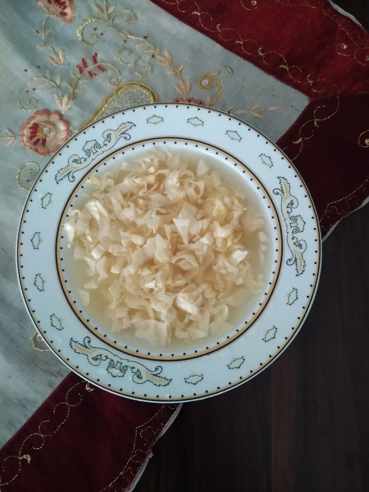
Muş Çorti Pickle is a geographically indicated value specific to the Muş region and registered by the Turkish Patent and Trademark Office on 25.12.2017 (with registration number 294).
View Official Geographical Indication Dossier for Muş Chorti Pickle →
2. Muş Çorti Vaccine (Dish) (Yemekler ve çorbalar)
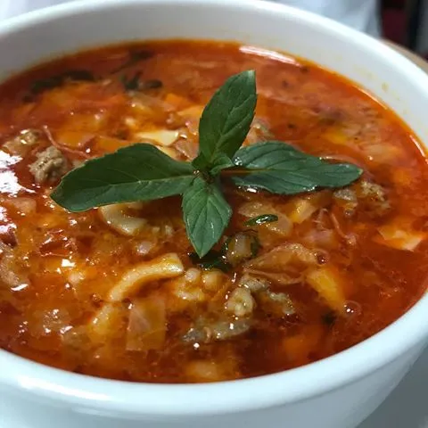
Cooking finely chopped and sour sauerkraut (chorti) with lamb meat on the bone and pounded wheat.
History: A sour healing vaccine that provides immunity in the freezing Muş winter.
View Official Geographical Indication Dossier for Muş Çorti Vaccine (Dish) →
3. Mus Old Cheddar (Peynirler)
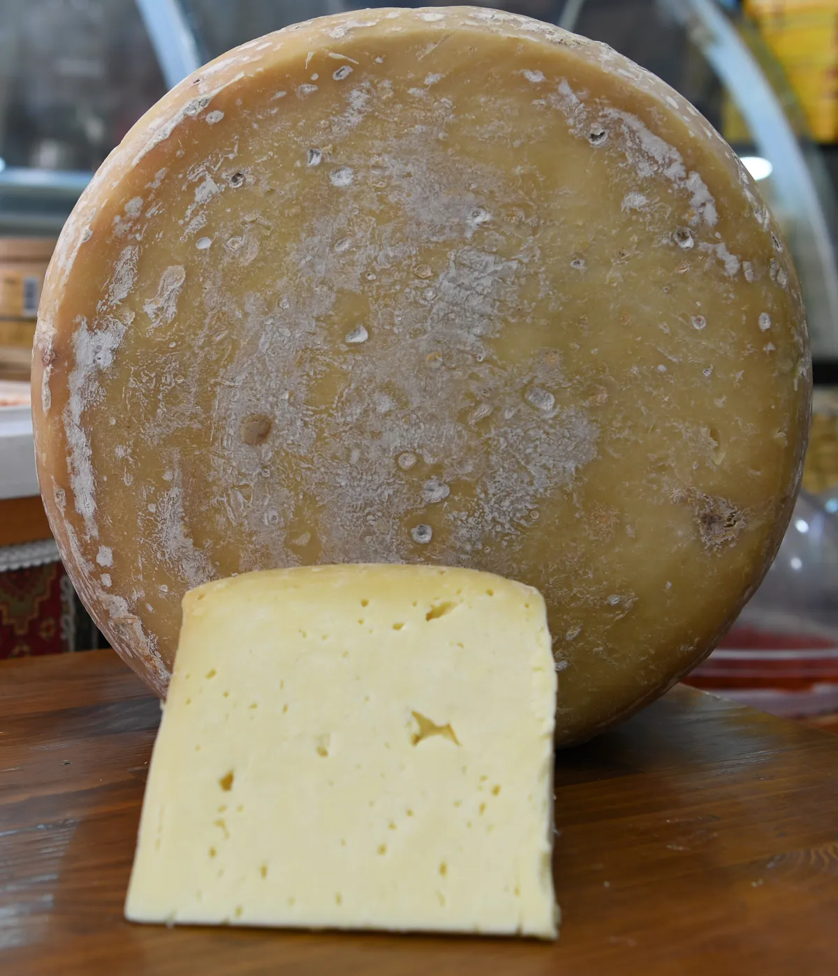
Muş Old Kashar is a geographically indicated value specific to the Muş region, registered by the Turkish Patent and Trademark Office on 22.06.2023 (with registration number 1393).
View Official Geographical Indication Dossier for Mus Old Cheddar →
4. Mus Meatballs (Yemekler ve çorbalar)
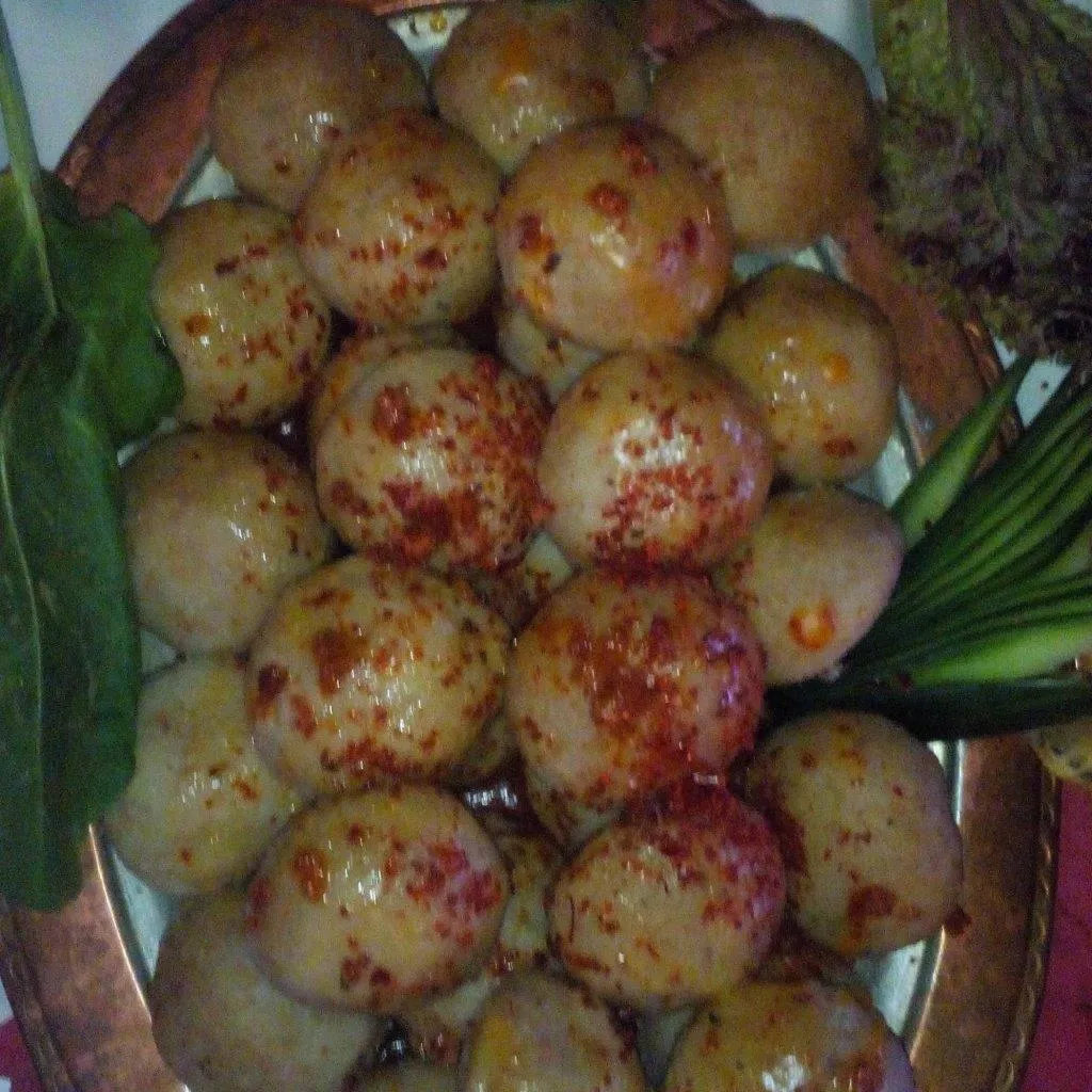
Product Story & History:
Muş Meatballs is a rich Eastern Anatolian culinary classic registered by the Turkish Patent and Trademark Office as Geographic Mark with registration number 544.
Distinctive Features & Material Profile:
Lean beef is pounded on a stone with a pestle until it reaches a paste consistency and kneaded with fine bulgur; It is stuffed with minced meat with walnuts and onions and boiled.
View Official Geographical Indication Dossier for Mus Meatballs →
Practical Travel & Transit Planning for Korkut, Muş (2026)
| Planning Category | Verified Local Information |
|---|---|
| Region & Administrative Center | Korkut, Muş, Türkiye |
| Best Time to Visit | Spring (April–June) and Autumn (September–November) for ideal sightseeing weather; Summer for highlands and coastal routes. |
| Public Transit & Highway Access | Regular municipal buses and local minibus cooperatives (Dolmuş) depart daily from the Muş Intercity Bus Terminal (Otogar) directly to Korkut. |
| Recommended Stay | 1 to 2 full days to explore the main historical landmarks, nature trails, and local culinary stops. |
Frequently Asked Questions About Visiting Korkut, Muş
What are the must-see places to visit in Korkut, Muş?
The top verified attractions in Korkut, Muş include Yünören Historical Mosque, Historical Korkut Tomb and Seljuk Tombstones, Kızıltaş Village Historical Rock Tombs and Ruins, Alazlı (Tırmêt) Archaeological Mound and Ancient Settlement, Karakale Historical Lookout Fortress and Ruins. Each location offers documented historical or natural heritage with clear road access.
How can I get to Korkut, Muş by public transport or car?
You can reach Korkut, Muş easily by car via Muş's main provincial highways, or take regular municipal buses and district minibuses departing throughout the day from the Muş central bus terminal (Otogar).
What are the famous local dishes and traditional foods to try in Korkut, Muş?
When visiting Korkut, Muş and Muş, be sure to taste officially registered specialties such as Muş Chorti Pickle, Muş Çorti Vaccine (Dish), Mus Old Cheddar, Mus Meatballs, prepared by local artisans and traditional restaurants.
Are the attractions in Korkut, Muş suitable for families and day trips?
Yes. Most historic monuments, parks, museums, and promenade areas in Korkut, Muş are family-friendly and well-suited for both weekend getaways and full-day cultural itineraries.
When is the best season to visit Korkut, Muş?
Spring and autumn offer the most comfortable temperatures for walking tours and photography in Korkut, Muş, while summer is popular for nature recreation, plateaus, and festivals.