
Planning a journey to Varto, Muş? This comprehensive 2026 Caves & Caverns guide brings together 10 verified landmarks, natural wonders, and cultural heritage sites with official visiting hours, GPS coordinates, public transit connections, and local gastronomy recommendations.
Quick Highlights & Discovery Route in Varto, Muş
- Koğ Hill Nature and Observation Area (Bingöl Mountains)
- Kunav Cave and Natural Canyon
- Little Hamurpet Lake
- Bingöl Mountains Yedigöller Plateau and Glacial Ponds
- Çayçatı Historical Stone Bridge and Canyon
- Büyük Hamurpet (Akdoğan) Lake
- Muş Chorti Pickle
- Muş Çorti Vaccine (Dish)
Caves, Karst Formations & Underground Wonders Guide in Varto, Muş
Shaped over millions of years by geological processes and underground water systems, the caves and rock formations around Varto, Muş (Muş) offer fascinating subterranean landscapes, stalactites, stalagmites, and cool microclimates.
- Footwear & Clothing: Cave floors can be damp and slippery; wear non-slip trekking shoes and bring a light jacket for cooler underground temperatures.
- Safe Exploration: Stay on illuminated walkways and marked trails, and never enter unmapped deep caverns without professional speleological equipment.
Top Verified Caves & Caverns & Must-See Landmarks in Varto, Muş
1. Koğ Hill Nature and Observation Area (Bingöl Mountains)
Free Public Access • GPS: 39.1725, 41.4571
History and General Information / Local Legends and Folklore
Koğ Hill is a legendary peak and viewing point rising on the southern range of the Bingöl Mountains overlooking Varto, bearing deep traces in the cultural memory and folk narratives of the district. It has hosted the traditional "Koğ Hill Culture and Art Festival", where Varto people and expatriates come together every August for years. In local legends, this hill is referred to as the lord of the mountains and the sacred protector of the mountaineers; In spring and summer, dengbej concerts and plateau festivals are held on the slopes adorned with colorful wildflowers.
Geographical Structure, Altitude and Natural Features
The altitude is approximately 2350 meters; It has a magnificent panorama that reveals the majestic peaks of the Bingöl Mountains, the Varto Plain and the winding Varto Stream valley. It is covered with high mountain meadows, cold springs and astragalus.
Visiting Hours, Days and Entrance Fees
- Entrance Fee: The open plateau and hill viewing area is completely FREE.
- Visiting Hours and Days (Mandatory): It can be visited 7 days a week from sunrise to sunset (June to September is the ideal season).
- Rules, Safety and Stroller/Disabled Access: High mountain plateau terrain; The paths are not suitable for passenger vehicles and strollers. Due to the high altitude, thick wind-resistant clothing should be taken.
- Facilities and Facilities: It is a natural plateau area; Temporary tents and stands are set up during the festival period.
Transportation, Public Transit Routes and Exact Location
- Address / Open Location: Koğ Tepesi Yayla Mevkii, 49900 Varto / Muş.
- Road Condition and Vehicle Availability: It is approximately 18 km away from Varto town centre; It can be reached by 4x4 or high-rise vehicles via the stabilized plateau.
- Actual Public Transport Information (Mandatory): There is no regular minibus service to the hill; Transportation is provided from Varto center by plateau taxis or festival shuttles.
- Parking Availability: Free car parking spaces are available in open areas on the hill plain.
Contextual Experience Tips, Photography and Local Gastronomy
- Best Photography Spots and Frames: 360-degree panorama of Bingöl Mountains from the summit, cloud sea view of Varto Plain and mountain ranges turning red at sunset.
- Light and Shooting Times: Early morning hours are perfect for cloud sea shots, and sunset (18:00 - 19:30) is perfect for dramatic mountain silhouettes.
- Local Gastronomy Recommendations: You should have a mountain breakfast at the summit, accompanied by highland thyme tea brewed in a samovar, Varto lavash and freshly churned butter.
Explore Full 5-Section Guide & Map for Koğ Hill Nature and Observation Area (Bingöl Mountains) →
2. Kunav Cave and Natural Canyon

Free Public Access • GPS: 39.1911, 41.5679
History and General Information / Local Legends and Folklore
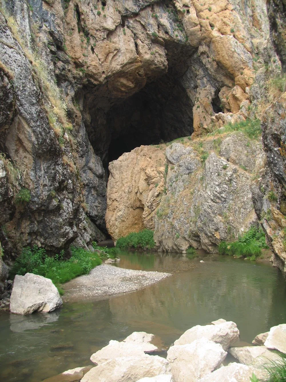
Kunav Cave (Künav Cave) is an active hydrological karst natural wonder, approximately 3 kilometers long and two-storey, located within the borders of Kayadelen Village of Varto district. The cave, whose ceiling height reaches up to 35 meters in places, is one of the most magnificent cave systems in Eastern Anatolia, with its deep canyon at the entrance and an underground spring flowing through it as large as a river. It contains natural stone bridges, stalactites, stalagmites, travertine steps and traces of ancient settlements. Local people believe that the water flowing loudly from the lower floor of the cave is healing and that the cave contains secret tunnels that open to valleys miles away.
Geographical Structure, Altitude and Natural Features
The altitude is approximately 1460 meters; Limestone and basalt are located within the canyon cleft. The interior of the cave has a constant coolness of 10-12 degrees throughout the year; The underground river inside rises to the surface by creating a sinkhole at the entrance.
Visiting Hours, Days and Entrance Fees
- Entrance Fee: It is a natural cave and canyon area and entrance is completely FREE.
- Visiting Hours and Days (Mandatory): It can be visited 7 days a week from sunrise to sunset.
- Rules, Safety and Stroller/Disabled Access: The cave interior is wet, slippery and contains uneven rocky ground; NOT SUITABLE FOR stroller and wheelchair use. When entering the cave, you should have a headlamp, waterproof non-slip boots and spare clothes; You should not proceed to deep galleries without a guide.
- Facilities and Facilities: It is a natural protected area; There are no commercial facilities in the area.
Transportation, Public Transit Routes and Exact Location
- Address / Open Location: Kayadelen Köyü Kanyon Mevkii, 49900 Varto / Muş.
- Road Condition and Vehicle Availability: It is 12 km away from Varto town centre; You can reach the canyon entrance by car following the asphalt village road.
- Real Public Transportation Information (Mandatory): You can reach the canyon junction with Kayadelen village minibuses departing from Varto center.
- Parking Availability: Free car parking is available in the open area at the entrance of the canyon.
Contextual Experience Tips, Photography and Local Gastronomy
- Best Photography Spots and Frames: The huge canyon mouth at the entrance of the cave, the giant stalactite-stalactite columns inside and the natural bridges where the underground river bubbles.
- Light and Shooting Hours: Noon hours (11:30 - 14:00), when the sun's rays filter into the cave mouth in beams, create wonderful light plays.
- Local Gastronomy Recommendations: After the canyon trip, organic plateau honey, village buns and brewed tea should be tasted in Kayadelen Village.
Explore Full 5-Section Guide & Map for Kunav Cave and Natural Canyon →
3. Little Hamurpet Lake

Free Public Access • GPS: 39.1400, 41.7395
History and General Information / Local Legends and Folklore
Little Hamurpet Lake is a perfectly circular shaped crater maar lake located approximately 300-400 meters south of Big Hamurpet Lake, at an elevation of 24 meters higher than it. The water of this lake, which is fed by underground sources independently of its bigger brother, fascinates with its emerald green color. According to local legend, the two lakes represent two mountain fairies in love; Little Hamurpet meets his beloved by flowing into Big Hamurpet through underground water channels. It is a hidden gem of nature, almost hidden by its very clear waters and the steep crater ridges around it.
Geographical Structure, Altitude and Natural Features
The altitude is 2173 meters; The depth of the circular crater bowl is approximately 40 meters. The cold springs boiling from the lake bottom and the rich wildflowers, endemic mountain tulips and thyme scents around it attract attention.
Visiting Hours, Days and Entrance Fees
- Entrance Fee: It is an open natural lake area and entrance is completely FREE.
- Visiting Hours and Days (Mandatory): Open 7 days a week from sunrise to sunset (recommended between May and October).
- Rules, Safety and Stroller/Disabled Access: The crater slope is steep and rocky; NOT suitable for baby stroller and wheelchair use. You should walk in sturdy-soled trekking shoes.
- Facilities and Facilities: It is a natural untouched plateau area; There is no facility.
Transportation, Public Transit Routes and Exact Location
- Address / Open Location: Hamurpet Plateau Güney Location, 49900 Varto / Muş.
- Road Condition and Vehicle Suitability: After reaching Büyük Hamurpet Lake, you can reach the lake basin by walking a 350-meter slightly uphill path towards the south.
- Real Public Transportation Information (Mandatory): You can come to Büyük Hamurpet from Varto center by plateau vehicles or taxis and walk from there.
- Parking Availability: The parking area by the Great Hamurpet Lake is used.
Contextual Experience Tips, Photography and Local Gastronomy
- Best Photography Spots and Frames: The viewing hill on the intermediate ridge that frames the two lakes in the same frame, the emerald green circular crater mirror and the steep rocky slopes.
- Light and Shooting Hours: Early morning hours (08:00 - 10:30) are unique for capturing the glass mirror effect on the lake surface before the wind rises.
- Local Gastronomy Recommendations: During the plateau walk, local mountain thyme should be collected and mountain tea should be brewed with fresh spring water.
Explore Full 5-Section Guide & Map for Little Hamurpet Lake →
4. Bingöl Mountains Yedigöller Plateau and Glacial Ponds
Free Public Access • GPS: 39.3342, 41.3342
History and General Information / Local Legends and Folklore
Bingöl Mountains Yedigöller Plateau is a fascinating natural wonder consisting of large and small crater and cirque lakes, which are the legacy of the ice age, at an altitude exceeding 2,000 meters. The plateau, where Yoruk and regional transhumants have been climbing with thousands of small cattle for centuries, is adorned with lush water springs, colorful alpine flowers and wild mountain thyme. Local folk songs tell about the love of the thousands of springs and plateaus of the Bingöl Mountains.
Geographical Structure, Altitude and Natural Features
Its altitude is 2,150 meters. It is the most untouched high mountain ecosystem of Eastern Anatolia, with its glacial ponds fed by snow water and the emerald green alpine meadows around it.
Visiting Hours, Days and Entrance Fees
- Entrance Fee: Free.
- Visiting Hours and Days: It can be visited between June and October after the snow melts.
- Rules, Safety and Stroller/Disabled Access: Durable boots, a windbreaker and plenty of water should be carried for high altitude hiking. High vehicle recommended.
- Facilities and Facilities: It is a pristine plateau environment; There are no facilities other than the plateau camps.
Transportation, Public Transit Routes and Exact Location
- Address / Open Location: Bingöl Dağları Mevkii, Varto / Muş.
- Road Condition and Vehicle Availability: It is 32 km away from Varto town centre; It can be reached via a stabilized plateau road.
- Real Public Transportation Information: It can be reached by private off-road vehicle or plateau shuttles.
- Parking Availability: There is a car park on the plateau plain.
Contextual Experience Tips, Photography and Local Gastronomy
- Best Photography Spots and Frames: The snowy Bingöl Mountain peaks and mountain flowers reflected in the glacial ponds at the summit offer unique views.
- Camping and Trekking: It is a great location to camp in nature and take photos of the milky way in the clear night sky.
Explore Full 5-Section Guide & Map for Bingöl Mountains Yedigöller Plateau and Glacial Ponds →
5. Çayçatı Historical Stone Bridge and Canyon
Free Public Access • GPS: 38.8622, 41.5127
History and General Information / Local Legends and Folklore
Çayçatı Historical Stone Bridge is a monumental single-arch bridge made of cut stone, built during the Ottoman and Seljuk periods on the deep canyon bed of the Varto Stream. The bridge, which has connected the Erzurum-Muş mountain passes of the historical Silk Road for centuries, has survived for centuries with its strong spurs against the surging waters in the spring months.
Geographical Structure, Altitude and Natural Features
Its altitude is 1,510 meters. It is located among poplar and willow trees at the bottom of the steep canyon where the Varto Stream splits the limestone cliffs.
Visiting Hours, Days and Entrance Fees
- Entrance Fee: Free.
- Visiting Hours and Days: Open 24 hours a day, 7 days a week.
- Rules, Safety and Stroller/Disabled Access: Walk carefully on the historic stone bridge deck; It is closed to vehicle traffic.
- Facilities and Facilities: There are natural sitting areas by the stream.
Transportation, Public Transit Routes and Exact Location
- Address / Open Location: Çayçatı Köyü, Varto / Muş.
- Road Condition and Vehicle Availability: It is 8 km away from Varto town centre; The road is completely asphalt.
- Real Public Transportation Information: It can be reached by Çayçatı minibuses departing from Varto bus terminal.
- Parking Availability: There is free parking at the bridge.
Contextual Experience Tips, Photography and Local Gastronomy
- Best Photography Spots and Frames: The clear stream cascading under the pointed arch of the bridge and the canyon cliffs offer beautiful photographs.
- Gastronomy: Fresh tandoori bread and Varto honey should be tasted in the village.
Explore Full 5-Section Guide & Map for Çayçatı Historical Stone Bridge and Canyon →
6. Büyük Hamurpet (Akdoğan) Lake
Free Public Access • GPS: 39.1395, 41.7397
History and General Information / Local Legends and Folklore
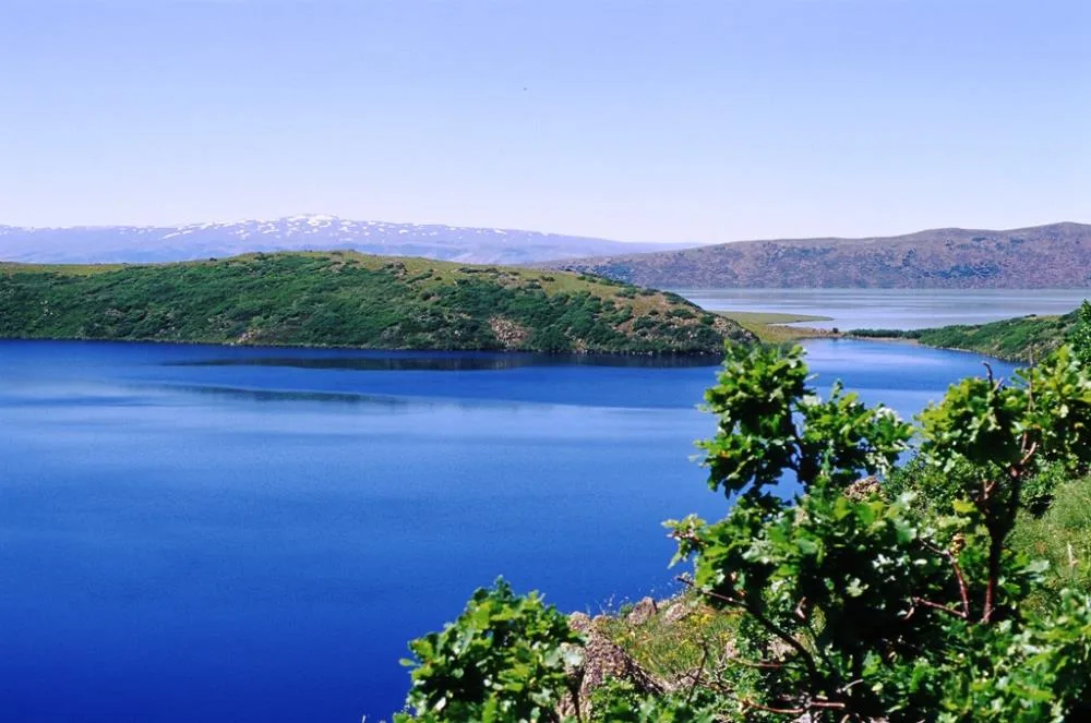
Büyük Hamurpet Lake (Lake Akdoğan) is one of the highest and deepest volcanic lakes in Eastern Anatolia, formed in the summit belt of the volcanic Akdoğan Mountains, in the northwest of Varto district. According to local legend, the lake was formed in ancient times when a piece of debris falling from the sky blocked the crater while the volcano was spewing lava, and took its name from the ancient Hamurpet plateau around it. During the winter months, a thick layer of ice of approximately 40-50 centimeters forms on the lake surface and does not thaw until April; Local residents do winter fishing by walking on the frozen lake. Plenty of delicious carp and chub live in the lake.
Geographical Structure, Altitude and Natural Features
The altitude is exactly 2149 meters; It attracts attention with its depth reaching approximately 47 meters. Its deep blue waters are surrounded by volcanic tuff slopes, birch trees and alpine meadows. It is the migration stop of mallard ducks, shepherds and wild geese.
Visiting Hours, Days and Entrance Fees
- Entrance Fee: The natural lake shore and plateau area are open to the public and FREE.
- Visiting Hours and Days (Mandatory): It can be visited 7 days a week from sunrise to sunset. The most suitable period is between May and October, as the roads may be closed due to snow depth during the winter months.
- Rules, Safety and Stroller/Disabled Access: Natural mountain plateau backdrop; You can walk along the shore, but swimming is dangerous and prohibited because the lake is very deep and the water is extremely cold.
- Facilities and Facilities: There are no commercial facilities in the area; There are drinking water springs and natural camping areas.
Transportation, Public Transit Routes and Exact Location
- Address / Open Location: Hamurpet Yaylası Mevkii, 49900 Varto / Muş.
- Road Condition and Vehicle Availability: It is approximately 32 km away from Varto town centre; It can be reached by off-road vehicle (SUV) or passenger car provided that it is used carefully, via stabilized mountains and plateaus.
- Actual Public Transportation Information (Mandatory): There is no direct public transportation to the lake; You can take minibuses from Varto Bus Terminal to the villages and reach the crossroads and go to the lake by taxi or walking.
- Parking Availability: Free car parking spaces are available on the open plains along the lake shore.
Contextual Experience Tips, Photography and Local Gastronomy
- Best Photography Spots and Frames: High angle shots from the summit slopes capturing the deep blue color of the lake and the snowy Akdoğan Mountains, morning water mirror reflections.
- Light and Shooting Hours: The hours between 11:00 - 14:00, when the sun is directly overhead, reveal the deep dark blue and turquoise color of the water.
- Local Gastronomy Recommendations: Before going to the lake, you should have a picnic on the plateau with registered Varto sheep cheese, tandoori bread and walnut halva, obtained from Varto center.
Explore Full 5-Section Guide & Map for Büyük Hamurpet (Akdoğan) Lake →
7. Kayalıdere Urartu Ancient City and Castle (Sardurihinili)
Free Public Access • GPS: 39.0646, 41.5797
History and General Information / Local Legends and Folklore
Kayalıdere Ancient City and Castle, Urartu King II. Dating back to the Sarduri period (764-735 BC), it is one of the most intact Urartian castle-cities in Eastern Anatolia that has survived to the present day. During the excavations carried out by the British Institute of Archeology in 1965 in the city built on a strategic hill on the shores of the Alparslan-2 Dam Lake; A magnificent Urartian Temple, wine cellars, giant grain warehouses and a monumental 6-room Urartian Royal Rock Tomb carved into the rock were unearthed. The priceless Urartian Lion Statue, arrowheads and bronze belts made of bronze found during the excavations are now exhibited among the masterpieces of the Ankara Anatolian Civilizations Museum.
Geographical Structure, Altitude and Natural Features
The altitude is approximately 1380 meters; It is located in the Murat River valley, on a steep rocky cape overlooking the waters of Alparslan-2 Dam Lake. There are canyon valleys and oak groves around it.
Visiting Hours, Days and Entrance Fees
- Entrance Fee: It has the status of an open-air archaeological site and the visit is completely FREE.
- Visiting Hours and Days (Mandatory): It can be visited 7 days a week from sunrise to sunset.
- Rules, Safety and Stroller/Disabled Access: Features scenic cliff tops and stepped trails; NOT suitable for baby stroller and wheelchair use. Attention should be paid to the steep cliffs and rock tomb entrances on the shores of the dam lake.
- Facilities and Facilities: There are promotional boards in the ruins area; Basic needs can be provided from Kayalıdere Village.
Transportation, Public Transit Routes and Exact Location
- Address / Open Location: Kayalıdere (Kayalıkale) Village Dam Shore, 49900 Varto / Muş.
- Road Condition and Vehicle Availability: It is 20 km away from Varto town centre; It can be easily reached by passenger vehicle via asphalt and dam.
- Real Public Transportation Information (Mandatory): Kayalıdere village minibuses departing from Varto center and reach the ruins 1 km away.
- Parking Availability: There is free parking on the side of the village road at the entrance of the ruins.
Contextual Experience Tips, Photography and Local Gastronomy
- Best Photography Spots and Frames: Urartian temple foundations rising against the view of the dam lake, huge cut stone blocks and the stone door of the 6-room rock tomb.
- Light and Shooting Hours: Early morning and afternoon sun (16:30 - 18:30) are ideal for capturing the silhouette of the ancient city walls over the lake waters.
- Local Gastronomy Recommendations: Varto's famous kashar cheese pan, buttermilk flatbread and honey should be tasted.
Explore Full 5-Section Guide & Map for Kayalıdere Urartu Ancient City and Castle (Sardurihinili) →
8. Mercimekkale Urartian Mound and Castle
Free Public Access • GPS: 38.9644, 41.5217
History and General Information / Local Legends and Folklore
Mercimekkale Mound and Castle is a well-established archaeological hill located on the Muş-Varto road, used as a military defense and observation castle during the Urartu and Byzantine periods. According to the famous legend that gave the hill its name, a stingy merchant hid his lentil warehouses from the public, and as a result of the curse, all the lentil grains turned into stone and turned into a mound. The petrified fossil lentil stones found on the surface of the mound keep this legend alive.
Geographical Structure, Altitude and Natural Features
Its altitude is 1,480 meters. It is built on a strategic hill overlooking the Murat River valley; It is surrounded by steppe flora and agricultural lands.
Visiting Hours, Days and Entrance Fees
- Entrance Fee: Free.
- Visiting Hours and Days: It can be visited in daylight 7 days a week.
- Rules, Safety and Stroller/Disabled Access: It is an archaeological site; The stones should be left in place.
- Facilities and Facilities: It is a natural protected area, there are no facilities.
Transportation, Public Transit Routes and Exact Location
- Address / Open Location: Mercimekkale Village, Varto / Muş.
- Road Condition and Vehicle Suitability: It is at the 28th kilometer of the Muş-Varto highway; It is next to the main road and can be reached by any vehicle.
- Real Public Transportation Information: Muş-Varto minibuses pass right in front of the castle.
- Parking Availability: Vehicles can be parked on the roadside.
Contextual Experience Tips, Photography and Local Gastronomy
- Best Photography Spots and Frames: The views overlooking the Murat Valley from the stone castle ruins on the mound provide great photographs.
- Archaeological Tip: Examining the lentil-shaped natural fossils found around the mound is the most interesting way to encounter the legend.
Explore Full 5-Section Guide & Map for Mercimekkale Urartian Mound and Castle →
9. Historical Gulan Waterfall and Varto Canyon
Free Public Access • GPS: 39.1695, 41.4534
History and General Information / Local Legends and Folklore
Gulan Waterfall, hidden in the deep canyon valley in the northeast of Varto district, is a fascinating natural wonder where clear waters fed by the snow waters of the Bingöl Mountains pour from approximately 15 meters. According to local narratives, it is believed that the deep natural pond into which the waterfall flows is healing, and that those who enter this water in the summer heat are protected from diseases throughout the year. It is known that the cave cavities around the canyon were used as natural shelters for shepherds and travelers in ancient times.
Geographical Structure, Altitude and Natural Features
It is located in a volcanic basalt valley at an altitude of approximately 1,680 meters. Water flow reaches its highest level with melting snow in spring. Around the waterfall there are wild walnut, poplar, blackberry bushes and rich plateau flora; The microclimate created by the water is cool and refreshing.
Visiting Hours, Days and Entrance Fees
- Entrance Fee: Visiting the natural wonder waterfall is completely free.
- Visiting Hours and Days: It is open to visitors 7 days a week during daylight hours (May-October is the most favorable season).
- Rules, Safety and Stroller/Disabled Access: Sports/trekking shoes are a must due to the slippery ground and steep descent of the trail. Attention should be paid to the current and depth of the waterfall pond; Not suitable for strollers or disabled people.
- Facilities and Facilities: It is a natural untouched area; Those who come for a picnic must take their garbage back.
Transportation, Public Transit Routes and Exact Location
- Address / Open Location: Gulan Deresi Mevkii, Varto Canyon Road, Varto / Muş.
- Road Condition and Vehicle Availability: It is 14 km away from Varto town centre; Asphalt until the village road, the last 1 km is a stabilized dirt road; Passenger vehicles can drive with careful driving.
- Real Public Transportation Information: From Varto district center, you can take village minibuses to the crossroads and take a 15-minute walk through the valley.
- Parking Availability: Vehicles can be parked free of charge in the open area at the end of the road.
Contextual Experience Tips, Photography and Local Gastronomy
- Best Photography Points and Frames: The moment when the waterfall pouring with white foam among the basalt rocks meets the pond and the rainbow formed by water droplets.
- Light and Shooting Hours: At noon, the sun's rays hit the depth of the canyon vertically, revealing the turquoise color of the water.
- Local Gastronomy Recommendations: Varto's famous ram's head sheep cheese, highland butter and honeycomb honey should definitely be tasted.
Explore Full 5-Section Guide & Map for Historical Gulan Waterfall and Varto Canyon →
10. Sazlıca Waterfalls and Nature Valley
Free Public Access • GPS: 39.1899, 41.4078
History and General Information / Local Legends and Folklore
Sazlıca Waterfalls are a series of natural waterfalls cascading down from the rocks in the mountainous western valley of Varto. With its waters bursting with melting snow and wild mint, thyme and mountain plane trees surrounding it, it is a popular recreation area where nature lovers go for picnics and nature walks. Local narratives say that the sound of waterfalls give peace and that mountain springs are healing.
Geographical Structure, Altitude and Natural Features
Its altitude is 1,620 meters. Foaming waterfalls on the lush green valley floor at the foot of the Bingöl Mountains create a cool microclimate.
Visiting Hours, Days and Entrance Fees
- Entrance Fee: Free.
- Visiting Hours and Days: It can be visited in daylight 7 days a week.
- Rules, Safety and Stroller/Disabled Access: Waterfall rocks can be slippery; Walking shoes are recommended.
- Facilities and Facilities: There are natural picnic areas, fountains and shade areas.
Transportation, Public Transit Routes and Exact Location
- Address / Open Location: Sazlıca Köyü Mevkii, Varto / Muş.
- Road Condition and Vehicle Availability: It is 6 km away from Varto town centre; It can be easily reached by passenger vehicle via the asphalt road.
- Real Public Transportation Information: It can be reached by village minibuses departing from Varto centre.
- Parking Availability: Vehicles can be parked at the entrance of the waterfall path.
Contextual Experience Tips, Photography and Local Gastronomy
- Best Photo Spots and Frames: The foamy flow of the cascading waterfall and the mossy rocks around it make for great long exposure shots.
- Visit Time: In spring, when the snow melts, water flow reaches its peak.
Explore Full 5-Section Guide & Map for Sazlıca Waterfalls and Nature Valley →
What to Eat in Varto, Muş? Registered Local Delicacies & Gastronomy
A trip to Varto, Muş is incomplete without tasting its officially registered geographical indication products and centuries-old Anatolian recipes:
1. Muş Chorti Pickle (İşlenmiş ve işlenmemiş meyve ve sebzeler ile mantarlar)
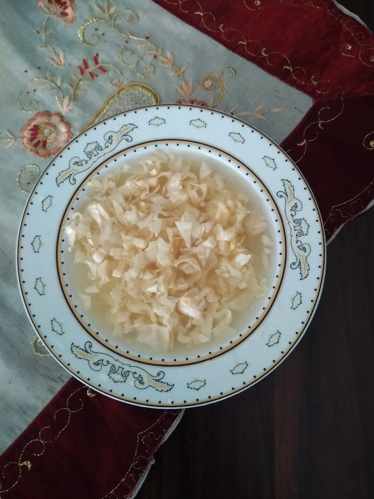
Muş Çorti Pickle is a geographically indicated value specific to the Muş region and registered by the Turkish Patent and Trademark Office on 25.12.2017 (with registration number 294).
View Official Geographical Indication Dossier for Muş Chorti Pickle →
2. Muş Çorti Vaccine (Dish) (Yemekler ve çorbalar)

Cooking finely chopped and sour sauerkraut (chorti) with lamb meat on the bone and pounded wheat.
History: A sour healing vaccine that provides immunity in the freezing Muş winter.
View Official Geographical Indication Dossier for Muş Çorti Vaccine (Dish) →
3. Mus Old Cheddar (Peynirler)
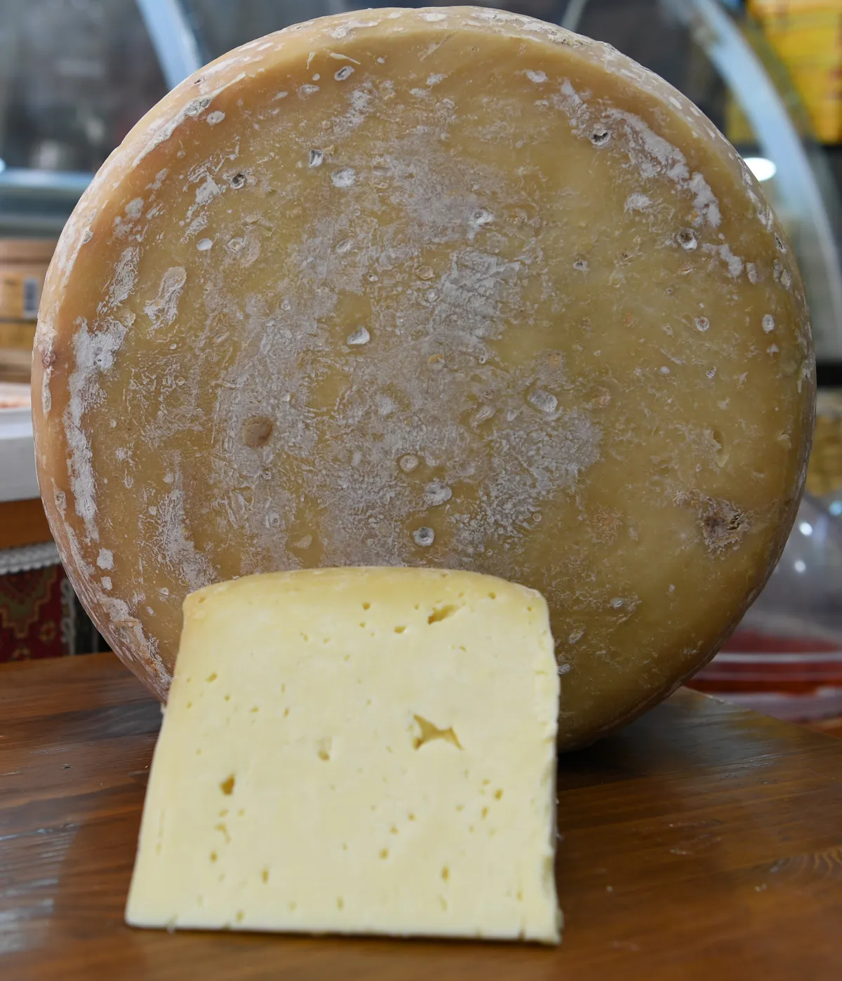
Muş Old Kashar is a geographically indicated value specific to the Muş region, registered by the Turkish Patent and Trademark Office on 22.06.2023 (with registration number 1393).
View Official Geographical Indication Dossier for Mus Old Cheddar →
4. Mus Meatballs (Yemekler ve çorbalar)

Product Story & History:
Muş Meatballs is a rich Eastern Anatolian culinary classic registered by the Turkish Patent and Trademark Office as Geographic Mark with registration number 544.
Distinctive Features & Material Profile:
Lean beef is pounded on a stone with a pestle until it reaches a paste consistency and kneaded with fine bulgur; It is stuffed with minced meat with walnuts and onions and boiled.
View Official Geographical Indication Dossier for Mus Meatballs →
Practical Travel & Transit Planning for Varto, Muş (2026)
| Planning Category | Verified Local Information |
|---|---|
| Region & Administrative Center | Varto, Muş, Türkiye |
| Best Time to Visit | Spring (April–June) and Autumn (September–November) for ideal sightseeing weather; Summer for highlands and coastal routes. |
| Public Transit & Highway Access | Regular municipal buses and local minibus cooperatives (Dolmuş) depart daily from the Muş Intercity Bus Terminal (Otogar) directly to Varto. |
| Recommended Stay | 1 to 2 full days to explore the main historical landmarks, nature trails, and local culinary stops. |
Frequently Asked Questions About Visiting Varto, Muş
What are the must-see places to visit in Varto, Muş?
The top verified attractions in Varto, Muş include Koğ Hill Nature and Observation Area (Bingöl Mountains), Kunav Cave and Natural Canyon, Little Hamurpet Lake, Bingöl Mountains Yedigöller Plateau and Glacial Ponds, Çayçatı Historical Stone Bridge and Canyon. Each location offers documented historical or natural heritage with clear road access.
How can I get to Varto, Muş by public transport or car?
You can reach Varto, Muş easily by car via Muş's main provincial highways, or take regular municipal buses and district minibuses departing throughout the day from the Muş central bus terminal (Otogar).
What are the famous local dishes and traditional foods to try in Varto, Muş?
When visiting Varto, Muş and Muş, be sure to taste officially registered specialties such as Muş Chorti Pickle, Muş Çorti Vaccine (Dish), Mus Old Cheddar, Mus Meatballs, prepared by local artisans and traditional restaurants.
Are the attractions in Varto, Muş suitable for families and day trips?
Yes. Most historic monuments, parks, museums, and promenade areas in Varto, Muş are family-friendly and well-suited for both weekend getaways and full-day cultural itineraries.
When is the best season to visit Varto, Muş?
Spring and autumn offer the most comfortable temperatures for walking tours and photography in Varto, Muş, while summer is popular for nature recreation, plateaus, and festivals.