
Planning a journey to Altunhisar, Niğde? This comprehensive 2026 History & Culture guide brings together 10 verified landmarks, natural wonders, and cultural heritage sites with official visiting hours, GPS coordinates, public transit connections, and local gastronomy recommendations.
Quick Highlights & Discovery Route in Altunhisar, Niğde
- Kınık Höyük Archaeological Ruins
- Karamanoğlu Yakup Bey Historical Mosque
- Bayatönü Rock Caves and Underground Settlement
- Kurra Castle and Ancient Rock Tombs
- Historical Altunhisar Mansions and Social Complex Bath
- Historical Altunhisar Grand Mosque
- Niğde Kelle Söğüş
- Niğde Pan
Historical Landmarks, Architecture & Cultural Heritage in Altunhisar, Niğde
Altunhisar, Niğde (Niğde) preserves a multi-layered historical fabric shaped by centuries of Anatolian civilizations, including Roman, Byzantine, Seljuk, and Ottoman eras. Historic castles, stone bridges, caravanserais, civil mansions, and monumental structures reflect the strategic and cultural importance of Altunhisar, Niğde.
Walking through the historic quarters of Altunhisar, Niğde allows visitors to observe traditional masonry, timber-framed architecture, and restored heritage buildings up close.
- Architectural Details: Pay attention to carved stone portals, historic fountains, courtyard mansions, and defensive bastions across Altunhisar, Niğde.
- Best Visiting Hours: Early morning and late afternoon golden light offer the best conditions for architectural photography and crowd-free exploration.
- Cultural Etiquette & Preservation: Respect restoration zones and signage at registered historical monuments in Altunhisar, Niğde.
Top Verified History & Culture & Must-See Landmarks in Altunhisar, Niğde
1. Kınık Höyük Archaeological Ruins

Free Public Access • GPS: 37.9375, 34.3802
History and General Information / Local Legends and Folklore
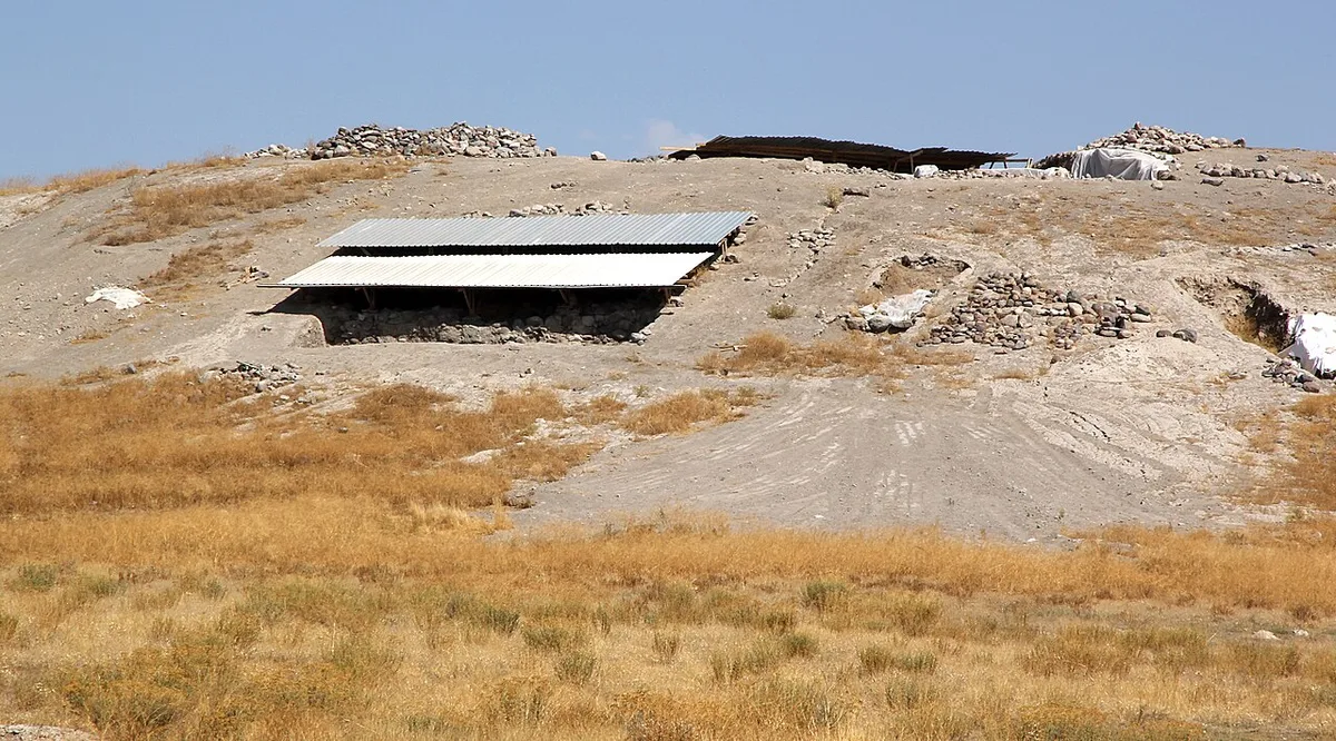
Kınık Höyük, located near the town of Yeşilyurt in Altunhisar district of Niğde, is one of the most important discoveries of Cappadocia and Central Anatolia archeology. In international excavations carried out in partnership with New York University and the University of Pavia; Enormous ruins dating back to the Late Bronze Age, Iron Age (Tabal Kingdom), Hellenistic and Achaemenid (Persian) periods have been unearthed. The Persian temple complex and monumental city walls dating back to the 5th century BC discovered at the summit of the mound prove that this was one of the religious and administrative centers of Persian rule in Cappadocia. Bird of prey (hawk/eagle) sculptures, bull head depictions and votive vessels carved from limestone found during the excavations are now exhibited among the rare collections of the Niğde Museum.
Geographical Structure, Altitude and Natural Features
Kınık Höyük is located at the southern end of the fertile Altunhisar and Misli plain, at an altitude of approximately 1,180 meters above sea level. The mound rises in the middle of the steppe with its conical structure, and the extensions of the Taurus Mountain range in the south and the Hasan Mountain volcanic cone in the north adorn the horizon.
Visiting Hours, Days and Entrance Fees
- Entrance Fee: Visiting the ruins is completely FREE.
- Visiting Hours and Days: It can be visited 7 days a week during daylight hours (08:30 - 18:30).
- Rules, Safety and Stroller/Disabled Access: Archaeological excavation pits and protected stone walls should not be stepped on. Comfortable walking shoes are recommended as the mound slopes consist of dirt and stony paths; It is partially unsuitable for baby stroller and wheelchair use.
- Facilities and Facilities: Excavation house information boards are available; For food, beverage and toilet needs, Yeşilyurt village center or Altunhisar district center, which is 1.5 km away, should be preferred.
Transportation, Public Transit Routes and Exact Location
- Address / Open Location: Yeşilyurt Köyü Mevkii, 51600 Altunhisar / Niğde.
- Road Condition and Vehicle Availability: It is 3 km away from Altunhisar district center and 35 km away from Niğde city center. It is asphalt from the Yeşilyurt road to the stabilized ruins junction and can be easily reached by passenger vehicles.
- Real Public Transportation Information: You can reach the ruins by taking village minibuses from Niğde Old Garage and Altunhisar district center to Yeşilyurt town throughout the day.
- Parking Availability: There is an open area at the entrance of the excavation area where vehicles can park free of charge.
Contextual Experience Tips, Photography and Local Gastronomy
- Best Photography Spots and Frames: Wide angle framing from the top of the mound to include the foundations of the Persian temple and the silhouette of Hasan Mountain behind it.
- Light and Shooting Hours: Early morning and late afternoon light, when the soil layers and stone foundations become apparent.
- Local Gastronomy Recommendations: Fresh grapes grown in Yeşilyurt and Altunhisar vineyards, the famous Altunhisar apple and roasted sack.
Explore Full 5-Section Guide & Map for Kınık Höyük Archaeological Ruins →
2. Karamanoğlu Yakup Bey Historical Mosque
Free Public Access • GPS: 38.0177, 34.2686
History and General Information / Local Legends and Folklore
Karamanoğlu Yakup Bey Mosque (Altunhisar Karamanoğlu Mosque) is the oldest and monumental historical place of worship in Altunhisar, built by Yakup Bey in the 15th century during the Karamanoğulları Principality. The building blends the Seljuk architectural tradition with the plain stone workmanship of the principalities period; It has been the spiritual center of the district for centuries with its cut stone walls, wooden beamed ceiling and original stone altar. In the courtyard of the mosque, there is a historical stone fountain (Karaman Fountain) belonging to the Karamanoğulları period and the graves of great people in its graveyard. Although the mosque was repaired during the Ottoman and Republican periods, it carries the Seljuk-Karamanoğlu roots of Altunhisar to the present day with its spiritual dignity and architectural character.
Geographical Structure, Altitude and Natural Features
The mosque is located in the old bazaar settlement in Altunhisar district center, at an altitude of approximately 1,190 meters above sea level. In the peaceful courtyard of the mosque, there are centuries-old plane and acacia trees that provide shade.
Visiting Hours, Days and Entrance Fees
- Entrance Fee: Visiting and worshiping are completely FREE.
- Visiting Hours and Days: It is open for worship and visits 7 days a week, from morning adhan to night prayer.
- Rules, Security and Baby Stroller/Disabled Access: You must enter the mosque without shoes and with proper attire. Thanks to its flat courtyard and step-free entrance gate, it is 100% accessible for disabled individuals and baby strollers.
- Facilities and Facilities: Ablution room, WC, historical courtyard fountain and resting benches are available.
Transportation, Public Transit Routes and Exact Location
- Address / Open Location: Cami Mahallesi, Akşam Caddesi, 51600 Altunhisar / Niğde.
- Road Condition and Vehicle Availability: It is very close to the government office and the municipality building in the town center and can be reached directly in front of the asphalt road. It is suitable for every vehicle.
- Real Public Transportation Information: It is a 2-minute walk from the last stop of Altunhisar district minibuses departing from Niğde center.
- Parking Availability: Free parking spaces are available in the mosque square and surrounding streets.
Spiritual Visiting Etiquette and Commemoration Guidelines
- Spiritual Visit and Prayer Etiquette: One enters the mosque with the right foot, prays and recites the Fatiha for the soul of Yakup Bey, the founder of the district, and his ancestors.
- Documentary & Respectful Shooting: The cut stone altar and wooden ceiling workmanship can be respectfully documented; The congregation should not be disturbed during prayer time.
- Highlight Detail: You should drink water from the historical Karaman Fountain in the courtyard and examine the historical stone inscription.
- Local Gastronomy Recommendations: Oven casserole and famous Niğde soda from the district market after the mosque.
Explore Full 5-Section Guide & Map for Karamanoğlu Yakup Bey Historical Mosque →
3. Bayatönü Rock Caves and Underground Settlement
Free Public Access • GPS: 38.0306, 34.3859
History and General Information / Local Legends and Folklore
Bayatönü Caves (Karaasmaz Caves) are one of the important underground settlements on the southwestern border of Cappadocia rock-carved architecture, carved into volcanic tuff slopes just north of Altunhisar district center. It was expanded by the local people for shelter and defense during the periods of oppression of Christians by the Roman Empire and the Arab raids in the Early Byzantine period. There are many rooms, corridors, ventilation shafts, food warehouses, wineries and animal shelters carved into the rock mass. According to legend, these caves were connected to the surrounding valleys through secret galleries extending underground and could protect hundreds of villagers for weeks in case of danger.
Geographical Structure, Altitude and Natural Features
The caves are located on the soft tuffaceous rock slopes overlooking the Altunhisar plain, at an altitude of approximately 1,220 meters above sea level. It is surrounded by apple and apricot orchards and has a natural and tranquil steppe landscape.
Visiting Hours, Days and Entrance Fees
- Entrance Fee: The visit is completely FREE.
- Visiting Hours and Days: It can be visited 7 days a week during daylight hours.
- Rules, Safety and Baby Stroller/Disabled Access: Visitors must have a powerful flashlight with them as there is no lighting inside the cave. Since the floor is dirt and steps, it is not possible to enter the interior with baby strollers and wheelchairs; Shoes with non-slip soles are recommended.
- Facilities and Facilities: It is a natural protected area and there are no facilities; Altunhisar district center, 2 km away, can be used for your needs.
Transportation, Public Transit Routes and Exact Location
- Address / Open Location: Bayatönü Mevkii (Karaasmaz Ridges), 51600 Altunhisar / Niğde.
- Road Condition and Vehicle Availability: It is 2 km away from the center of Altunhisar. There is a stabilized dirt road from the town center to the foothills of the cave and it can be easily reached by passenger vehicles.
- Real Public Transportation Information: It takes 20 minutes on foot from Altunhisar district center or 5 minutes by district taxi.
- Parking Availability: Free car parking is available in the open area at the foot of the cave.
Contextual Experience Tips, Photography and Local Gastronomy
- Best Photo Spots and Frames: View of Altunhisar plain from rock windows, carved niches and layered erosion traces in tuff rocks.
- Light and Shooting Hours: Morning and afternoon light when the sun hits the cave mouths.
- Local Gastronomy Recommendations: Walnut kete and fresh apple fruit pulp from Altunhisar bakeries.
Explore Full 5-Section Guide & Map for Bayatönü Rock Caves and Underground Settlement →
4. Kurra Castle and Ancient Rock Tombs
Free Public Access • GPS: 37.9686, 34.6800
History and General Information / Local Legends and Folklore
Kurra Castle is an ancient defense and observation castle built on a steep volcanic hill in the historical mountain pass between Altunhisar and Çiftlik. The castle, which was used during the Hellenistic, Roman and Byzantine periods, has cisterns carved into the rocks, city walls foundations and ancient rock tombs at the foot of the hills. The castle, which keeps the mountain pass under control with its strategic location, ensured the safety of the caravan between Hasan Mountain and Melendiz Mountains. Local legends say that the castle contains hidden treasures and shelter rooms.
Geographical Structure, Altitude and Natural Features
The castle rises on the crest of a volcanic hill at an altitude of approximately 1,480 meters above sea level. It has a 360-degree viewing angle and is surrounded by dwarf oak, juniper and thyme flora.
Visiting Hours, Days and Entrance Fees
- Entrance Fee: Free.
- Visiting Hours and Days: It can be visited 7 days a week in daylight.
- Rules, Safety and Stroller/Disabled Access: The path up the hill is steep and rocky; mountaineering or sports shoes are required; Children must be supervised.
- Facilities and Facilities: It is a natural protected area, there are no facilities; It must be supplied.
Transportation, Public Transit Routes and Exact Location
- Address / Open Location: Kurra Mevkii, 51600 Altunhisar / Niğde.
- Road Condition and Vehicle Availability: 8 km from Altunhisar center; You can reach the foot of the hill by passenger vehicles on a stabilized road from the Altunhisar-Çiftlik asphalt road.
- Real Public Transportation Information: Village minibuses operating between Altunhisar and Çiftlik drop off passengers at the crossroads.
- Parking Availability: Vehicles can be left free of charge in the plain at the foot of the hill.
Contextual Experience Tips, Photography and Local Gastronomy
- Best Photography Spots and Frames: Snowy peaks of Mount Hasan from the summit, Altunhisar Plain and facades of ancient rock tombs.
- Light and Shooting Times: Afternoon sun and sunset hours are unique for photographing mountain silhouettes.
- Local Gastronomy Recommendations: Take a thermos of tea and Altunhisar village cookies with you and take a break against the view.
Explore Full 5-Section Guide & Map for Kurra Castle and Ancient Rock Tombs →
5. Historical Altunhisar Mansions and Social Complex Bath
Free Public Access • GPS: 37.9812, 34.6540
History and General Information / Local Legends and Folklore
Founded at the foothills of Mount Hasan, Altunhisar (formerly known as Ortaköy) hosts the most original examples of civil stone architecture of the Ottoman and late principalities periods. Historical stone mansions located in the old neighborhoods of the district; It attracts attention with its wooden ceiling decorations, wide iwans and relief stone arched courtyard doors. The historical complex bath from the Karamanoğlu period keeps the centuries-old bathing tradition alive with its hot vaults and dome corestone.
Geographical Structure, Altitude and Natural Features
It is located on the fertile volcanic foothills of Mount Hasan at an altitude of approximately 1,190 meters. Its surroundings are covered with apple and walnut orchards.
Visiting Hours, Days and Entrance Fees
- Entrance Fee: It is free to visit the historical streets and mansion exteriors.
- Visiting Hours and Days: It is open to visitors all day long, 7 days a week.
- Rules, Safety and Stroller/Disabled Access: Streets are smooth cobblestone; It is stroller and wheelchair accessible.
- Facilities and Facilities: There are tea gardens, bakeries and recreation areas in the town centre.
Transportation, Public Transit Routes and Exact Location
- Address / Open Location: Eski Mahalle, Tarih Konaklar Mevkii, Altunhisar / Niğde.
- Road Condition and Vehicle Availability: It is 38 km from Niğde city center and 22 km from Bor; It can be easily reached by passenger vehicles on the divided asphalt road.
- Real Public Transportation Information: You can get off at the center with Altunhisar minibuses, which depart regularly from Niğde and Bor bus terminals.
- Parking Availability: Free parking is available in the town square.
Contextual Experience Tips, Photography and Local Gastronomy
- Best Photo Spots and Frames: Stone mansion courtyard doors and the volcanic Hasan Mountain silhouette rising majestically in the background.
- Light and Shooting Hours: Morning hours and afternoon sun deepen the stonework.
- Local Gastronomy Recommendations: Altunhisar apple, baked apple dessert and tandoori kete bread should be tasted.
Explore Full 5-Section Guide & Map for Historical Altunhisar Mansions and Social Complex Bath →
6. Historical Altunhisar Grand Mosque
Free Public Access • GPS: 38.0183, 34.2683
History and General Information / Local Legends and Folklore
The historical Altunhisar Grand Mosque is a monumental place of worship in the district center, inherited from the Seljuk and Karamanoğulları periods and underwent major repairs during the Ottoman era. Located in the heart of the ancient town of Altunhisar, founded at the foothills of Hasan Mountain, the mosque attracts attention with its cut stone architecture, wooden ceiling beams and crown gate. According to local rumors, the mosque was built by the first Turkmen lords who settled in the region and has been the meeting point of the surrounding villages for Friday and Eid prayers for centuries.
Geographical Structure, Altitude and Natural Features
The mosque is built on a gently sloping slope, at an altitude of approximately 1,185 meters above sea level. It is surrounded by fruit vineyards, walnut trees and traditional stone-built Altunhisar houses.
Visiting Hours, Days and Entrance Fees
- Entrance Fee: The visit is completely free.
- Visiting Hours and Days: It is open for worship and visits 7 days a week, from the morning adhan until after the night prayer.
- Rules, Safety and Baby Stroller/Disabled Access: One must enter the mosque without shoes and the rules of etiquette must be observed; The entrance has flat feet and is suitable for wheelchair use.
- Facilities and Facilities: There is an ablution room, a fountain, a toilet and a recreation courtyard under the shade of centuries-old trees.
Transportation, Public Transit Routes and Exact Location
- Address / Open Location: Cami Mahallesi, Ulu Cami Caddesi, 51600 Altunhisar / Niğde.
- Road Condition and Vehicle Suitability: Located in the town centre; It is adjacent to the Bor-Altunhisar highway and can be easily reached by all kinds of passenger vehicles.
- Real Public Transportation Information: Altunhisar district minibuses departing from Niğde and Bor bus terminals stop 100 meters from the mosque.
- Parking Availability: There are free municipal parking areas around the mosque courtyard and on the street.
Contextual Experience Tips, Photography and Local Gastronomy
- Spiritual Visit and Prayer Etiquette: It is recommended to perform the two-rakat tahiyyetu'l-masjid prayer and pray under the peaceful, centuries-old stone dome of the mosque.
- Documentary & Respectful Shooting: The cut stone minaret, wooden pulpit and historical inscriptions can be photographed.
- Important Commemoration Days: Spiritual enthusiasm is experienced in the historical courtyard on Fridays, Ramadan nights and holy nights.
- Local Spiritual Tradition: Altunhisar halva and sherbet are served by charitable district tradesmen after prayers.
Explore Full 5-Section Guide & Map for Historical Altunhisar Grand Mosque →
7. Sıraçakıl Historical Caravanserai and Stone Bridge
Free Public Access • GPS: 38.0306, 34.3880
History and General Information / Local Legends and Folklore
Sıraçakıl Historical Caravanserai and Stone Bridge is an Ottoman period range structure built on the ancient caravan route in the southwest of Altunhisar. The inn, which was established to ensure the safety of caravans and passengers on the historical trade route between Cappadocia, Cilicia and Konya, has survived to the present day with its solid cut stone walls and a single-arch arched stone bridge right next to it. According to the stories told by the caravanners, this inn had thick doors that were protected against Hasan Mountain bandits and warm stables that sheltered hundreds of animals during winter storms.
Geographical Structure, Altitude and Natural Features
The building complex is located on the edge of Sıraçakıl Creek bed, at an altitude of approximately 1,140 meters. Its surroundings are covered with steppe vegetation, wild oleaster trees and volcanic andesite rocks.
Visiting Hours, Days and Entrance Fees
- Entrance Fee: Entrance is completely free.
- Visiting Hours and Days: It can be visited freely in daylight 7 days a week.
- Rules, Safety and Stroller/Disabled Access: Historic stone arch and wall ruins should not be climbed; The ground is natural soil and gravel.
- Facilities and Amenities: There are no facilities in the open land; Basic needs should be met from Altunhisar center, 3 km away.
Transportation, Public Transit Routes and Exact Location
- Address / Open Location: Sıraçakıl Mevkii, 51600 Altunhisar / Niğde.
- Road Condition and Vehicle Availability: 4 km from Altunhisar center; It can be reached by driving carefully with passenger vehicles via the stabilized connection road.
- Real Public Transportation Information: It can be reached from Altunhisar center by taxi or by hiking.
- Parking Availability: Cars can be parked free of charge on the plain in front of the inn ruins.
Contextual Experience Tips, Photography and Local Gastronomy
- Best Photo Spots and Frames: The stream bed flowing under the stone arch bridge, the stone walls of the inn and the silhouette of Mount Hasan in the background.
- Light and Shooting Times: Early morning and afternoon hours are the angles that show the stone texture richest.
- Local Gastronomy Recommendations: Altunhisar's famous fragrant strawberries and fresh walnuts should be tasted.
Explore Full 5-Section Guide & Map for Sıraçakıl Historical Caravanserai and Stone Bridge →
8. Yesilyurt Rock Monastery and Ancient Church Ruins
Free Public Access • GPS: 38.0022, 34.3839
History and General Information / Local Legends and Folklore
Yeşilyurt Rock Monastery is a registered rock-carved monastery complex dating back to the Late Roman and Byzantine ages, located on the steep rocky slopes of Yeşilyurt village in Altunhisar district. In this settlement where early Christian monks and nuns retreated, prayed and were protected from enemy attacks; There are church halls, monk cells, grave niches and ventilation chimneys carved into the rocks. It is believed among the local people that this place is connected to Kınık Höyük and the underground galleries at the foot of Hasan Mountain through secret tunnels.
Geographical Structure, Altitude and Natural Features
The monastery is located at an altitude of approximately 1,250 meters, on the valley slope where volcanic tuff and andesite rocks become steep. There are almond trees, mountain thyme and springs on the valley floor.
Visiting Hours, Days and Entrance Fees
- Entrance Fee: Visiting is free.
- Visiting Hours and Days: It can be visited freely during daylight hours.
- Rules, Safety and Baby Stroller/Disabled Access: Trekking shoes should be worn and a flashlight should be carried as the rock climbing steps can be slippery.
- Facilities and Facilities: There is a grocery store and a fountain in Yesilyurt village centre.
Transportation, Public Transit Routes and Exact Location
- Address / Open Location: Yeşilyurt Köyü, 51600 Altunhisar / Niğde.
- Road Condition and Vehicle Suitability: It is 7 km from Altunhisar town center and 2 km from Kınık Höyük; It can be easily reached by all passenger vehicles via the asphalt road.
- Real Public Transportation Information: You can reach Yeşilyurt by village minibuses departing from Altunhisar.
- Parking Availability: Free parking is available at the village entrance and at the beginning of the rocky path.
Contextual Experience Tips, Photography and Local Gastronomy
- Best Photo Spots and Frames: View of the valley from the apse window of the rock church and the cross reliefs carved into the rock facade.
- Light and Shooting Hours: Between 09:00 and 11:30 in the morning, the rock fronts receive direct sunlight.
- Local Gastronomy Recommendations: Yesilyurt village's homemade tandoori bun and tulum cheese should be tried.
Explore Full 5-Section Guide & Map for Yesilyurt Rock Monastery and Ancient Church Ruins →
9. Altunhisar Martyrs Park and City Square
Free Public Access • GPS: 38.0005, 34.3686
History and General Information / Local Legends and Folklore
Altunhisar Martyrs Park and City Square is a central memorial square built in the district center to keep the cherished memory of our heroic martyrs who died for the sake of the country alive forever. The Martyrs' Monument rising in the square bears the names of the brave men of Altunhisar who gave their lives in defense of the homeland, from Çanakkale to the War of Independence and the fight against terrorism. The square, where the people of the district meet on national holidays, ceremonies and celebrations, represents Altunhisar's spirit of loyalty and independence.
Geographical Structure, Altitude and Natural Features
The square is located on a flat area in the town center, at an altitude of 1,180 meters. Its regular landscape includes pine trees, ornamental plants, lawns and flower beds.
Visiting Hours, Days and Entrance Fees
- Entrance Fee: It is open to the public and completely free.
- Visiting Hours and Days: It can be visited 24 hours a day, 7 days a week.
- Rules, Safety and Baby Stroller/Disabled Access: Thanks to the flat stone floor, it is fully wheelchair and stroller accessible.
- Facilities and Facilities: There are resting benches, children's playground, fountain, lighting and municipal cafeterias around it.
Transportation, Public Transit Routes and Exact Location
- Address / Open Location: Orta Mahallesi, Akşam Caddesi, 51600 Altunhisar / Niğde.
- Road Condition and Vehicle Availability: It is on the main street in the town center and can be reached directly by all vehicles.
- Real Public Transportation Information: District minibuses coming from Niğde and Bor drop off passengers right in front of the square.
- Parking Availability: There is free municipal parking around the square.
Contextual Experience Tips, Photography and Local Gastronomy
- Spiritual Visit and Prayer Etiquette: It is a national duty to observe a moment of silence in front of the martyrs' monument and recite the Fatiha to the souls of the heroes of the homeland.
- Documentary & Respectful Shooting: Marble inscriptions with the names of martyrs and the Turkish flag can be framed.
- Important Commemoration Days: Official ceremonies are held in the square on 18 March Martyrs' Memorial Day and 29 October Republic Day.
- Local Spiritual Tradition: Halva and sherbet are served to the public in the square on holy days and holiday mornings.
Explore Full 5-Section Guide & Map for Altunhisar Martyrs Park and City Square →
10. Historical Keçikalesi and Rock Settlement
Free Public Access • GPS: 38.0595, 34.1120
History and General Information / Local Legends and Folklore
Historical Keçikalesi is a steep mountain castle built on a steep and steep volcanic hill on the southwestern foothills of Hasan Mountain and has witnessed the Ancient Roman, Byzantine and Seljuk periods. According to the rumor among the people, in order to surprise the enemy army surrounding the castle and to appear large in number, the people of the castle tied candles and kindling to the horns of hundreds of goats and released them onto the mountain slope at night; The enemy panicked and lifted the siege, thinking that a huge army was coming to help. It is said that the castle got its name "Keçikalesi" from this clever defense trick. Cisterns carved into the rocks, watchtowers, shelter rooms and defensive battlements within the castle have survived to the present day.
Geographical Structure, Altitude and Natural Features
Keçikalesi is located on a basaltic volcanic rock mass rising suddenly from the plain, at an altitude of approximately 1,350 meters above sea level. From the summit, the majestic 3,268-meter peak of Hasan Mountain, Aksaray and Niğde plains can be viewed from a bird's eye view. Thyme, catnip and wild almond trees are common in the foothills.
Visiting Hours, Days and Entrance Fees
- Entrance Fee: Visiting the historical castle is completely FREE.
- Visiting Hours and Days: It can be visited 7 days a week during daylight hours.
- Rules, Safety and Baby Stroller/Disabled Access: Climbing the hill is done via a stony and sloping path. Since there are no railings on the cliff edges of the castle walls, care should be taken with children and trekking shoes with non-slip soles should be worn. It is not suitable for wheelchairs and strollers.
- Facilities and Facilities: There is a bakery, grocery store, tea garden and mosque in Keçikalesi town centre.
Transportation, Public Transit Routes and Exact Location
- Address / Open Location: Keçikalesi Town, Kale Mevkii, 51600 Altunhisar / Niğde.
- Road Condition and Vehicle Availability: It is 22 km away from Altunhisar district center. It is an asphalt road until the town centre; You can reach the foothills of the castle by car, the last part is a 10-minute climb on foot.
- Real Public Transportation Information: There are town minibuses that run from Niğde and Altunhisar to Keçikalesi town several times a day.
- Parking Availability: Free parking is available in the town square and in the open area at the foot of the castle.
Contextual Experience Tips, Photography and Local Gastronomy
- Best Photography Spots and Frames: Panorama from the castle walls with Hasan Mountain in the background and light refractions of volcanic rock cisterns.
- Light and Shooting Hours: The clear morning air and the sunset moment when the setting sun paints the volcanic rocks red.
- Local Gastronomy Recommendations: Hot nail pita from the village oven in Keçikalesi town, sheep tulum cheese and plateau honey.
Explore Full 5-Section Guide & Map for Historical Keçikalesi and Rock Settlement →
What to Eat in Altunhisar, Niğde? Registered Local Delicacies & Gastronomy
A trip to Altunhisar, Niğde is incomplete without tasting its officially registered geographical indication products and centuries-old Anatolian recipes:
1. Niğde Kelle Söğüş (Yemekler ve çorbalar)
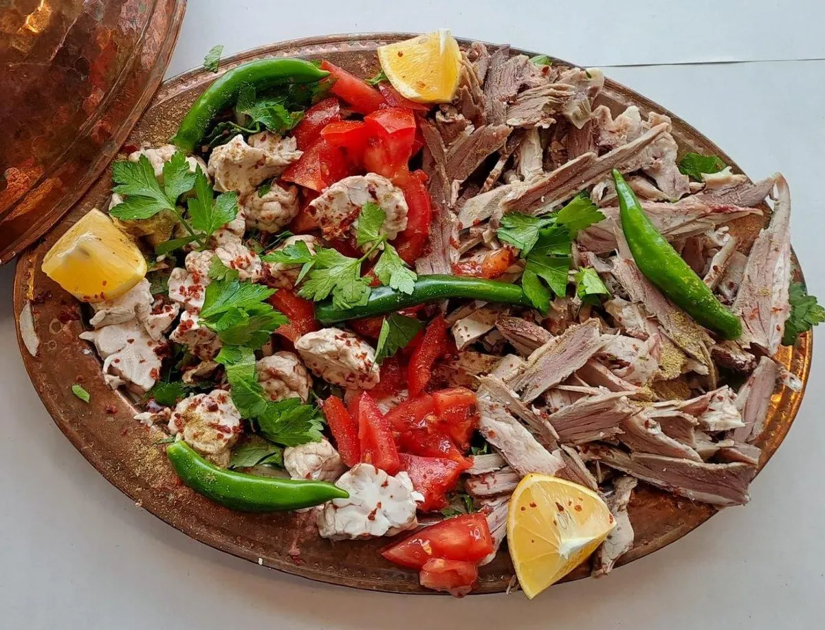
Lamb head, cooked slowly in the oven for 8 hours, is removed from the bones and served in lavash with fresh greens and cumin.
History: Centuries-old breakfast and lunch ritual of Niğde mornings and bazaar tradesmen.
View Official Geographical Indication Dossier for Niğde Kelle Söğüş →
2. Niğde Pan (Yemekler ve çorbalar)
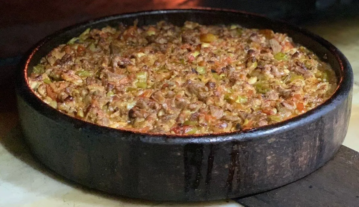
Product Story & History:
Niğde Tavası is a traditional oven dish registered as Geographical Sign by the Turkish Patent and Trademark Office with registration number 598.
Distinctive Features & Material Profile:
Lamb ribs and shoulder meat are slowly cooked in a stone oven in a copper pan with local Niğde tomatoes and green peppers, garlic and tail fat.
View Official Geographical Indication Dossier for Niğde Pan →
3. Obruk (Arısama) Carpet (Halılar ve kilimler)
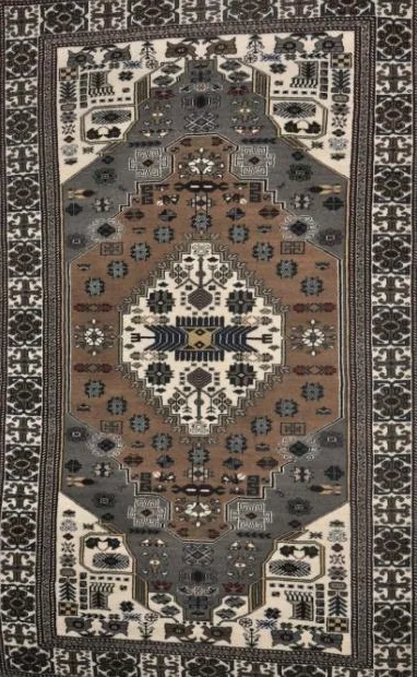
Obruk (Arısama) Carpet is a geographically indicated value of ours, unique to the Niğde region and registered by the Turkish Patent and Trademark Office on 13.12.2017 (with registration number 274).
View Official Geographical Indication Dossier for Obruk (Arısama) Carpet →
4. Niğde Astragalus Honey (Bal)
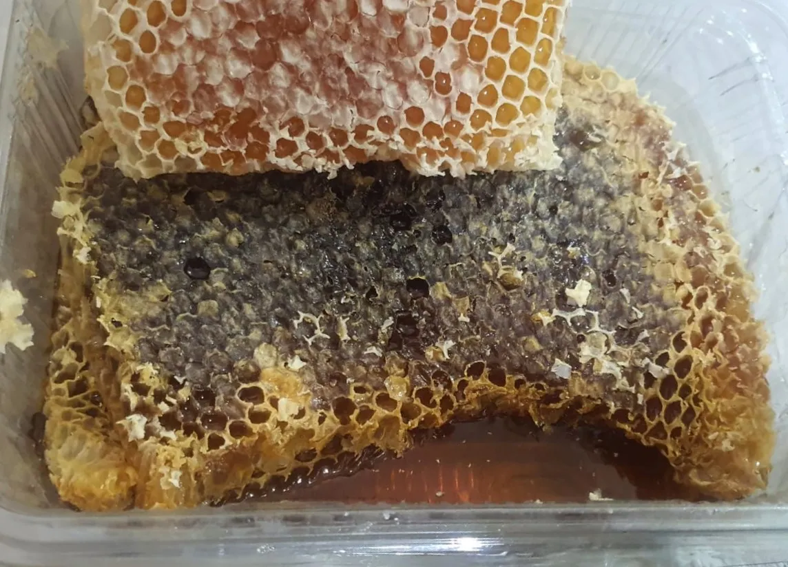
Transparent honey milked from the wild white astragalus and thyme flora in the pastures of Kop Mountain at an altitude of 2400 meters.
History: Pure pure highland honey of the Kop Mountain Pass flora.
View Official Geographical Indication Dossier for Niğde Astragalus Honey →
5. Bottleneck Cherry (İşlenmiş ve işlenmemiş meyve ve sebzeler ile mantarlar)

Darboğaz Cherry is a geographically indicated value of ours, unique to the Niğde region and registered by the Turkish Patent and Trademark Office on 28.09.2020 (with registration number 550).
View Official Geographical Indication Dossier for Bottleneck Cherry →
6. Boron Absorption (Yemekler ve çorbalar)
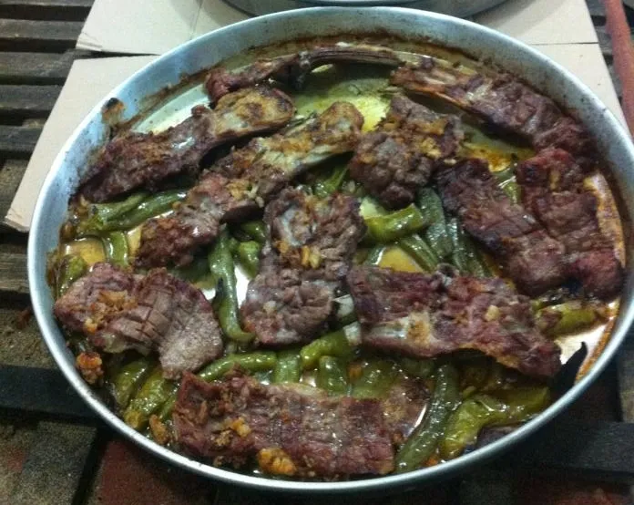
Lamb ribs and shoulder meat are sliced and placed on a copper tray, only rock salt, peeled garlic and green pepper are added and cooked slowly in wood ash in a stone oven for 2 hours.
History: A centuries-old oven dish that butchers in the historical Bor market send to the oven on trays for weddings and special occasions.
Production Method: No tomato paste, water or extra oil is added; The meat is cooked only in its own fat and juice.
View Official Geographical Indication Dossier for Boron Absorption →
Practical Travel & Transit Planning for Altunhisar, Niğde (2026)
| Planning Category | Verified Local Information |
|---|---|
| Region & Administrative Center | Altunhisar, Niğde, Türkiye |
| Best Time to Visit | Spring (April–June) and Autumn (September–November) for ideal sightseeing weather; Summer for highlands and coastal routes. |
| Public Transit & Highway Access | Regular municipal buses and local minibus cooperatives (Dolmuş) depart daily from the Niğde Intercity Bus Terminal (Otogar) directly to Altunhisar. |
| Recommended Stay | 1 to 2 full days to explore the main historical landmarks, nature trails, and local culinary stops. |
Frequently Asked Questions About Visiting Altunhisar, Niğde
What are the must-see places to visit in Altunhisar, Niğde?
The top verified attractions in Altunhisar, Niğde include Kınık Höyük Archaeological Ruins, Karamanoğlu Yakup Bey Historical Mosque, Bayatönü Rock Caves and Underground Settlement, Kurra Castle and Ancient Rock Tombs, Historical Altunhisar Mansions and Social Complex Bath. Each location offers documented historical or natural heritage with clear road access.
How can I get to Altunhisar, Niğde by public transport or car?
You can reach Altunhisar, Niğde easily by car via Niğde's main provincial highways, or take regular municipal buses and district minibuses departing throughout the day from the Niğde central bus terminal (Otogar).
What are the famous local dishes and traditional foods to try in Altunhisar, Niğde?
When visiting Altunhisar, Niğde and Niğde, be sure to taste officially registered specialties such as Niğde Kelle Söğüş, Niğde Pan, Obruk (Arısama) Carpet, Niğde Astragalus Honey, Bottleneck Cherry, prepared by local artisans and traditional restaurants.
Are the attractions in Altunhisar, Niğde suitable for families and day trips?
Yes. Most historic monuments, parks, museums, and promenade areas in Altunhisar, Niğde are family-friendly and well-suited for both weekend getaways and full-day cultural itineraries.
When is the best season to visit Altunhisar, Niğde?
Spring and autumn offer the most comfortable temperatures for walking tours and photography in Altunhisar, Niğde, while summer is popular for nature recreation, plateaus, and festivals.