
Planning a journey to Ulukışla, Niğde? This comprehensive 2026 History & Culture guide brings together 10 verified landmarks, natural wonders, and cultural heritage sites with official visiting hours, GPS coordinates, public transit connections, and local gastronomy recommendations.
Quick Highlights & Discovery Route in Ulukışla, Niğde
- Porsuk Castle and Hittite Stone Fortifications
- Öküz Mehmet Pasha Social Complex and Caravanserai (Inn Walls)
- Ulukışla Martyrs Park and City Square
- Porsuk (Zeyve) Mound Archaeological Ruins
- Kepez Castle and Ancient Watchtower
- Basmakçı Village Roman Rock Tombs and Ruins
- Niğde Kelle Söğüş
- Niğde Pan
Historical Landmarks, Architecture & Cultural Heritage in Ulukışla, Niğde
Ulukışla, Niğde (Niğde) preserves a multi-layered historical fabric shaped by centuries of Anatolian civilizations, including Roman, Byzantine, Seljuk, and Ottoman eras. Historic castles, stone bridges, caravanserais, civil mansions, and monumental structures reflect the strategic and cultural importance of Ulukışla, Niğde.
Walking through the historic quarters of Ulukışla, Niğde allows visitors to observe traditional masonry, timber-framed architecture, and restored heritage buildings up close.
- Architectural Details: Pay attention to carved stone portals, historic fountains, courtyard mansions, and defensive bastions across Ulukışla, Niğde.
- Best Visiting Hours: Early morning and late afternoon golden light offer the best conditions for architectural photography and crowd-free exploration.
- Cultural Etiquette & Preservation: Respect restoration zones and signage at registered historical monuments in Ulukışla, Niğde.
Top Verified History & Culture & Must-See Landmarks in Ulukışla, Niğde
1. Porsuk Castle and Hittite Stone Fortifications

Free Public Access • GPS: 37.5320, 34.5663
History and General Information / Local Legends and Folklore
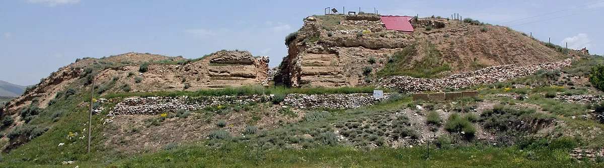
Porsuk Castle, located on the borders of Porsuk (Zeyve) Village of Ulukışla, is the most strategic border garrison that has controlled the Cilician Gates (Gülek Strait) of the Hittite Empire since the 1600s BC. The huge adobe and cut stone walls unearthed by French and Turkish archaeologists testify to the military engineering of the Late Hittite and Tabal kingdoms. Luwian hieroglyphic inscriptions and iron weapon workshops in the castle show that Taurus mines were processed in this castle and distributed to caravans.
Geographical Structure, Altitude and Natural Features
It is on a dominant hill at an altitude of 1,380 meters in the northern gorge of the Bolkar Mountains. It is located in a windy strait with wide viewing angles.
Visiting Hours, Days and Entrance Fees
- Entrance Fee: It is an open archaeological site and entrance is free.
- Visiting Hours and Days: It can be visited 7 days a week in daylight.
- Rules, Safety and Stroller/Disabled Access: Sneakers must be worn due to the rocky and pathy terrain; It is not suitable for wheelchairs.
- Facilities and Amenities: There are no facilities in the area; The facilities in Porsuk Village and Ulukışla center are used.
Transportation, Public Transit Routes and Exact Location
- Address / Open Location: Porsuk Höyuğu Mevkii, Porsuk Village, Ulukışla / Niğde.
- Road Condition and Vehicle Availability: It is 9 km away from Ulukışla district center; It can be easily reached by passenger vehicles via the asphalt village road.
- Real Public Transportation Information: Transportation from Ulukışla can be provided by Porsuk village minibuses.
- Parking Availability: Free parking is available at the village entrance and at the foot of the castle.
Contextual Experience Tips, Photography and Local Gastronomy
- Best Photo Spots and Frames: The moment when the huge Hittite-era city wall foundations meet the backdrop of the Bolkar Mountains.
- Light and Shooting Hours: Early morning hours are the time to show the texture of the stones and hieroglyphic reliefs most clearly.
- Local Gastronomy Recommendations: On your return from the visit, you should try the casserole of beans and Toros plateau cheese in Ulukışla.
Explore Full 5-Section Guide & Map for Porsuk Castle and Hittite Stone Fortifications →
2. Öküz Mehmet Pasha Social Complex and Caravanserai (Inn Walls)

Free Public Access • GPS: 37.5471, 34.4815
History and General Information / Local Legends and Folklore
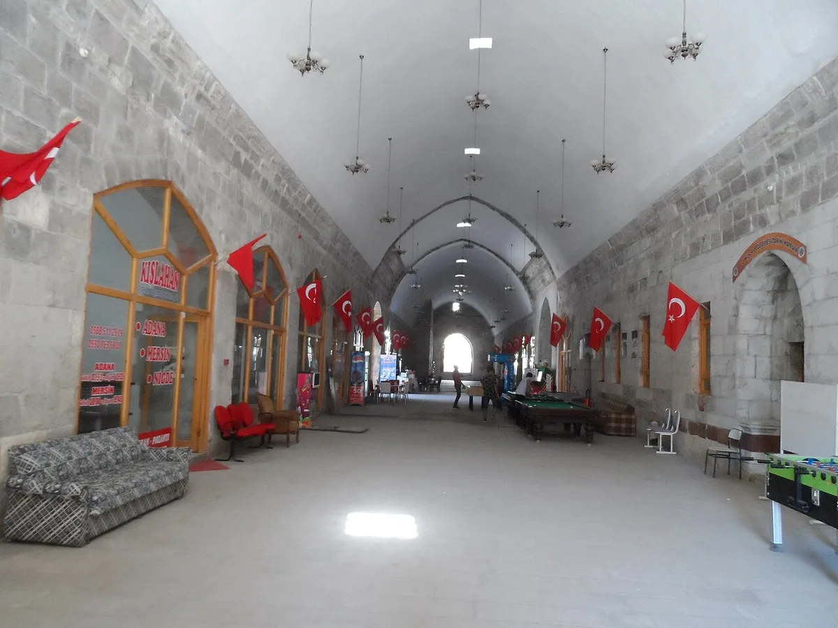
Öküz Mehmet Pasha Social Complex, built by the Ottoman Grand Vizier Damat Öküz Mehmet Pasha between 1616 and 1619, is the most monumental masterpiece of Ottoman mansion architecture in Anatolia. Complex; It consists of a huge covered caravanserai, a mosque, a double bath, a primary school and a covered bazaar (arasta) consisting of vaulted shops. The complex was the most strategic range where the Ottoman armies wintered during their eastern and southern campaigns (on the route of Baghdad, Damascus and Egypt), and gave its name to the district ("Ulu Barracks"). This is the historical inn that inspired the famous poem "Inn Walls", which the unforgettable poet of Turkish literature, Faruk Nafiz Çamlıbel, passed by in a spring car on a cold winter day in 1922, while he was appointed as a teacher at Kayseri High School, and started with the lines "The black horses neighed, the leather whip cracked / The car paused for a minute" and the sad exile epic of Maraşlı Şeyhoğlu Satulmuş.
Geographical Structure, Altitude and Natural Features
The complex is located in the Ulukışla district center, at the entrance of the Bosphorus, where the Central Anatolian plateau opens to the Taurus Mountains and the Mediterranean passages, at an altitude of approximately 1,450 meters above sea level. It has been rising like a castle of shelter for centuries with its thick cut stone walls against the harsh winds of the continental climate during the winter months.
Visiting Hours, Days and Entrance Fees
- Entrance Fee: Visiting the complex, historical arasta and mosque is completely FREE.
- Visiting Hours and Days: Open 7 days a week between 08:30 - 18:30; The mosque section is open until night prayer.
- Rules, Security and Baby Stroller/Disabled Access: Calm must be maintained as there is a lot of sound echoing under the historical caravanserai vaults. The courtyard of the social complex and the corridors have smooth cut stone floors and are accessible for disabled individuals and baby strollers.
- Facilities and Facilities: Ministry of Culture and Tourism information boards, handicraft workshops, library, cafeteria, ablution room and WC are available.
Transportation, Public Transit Routes and Exact Location
- Address / Open Location: Alpagut Mahallesi, Mehmet Paşa Caddesi, 51900 Ulukışla / Niğde.
- Road Conditions and Vehicle Availability: It is located in the Ulukışla district center, opposite the Government Office; All types of passenger vehicles can easily reach its door via the asphalt road within the district, which separates from the E-90 highway.
- Real Public Transportation Information: All buses coming from Niğde, Adana, Konya and Ereğli stop at Ulukışla bus terminal; Kervansaray is a 4-minute walk from the town center. It is also 600 meters from the historical Toros Express Ulukışla Train Station.
- Parking Availability: There are ample free parking spaces around the social complex and in the town square.
Contextual Experience Tips, Photography and Local Gastronomy
- Best Photography Spots and Frames: The hearth niches in the huge vaulted inner hall of the caravanserai, the "Inn Walls" monument corner and the stone arched corridor of the arasta.
- Light and Shooting Hours: Noon hours when dramatic light beams filtering through the caravanserai windows appear.
- Local Gastronomy Recommendations: Hot Ulukışla pan cooked in bazaar ovens at the exit of the social complex, potato pastry and Taurus highland thyme tea.
3. Ulukışla Martyrs Park and City Square
Free Public Access • GPS: 37.5516, 34.4769
History and General Information / Local Legends and Folklore
Ulukışla Martyrs Park and City Square is a central memorial square built in the district center to keep alive the memory of our beloved martyrs who sacrificed their lives for the sake of the homeland. The Martyrs' Monument rising in the square bears the names of the heroes of Ulukışla who were martyred in defense of the homeland, from the Battle of Gallipoli to the War of Independence and the fight against terrorism. This square in the heart of the historical barracks and caravanserai town, which is the subject of Faruk Nafiz Çamlıbel's immortal poem 'Inn Walls', is the symbol of loyalty and national pride of the district.
Geographical Structure, Altitude and Natural Features
The square is located on a flat area in the town center, at an altitude of 1,425 meters. It is equipped with pine trees, acacia and flower beds.
Visiting Hours, Days and Entrance Fees
- Entrance Fee: It is open to the public and completely free.
- Visiting Hours and Days: It can be visited 24 hours a day, 7 days a week.
- Rules, Safety and Stroller/Disabled Access: The walking paths are flat and fully wheelchair and stroller accessible.
- Facilities and Facilities: There are resting benches, a fountain, a children's playground and cafeterias around it.
Transportation, Public Transit Routes and Exact Location
- Address / Open Location: Doğu Mahallesi, Akşam Caddesi, 51900 Ulukışla / Niğde.
- Road Condition and Vehicle Availability: It is 300 meters from the historical Öküz Mehmet Pasha Caravanserai; It can be easily reached by all vehicles.
- Real Public Transportation Information: You can reach the square in 5 minutes by walking from Niğde-Adana highway and train station.
- Parking Availability: There is free municipal parking around the square.
Contextual Experience Tips, Photography and Local Gastronomy
- Spiritual Visit and Prayer Etiquette: It is recommended to observe a moment of silence in front of the martyrs' monument and recite Fatiha to the souls of our heroic martyrs.
- Documentary & Respectful Shooting: Marble inscriptions with the names of martyrs and the Turkish flag can be framed.
- Important Commemoration Days: District ceremonies are held here on 18 March Martyrs' Memorial Day and 29 October Republic Day.
- Local Spiritual Tradition: During national and religious holidays, lokma and sherbet are served to citizens in the square.
Explore Full 5-Section Guide & Map for Ulukışla Martyrs Park and City Square →
4. Porsuk (Zeyve) Mound Archaeological Ruins
Free Public Access • GPS: 37.5270, 34.5723
History and General Information / Local Legends and Folklore
Porsuk Höyük (Zeyve Höyük) is a strategic border castle founded by the Hittite Empire to control the route opening to the Taurus Mountains and the Mediterranean (Cilician gates), used uninterruptedly from the 1600s BC until the Iron Age and Roman periods. The mound was excavated for many years by the French Institute of Anatolian Research (IFEA) and international archaeological delegations; Defensive walls built from huge limestone blocks, square-planned bastions and mudbrick fortifications from the Hittite period were unearthed. Hieroglyphic inscriptions, military garrison ruins, grain warehouses and bronze weapons were found in the settlement, which was an outpost of the Late Hittite Tabal Kingdom and the Phrygians during the Iron Age. The priceless Hittite and Phrygian artifacts unearthed here are exhibited in Niğde Museum.
Geographical Structure, Altitude and Natural Features
The mound is located near the Porsuk village of Ulukışla, at an altitude of approximately 1,320 meters above sea level, on a dominant hill overlooking the Taurus passes. Almond and apricot trees are lined along the surrounding valley.
Visiting Hours, Days and Entrance Fees
- Entrance Fee: Visiting the ruins is completely FREE.
- Visiting Hours and Days: It can be visited 7 days a week during daylight hours.
- Rules, Safety and Stroller/Disabled Access: Hittite stone wall foundations in the archaeological excavation area should not be stepped on. Since the mound slopes consist of stony paths, comfortable walking shoes are recommended; It is partially unsuitable for baby stroller and wheelchair use.
- Facilities and Facilities: There is a grocery store, fountain and coffee house in Porsuk village.
Transportation, Public Transit Routes and Exact Location
- Address / Open Location: Porsuk Village, Zeyve Mevkii, 51900 Ulukışla / Niğde.
- Road Condition and Vehicle Availability: It is 9 km away from Ulukışla district center. It can be easily reached by passenger vehicle via the asphalt road branching from Ankara-Adana E-90 highway to Porsuk village.
- Real Public Transportation Information: It takes 10 minutes by minibuses from Ulukışla to Porsuk village or by taxi from the town center.
- Parking Availability: There is an open area where vehicles can be parked at the foot of the mound.
Contextual Experience Tips, Photography and Local Gastronomy
- Best Photo Spots and Frames: 3,500-year-old gigantic Hittite limestone city walls, bastion foundations and the Taurus mountain range in the background.
- Light and Shooting Hours: Early morning and late afternoon light when the stone texture becomes apparent.
- Local Gastronomy Recommendations: Fresh village apricots in Porsuk village and Ulukışla oven pita.
Explore Full 5-Section Guide & Map for Porsuk (Zeyve) Mound Archaeological Ruins →
5. Kepez Castle and Ancient Watchtower
Free Public Access • GPS: 37.5171, 34.4611
History and General Information / Local Legends and Folklore
Kepez Castle is an ancient castle located on a steep hill overlooking the strategic mountain gorge of Ulukışla district, with roots dating back to 2000 BC (Hittite and Luwian period) and fortified in the Roman era. The castle, which was built to monitor the Taurus mountain passes and the caravan route down to the Gülek Gorge, includes rock-cut cisterns, watchtowers and city walls foundations. It is rumored among the local people that the castle hosted a huge army garrison in ancient times and had secret escape tunnels.
Geographical Structure, Altitude and Natural Features
The castle is located at an altitude of approximately 1,520 meters, at the top of a steep limestone cliff overlooking its surroundings. It has a 360 degree view of the Taurus mountains and valley.
Visiting Hours, Days and Entrance Fees
- Entrance Fee: Entrance is free.
- Visiting Hours and Days: It can be visited during daylight throughout the year.
- Rules, Safety and Stroller/Disabled Access: Ascent to the top is via a steep goat path; mountaineering or solid-soled sneakers are required; Attention should be paid to cliff parts.
- Facilities and Facilities: There are no facilities in the natural ruins.
Transportation, Public Transit Routes and Exact Location
- Address / Open Location: Kepez Mevkii, 51900 Ulukışla / Niğde.
- Road Condition and Vehicle Availability: It is 7 km away from Ulukışla district center; After the asphalt road, you can reach the beginning of the short stabilized path by passenger vehicle.
- Real Public Transportation Information: It can be reached from the town center by taxi in 10 minutes or by following the trekking route.
- Parking Availability: Vehicles can be left free of charge in the open area at the foot of the hill.
Contextual Experience Tips, Photography and Local Gastronomy
- Best Photography Spots and Frames: Panorama of Bolkar Mountains and Ulukışla Plain from the ancient lookout point at the summit.
- Light and Shooting Hours: Sunset golden hours are the moment when the rocky peak turns red.
- Local Gastronomy Recommendations: After the nature walk, you should taste the famous meat stew and ayran in Ulukışla center.
Explore Full 5-Section Guide & Map for Kepez Castle and Ancient Watchtower →
6. Basmakçı Village Roman Rock Tombs and Ruins
Free Public Access • GPS: 37.6586, 34.7210
History and General Information / Local Legends and Folklore
Basmakçı Village Roman Rock Tombs are the remains of a necropolis and rock settlement dating back to the Late Roman and Early Byzantine periods, located on the rocky slopes of Basmakçı village in the north of Ulukışla. Single and multi-room arcosolium tombs, klines (dead beds) and grave niches carved into tufa and limestone rocks display the burial culture of the period. Local people say that these rocks are an old Roman bishopric center and that there are ancient inscriptions in the tombs.
Geographical Structure, Altitude and Natural Features
The settlement is located on a slightly rugged mountainside at an altitude of approximately 1,390 meters above sea level. It is surrounded by steppe vegetation, wild almond trees and mountain thyme.
Visiting Hours, Days and Entrance Fees
- Entrance Fee: It is completely free.
- Visiting Hours and Days: It can be visited in daylight 7 days a week.
- Rules, Safety and Stroller/Disabled Access: Archaeological remains should not be damaged; Sports shoes should be preferred on rocky terrain.
- Facilities and Facilities: There is a grocery store, mosque and fountain in Basmakçı village centre.
Transportation, Public Transit Routes and Exact Location
- Address / Open Location: Basmakçı Köyü, 51900 Ulukışla / Niğde.
- Road Condition and Vehicle Availability: It is 11 km away from the center of Ulukışla; It can be reached in 12 minutes by passenger vehicles via the asphalt village road.
- Real Public Transportation Information: Basmakçı village minibuses depart from Ulukışla district bus station.
- Parking Availability: Free parking is available in the village square and in front of the rocky area.
Contextual Experience Tips, Photography and Local Gastronomy
- Best Photo Spots and Frames: The arched entrance facades of the rock tombs and the view extending from the valley to the Bolkar Mountains.
- Light and Shooting Hours: In the afternoon, when the sun hits obliquely, the shadows of the grave niches are most clearly reflected.
- Local Gastronomy Recommendations: You should try the village bread with potatoes and sheep cheese baked in the oven in Basmakçı village.
Explore Full 5-Section Guide & Map for Basmakçı Village Roman Rock Tombs and Ruins →
7. Emirs - Historic Byzantine Stone Bridge
Free Public Access • GPS: 37.9784, 34.6928
History and General Information / Local Legends and Folklore
Emirler - Kulan Historical Byzantine Stone Bridge is a single-arched monumental stone bridge from the Byzantine period, located at the deep valley passage between the Emirler and Kulan villages of Ulukışla. Built on a strategic stream bed on the ancient military and trade route leading to the Cilician Gates (Gülek Strait), the bridge has been standing for centuries with its cut stone arch architecture and solid mortar structure. The bridge used by caravans and Roman legions in the region to cross the Taurus mountain passes is the oldest surviving engineering work in the region.
Geographical Structure, Altitude and Natural Features
The bridge is located above the rocky gorge formed by a seasonal mountain stream, at an altitude of approximately 1,380 meters. It is surrounded by wild junipers, oaks and limestone cliffs.
Visiting Hours, Days and Entrance Fees
- Entry Fee: Completely free and open.
- Visiting Hours and Days: It can be visited all day long, 7 days a week.
- Rules, Safety and Baby Stroller/Disabled Access: You should be balanced while walking on the historical stone arch, and be careful on parts without railings; sneakers are required.
- Facilities and Facilities: It is a natural protected area, there are no facilities; Necessities can be met from the Kulan village, 2 km away.
Transportation, Public Transit Routes and Exact Location
- Address / Open Location: Emirler-Kulan Köy Yolu, 51900 Ulukışla / Niğde.
- Road Condition and Vehicle Availability: It is 14 km away from the center of Ulukışla; It is located in the stream bed right next to the asphalt village road; It can be reached by any passenger vehicle.
- Real Public Transportation Information: Transportation can be provided by minibuses from Ulukışla to Kulan village.
- Parking Availability: Free car parking is available on the roadside plain near the bridge.
Contextual Experience Tips, Photography and Local Gastronomy
- Best Photo Spots and Frames: View of the valley from under the arched stone bridge, cut stone masonry and flowing stream waters.
- Light and Shooting Hours: Morning hours illuminate the eastern face of the stone arch and give the clearest photographs.
- Local Gastronomy Recommendations: Kulan village's famous table cherries, molasses and plateau buns should be tasted.
Explore Full 5-Section Guide & Map for Emirs - Historic Byzantine Stone Bridge →
8. Maden Village Ancient Mine Galleries and Historical Canyon
Free Public Access • GPS: 37.4490, 34.6244
History and General Information / Local Legends and Folklore
Maden Village Ancient Mine Galleries and Historical Canyon is a historical mining center located on the steep cliffs of the Bolkar Mountains, south of Ulukışla, where silver, lead and gold have been mined since the ancient Roman and Ottoman times. Maden village, which met a significant part of the silver needs of the mint during the Ottoman Empire, was a specially privileged town where hundreds of master miners worked at that time. Historical mine mouths, slag ruins and stone structures located on the canyon slopes are unique legacies of industrial archaeology.
Geographical Structure, Altitude and Natural Features
The village and the canyon are located in a steep rocky canyon bed, approximately 1,650 meters above sea level. It is covered with mountain springs, juniper trees and rich mineral veins.
Visiting Hours, Days and Entrance Fees
- Entrance Fee: Entrance is free.
- Visiting Hours and Days: It can be visited freely during daylight hours.
- Rules, Safety and Stroller/Disabled Access: Entering historic mine galleries uncontrolled and unguided is dangerous due to the risk of gas and cave-ins; Mountaineering shoes are a must for canyon hiking.
- Facilities and Amenities: There is a grocery store, mosque and fountain in the village.
Transportation, Public Transit Routes and Exact Location
- Address / Open Location: Maden Köyü, 51900 Ulukışla / Niğde.
- Road Condition and Vehicle Availability: It is 22 km from Ulukışla center and 12 km from Çiftehan; It can be reached by careful driving by passenger vehicles via an asphalt and stabilized mountain road.
- Real Public Transportation Information: It can be reached by village minibuses departing from Ulukışla.
- Parking Availability: Vehicles can be parked free of charge at the village entrance and at the mouth of the canyon.
Contextual Experience Tips, Photography and Local Gastronomy
- Best Photo Spots and Frames: Sheer canyon cliffs, historic stone miners' houses and the steep peaks of the Bolkar Mountains.
- Light and Shooting Hours: At noon, when the sun's rays hit the canyon floor vertically, the color contrast is great.
- Local Gastronomy Recommendations: Maden village mountain thyme tea and oven-baked lamb chops should be tasted.
Explore Full 5-Section Guide & Map for Maden Village Ancient Mine Galleries and Historical Canyon →
9. Çiftehan Thermal Springs and Healing Waters Region

Ticketed / MuseumPass Check • GPS: 37.5122, 34.7732
History and General Information / Local Legends and Folklore
Çiftehan Thermal Springs is one of the most established and high mineral value thermal springs in Türkiye, dating back to the Ancient Roman, Byzantine and Seljuk periods. According to historical sources and popular legend, on her way to meet Antony in Tarsus, Egyptian Queen Cleopatra bathed in the healing hot waters of Çiftehan before the Gülek Strait and healed her wounds and skin ailments here; For this reason, hot spring pools are also known as "Cleopatra Pool" among the public. There are ruins of ancient baths and Roman water channels in the area, which was called "Aquae Calidae" (Hot Waters) during the Roman and Byzantine periods. Çiftehan waters have a well exit temperature of 53°C and contain sulfur, sodium, calcium and bicarbonate; It has been healing rheumatism, sciatica, arthritis, skin and gynecological diseases for centuries.
Geographical Structure, Altitude and Natural Features
Çiftehan is located between the deep valley crevices of the Taurus Mountains, at an altitude of approximately 980 meters above sea level. It is in a transition zone between Central Anatolia and the Mediterranean climate and is surrounded by pine forests, orchards and rocky canyon slopes.
Visiting Hours, Days and Entrance Fees
- Entrance Fee: Appropriate entrance fee is applied for municipal public spas and daily thermal facilities; Private hotels and SPA pools apply their own price policies.
- Visiting Hours and Days: Thermal facilities are open 7 days a week between 07:00 and 23:00.
- Rules, Safety and Baby Stroller/Disabled Access: It is recommended that heart, blood pressure and severe asthma patients do not stay in the hot pool for more than 15-20 minutes without medical supervision. The facilities are equipped with disabled ramps and elevators and are suitable for baby strollers and wheelchairs.
- Facilities and Facilities: Thermal outdoor and indoor pools, Turkish baths, mud baths, massage rooms, relaxation cafes, hostels and parking lots are available.
Transportation, Public Transit Routes and Exact Location
- Address / Open Location: Kaplıcalar Mevkii, Çiftehan Town, 51900 Ulukışla / Niğde.
- Road Condition and Vehicle Availability: It is 30 km from Ulukışla district center, 80 km from Niğde city center, and 110 km from Adana. The Ankara-Adana highway and the E-90 highway pass right through the town, making transportation extremely comfortable.
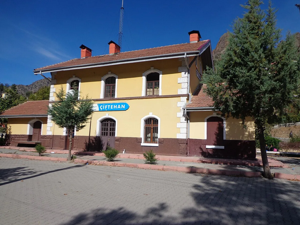
- Real Public Transportation Information: Buses departing from Niğde, Adana, Mersin and Ereğli throughout the day and stop in Çiftehan. Additionally, the historical Çiftehan Train Station is 300 meters from the hot springs area.
- Parking Availability: There are large and free parking areas around the thermal facilities.
Contextual Experience Tips, Photography and Local Gastronomy
- Best Photography Spots and Frames: Hot spring vapors rising through the Taurus Mountains canyon, the historical train station building and the sunset lights of the valley.
- Light and Shooting Hours: Moments when vapors condense in the cool early morning hours.
- Local Gastronomy Recommendations: Toros plateau honey after a hot spring bath, freshly squeezed pomegranate juice and lamb stew in Çiftehan restaurants.
Explore Full 5-Section Guide & Map for Çiftehan Thermal Springs and Healing Waters Region →
10. Meydan Plateau and Bolkar Mountains Camping Area
Free Public Access • GPS: 37.4211, 34.5666
History and General Information / Local Legends and Folklore
Meydan Plateau, stretching like a huge bowl on the northern slopes of the Bolkar Mountains, is a legendary plateau center where Yoruk tribes have set up hair tents and pastured their herds during the summer months for centuries. The plateau is the traditional base camp and gathering point for climbers climbing the Karagöl and Çiniligöl glacial lakes and the Medetsiz Peak (3,524 m). Meydan Plateau, where Yoruk women beat chitil (yayık) in the springs of the plateau, press goat cheese and sing sad folk songs to the wind, hosts the traditional Bolkar Mountains Karagöl festivities and plateau festivals held every year in July.
Geographical Structure, Altitude and Natural Features
The plateau is located at an altitude of approximately 2,200 meters above sea level. It is surrounded by rich alpine meadows, wild mountain thyme, St. John's wort and ice-cold, flowing spring waters. The plateau plain is extremely suitable for tenting and caravan accommodation.
Visiting Hours, Days and Entrance Fees
- Entrance Fee: Entrance to the plateau and camping is completely FREE.
- Visiting Hours and Days: Open 24 hours a day, 7 days a week; The most comfortable visiting period is June - September.
- Rules, Safety and Baby Stroller/Disabled Access: A sleeping bag and winter clothing should be carried as night temperatures in the plateau can approach zero even in summer. Garbage should be collected, and uncontrolled driving should not be done on the plateau plain. The plateau plain is accessible for disabled and strollers.
- Facilities and Facilities: Drinkable natural spring water fountains, Yoruk tents, camping areas are available; Since there is no electricity or market facilities, you must come with supplies.
Transportation, Public Transit Routes and Exact Location
- Address / Open Location: Above Darboğaz Village, Meydan Yaylası Mevkii, 51900 Ulukışla / Niğde.
- Road Condition and Vehicle Availability: It is 25 km away from Ulukışla district center. There is an 8 km stabilized plateau road after Darboğaz village, which can be easily reached with careful passenger vehicles and SUVs in the summer months.
- Real Public Transport Information: There are village minibuses operating up to Darboğaz village; The plateau can be reached from the village by local vehicles or by walking.
- Parking Availability: There is unlimited open space on the plateau plain where vehicles can park safely.
Contextual Experience Tips, Photography and Local Gastronomy
- Best Photo Spots and Frames: Highland meadows decorated with grazing flocks of sheep and goats, colorful mountain flowers, the Bolkar range reaching into the sky, and the Milky Way with tent lights at night.
- Light and Shooting Hours: Early morning fog and sunset golden hours.
- Local Gastronomy Recommendations: Freshly cooked churned butter in nomad tents, goat tulum cheese, compress and thyme tea.
Explore Full 5-Section Guide & Map for Meydan Plateau and Bolkar Mountains Camping Area →
What to Eat in Ulukışla, Niğde? Registered Local Delicacies & Gastronomy
A trip to Ulukışla, Niğde is incomplete without tasting its officially registered geographical indication products and centuries-old Anatolian recipes:
1. Niğde Kelle Söğüş (Yemekler ve çorbalar)
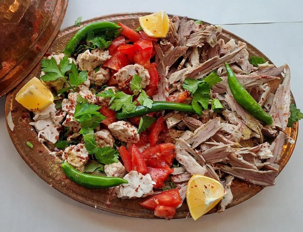
Lamb head, cooked slowly in the oven for 8 hours, is removed from the bones and served in lavash with fresh greens and cumin.
History: Centuries-old breakfast and lunch ritual of Niğde mornings and bazaar tradesmen.
View Official Geographical Indication Dossier for Niğde Kelle Söğüş →
2. Niğde Pan (Yemekler ve çorbalar)
Product Story & History:
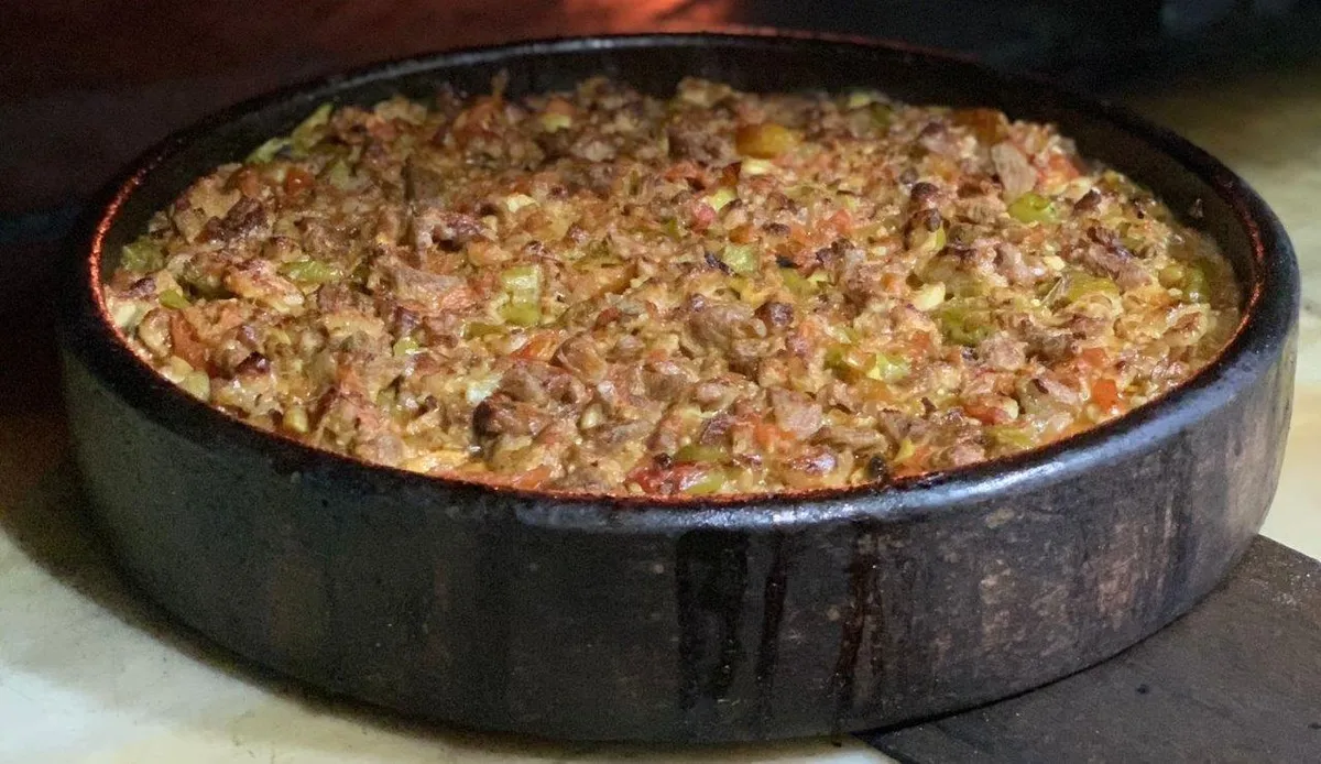
Niğde Tavası is a traditional oven dish registered as Geographical Sign by the Turkish Patent and Trademark Office with registration number 598.
Distinctive Features & Material Profile:
Lamb ribs and shoulder meat are slowly cooked in a stone oven in a copper pan with local Niğde tomatoes and green peppers, garlic and tail fat.
View Official Geographical Indication Dossier for Niğde Pan →
3. Obruk (Arısama) Carpet (Halılar ve kilimler)
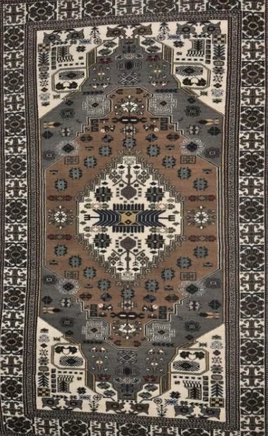
Obruk (Arısama) Carpet is a geographically indicated value of ours, unique to the Niğde region and registered by the Turkish Patent and Trademark Office on 13.12.2017 (with registration number 274).
View Official Geographical Indication Dossier for Obruk (Arısama) Carpet →
4. Niğde Astragalus Honey (Bal)
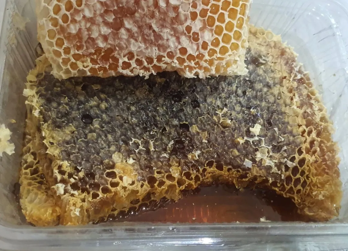
Transparent honey milked from the wild white astragalus and thyme flora in the pastures of Kop Mountain at an altitude of 2400 meters.
History: Pure pure highland honey of the Kop Mountain Pass flora.
View Official Geographical Indication Dossier for Niğde Astragalus Honey →
5. Bottleneck Cherry (İşlenmiş ve işlenmemiş meyve ve sebzeler ile mantarlar)

Darboğaz Cherry is a geographically indicated value of ours, unique to the Niğde region and registered by the Turkish Patent and Trademark Office on 28.09.2020 (with registration number 550).
View Official Geographical Indication Dossier for Bottleneck Cherry →
6. Boron Absorption (Yemekler ve çorbalar)
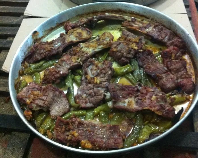
Lamb ribs and shoulder meat are sliced and placed on a copper tray, only rock salt, peeled garlic and green pepper are added and cooked slowly in wood ash in a stone oven for 2 hours.
History: A centuries-old oven dish that butchers in the historical Bor market send to the oven on trays for weddings and special occasions.
Production Method: No tomato paste, water or extra oil is added; The meat is cooked only in its own fat and juice.
View Official Geographical Indication Dossier for Boron Absorption →
Practical Travel & Transit Planning for Ulukışla, Niğde (2026)
| Planning Category | Verified Local Information |
|---|---|
| Region & Administrative Center | Ulukışla, Niğde, Türkiye |
| Best Time to Visit | Spring (April–June) and Autumn (September–November) for ideal sightseeing weather; Summer for highlands and coastal routes. |
| Public Transit & Highway Access | Regular municipal buses and local minibus cooperatives (Dolmuş) depart daily from the Niğde Intercity Bus Terminal (Otogar) directly to Ulukışla. |
| Recommended Stay | 1 to 2 full days to explore the main historical landmarks, nature trails, and local culinary stops. |
Frequently Asked Questions About Visiting Ulukışla, Niğde
What are the must-see places to visit in Ulukışla, Niğde?
The top verified attractions in Ulukışla, Niğde include Porsuk Castle and Hittite Stone Fortifications, Öküz Mehmet Pasha Social Complex and Caravanserai (Inn Walls), Ulukışla Martyrs Park and City Square, Porsuk (Zeyve) Mound Archaeological Ruins, Kepez Castle and Ancient Watchtower. Each location offers documented historical or natural heritage with clear road access.
How can I get to Ulukışla, Niğde by public transport or car?
You can reach Ulukışla, Niğde easily by car via Niğde's main provincial highways, or take regular municipal buses and district minibuses departing throughout the day from the Niğde central bus terminal (Otogar).
What are the famous local dishes and traditional foods to try in Ulukışla, Niğde?
When visiting Ulukışla, Niğde and Niğde, be sure to taste officially registered specialties such as Niğde Kelle Söğüş, Niğde Pan, Obruk (Arısama) Carpet, Niğde Astragalus Honey, Bottleneck Cherry, prepared by local artisans and traditional restaurants.
Are the attractions in Ulukışla, Niğde suitable for families and day trips?
Yes. Most historic monuments, parks, museums, and promenade areas in Ulukışla, Niğde are family-friendly and well-suited for both weekend getaways and full-day cultural itineraries.
When is the best season to visit Ulukışla, Niğde?
Spring and autumn offer the most comfortable temperatures for walking tours and photography in Ulukışla, Niğde, while summer is popular for nature recreation, plateaus, and festivals.