İçeriğe Geç
Historical Cut Bridge (Kizilirmak Bridge)
Ana Kapak Görseli
Tarihi Yapılar & KalelerMerkez, Sivas

Historical Cut Bridge (Kizilirmak Bridge)

View on Map
Admission StatusFree Entry
Visiting HoursOpen Daily

About & Visitor Guide

History and General Information / Local Legends and Folklore

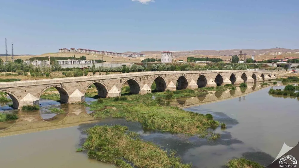
  • •The Historical Truncated Bridge, built on the Kızılırmak River in 1292 during the Anatolian Seljuk period, is one of the most vital crossing points of the Silk Road and caravan routes.
  • •The bridge consists of a total of 19 pointed arches and is called 'Cut Bridge' among the public because it was built by cutting it into two pieces according to the floodplain of the river.
  • •The bridge, over which caravanners and dervishes safely crossed the rough waters of the Kızılırmak during their journeys between east and west for centuries, is a masterpiece of Seljuk engineering and stonemasonry. Geographical Structure, Altitude and Natural Features
  • •The altitude is approximately 1,270 meters above sea level. It lies on the wide alluvial base of the Kızılırmak valley, southwest of the center of Sivas.
  • •The riverbank, surrounded by willows, poplars and reeds, is home to rich species of waterfowl and fish.
  • •The silvery flow of the Kızılırmak and the wide horizon of the steppe valley can be watched from the bridge. Visiting Hours, Days and Entrance Fees
  • •Entrance Fee:The historical bridge and recreation area are completely free and open to the public.
  • •Visiting Hours and Days:It can be visited 24 hours a day, 7 days a week.
  • •Rules, Safety and Stroller/Disabled Access: The bridge is open to pedestrian traffic and is covered with smooth cut stone; Care should be taken around the edges of the railing. Suitable for baby strollers.
  • •Facilities and Facilities:There are riverside walking paths, a promenade and recreation park, and lighting at the bridgehead. Transportation, Public Transit Routes and Exact Location
  • •Address / Open Location:Kesikköprü District, Kızılırmak Coast, Center / Sivas.
  • •Road Condition and Vehicle Availability: It is 5 km away from Sivas city center in the direction of Kayseri Highway and can be reached in 7 minutes by passenger vehicles on a double asphalt road.
  • •Real Public Transportation Information: University-Kesikköprü public buses departing from Sivas Square drop off at the stop at the bridge.
  • •Parking Availability:Free car parking is available in the recreation area car park at the bridge entrance. Contextual Experience Tips, Photography and Local Gastronomy
  • •Best Photography Spots and Frames:The reflections of 19 arches on the water and the sunset silhouette from the Kızılırmak shore.
  • •Light and Shooting Hours:17:30 - 19:15 in the evening when the sun turns red on the horizon.
  • •Local Gastronomy Recommendations:You should drink brewed samovar tea and taste roasted corn at the riverside facilities.
  • Location & Directions

    39.7219, 36.9626
    Harita yükleniyor...
    Historical Cut Bridge (Kizilirmak Bridge) Konumu
    39.7219, 36.9626
    Hoşunuza Gidebilir

    Merkez Tarihi Yapılar & Kaleler Noktaları

    Sponsorlu Reklam
    -

    Visitor Reviews

    No reviews yet