
Planning a journey to Saray, Van? This comprehensive 2026 Places to Visit guide brings together 10 verified landmarks, natural wonders, and cultural heritage sites with official visiting hours, GPS coordinates, public transit connections, and local gastronomy recommendations.
Quick Highlights & Discovery Route in Saray, Van
- Kapıköy Historical Train Station and Railway Crossing
- Saray Observation Hill and Nature Trail
- Palace Government Square and Republic Park
- Keçikıran Mountain and Plateaus
- Çaybağı Valley and Recreation Area
- Palace Martyrs Park and Monument
- Van Kavut
- Jirkan Rug
Natural Wonders, Valleys, Plateaus & Eco-Discovery in Saray, Van
Saray, Van (Van) captivates nature lovers with its unspoiled valleys, lush forests, high plateaus (yaylalar), canyons, and diverse flora. Each season transforms the landscapes of Saray, Van, from vibrant spring blossoms to golden autumn foliage.
- Seasonal Highlights: Spring (April–June) brings rushing streams and wildflowers, while autumn (October–November) turns the forests around Saray, Van into a photographer's paradise.
- Outdoor Preparedness: Wear layered clothing, carry sufficient drinking water, and download offline maps before venturing into rural trails in Saray, Van.
- Eco-Conscious Travel: Protect the natural habitats of Saray, Van by leaving zero waste and staying on marked paths.
Top Verified Places to Visit & Must-See Landmarks in Saray, Van
1. Kapıköy Historical Train Station and Railway Crossing

Free Public Access • GPS: 38.4981, 44.3313
History & True Legends / Legends
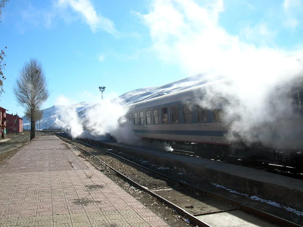
Kapıköy Historical Train Station is the last station and customs gate in Türkiye of the Trans-Asian railway line connecting Türkiye and Iran. This historical railway corridor, which was completed in 1971 and connects the European and Asian continents via rails with the Van Lake ferry line; It is the continuation of the centuries-old Silk Road trade on modern steel rails. The station building is a historical range that attracts the attention of railway enthusiasts with its nostalgic switches and border line silhouette.
Geographical Structure & Altitude & Nature
It is located on the Türkiye-Iran border, on a wide mountain gorge plain with an altitude of 2,050 meters. It is surrounded by border mountains and steppe geography.
Visiting Hours & Days & Entrance Fee
- Entrance Fee: Visiting the station area and the historical railway area is free.
- Visiting Hours and Days: It can be visited all day long, 7 days a week.
- Rules, Security and Stroller/Disabled Access: Since it is an international border and an active railway line, security signs and border rules must be strictly followed. It has a flat floor.
- Facilities and Facilities: TCDD station building, waiting room, customs facilities, cafeteria and WC are available.
Real Transportation & Public Transport Lines & Open Location
- Address / Open Location: Kapıköy Border Gate Location, Saray / Van.
- Road Condition and Vehicle Suitability: It is located on the continuation of the Van-Özalp-Saray highway; The road is an international divided asphalt and can be easily reached by any passenger vehicle.
- Real Public Transportation Information: Regular passenger shuttles and minibuses operate from Van and Saray to the Kapıköy border gate throughout the day.
- Parking Availability: There is a large and free parking lot next to the border gate and the station.
Contextual Experience Tips
- Best Photo Spots and Frames: Railway tracks stretching through the mountains to the horizon and the nostalgic station sign.
- Light and Shooting Hours: Early mornings and sunsets are the most beautiful moments when the rails shine.
- Local Gastronomy Recommendations: Hot soup and freshly brewed tea should be consumed in border rest facilities.
Explore Full 5-Section Guide & Map for Kapıköy Historical Train Station and Railway Crossing →
2. Saray Observation Hill and Nature Trail
Free Public Access • GPS: 38.4973, 44.3182
History and General Information / Local Legends and Folklore
Saray Seyir Hill is a unique viewing point located on a hill overlooking the town center and panoramically revealing the Kotur Stream valley, the railway line and the magnificent mountain ranges on the Turkey-Iran border. The hill, where hikers and photographers flock at sunset, makes you feel the majesty of the vast border geography.
Geographical Structure, Altitude and Natural Features
The altitude is approximately 2160 meters. It is the dominant hill offering views of the wide valley and border mountain ranges.
Visiting Hours, Days and Entrance Fees
- Entrance Fee: Free.
- Visiting Hours and Days (Mandatory): It can be visited in daylight 7 days a week.
- Rules, Safety and Stroller/Disabled Access: The trail is a walking route; sports shoes are recommended.
- Facilities and Facilities: Natural observation terrace and walking path.
Transportation, Public Transit Routes and Exact Location
- Address / Open Location: Seyir Tepesi Mevkii, 65830 Saray / Van.
- Road Conditions and Vehicle Availability: Saray is 2 km away from the town centre; It can be reached by car or on foot on a stabilized road.
- Real Public Transportation Information (Mandatory): Easily accessible from the town center on foot or by taxi.
- Parking Availability: There is a parking area at the foot of the hill.
Contextual Experience Tips, Photography and Local Gastronomy
- Best Photo Spots and Frames: The sun setting behind the border mountains and the folds of the Kotur Stream valley.
- Local Gastronomy Recommendations: Fresh hot tandoori bun from the district bakery upon arrival.
Explore Full 5-Section Guide & Map for Saray Observation Hill and Nature Trail →
3. Palace Government Square and Republic Park
Free Public Access • GPS: 38.6479, 44.1725
History and General Information / Local Legends and Folklore
Saray Government Square and Cumhuriyet Park are the administrative and social center of Saray, the strategic border district where the Türkiye-Iran border gate Kapıköy opens. The Atatürk Monument and the surrounding green park area host the official ceremonies of the city and the daily meetings of the people of the district, which carries the liveliness of the border trade.
Geographical Structure, Altitude and Natural Features
The altitude is approximately 2080 meters. It is a high border plateau overlooking the Kotur Stream valley.
Visiting Hours, Days and Entrance Fees
- Entrance Fee: Free.
- Visiting Hours and Days (Mandatory): Open 24 hours a day, 7 days a week.
- Rules, Safety and Stroller/Disabled Access: It is completely flat and suitable for disabled and stroller access.
- Facilities and Amenities: Rest benches, children's playground, tea gardens and government office buildings.
Transportation, Public Transit Routes and Exact Location
- Address / Open Location: Government Street, 65830 Saray / Van.
- Road Condition and Vehicle Availability: Van-Kapıköy is on the D300 international highway; It can be reached very easily by any vehicle.
- Real Public Transportation Information (Mandatory): Saray-Kapıköy minibuses departing from Van district bus terminal and drop off directly at the square.
- Parking Availability: There are municipal street parking lots around the square.
Contextual Experience Tips, Photography and Local Gastronomy
- Best Photo Spots and Frames: The Ataturk Monument and the border mountains silhouette in the park.
- Local Gastronomy Recommendations: Hot tandoori bread and herbed cheese from the bazaar bakery.
Explore Full 5-Section Guide & Map for Palace Government Square and Republic Park →
4. Keçikıran Mountain and Plateaus
Free Public Access • GPS: 38.5801, 44.2503
History & True Legends / Legends
Keçikıran Mountain (Koçkıran Mountain) is a magnificent natural monument reaching into the sky on the eastern border of Saray district with its majestic peak reaching 3,298 meters. This mountain is known for its rich alpine vegetation, cool plateaus and centuries-old nomadic transhumance culture; It is a discovery route for nature lovers with its lush springs fed by snow water in spring and summer, endemic flowers and trekking routes. From its summit, the lands of Turkey and Iran can be viewed like a panoramic painting.
Geographical Structure & Altitude & Nature
It has a peak altitude of 3,298 meters. It contains karst rocky masses, wide mountain meadows and valley crevices. It is home to wild goats, eagles and endemic mountain flora.
Visiting Hours & Days & Entrance Fee
- Entrance Fee: Mountain and plateau walks are completely free.
- Visiting Hours and Days: Climbing and plateau trips are suitable between June and September when the weather conditions are suitable.
- Rules, Safety and Stroller/Disabled Access: High altitude mountain climbing experience requires sturdy trekking shoes and windbreaker.
- Facilities and Facilities: Natural spring waters and yaylaci nomads are available.
Real Transportation & Public Transport Lines & Open Location
- Address / Open Location: Keçikıran Mountain Plateau Line, Saray / Van.
- Road Condition and Vehicle Suitability: A stabilized mountain road extends from Saray center to the foothills of the plateau; high-floor off-road vehicle or 4x4 recommended.
- Real Public Transportation Information: You can reach the foothills by minibuses going from Saray center to the plateau villages.
- Parking Availability: There are suitable natural areas in the plateau plains where vehicles can be parked.
Contextual Experience Tips
- Best Photography Spots and Frames: Vast mountain ranges stretching from the summit along the border and yellow plateau flowers blooming in spring.
- Light and Shooting Hours: The fog covering the mountain peaks in the early morning hours and the sunrise light.
- Local Gastronomy Recommendations: You should try fresh highland milk from plateau producers and fresh fermented sheep yoghurt.
Explore Full 5-Section Guide & Map for Keçikıran Mountain and Plateaus →
5. Çaybağı Valley and Recreation Area
Free Public Access • GPS: 38.5201, 44.1803
History & True Legends / Legends
Çaybağı Valley is a natural recreation area extending along the Çaybağı neighborhood of Saray, coming to life with the clear stream waters filtering through the mountains, creating the greenest and most peaceful oasis of the district. The valley, which offers a cool corner of paradise in the middle of the steppe with its stream flowing with melting snow in the spring months and centuries-old willow and poplar groves on its banks, is a picnic and breathing stop for the people of the district.
Geographical Structure & Altitude & Nature
It is a river valley located at an altitude of approximately 2,080 meters. It is surrounded by willow groves, meadow plains and clear spring waters along the coast.
Visiting Hours & Days & Entrance Fee
- Entrance Fee: Entrance to the valley and use of the promenade are completely free.
- Visiting Hours and Days: It can be visited freely in daylight, 7 days a week.
- Rules, Safety and Baby Stroller/Disabled Access: Attention should be paid to natural cleanliness and garbage should not be left behind. The valley floor is suitable for flat-footed walking.
- Facilities and Facilities: There are natural picnic areas, streamside resting points and village fountains.
Real Transportation & Public Transport Lines & Open Location
- Address / Open Location: Çaybağı Mahallesi Mevkii, Saray / Van.
- Road Conditions and Vehicle Availability: Saray is approximately 6 km away from the town centre; The road is asphalt and can be easily navigated by all kinds of passenger vehicles.
- Real Public Transportation Information: Çaybağı village minibuses operate regularly from Saray center.
- Parking Availability: There are free car parking areas at the entrance of the valley and at the roadside.
Contextual Experience Tips
- Best Photo Spots and Frames: Willowy valley landscape with clear stream meandering and rocky mountain slopes in the distance.
- Light and Shooting Hours: Hours in the afternoon when the shadow of the willow trees falls on the water.
- Local Gastronomy Recommendations: You should have a picnic by the stream with samovar tea and plateau herb lavash wrap.
Explore Full 5-Section Guide & Map for Çaybağı Valley and Recreation Area →
6. Palace Martyrs Park and Monument
Free Public Access • GPS: 38.5161, 44.1781
History and General Information / Local Legends and Folklore
Saray Martyrs Park was built to keep alive forever the memory of the heroic Mehmetçiks and our Saray martyrs who lost their lives in protecting the borders of the homeland and in the fight against terrorism. The Martyrs' Monument, under the shadow of our waving glorious flag, is a sacred place of memory remembered with prayers and respect.
Geographical Structure, Altitude and Natural Features
The altitude is approximately 2080 meters. It is a peaceful memorial park full of pine and cypress trees.
Visiting Hours, Days and Entrance Fees
- Entrance Fee: Free.
- Visiting Hours and Days (Mandatory): Open 24 hours a day, 7 days a week.
- Rules, Safety and Stroller/Disabled Access: It is completely flat and suitable for disabled and stroller access.
- Facilities and Amenities: Memorial area, benches, walkways and lighting.
Transportation, Public Transit Routes and Exact Location
- Address / Open Location: Şehitler Caddesi, 65830 Saray / Van.
- Road Conditions and Vehicle Availability: Saray is in the district center; It is very easily accessible by any vehicle.
- Actual Public Transportation Information (Mandatory): District minibuses drop off in front of the park.
- Parking Availability: There are car parks around the park.
Contextual Experience Tips, Photography and Local Gastronomy
- Spiritual Visit and Prayer Etiquette: It is essential to stand in front of the Martyrs' Monument and recite Fatiha.
- Local Gastronomy Recommendations: Fresh tea and bagels at the park cafe.
Explore Full 5-Section Guide & Map for Palace Martyrs Park and Monument →
7. Kazlıgöl Wetland and Bird Watching Point
Free Public Access • GPS: 38.5498, 44.2168
History and General Information / Local Legends and Folklore
Kazlıgöl is a natural wetland fed by snow water coming from the mountains and underground springs, and takes its name from the wild geese, shepherds and migratory water birds that flock to the lake every spring. Shining like an oasis in the middle of the steppe, the lake hosts a unique ecosystem for bird watchers and nature lovers.
Geographical Structure, Altitude and Natural Features
The altitude is approximately 2090 meters. The reeds are a freshwater lake and wetland meadow ecosystem.
Visiting Hours, Days and Entrance Fees
- Entrance Fee: Free.
- Visiting Hours and Days (Mandatory): It can be visited in daylight 7 days a week.
- Rules, Safety and Stroller/Disabled Access: Quietness must be maintained during bird breeding season; The reeds should not be entered.
- Facilities and Facilities: Natural observation points and walking paths.
Transportation, Public Transit Routes and Exact Location
- Address / Open Location: Kazlıgöl Mevkii, 65830 Saray / Van.
- Road Condition and Vehicle Availability: Saray is 5 km away from the town centre; It can be reached by any vehicle on a stabilized road.
- Actual Public Transportation Information (Mandatory): It can be reached from the district center by taxi or private vehicle.
- Parking Availability: There is a parking lot on the lake shore.
Contextual Experience Tips, Photography and Local Gastronomy
- Best Photo Spots and Frames: Wild geese taking off from the reeds and lake reflections.
- Local Gastronomy Recommendations: Samovar tea and Van buns in a thermos during a nature walk.
Explore Full 5-Section Guide & Map for Kazlıgöl Wetland and Bird Watching Point →
8. Historical Palace Central Mosque
Free Public Access • GPS: 38.6624, 44.1898
History and General Information / Local Legends and Folklore
The Historical Palace Central Mosque is the most established place of worship in the border district with its cut stone architecture, wooden ceiling workmanship and elegant minaret. The mosque, built in the military and civilian settlements along the eastern borders of the Ottoman Empire, has been the spiritual center of the people of the Palace for centuries.
Geographical Structure, Altitude and Natural Features
The altitude is approximately 2080 meters. It is located in the historical settlement pattern in the district center.
Visiting Hours, Days and Entrance Fees
- Entrance Fee: Free.
- Visiting Hours and Days (Mandatory): It is open for worship and visits from morning prayer to night prayer.
- Rules, Safety and Stroller/Disabled Access: House of worship etiquette must be observed; You can enter without shoes.
- Facilities and Amenities: Fountain, ablution room and courtyard recreation area.
Transportation, Public Transit Routes and Exact Location
- Address / Open Location: Cami Mahallesi, 65830 Saray / Van.
- Road Conditions and Vehicle Availability: Located in the center of the palace; It can be reached very easily by any vehicle.
- Actual Public Transportation Information (Mandatory): District minibuses drop off near the mosque.
- Parking Availability: There is parking space around the mosque.
Contextual Experience Tips, Photography and Local Gastronomy
- Best Photo Spots and Frames: Cut stone minaret and stone details of the historical courtyard.
- Local Gastronomy Recommendations: Freshly baked buns and tea after leaving the mosque.
Explore Full 5-Section Guide & Map for Historical Palace Central Mosque →
9. Yeşilalıç (Pagan) Castle and Stone Gate (Urartu Open Air Temple)
Free Public Access • GPS: 38.4822, 44.2754
History & True Legends / Legends
Yeşilalıç Castle and Stone Gate (Pagan Temple) is a worldwide Urartian heritage registered as a First Degree Archaeological Site, located in Yeşilalıç village of Saray district. The monumental "Stone Gate" (blind gate), approximately 5 meters high, carved into the steep limestone cliff, is a sacred open-air temple where the Urartian kings made offerings to the God Haldi. The votive and victory texts engraved in Urartian cuneiform script on the door frame, as well as the water cisterns and ancient rock paintings in the castle, constitute one of the most mysterious ancient temples of Eastern Anatolia.
Geographical Structure & Altitude & Nature
It is located on steep limestone cliffs at an altitude of approximately 2,250 meters, on a mountain slope close to the Türkiye-Iran border line. High mountain steppes and deep rock crevices lie around it.
Visiting Hours & Days & Entrance Fee
- Entrance Fee: Visiting the open-air protected area and the monumental gate is completely free.
- Visiting Hours and Days: It can be visited 7 days a week in daylight.
- Rules, Security and Stroller/Disabled Access: It is a 1st degree protected area; Stone inscriptions and rock surfaces should never be touched or damaged. The steep trail requires trekking shoes.
- Facilities and Facilities: There is a Cultural Heritage Preservation Board registration plate.
Real Transportation & Public Transport Lines & Open Location
- Address / Open Location: Yeşilalıç (Pagan) Village Location, Saray / Van.
- Road Conditions and Vehicle Availability: Saray is approximately 35 km away from the town centre; The village road is asphalt and stabilized. It can be reached by careful driving with passenger vehicles.
- Real Public Transportation Information: Yeşilalıç village minibuses depart from Saray district center on certain days.
- Parking Availability: There is a suitable flat area for parking at the village entrance.
Contextual Experience Tips
- Featured Rare Artifacts & Exhibition Tips: The Stone Gate with 5 meters of steps carved into a solid rock and the cuneiform lines on it should be examined carefully.
- Culture & Coffee Stops around the Museum: The legends of the place should be listened to with freshly brewed tea offered by the local residents of the village.
- Visiting Time: Early mornings in the summer months, when the sun fully illuminates the door niche, is the ideal time.
10. Palace Historical Castle and Acropolis Hill
Free Public Access • GPS: 38.5141, 44.1683
History & True Legends / Legends
Saray Castle is a historical acropolis castle, the foundations of which were laid in the ancient Urartian period on a high and rocky hill overlooking the district center, and was used as a border post and garrison of Mahmudi lords during the Ottoman period. Ruins of castle walls, observation posts and water cisterns resting on steep rock walls; It bears the traces of the military strategy that watched over the Silk Road and the Iranian border. The Saray district and the endless border plain can be viewed panoramically from the hill.
Geographical Structure & Altitude & Nature
The palace is located on a rocky hill adjacent to the town center, at an altitude of approximately 2,120 meters. It dominates the wide plain and mountain view.
Visiting Hours & Days & Entrance Fee
- Entrance Fee: Visiting the historical castle hill is completely free.
- Visiting Hours and Days: It can be visited 7 days a week in daylight.
- Rules, Safety and Baby Stroller/Disabled Access: You should walk carefully on the stone path up the hill and wear sturdy shoes.
- Facilities and Facilities: There is an information board and environmental viewing points.
Real Transportation & Public Transport Lines & Open Location
- Address / Open Location: Kale Mahallesi, Saray / Van.
- Road Condition and Vehicle Suitability: It is 1 km away from Saray district center and can be reached by an asphalt road up to the foot of the hill.
- Real Public Transportation Information: You can reach the castle in 10 minutes by walking from Saray district center.
- Parking Availability: There are suitable open areas at the foot of the hill where vehicles can be parked.
Contextual Experience Tips
- Best Photography Spots and Frames: Panoramic shot of Saray district, railway line and border mountains rising behind from Kale hill.
- Light and Shooting Hours: The sunset golden hour in the evening creates a magnificent red glow on the stone walls of the castle.
- Local Gastronomy Recommendations: Hot lavash and fresh cheese should be obtained from the bakeries in Saray center at the descent of the hill.
Explore Full 5-Section Guide & Map for Palace Historical Castle and Acropolis Hill →
What to Eat in Saray, Van? Registered Local Delicacies & Gastronomy
A trip to Saray, Van is incomplete without tasting its officially registered geographical indication products and centuries-old Anatolian recipes:
1. Van Kavut (Yemekler ve çorbalar)
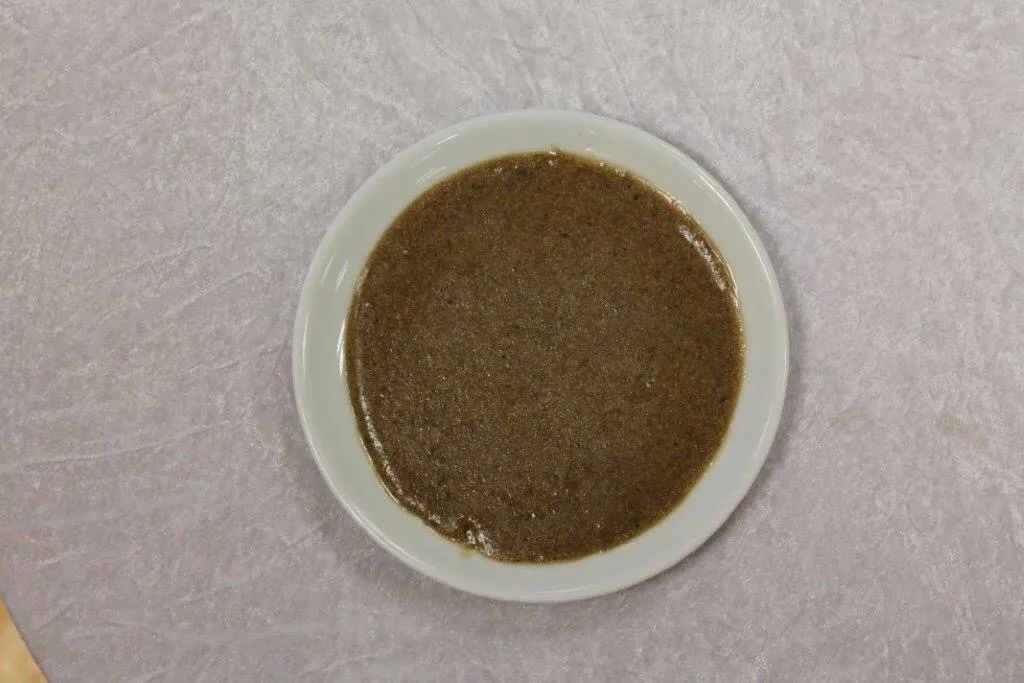
Roasted wheat grains are ground into flour in a stone mill and mixed with butter and honey.
History: The oldest breakfast halva made on the outskirts of Van Castle since the Urartians.
View Official Geographical Indication Dossier for Van Kavut →
2. Jirkan Rug (Halılar ve kilimler)
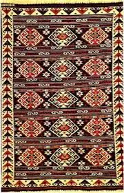
Jirkan Kilimi is an official Geographically Indicated value of ours, unique to the Van region and registered by the Turkish Patent and Trademark Office on 14.11.1997 (with registration number 22).
View Official Geographical Indication Dossier for Jirkan Rug →
3. Cembeli Dessert (Fırıncılık ve pastacılık mamulleri, hamur işleri, tatlılar)
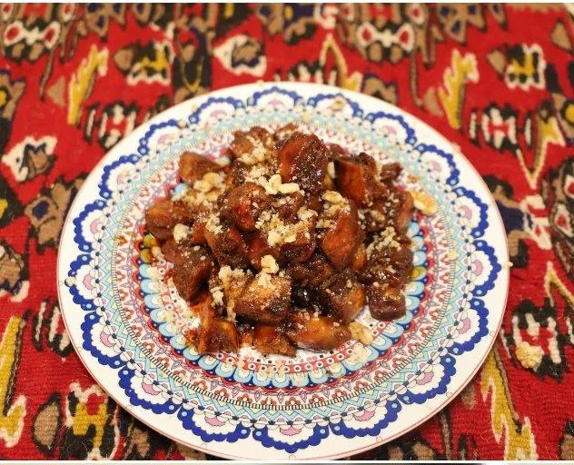
Cembeli Tatlı is a geographically indicated value of ours, unique to the Van region and registered by the Turkish Patent and Trademark Office on 03.04.2026 (with registration number 1837).
View Official Geographical Indication Dossier for Cembeli Dessert →
4. Van Savatlı Silver Embroidery (Halılar, kilimler ve dokumalar dışında kalan el sanatı ürünleri)
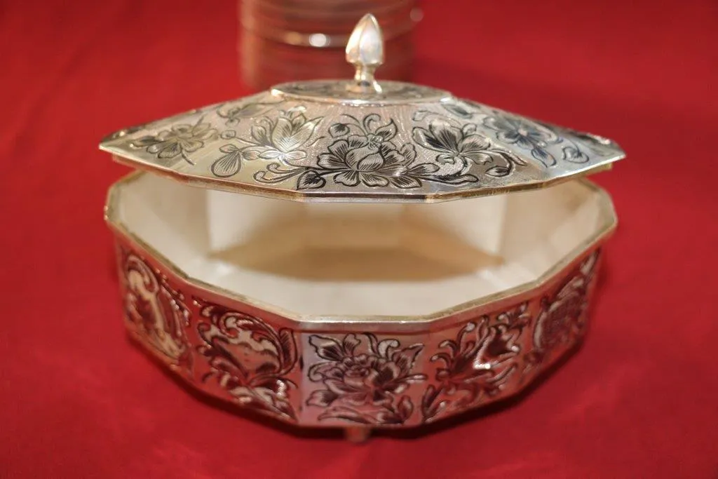
Van Savatlı Silver Processing is a value with an official Origin Name and geographical indication, unique to the Van region and registered by the Turkish Patent and Trademark Office on 23.11.2017 (with registration number 242).
View Official Geographical Indication Dossier for Van Savatlı Silver Embroidery →
5. Reşik (Halılar, kilimler ve dokumalar dışında kalan el sanatı ürünleri)
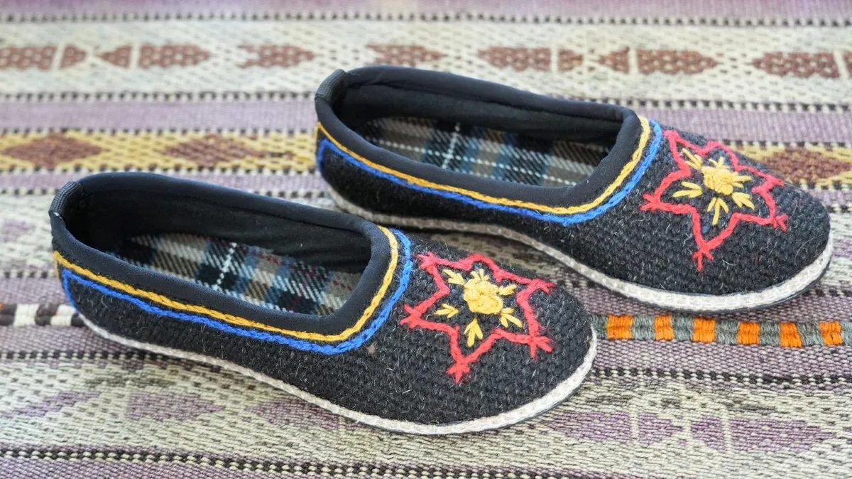
Reşik is an ancient handicraft shoe that is woven with traditional mastery on hand looms in the Van region from goat hair and sheep wool, keeps the feet warm in winter and cool in summer and is waterproof.
View Official Geographical Indication Dossier for Reşik →
6. Van Tava Dinner (Yemekler ve çorbalar)
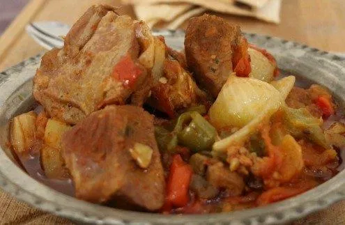
Lamb cubes, tail fat, green pepper, tomato and garlic cooked like pomegranate on a copper tray in a stone oven.
History: The famous banquet pan sent to the ovens in Niğde vineyard houses during the summer months.
View Official Geographical Indication Dossier for Van Tava Dinner →
Practical Travel & Transit Planning for Saray, Van (2026)
| Planning Category | Verified Local Information |
|---|---|
| Region & Administrative Center | Saray, Van, Türkiye |
| Best Time to Visit | Spring (April–June) and Autumn (September–November) for ideal sightseeing weather; Summer for highlands and coastal routes. |
| Public Transit & Highway Access | Regular municipal buses and local minibus cooperatives (Dolmuş) depart daily from the Van Intercity Bus Terminal (Otogar) directly to Saray. |
| Recommended Stay | 1 to 2 full days to explore the main historical landmarks, nature trails, and local culinary stops. |
Frequently Asked Questions About Visiting Saray, Van
What are the must-see places to visit in Saray, Van?
The top verified attractions in Saray, Van include Kapıköy Historical Train Station and Railway Crossing, Saray Observation Hill and Nature Trail, Palace Government Square and Republic Park, Keçikıran Mountain and Plateaus, Çaybağı Valley and Recreation Area. Each location offers documented historical or natural heritage with clear road access.
How can I get to Saray, Van by public transport or car?
You can reach Saray, Van easily by car via Van's main provincial highways, or take regular municipal buses and district minibuses departing throughout the day from the Van central bus terminal (Otogar).
What are the famous local dishes and traditional foods to try in Saray, Van?
When visiting Saray, Van and Van, be sure to taste officially registered specialties such as Van Kavut, Jirkan Rug, Cembeli Dessert, Van Savatlı Silver Embroidery, Reşik, prepared by local artisans and traditional restaurants.
Are the attractions in Saray, Van suitable for families and day trips?
Yes. Most historic monuments, parks, museums, and promenade areas in Saray, Van are family-friendly and well-suited for both weekend getaways and full-day cultural itineraries.
When is the best season to visit Saray, Van?
Spring and autumn offer the most comfortable temperatures for walking tours and photography in Saray, Van, while summer is popular for nature recreation, plateaus, and festivals.