
Planning a journey to Tuşba, Van? This comprehensive 2026 Winter Tourism & Ski Resorts guide brings together 10 verified landmarks, natural wonders, and cultural heritage sites with official visiting hours, GPS coordinates, public transit connections, and local gastronomy recommendations.
Quick Highlights & Discovery Route in Tuşba, Van
- Ayanis Ancient City and Haldi Temple
- Tuşba Government Square and City Park
- Historical Meher Kapı Urartian Open Air Temple
- Adır (Lim) Island and Historical Lim Monastery
- YYÜ Cat Villa and Van Cat Research Center
- Historical Yeşilköy (Canik) Rock Tombs and Cisterns
- Van Kavut
- Jirkan Rug
Winter Tourism, Snow Landscapes & Cozy Seasonal Travel Guide in Tuşba, Van
While many travelers associate Turkey with summer holidays, Tuşba, Van (Van) reveals a serene and atmospheric charm during the winter months. Snow-dusted hills, misty valleys, quiet historic streets, and hearty wood-fired Anatolian dishes make winter a rewarding season to discover Tuşba, Van.
- Winter Photography & Nature: Crisp morning light, snow-covered forests, and tranquil viewpoints offer extraordinary winter photography in Tuşba, Van.
- Warm Winter Gastronomy: Warm up at local artisan restaurants with hot regional soups, slow-cooked casseroles, salep, and herbal mountain teas.
- Road & Weather Preparation: Ensure your vehicle is equipped with winter tires and check provincial highway weather updates when traveling to higher elevations around Tuşba, Van.
Top Verified Winter Tourism & Ski Resorts & Must-See Landmarks in Tuşba, Van
1. Ayanis Ancient City and Haldi Temple

Free Public Access • GPS: 38.7083, 43.2117
History & True Legends / Legends
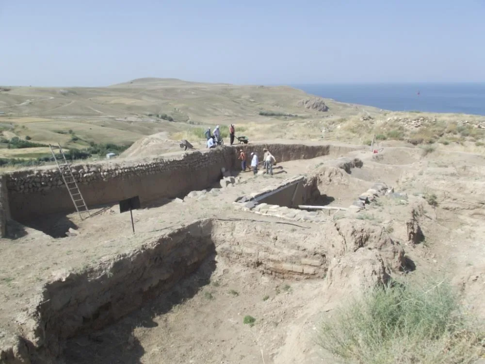
Ayanis Castle and Haldi Temple were built by the last great and powerful ruler of Urartu, II., between 645 and 643 BC. It is the best-preserved Urartian castle in world archaeology, built by Rusa on a steep hill on the eastern shore of Lake Van. God Haldi Temple located in the center of the castle; It is the highest aesthetic peak reached by Urartian religious architecture with its alabaster carving decorations, cuneiform inscriptions engraved on andesite blocks, lion and tree of life motifs. Bronze shields, helmets and votive items unearthed during excavations adorn museums around the world.
Geographical Structure & Altitude & Nature
It is located on the ridge of Ağartı village on the shores of Lake Van, at an altitude of approximately 1,860 meters. It is located on a steep rocky cape overlooking Lake Van and embraces the endless blue of the lake.
Visiting Hours & Days & Entrance Fee
- Entrance Fee: Visiting the ruins is free (special protected areas are visited with a guide during the excavation season).
- Visiting Hours and Days: Open 7 days a week between 08:30 - 18:30.
- Rules, Safety and Stroller/Disabled Access: The Haldi Temple and the stone blocks under its protective roofs should never be touched; Comfortable shoes should be worn on the walking path climbing the hill.
- Facilities and Facilities: The excavation house has information boards, a viewing platform and directional signs.
Real Transportation & Public Transport Lines & Open Location
- Address / Open Location: Ağartı (Ayanis) Village Location, Tuşba / Van.
- Road Condition and Vehicle Suitability: It is 35 km away from Van city center and the lake coastal road is asphalt; It can be easily reached by any kind of passenger vehicle.
- Real Public Transportation Information: You can reach the ruins with Ağartı (Ayanis) village minibuses departing from Van Bus Terminal and Tuşba district center.
- Parking Availability: There is a free open car parking area at the entrance of the ruins.
Contextual Experience Tips
- Featured Rare Artifacts & Exhibition Tips: Unique intaglio carved figures on the alabaster-covered walls of Haldi Temple and II. Monumental cuneiform inscription of Rusa.
- Culture & Coffee Stops around the Museum: You should watch the lake view while drinking brewed tea at the local fishermen's teahouses on the Ağartı coast.
- Visit Time: In the afternoon, the oblique sunlight illuminates the carved stone details of the temple in a fascinating way.
Explore Full 5-Section Guide & Map for Ayanis Ancient City and Haldi Temple →
2. Tuşba Government Square and City Park
Free Public Access • GPS: 38.5145, 43.3765
History and General Information / Local Legends and Folklore
Tuşba Government Square and City Park is the administrative, social and ceremonial heart of the district, which takes its name from Tuşpa, the legendary capital of the Urartian civilization. Equipped with extensive landscaping, the Atatürk Monument, ornamental pools and children's playgrounds, the square is a modern public center where the people of the district come together on public holidays and in the evenings.
Geographical Structure, Altitude and Natural Features
The altitude is approximately 1710 meters. It is a spacious urban gathering square in the northern part of the Van Plain.
Visiting Hours, Days and Entrance Fees
- Entrance Fee: Free.
- Visiting Hours and Days (Mandatory): Open 24 hours a day, 7 days a week.
- Rules, Safety and Stroller/Disabled Access: It is completely flat and suitable for disabled and stroller access.
- Facilities and Facilities: Rest benches, children's playground, ornamental pool and municipal service buildings.
Transportation, Public Transit Routes and Exact Location
- Address / Open Location: Kalecik Yolu Üzeri, Akşam Caddesi, 65040 Tuşba / Van.
- Road Condition and Vehicle Availability: Located in Tuşba district center; It is very easily accessible by any vehicle.
- Real Public Transportation Information (Mandatory): Tuşba municipal buses departing from Van center drop off directly at the square.
- Parking Availability: There are municipal parking areas around the square.
Contextual Experience Tips, Photography and Local Gastronomy
- Best Photography Spots and Frames: Ataturk Monument and modern architectural structures in the park.
- Local Gastronomy Recommendations: Hot Van buns and strong tea from the surrounding bakeries.
Explore Full 5-Section Guide & Map for Tuşba Government Square and City Park →
3. Historical Meher Kapı Urartian Open Air Temple
Free Public Access • GPS: 38.5284, 43.3752
History & True Legends / Legends
Meher Gate (Mihr Gate) is a monumental rock niche and sacred open-air temple, approximately 4 meters high, which was opened by the Urartian Kings İşpuini and his son Menua by shaving off the monolithic limestone cliff between 820 and 810 BC. The huge inscription known as the "Urartu Pantheon", engraved in Urartian cuneiform script on the inner surface of the door; It is the most complete and invaluable theological document in the world, listing the names of the 79 gods and goddesses in the Urartian religion, their order of importance, and the sacrifices (bull, sheep, etc.) to be offered to each of them. Many legends have been told among the people that this door opens to hidden treasures.
Geographical Structure & Altitude & Nature
It is located on the western slope of the Zimzim Mountains, on the Akköprü ridge, at an altitude of approximately 1,800 meters. It is on a high terrace overlooking the Van Plain and Van Castle.
Visiting Hours & Days & Entrance Fee
- Entrance Fee: Visiting the open-air monument is completely free.
- Visiting Hours and Days: It can be visited freely in daylight, 7 days a week.
- Rules, Security and Baby Stroller/Disabled Access: The cuneiform rock surface, which is the apple of the world's archaeology, should not be touched or damaged. Sturdy shoes should be worn on the trail.
- Facilities and Facilities: There is an information sign of the Ministry of Culture and Tourism and a landscaping area.
Real Transportation & Public Transport Lines & Open Location
- Address / Open Location: Beyüzümü (Akköprü Ridges) Location, Tuşba / Van.
- Road Condition and Vehicle Availability: It is only 5 km away from Van city centre; You can easily reach the foothills of the rocks via the asphalt road from the neighborhood.
- Real Public Transportation Information: It is within walking distance with the Beyüzümü and Akköprü city minibuses departing from Van Beşyol.
- Parking Availability: There are suitable roadside pockets where vehicles can be parked in the street below the monument.
Contextual Experience Tips
- Featured Rare Artifacts & Exhibition Tips: The 94-line cuneiform monumental inscription describing the Urartian pantheon of gods engraved on the rock should be examined carefully.
- Culture & Coffee Stops around the Museum: After the visit, you can go to the Van Museum and see the translations and replicas of the inscription.
- Visit Time: In the early morning hours, when the sunlight hits the door niche vertically, the cuneiform writings can be read very clearly.
Explore Full 5-Section Guide & Map for Historical Meher Kapı Urartian Open Air Temple →
4. Adır (Lim) Island and Historical Lim Monastery
Free Public Access • GPS: 38.8669, 43.3519
History and General Information / Local Legends and Folklore
- Adır Island (Lim Island), the largest island of Lake Van in terms of surface area, is a thousand-year-old historical retreat center with the Saint Georges (Surp Gevorg) Monastery, chapels and monk rooms built in 1305.
- In 1915, it became a historical shelter where thousands of innocent people around Van took shelter and survived.
- Legends tell that the reclusive clergy living on the island guided the boats to the shore with lights on stormy nights on the soda waters of Lake Van, and that the island was blessed with seagulls.
Geographical Structure, Altitude and Natural Features
- The altitude is approximately 1,650 meters above the lake level. It is located in the northeastern basin of Lake Van, approximately 2 km off the coast of Tuşba.
- The island, which is the breeding and incubation area of tens of thousands of Lake Van seagulls every spring, is a nature paradise with its untouched virgin nature.
- Almond trees, island cliffs and turquoise soda lake water offer a unique island ecosystem.
Visiting Hours, Days and Entrance Fees
- Entrance Fee: Visiting the island is free; A round-trip boat tour fee applies.
- Visiting Hours and Days: During the summer months, it can be visited by boat services 7 days a week during daylight hours.
- Rules, Safety and Baby Stroller/Disabled Access: Bird nests should not be approached during April-May, the breeding season of seagulls; Since the island terrain is full of paths, walking shoes are a must.
- Facilities and Facilities: It is a natural protected area; There are no commercial facilities on the island, visitors are recommended to bring water and supplies with them.
Transportation, Public Transit Routes and Exact Location
- Address / Open Location: Off Yaylıyaka (Gedelbulak) Village, Inside Van Lake, Tuşba / Van.
- Road Condition and Vehicle Availability: You can reach Tuşba Yaylıyaka Pier from Van center in 30 minutes via a 35 km asphalt road; From here, you can reach the island by boat in 15 minutes.
- Real Public Transportation Information: You can reach the pier by Yaylıyaka village minibuses departing from Van Bus Terminal.
- Parking Availability: Free car parking is available in the area along the Yaylıyaka pier.
Contextual Experience Tips, Photography and Local Gastronomy
- Best Photo Spots and Frames: Historical monastery ruins from the island ridge, flocks of seagulls soaring in the sky and the silhouette of Mount Süphan in the background.
- Light and Shooting Hours: Early morning and sunset golden hours.
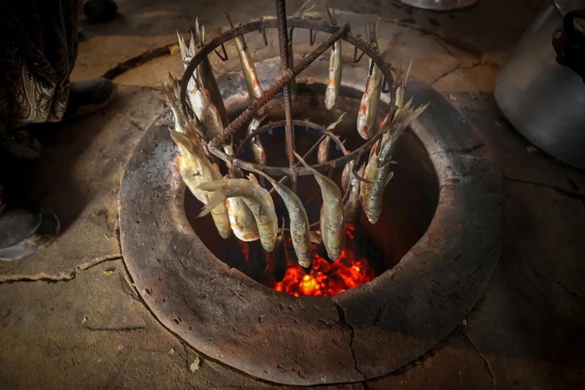
- Local Gastronomy Recommendations: After the trip, you should taste fresh fried pearl mullet from Lake Van at the fish restaurants on the Tuşba coast.
Explore Full 5-Section Guide & Map for Adır (Lim) Island and Historical Lim Monastery →
5. YYÜ Cat Villa and Van Cat Research Center
Ticketed / MuseumPass Check • GPS: 38.5772, 43.2874
History & True Legends / Legends
Van Cat Villa is an internationally registered research and living center established within Van Yüzüncü Yıl University in order to protect the world-famous endemic Van Cat breed, known for its world-famous amber-yellow eye and turquoise-blue blue color (heterochromia), silky white fur and noble temperament that loves to go into water. In this special facility, where genetic purity is preserved, hundreds of cute Van cats are raised with love in rooms with private gardens, and visitors are allowed to pet and feed the cats closely.
Geographical Structure & Altitude & Nature
It is located in a green garden at an altitude of approximately 1,660 meters, within the Zeve Campus of Van Yüzüncü Yıl University on the shores of Lake Van.
Visiting Hours & Days & Entrance Fee
- Entrance Fee: A small symbolic entrance fee is applied for the benefit of the university foundation.
- Visiting Hours and Days: It is open to visitors 7 days a week between 08:30 - 18:30.
- Rules, Security and Baby Stroller/Disabled Access: Cats should not be given food from outside, they should only be fed with appropriate food offered by the facility. The facility has a completely flat surface and is suitable for disabled and stroller access.
- Facilities and Facilities: Cat playgrounds, feeding areas, souvenir section, cafeteria, campus recreation parks and WC facilities are available.
Real Transportation & Public Transport Lines & Open Location
- Address / Open Location: YYÜ Zeve Campus, Bardakçı Mevkii, Tuşba / Van.
- Road Condition and Vehicle Availability: It is 14 km away from Van city center; The campus road is a double-lane wide asphalt and is easily accessible by all types of vehicles.
- Real Public Transportation Information: YYÜ Campus municipal buses and purple minibuses departing from Van center Beşyol and Maraş Streets pass directly in front of the cat villa.
- Parking Availability: There is a large and free university parking lot in front of the Cat Villa.
Contextual Experience Tips
- Featured Rare Artworks & Exhibition Tips: Moments in the playground of purebred mother cats and cute kittens who fascinate the world with their different colored eyes.
- Culture & Coffee Stops around the Museum: You can drink coffee in the cafeterias on the campus beach, accompanied by the breeze of Lake Van.
- Visiting Time: Early morning hours are feeding times when cats are most playful and energetic.
Explore Full 5-Section Guide & Map for YYÜ Cat Villa and Van Cat Research Center →
6. Historical Yeşilköy (Canik) Rock Tombs and Cisterns
Free Public Access • GPS: 38.8347, 43.4415
History and General Information / Local Legends and Folklore
Yeşilköy (Canik) Rock Tombs are multi-room monumental royal/noble tombs and water cisterns carved into limestone rocks with great skill during the Urartian Kingdom. It is one of the most striking examples of Urartian rock carving art within the borders of Tuşba, with its stepped entrances, klines and ceiling ventilation channels.
Geographical Structure, Altitude and Natural Features
The altitude is approximately 1710 meters. It contains rocky slopes and almond groves overlooking the shores of Lake Van.
Visiting Hours, Days and Entrance Fees
- Entrance Fee: Free.
- Visiting Hours and Days (Mandatory): It can be visited in daylight 7 days a week.
- Rules, Safety and Stroller/Disabled Access: It is rocky terrain; Walking shoes with non-slip soles should be worn.
- Facilities and Facilities: It is a natural archaeological site.
Transportation, Public Transit Routes and Exact Location
- Address / Open Location: Yeşilköy (Canik) Mevkii, 65040 Tuşba / Van.
- Road Condition and Vehicle Availability: It is 18 km away from the center of Tuşba; It can be reached via an asphalt and stabilized village road.
- Real Public Transportation Information (Mandatory): It can be reached by coastal village minibuses departing from the district bus station.
- Parking Availability: There is a parking area at the foot of the cliff.
Contextual Experience Tips, Photography and Local Gastronomy
- Best Photography Spots and Frames: Frames opening from the rock tomb gate to the blue of Lake Van.
- Local Gastronomy Recommendations: Fresh village lavash and Van herbed cheese.
Explore Full 5-Section Guide & Map for Historical Yeşilköy (Canik) Rock Tombs and Cisterns →
7. Çarpanak Island and Historical Ktouts Monastery
Free Public Access • GPS: 38.6053, 43.0905
History & True Legends / Legends
Çarpanak Monastery (Ktouts Monastery) is a historical monastery complex on Çarpanak Island off the northeast coast of Lake Van, built in the 9th or 11th century and expanded by Mimar Minas in the 15th century. This monastery dedicated to St. John; It was an important manuscript duplication center (scriptorium) of Eastern Christianity during the Middle Ages. The island, whose large domed main church (Surp Karapet), jamatun front hall and chapels survive today; It has a fairytale-like serenity with its untouched nature adorned with almond flowers in spring and bird colonies where thousands of seagulls nest.
Geographical Structure & Altitude & Nature
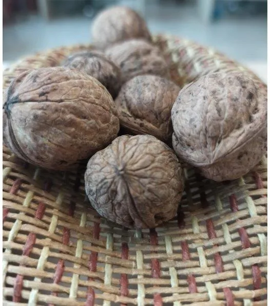
It is on an island located on Lake Van, off the Çitören village of Tuşba, at an altitude of approximately 1,675 meters. It is surrounded by turquoise lake waters, limestone cliffs, and almond and walnut trees.
Visiting Hours & Days & Entrance Fee
- Entrance Fee: Visiting the island and the historical monastery is free (boat rental fee is paid from Çitören fishing shelter).
- Visiting Hours and Days: It can be visited 7 days a week during daylight hours by boat trips.
- Rules, Safety and Stroller/Disabled Access: Historic church walls and fresco traces should not be touched; Bird nests should not be approached during the spring months, which is the breeding season of seagulls.
- Facilities and Facilities: There are no commercial facilities on the island; nature and history are preserved untouched.
Real Transportation & Public Transport Lines & Open Location
- Address / Open Location: Çarpanak Island, Off Çitören Village, Tuşba / Van.
- Road Condition and Vehicle Availability: It is 25 km asphalt road from Van center to Çitören fishing pier; From here you can reach the island with a 15-minute boat ride.
- Real Public Transportation Information: From Van center, Çitören village minibuses come to the pier and local boats take the transit.
- Parking Availability: Free secure car parking is available at Çitoren fishing shelter.
Contextual Experience Tips
- Best Photo Spots and Frames: As you approach the island by boat, the stone monastery dome rising in the middle of the turquoise lake and Mount Süphan in the background.
- Light and Shooting Times: The calm waters of the early morning and the golden hours of the evening are perfect for photography.
- Local Gastronomy Recommendations: Before going to the island, you should taste freshly cooked pearl mullet from local fishermen in Çitören village.
Explore Full 5-Section Guide & Map for Çarpanak Island and Historical Ktouts Monastery →
8. Molla Kasım Blue Flag Public Beach and Coastal Park
Free Public Access • GPS: 38.6341, 43.1425
History & True Legends / Legends
Molla Kasım Public Beach is the first and only registered holiday beach in Türkiye that was awarded the "Blue Flag" award by the International Environmental Education Foundation, even though it does not have a seashore. This beach, combined with the refreshing effect of the soda and healing waters of Lake Van that is good for the skin; It is the most prestigious summer tourism center in Eastern Anatolia, reminiscent of the Mediterranean, with its clear turquoise waters, pristine beach and modern social facilities.
Geographical Structure & Altitude & Nature
It is located on the northern shore of Lake Van, in Molla Kasım bay, at an altitude of approximately 1,648 meters. It has an ideal nature for swimming with its fine sand, clear water and sheltered bay structure.
Visiting Hours & Days & Entrance Fee
- Entrance Fee: Entrance to the public beach is completely free; Sun loungers, umbrellas and changing cabins are subject to the municipality's nominal fee.
- Visiting Hours and Days: Open 7 days a week between 08:00 - 20:00 during the summer season.
- Rules, Safety and Stroller/Disabled Access: Lifeguard supervised; There are disabled ramps and a disabled launching mechanism.
- Facilities and Facilities: There is a lifeguard tower, showers, changing cabins, sun lounger areas, cafeteria, children's playground, prayer room and modern WCs.
Real Transportation & Public Transport Lines & Open Location
- Address / Open Location: Molla Kasım Mahallesi, Sahil Caddesi, Tuşba / Van.
- Road Condition and Vehicle Availability: It is 30 km away from Van city center; The road is completely wide asphalt and can be easily reached by any passenger vehicle.
- Real Public Transportation Information: During the summer season, regular municipal public buses and private minibuses depart from Van city center to Molla Kasım Beach.
- Parking Availability: There is a large free parking area with a capacity for hundreds of vehicles at the entrance of the beach facility.
Contextual Experience Tips
- Best Photography Spots and Frames: Summer photos combining deep blue lake waves, the waving Blue Flag and the snowy peaks on the opposite shore.
- Light and Shooting Hours: The clear sunlight of the morning and the pastel purple colors of the lake at sunset.
- Local Gastronomy Recommendations: Ice-cold highland ayran and Van watermelon should be consumed at the beach cafe.
Explore Full 5-Section Guide & Map for Molla Kasım Blue Flag Public Beach and Coastal Park →
9. Tuşba Beach Park and Pier Promenade
Free Public Access • GPS: 38.5238, 43.3167
History and General Information / Local Legends and Folklore
Tuşba Coastal Park and Pier Promenade is the largest coastal recreation area in Eastern Anatolia, built on the coast of the Van Sea. The promenade stretching next to the historical ferry pier is the city's most popular attraction for watching the sunset over the soda waters of Lake Van, taking coastal walks and relaxing with the sounds of seagulls.
Geographical Structure, Altitude and Natural Features
The altitude is approximately 1650 meters. The shores of Lake Van contain reeds and coastal dunes.
Visiting Hours, Days and Entrance Fees
- Entrance Fee: Free.
- Visiting Hours and Days (Mandatory): Open 24 hours a day, 7 days a week.
- Rules, Safety and Stroller/Disabled Access: It is a completely flat cord and is perfectly suitable for disabled people and strollers.
- Facilities and Facilities: Bicycle paths, walking promenade, viewing piers, cafes, children's playgrounds and parking.
Transportation, Public Transit Routes and Exact Location
- Address / Open Location: İskele Mahallesi, Sahil Caddesi, 65040 Tuşba / Van.
- Road Condition and Vehicle Availability: It is 6 km away from Van center; It can be reached comfortably by any vehicle via the divided asphalt road.
- Real Public Transportation Information (Mandatory): İskele municipal buses depart regularly from Van center and drop off directly at the cordon.
- Parking Availability: Ample free municipal parking lots are available along the beach.
Contextual Experience Tips, Photography and Local Gastronomy
- Best Photography Points and Frames: Süphan Mountain and sunset reflections on the horizon of the lake from the pier.
- Local Gastronomy Recommendations: Fresh pearl mullet and halva cooked in tandoor at seaside restaurants.
Explore Full 5-Section Guide & Map for Tuşba Beach Park and Pier Promenade →
10. Toprakkale (Rusahinili) Urartu Castle and Acropolis
Free Public Access • GPS: 38.6909, 43.2392
History and General Information / Local Legends and Folklore
Toprakkale was built by Urartu King II in the 7th century BC. It is the second Urartian capital founded by Rusa and called 'Rusahinili'. The Haldi Temple ruins, palace foundations, huge water cisterns and famous bronze shields in the castle built on a rocky ridge are world-class masterpieces of the Urartian mining and architectural genius.
Geographical Structure, Altitude and Natural Features
The altitude is approximately 1820 meters. It is on a steep limestone hill overlooking the Van Plain and the city.
Visiting Hours, Days and Entrance Fees
- Entrance Fee: Free.
- Visiting Hours and Days (Mandatory): It can be visited in daylight 7 days a week.
- Rules, Safety and Stroller/Disabled Access: It is a rocky cliff trail; Walking shoes must be worn.
- Facilities and Facilities: Archaeological site and information signs.
Transportation, Public Transit Routes and Exact Location
- Address / Open Location: Şerefiye Mahallesi Ridges, 65040 Tuşba / Van.
- Road Condition and Vehicle Availability: 3 km from Van center; You can easily reach the foot of the hill via an asphalt road.
- Actual Public Transportation Information (Mandatory): It can be reached by using local minibuses up to the hillside and a short climb.
- Parking Availability: There is a car park at the foot of the hill.
Contextual Experience Tips, Photography and Local Gastronomy
- Best Photography Spots and Frames: Magnificent panorama of Van city, Van Lake and Van Castle from the Acropolis ridge.
- Local Gastronomy Recommendations: Van honey, clotted cream and hot tandoori buns at local breakfast rooms upon landing.
Explore Full 5-Section Guide & Map for Toprakkale (Rusahinili) Urartu Castle and Acropolis →
What to Eat in Tuşba, Van? Registered Local Delicacies & Gastronomy
A trip to Tuşba, Van is incomplete without tasting its officially registered geographical indication products and centuries-old Anatolian recipes:
1. Van Kavut (Yemekler ve çorbalar)
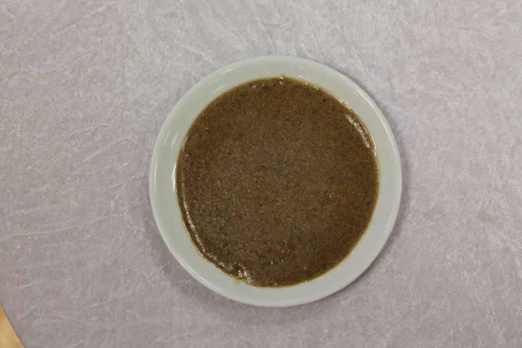
Roasted wheat grains are ground into flour in a stone mill and mixed with butter and honey.
History: The oldest breakfast halva made on the outskirts of Van Castle since the Urartians.
View Official Geographical Indication Dossier for Van Kavut →
2. Jirkan Rug (Halılar ve kilimler)
Jirkan Kilimi is an official Geographically Indicated value of ours, unique to the Van region and registered by the Turkish Patent and Trademark Office on 14.11.1997 (with registration number 22).
View Official Geographical Indication Dossier for Jirkan Rug →
3. Cembeli Dessert (Fırıncılık ve pastacılık mamulleri, hamur işleri, tatlılar)
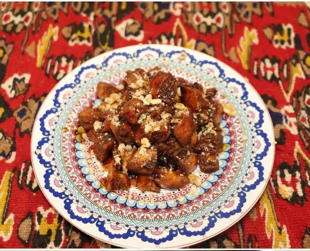
Cembeli Tatlı is a geographically indicated value of ours, unique to the Van region and registered by the Turkish Patent and Trademark Office on 03.04.2026 (with registration number 1837).
View Official Geographical Indication Dossier for Cembeli Dessert →
4. Van Savatlı Silver Embroidery (Halılar, kilimler ve dokumalar dışında kalan el sanatı ürünleri)
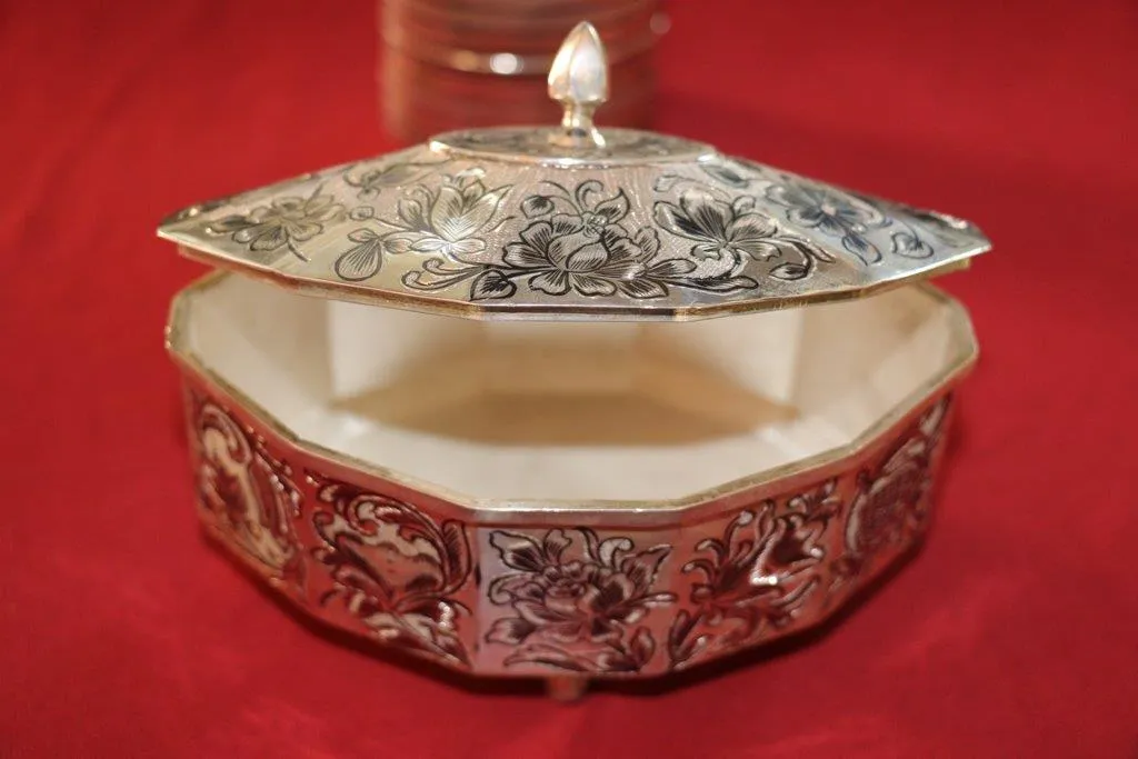
Van Savatlı Silver Processing is a value with an official Origin Name and geographical indication, unique to the Van region and registered by the Turkish Patent and Trademark Office on 23.11.2017 (with registration number 242).
View Official Geographical Indication Dossier for Van Savatlı Silver Embroidery →
5. Reşik (Halılar, kilimler ve dokumalar dışında kalan el sanatı ürünleri)
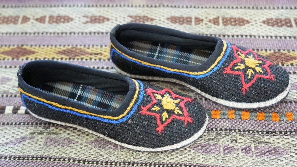
Reşik is an ancient handicraft shoe that is woven with traditional mastery on hand looms in the Van region from goat hair and sheep wool, keeps the feet warm in winter and cool in summer and is waterproof.
View Official Geographical Indication Dossier for Reşik →
6. Van Tava Dinner (Yemekler ve çorbalar)
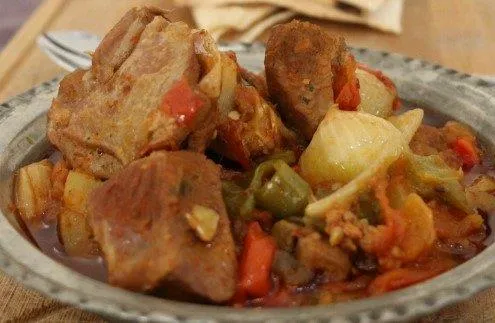
Lamb cubes, tail fat, green pepper, tomato and garlic cooked like pomegranate on a copper tray in a stone oven.
History: The famous banquet pan sent to the ovens in Niğde vineyard houses during the summer months.
View Official Geographical Indication Dossier for Van Tava Dinner →
Practical Travel & Transit Planning for Tuşba, Van (2026)
| Planning Category | Verified Local Information |
|---|---|
| Region & Administrative Center | Tuşba, Van, Türkiye |
| Best Time to Visit | Spring (April–June) and Autumn (September–November) for ideal sightseeing weather; Summer for highlands and coastal routes. |
| Public Transit & Highway Access | Regular municipal buses and local minibus cooperatives (Dolmuş) depart daily from the Van Intercity Bus Terminal (Otogar) directly to Tuşba. |
| Recommended Stay | 1 to 2 full days to explore the main historical landmarks, nature trails, and local culinary stops. |
Frequently Asked Questions About Visiting Tuşba, Van
What are the must-see places to visit in Tuşba, Van?
The top verified attractions in Tuşba, Van include Ayanis Ancient City and Haldi Temple, Tuşba Government Square and City Park, Historical Meher Kapı Urartian Open Air Temple, Adır (Lim) Island and Historical Lim Monastery, YYÜ Cat Villa and Van Cat Research Center. Each location offers documented historical or natural heritage with clear road access.
How can I get to Tuşba, Van by public transport or car?
You can reach Tuşba, Van easily by car via Van's main provincial highways, or take regular municipal buses and district minibuses departing throughout the day from the Van central bus terminal (Otogar).
What are the famous local dishes and traditional foods to try in Tuşba, Van?
When visiting Tuşba, Van and Van, be sure to taste officially registered specialties such as Van Kavut, Jirkan Rug, Cembeli Dessert, Van Savatlı Silver Embroidery, Reşik, prepared by local artisans and traditional restaurants.
Are the attractions in Tuşba, Van suitable for families and day trips?
Yes. Most historic monuments, parks, museums, and promenade areas in Tuşba, Van are family-friendly and well-suited for both weekend getaways and full-day cultural itineraries.
When is the best season to visit Tuşba, Van?
Spring and autumn offer the most comfortable temperatures for walking tours and photography in Tuşba, Van, while summer is popular for nature recreation, plateaus, and festivals.