
Planning a journey to Ardahan? This comprehensive 2026 Festivals & Cultural Events guide brings together 10 verified landmarks, natural wonders, and cultural heritage sites with official visiting hours, GPS coordinates, public transit connections, and local gastronomy recommendations.
Quick Highlights & Discovery Route in Ardahan
- Historical Ardahan Castle
- Çıldır Lake and Winter Tourism Area
- Historical Ardahan Castle and Kura River Promenade
- Historic Russian Baltic Architecture Stone Buildings (Congress Building and Mansions)
- Historical Bülbülan Plateau and Nature Trail
- Yalnızçam Ski Center and Plateau
- Posof Apple / Badele Apple
- Ardahan Flower Honey
Local Festivals, Harvest Celebrations & Cultural Events Calendar in Ardahan
Throughout the year, Ardahan (Ardahan) celebrates its agricultural abundance, highland heritage, and centuries-old Anatolian traditions with vibrant local festivals, harvest fairs, and municipal cultural events. Attending a local festival in Ardahan gives travelers a genuine window into local music, folk dances, artisan markets, and communal hospitality.
- Traditional Harvest & Highland Festivals: Celebrated mainly from late spring through autumn, highlighting Ardahan's signature crops, honey, fruits, and culinary heritage.
- Open-Air Concerts & Folk Shows: Municipal squares and festival grounds in Ardahan host traditional folk ensembles, local artisans, and family-friendly evening events.
- Visitor Tip: Check official municipal announcements before your trip and book accommodation early during major summer and autumn festival weekends.
Top Verified Festivals & Cultural Events & Must-See Landmarks in Ardahan
1. Historical Ardahan Castle

Free Public Access • GPS: 41.1140, 42.7020
History and General Information / Local Legends and Folklore
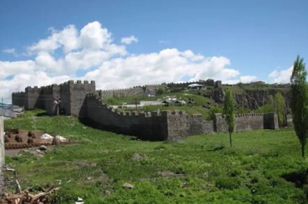
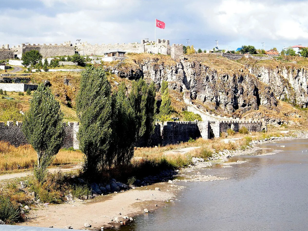
The historical Ardahan Castle is a magnificent border fortification rising on a rocky hill on the northern bank of the Kura River, rebuilt on Seljuk foundations in the 16th century by the order of the Ottoman sultan Suleiman the Magnificent. Polygonal planned castle; It is one of the most intact military castles of Eastern Anatolia that has survived to the present day, with its 14 half-round and polygonal towers, battlemented stone walls, Ottoman inscription on the entrance gate and inner castle. According to local legend, it is said that the castle provided uninterrupted water supply for Ottoman soldiers during sieges, thanks to its secret water gate and tunnels overlooking the Kura River, and that it was considered the spiritual protector of the city.
Geographical Structure, Altitude and Natural Features
It is located on a steep rock terrace on the banks of the Kura River, at an altitude of approximately 1,830 meters. It dominates the view of the river valley, poplar trees and the Yalnızçam Mountains surrounding the city.
Visiting Hours, Days and Entrance Fees
- Entrance Fee: Visiting the castle courtyard and the city walls is completely free.
- Visiting Hours and Days: It is open to visitors 7 days a week between 08:00 - 20:00.
- Rules, Security and Baby Stroller/Disabled Access: Care should be taken on the steps of the city walls and around the edges of the bastions. The castle courtyard has flat ground and is accessible for baby strollers and disabled chairs.
- Facilities and Facilities: There are walking paths inside the castle, a cafeteria, observation terraces, rest benches and WC.
Transportation, Public Transit Routes and Exact Location
- Address / Open Location: Halil Efendi Mahallesi, Kale Caddesi, Merkez / Ardahan.
- Road Condition and Vehicle Availability: It can be reached in 3 minutes by crossing the Kura River bridge in Ardahan city centre; It can be easily reached by any kind of passenger vehicle.
- Real Public Transport Information: Urban minibuses carry passengers to the castle gate; It can be reached by walking from the center in 10 minutes.
- Parking Availability: There is a large free outdoor parking lot at the entrance of the castle.
Contextual Experience Tips, Photography and Local Gastronomy
- Best Photography Spots and Frames: The angle of the historical bridge over the Kura River, framing the stone bastions of the castle and the mighty mountains behind it.
- Light and Shooting Hours: The red tones gained by the stone walls of the castle during the sunset golden hour in the evening and evening lighting.
- Local Gastronomy Recommendations: Ardahan goose meat tiridi, kete and buttermilk at the restaurants along the river at the exit of the castle.
Explore Full 5-Section Guide & Map for Historical Ardahan Castle →
2. Çıldır Lake and Winter Tourism Area

Free Public Access • GPS: 41.0580, 43.2116
History and General Information / Local Legends and Folklore
Çıldır Lake, with its altitude of 1,959 meters and a surface area of 123 square kilometers, is the second largest lake in the Eastern Anatolia Region after Lake Van and the apple of the eye of winter tourism. During the winter months, when the temperature drops to minus 30 degrees, the lake surface freezes completely and is covered with a massive layer of ice 40 to 80 centimeters thick. On the frozen lake, a centuries-old tradition of horse-drawn sleigh rides is carried out, and fishermen pierce the ice layer with pickaxes and cast nets "Eskimo style" to catch the delicious yellowfish (carp) unique to the lake. Local legend tells that there was once a rich brain farm on the site of the lake, and when the brain forgot to open the lid of the spring, the gushing waters flooded the plain and created this freezing lake.
Geographical Structure, Altitude and Natural Features
Çıldır, a tectonic and lava dam lake, is surrounded by plateaus and volcanic hills at an altitude of 1,959 meters. While it turns into a white ice desert in winter, in summer it is a breeding ground for its cool waters and hundreds of migratory water birds such as pelicans and shepherds.
Visiting Hours, Days and Entrance Fees
- Entrance Fee: Visiting the lakeshore and ice area is completely free; Sleigh tours are subject to local operating tariffs.
- Visiting Hours and Days: It can be visited freely in daylight, 7 days a week; Sledding and fishing activities on ice take place between December and March.
- Rules, Safety and Baby Stroller/Disabled Access: Only safe routes should be used on the frozen lake, with designated and ice thickness approved, and cracked areas should be avoided; Thermal snow clothes should be worn in winter. Coastal facilities are flat and suitable for disabled access.
- Facilities and Facilities: There are fish restaurants, country cafes, sleigh departure points, WC and rest areas on the lake shore.
Transportation, Public Transit Routes and Exact Location
- Address / Open Location: Taşbaşı and Akçakale Villages Beach, Çıldır / Ardahan.
- Road Condition and Vehicle Availability: It is 15 km from Çıldır town centre, 45 km from Ardahan city centre, and 65 km from Kars; It can be easily reached by passenger vehicles with winter tires via the asphalt highway, which is cleared of snow in winter.
- Real Public Transportation Information: You can come directly to the lakeside facilities with Çıldır minibuses and tour shuttles departing from Ardahan and Kars centre.
- Parking Availability: There is a large free outdoor parking lot in front of the lakeside facilities.
Contextual Experience Tips, Photography and Local Gastronomy
- Best Photo Spots and Frames: Snowflakes flying behind horse-drawn sleighs on a frozen lake, the moment of ice penetration, and golden reflections hitting the ice surface at sunset.
- Light and Shooting Hours: Crystalline frost sparkles in the early morning and sunset golden hour in the evening.
- Local Gastronomy Recommendations: Fresh Çıldır yellowfish fried like a pomegranate in butter, halvah and samovar tea at the lakeside restaurants.
Explore Full 5-Section Guide & Map for Çıldır Lake and Winter Tourism Area →
3. Historical Ardahan Castle and Kura River Promenade

Free Public Access • GPS: 41.1172, 42.7021
History and General Information / Local Legends and Folklore
Rising on the strategic hill where the Kura River curves, the Historical Ardahan Castle was built on the foundations of ancient defensive walls by the order of the Ottoman Sultan Suleiman the Magnificent in the mid-16th century. It is the most magnificent Ottoman military fortification in the transition corridor between Eastern Anatolia and the Caucasus.
Architectural Structure and Details
The castle walls, which have a polygonal plan almost square, are built with smooth cut basalt stones and Khorasan mortar. 14 half-round and polygonal bastions rise along the 745-meter-long city walls. The inscription on the entrance gate is a classic example of Ottoman military inscription art.
Spiritual Visiting Etiquette and Commemoration Guidelines
When you go up to the castle bastions, you can see the serenity of the winding Kura River on one side, and the panoramic view of the Ardahan Plain and Yalnızçam Mountains on the other. Strolling along the riverside promenade accompanied by the sounds of water gives you a unique tranquility.
Practical Visiting Tips & Transportation / Check-in
It is located in Ardahan city center, Halil Efendi District. It can be reached on foot in 5 minutes from the city centre. It is open to visitors all day long and is free of charge; Thanks to its lighting, it also has a magnificent view at night.
Surrounding Routes & Local Gastronomy Discovery
It provides a complete city tour with the Historical Bath Ruins, Kura Bridge and Russian Baltic Architecture Congress Building. After the trip, you should drink tea with registered Ardahan kashar, feselli, crispy and local kete at the restaurants in the center.
- Address / Open Location: Historical Ardahan Castle and Kura River Coastal Promenade Location, Center, Ardahan, Türkiye
Explore Full 5-Section Guide & Map for Historical Ardahan Castle and Kura River Promenade →
4. Historic Russian Baltic Architecture Stone Buildings (Congress Building and Mansions)
Free Public Access • GPS: 41.1105, 42.7015
History and General Information / Local Legends and Folklore
Historical Baltic Architecture Buildings in Ardahan are extraordinary stone structures built by Tsarist Russia with the plans of Dutch and Russian engineers during the 40-year Russian occupation between 1878 and 1918. These structures were built by interlocking black cut andesite and basalt stones without mortar; It creates a unique urbanism texture with its wide corridors, high ceilings, grooved recessed columns, exterior reliefs and decorated historical tile stoves called "petch" that heat the rooms. The most important of these buildings is the I. and II. buildings, which were one of the first steps of the War of Independence in 1919. It is the Historical Congress Building where Ardahan Congresses are held.
Geographical Structure, Altitude and Natural Features
It is located on the grid-planned streets (Atatürk and İnönü Streets) in Ardahan city center, at an altitude of approximately 1,825 meters.
Visiting Hours, Days and Entrance Fees
- Entrance Fee: Examining the historical streets and exterior architecture of the buildings is completely free.
- Visiting Hours and Days: It can be visited at any time of the day, 7 days a week.
- Rules, Safety and Stroller/Disabled Access: The privacy of buildings used as government offices or residences must be respected. The streets are completely level and very accessible for strollers and disabled chairs.
- Facilities and Amenities: There are cafes, restaurants, shops and recreation areas on the ground floors of historical buildings.
Transportation, Public Transit Routes and Exact Location
- Address / Open Location: Kaptanpaşa and İnönü Neighborhoods, Center / Ardahan.
- Road Condition and Vehicle Suitability: Located on the main streets of the city center; It can be easily reached by passenger vehicles.
- Real Public Transportation Information: All minibus lines within the city of Ardahan pass through these historical streets.
- Parking Availability: Municipal parking lots along the street and in the square can be used.
Contextual Experience Tips, Photography and Local Gastronomy
- Best Photo Spots and Frames: Symmetrical windows and crown gates of black cut stone buildings and the monumental facade of the Historic Capitol Building.
- Light and Shooting Hours: Oblique sunlight revealing the reliefs on the surface of the stones in the morning and afternoon hours.
- Local Gastronomy Recommendations: Hot kete and chechil cheese pastry from local bakeries on the historical street.
5. Historical Bülbülan Plateau and Nature Trail
Free Public Access • GPS: 41.0641, 42.3067
Historical Bülbülan Plateau and Nature Trail
History and General Information / Local Legends and Folklore
- Bülbülan Plateau, located at the summit where the Eastern Black Sea mountains and the Eastern Anatolian plateau meet, has been the ancient caravan and fairground stopping place of nomadic plateauers, lovers and merchants for centuries.
- According to local legends, it is said that the plateau got its name from the singing of nightingales feeding on wild flowers of many colors and that the water of the plateau bestows youth and vitality.
- The traditional plateau fair held every summer is a lively cultural festival where Ardahan and Black Sea cultures embrace with horon and halay.
Geographical Structure, Altitude and Natural Features
- Located at an altitude of approximately 2550 meters above sea level, the plateau is located on endless alpine meadows and volcanic basalt ridges.
- Surrounded by snowy peaks, yellow field daisies, inverted tulips and crystal clear snowmelt springs for eight months of the year.
Visiting Hours, Days and Entrance Fees
- Entrance Fee: Entrance to the plateau area and viewing hills is completely free.
- Visiting Hours and Days: It is open to the public 24 hours a day, 7 days a week during the summer months (June - October).
- Rules, Safety and Stroller/Disabled Access: High altitude mountain climate prevails; A windbreaker and warm clothing should be taken. The plateau plains are grassy and comfortable walking shoes are a must.
- Facilities and Facilities: During the plateau season, traditional nomad coffeehouses, organic plateau products sales tents and fountains are available.
Transportation, Public Transit Routes and Exact Location
- Address / Open Location: Ardahan - Şavşat Provincial Border, Bülbülan Geçidi Location, Center / Ardahan.
- Road Condition and Vehicle Availability: It is 28 km away from Ardahan city center; The highway route can be easily accessed by all types of vehicles on a divided asphalt road.
- Real Public Transportation Information: All district and village minibuses going from Ardahan Bus Terminal towards Şavşat and Artvin drop off passengers from the plateau pass.
- Parking Availability: There are large and free car parking areas in the Yayla Fair Square.
Contextual Experience Tips, Photography and Local Gastronomy
- Best Photography Spots and Frames: Double-horizon panoramic view frame from the summit ridges, covering the cloud sea of the Black Sea on one side and the endless Ardahan plain on the other.
- Light and Shooting Hours: Early morning cloud sea moment (07:30 - 09:30) and sunset red.
- Local Gastronomy Recommendations: You should try hot plateau kuymak, gogermiş cheese, kete and fresh plateau butter cooked from freshly milked cow's milk in the plateau camps.
Explore Full 5-Section Guide & Map for Historical Bülbülan Plateau and Nature Trail →
6. Yalnızçam Ski Center and Plateau
Free Public Access • GPS: 41.0426, 42.5215
History and General Information / Local Legends and Folklore
Yalnızçam Ski Center and Plateau is a first-class winter and nature sports center located on the slopes of Uğurludağ, which reaches a peak of 2,715 meters, with a modern chair lift with a closed cabin at European standards and crystal powder snow quality. The center, where the crystal snow structure unique to the Alps is preserved throughout the season, is protected from the wind by its tracks surrounded by Scots pine forests. In the summer months, it turns into a lush plateau full of colorful flowers and hosts plateau festivals. According to local legend, it is believed that the only great pine tree at the top of the Yalnızçam Mountains protects the mountains and that the springs of the plateau are the elixir of youth.
Geographical Structure, Altitude and Natural Features
It is located at the foothills of Uğurludağ, at an altitude of 2,050 to 2,715 meters. Lush green Scots pine forests, wide plateau plains and clear high altitude air prevail.
Visiting Hours, Days and Entrance Fees
- Entrance Fee: Entrance to the center and plateau is free; Mechanical facility and ski rental are subject to operating tariffs.
- Visiting Hours and Days: Open 7 days a week between 09:00 - 16:30 during the winter season (December-April); In summer, the plateau can be visited 24 hours a day.
- Rules, Safety and Stroller/Disabled Access: Helmet and ski safety rules must be followed during the winter months; Thermal clothing should be worn. Visitor facilities are flat and disabled accessible.
- Facilities and Facilities: There is a 3-kilometer indoor cabin chair lift, ski rental center, ski room, cafeteria, hotel, children's track and parking lot.
Transportation, Public Transit Routes and Exact Location
- Address / Open Location: Yalnızçam Köyü Mevkii, Uğurludağ Foothills, Center / Ardahan.
- Road Condition and Vehicle Availability: It is 20 km away from Ardahan city center; It can be easily reached by passenger vehicles with winter tires via the asphalt highway, which is constantly cleared of snow in winter.
- Real Public Transportation Information: During the ski season, shuttles depart from Ardahan city center on weekends and every day.
- Parking Availability: There is a large free outdoor parking area in front of the facility.
Contextual Experience Tips, Photography and Local Gastronomy
- Best Photography Spots and Frames: Breathtaking panoramic view of the Ardahan Plain and the Caucasus Mountains from the 2,715 meter summit station, reached by chairlift.
- Light and Shooting Hours: Noon hours when crystal snow shines like diamonds on sunny winter days.
- Local Gastronomy Recommendations: Hot sausage bread, sahlep and baked halva in the mountain cafe after skiing.
Explore Full 5-Section Guide & Map for Yalnızçam Ski Center and Plateau →
7. Çamlıçatak Forest Park and Recreation Area
Free Public Access • GPS: 41.1245, 42.8300
Çamlıçatak Forest Park and Recreation Area
History and General Information / Local Legends and Folklore
- The forest park, located in Çamlıçatak (formerly Gölebert) location, 14 km south of Ardahan city center, near the Ardahan University campus, is the city's most popular nature recreation and recreation area.
- It is a great Scots pine grove where the people of Serhat have gathered for centuries to cool off in the summer months, have family picnics and organize traditional festivals.
Geographical Structure, Altitude and Natural Features
- Its altitude is 1,880 meters; It is covered with dense Scots pine forests covering an area of 25 hectares.
- The forest interior is richly decorated with thyme, fern and mountain flowers; It offers healing to asthma and respiratory tract with its clean air and resin smell.
Visiting Hours, Days and Entrance Fees
- Entrance Fee: It is a public municipality and forest recreation area and entrance is completely free.
- Visiting Hours and Days: Open 7 days a week between 08:00 - 21:00.
- Rules and Safety: During picnics, fires should be lit only in designated pit areas, and the forest should be kept clean.
- Facilities and Facilities: Wooden picnic pergolas, children's playgrounds, fountains, volleyball court, walking paths and WC are available.
Transportation, Public Transit Routes and Exact Location
- Address / Open Location: Çamlıçatak Köyü Orman Mevkii, 75100 Merkez / Ardahan.
- Road Condition: Ardahan-Lake can be easily reached by passenger vehicles in just 12 minutes via the divided asphalt highway.
- Real Public Transportation Information: University and Çamlıçatak municipal buses and minibuses departing from Ardahan Center and go to the door of the recreation area.
- Parking Availability: There is a large open parking area for 80 vehicles at the entrance of the forest park.
Contextual Experience Tips, Photography and Local Gastronomy
- The green forest corridor and wooden paths formed by centuries-old Scots pine trees offer fascinating photographs, especially in autumn and spring.
- You should have a country breakfast with the famous Ardahan tulum cheese, honey and hot lavash accompanied by fresh tea brewed in a samovar in the recreation area.
Explore Full 5-Section Guide & Map for Çamlıçatak Forest Park and Recreation Area →
8. Historical Derviş Bey Mosque
Free Public Access • GPS: 41.1131, 42.7042
History and General Information / Local Legends and Folklore
The historical Derviş Bey Mosque was built from cut basalt stone by Derviş Bey, one of the Ardahan notables, in 1868 (Hijri 1285), and is the oldest and most distinguished Ottoman place of worship in the city. The mosque, which has a square plan, a single dome and features Late Ottoman architecture, was used as a military warehouse during the 40-year Russian occupation, which started after the 1877-1878 Ottoman-Russian War (93 War), and when Ardahan was reunited with the motherland in 1921, the call to prayer was heard again from its minaret. It is rumored among the local people that Derviş Bey added fertility prayers to the mortar while building this mosque and that the crescent on its dome was never destroyed even during the years of occupation.
Geographical Structure, Altitude and Natural Features
It is located in Ardahan city center, Kaptanpaşa District, at an altitude of approximately 1,805 meters. Under the sun of the high altitude plateau, it displays a noble stance dominating the city with its black and dark gray cut basalt stones.
Visiting Hours, Days and Entrance Fees
- Entrance Fee: Visiting the historical mosque is completely free.
- Visiting Hours and Days (Mandatory): It is open for worship and visits 7 days a week from morning prayer to night prayer (05:30 - 22:30).
- Rules, Security and Baby Stroller/Disabled Access: Shoes must be removed at the entrance of the mosque and dress code must be observed. Thanks to its flat-footed courtyard entrance, it is wheelchair and stroller accessible.
- Facilities and Facilities: Ablution room, WC, women's lounge and benches are available in the courtyard.
Transportation, Public Transit Routes and Exact Location
- Address / Open Location: Kaptanpaşa Mahallesi, Derviş Bey Caddesi No:12, Merkez / Ardahan.
- Road Condition and Vehicle Availability: 300 meters from Ardahan Governorship and Atatürk Street; All roads within the city are asphalt.
- Actual Public Transport Information (Mandatory): All minibus lines in the city center pass from mosque street or bazaar stop; 2 minutes walk from the bus stop.
- Parking Availability: Street parking and municipal parking lots around the mosque can be used free of charge.
Contextual Experience Tips, Photography and Local Gastronomy
- Best Photography Spots and Frames: The dark cut basalt stone walls of the mosque, the dome drum and the historical fountain in the courtyard should be framed.
- Light and Shooting Hours: The texture of basalt stones produces the most distinctive photographs in the afternoon when the sun hits the western facade.
- Local Gastronomy Recommendations: After visiting the mosque, it is recommended to taste geographically marked Ardahan kashar, feselli, goose meat pilaf and buttermilk in the bazaar.
Explore Full 5-Section Guide & Map for Historical Derviş Bey Mosque →
9. Ardahan Yanık Mosque Martyrdom and Monument
Free Public Access • GPS: 41.1194, 42.7005
History and General Information / Local Legends and Folklore
Ardahan Yanık Mosque Martyrdom and Monument is a monument of national mourning and loyalty built in memory of hundreds of innocent civilian Muslim Turks who were burned alive by Russian occupation forces and Armenian Dashnak gangs in the mosque during the Caucasian Front of World War I in 1915. The stone wall ruins and the monument base of the historical mosque remaining from the fire are concrete evidence of the great atrocities experienced by the border city of Ardahan and the price of independence. In folk narratives, it is told with respect and tears that the cries rising from the mosque to the sky mixed with the waters of the Kura River, and with the prayers of the martyrs, Ardahan became the eternal Turkish homeland again on February 23, 1921.
Geographical Structure, Altitude and Natural Features
It is located in Ardahan city center, in Halil Efendi District, on a plain near the banks of the Kura River, at an altitude of approximately 1,810 meters. In the cool mountain air of the high Eastern Anatolian plateau, surrounded by pines and birch trees, the area has a deep spiritual tranquility.
Visiting Hours, Days and Entrance Fees
- Entrance Fee: Visiting the martyrs' cemetery is completely free.
- Visiting Hours and Days (Mandatory): It is open to visitors 24 hours a day, 7 days a week.
- Rules, Safety and Stroller/Disabled Access: Spiritual decorum, reverence and silence must be maintained at the Martyrs' Memorial site. It is fully wheelchair and stroller accessible thanks to smooth stone paths.
- Facilities and Facilities: Martyrdom monument base, flagpoles, information boards and rest benches are available.
Transportation, Public Transit Routes and Exact Location
- Address / Open Location: Halil Efendi Mahallesi, Şehitlik Caddesi No:8, Merkez / Ardahan.
- Road Condition and Vehicle Availability: 800 meters from Ardahan Castle and Congress Street; It can be easily reached by all kinds of passenger vehicles via the urban asphalt road.
- Real Public Transportation Information (Mandatory): Halil Efendi minibuses in the city center pass in front of the martyrs' cemetery; It can be reached by walking from the center in 10 minutes.
- Parking Availability: There is a free area around the monument where vehicles can park easily.
Spiritual Visiting Etiquette and Commemoration Guidelines
- Spiritual Visitation and Prayer Etiquette: Visitors should stand with decorum in front of the monument; Surahs Fatiha, Yasin and Ihlas should be read to the souls of innocent women, children and elderly people who were brutally martyred in the mosque.
- Documentary & Respectful Shooting: Martyrdom inscriptions and monumental reliefs should be photographed with dignity; Casual selfies should be avoided.
- Important Commemoration Days: Commemoration ceremonies are held on February 23, the Liberation of Ardahan, and March 18, Martyrs' Day, with the participation of the provincial protocol and citizens.
- Local Spiritual Tradition: On commemoration days, traditional Ardahan kete, halva and tea are served to the participants and prayers are sent to the holy souls of our martyrs.
Explore Full 5-Section Guide & Map for Ardahan Yanık Mosque Martyrdom and Monument →
10. Historical Bath Ruins and Kura Bridge
Free Public Access • GPS: 41.1163, 42.7016
History and General Information / Local Legends and Folklore
Historical Bath Ruins and Kura Bridge are the ruins of a classical Ottoman period stone bridge rising over the Kura River, just at the southern foot of Ardahan Castle, and the ruins of a historical domed stone bath on the river bank. The historical bridge, built of cut basalt stone, has been the most critical crossing point for caravans and armies crossing the Kura River to the Caucasus for centuries. The historical bathhouse located at the foot of the bridge hosted the caravanners and the castle garrison with its hot steam alongside the cool waters of the river. Local legend tells that the waters of the bath are fed by the underground veins of the Kura River.
Geographical Structure, Altitude and Natural Features
It is located in the Kura River bed, at an altitude of approximately 1,810 meters. It has a peaceful riverside atmosphere, intertwined with coastal willows and river babble.
Visiting Hours, Days and Entrance Fees
- Entrance Fee: Visiting the historical bridge and bath ruins is completely free.
- Visiting Hours and Days: Open 24 hours a day, 7 days a week.
- Rules, Safety and Stroller/Disabled Access: The bridge is open to pedestrians and has a flat surface; It can be easily traveled with a baby stroller and a disabled chair. One should not climb into the ruins of the baths.
- Facilities and Facilities: Riverside walking track, rest benches and lighting are available.
Transportation, Public Transit Routes and Exact Location
- Address / Open Location: Kale Skirt, Along Kura River, Center / Ardahan.
- Road Conditions and Vehicle Availability: Located in the city center; It is extremely easy to reach by all kinds of passenger vehicles.
- Real Public Transportation Information: All public transportation vehicles going from the city center to the castle pass through the bridgehead.
- Parking Availability: Free parking spaces are available at the bridgehead and the castle car park.
Contextual Experience Tips, Photography and Local Gastronomy
- Best Photography Points and Frames: The angle where the waters of the Kura River flowing under the bridge arch meet and the walls of Ardahan Castle rising behind.
- Light and Shooting Times: River mist in the early morning and bridge lighting in the evening.
- Local Gastronomy Recommendations: Samovar tea and crispy Ardahan bagel in the riverside tea garden.
Explore Full 5-Section Guide & Map for Historical Bath Ruins and Kura Bridge →
What to Eat in Ardahan? Registered Local Delicacies & Gastronomy
A trip to Ardahan is incomplete without tasting its officially registered geographical indication products and centuries-old Anatolian recipes:
1. Posof Apple / Badele Apple (İşlenmiş ve işlenmemiş meyve ve sebzeler ile mantarlar)
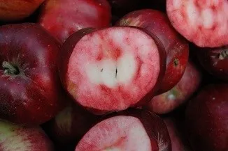
Posof Apple / Badele Apple is a value with an official Origin Name and geographical indication, unique to the Ardahan region, registered by the Turkish Patent and Trademark Office on 22.04.2019 (with registration number 429).
View Official Geographical Indication Dossier for Posof Apple / Badele Apple →
2. Ardahan Flower Honey (Bal)
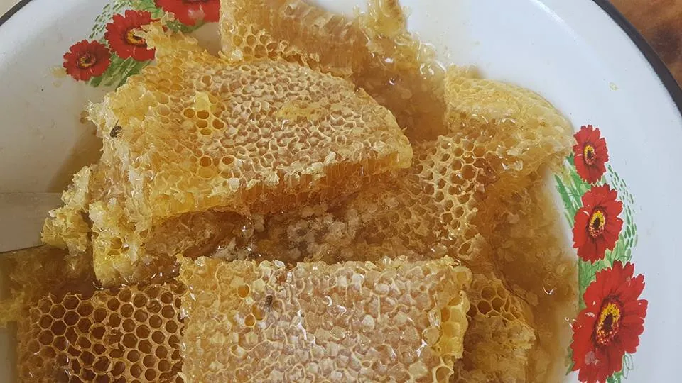
Clear, light amber colored pure honey collected by the Caucasian Bee race (Apis mellifera caucasica) with its long tongue from hundreds of endemic flower and astragalus species in the high altitude Ardahan plateaus.
History: A healing source produced in untouched nature without industry in Ardahan, the homeland of the pure Caucasian bee, one of the 4 most important bee races in the world.
Production Method: Pure breed is hived in the protection zone; Milking is done at the peak of plateau flowering without adding sugar or additives.
View Official Geographical Indication Dossier for Ardahan Flower Honey →
3. Damal Doll (Halılar, kilimler ve dokumalar dışında kalan el sanatı ürünleri)
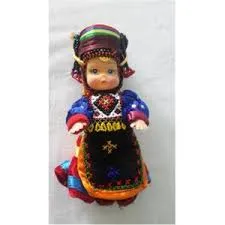
World-famous handmade folkloric doll decorated with three skirts, aprons, silver buckles and fez of Turkmen women.
History: Registered craft in Japan that was chosen first in the world doll competition.
View Official Geographical Indication Dossier for Damal Doll →
4. Ardahan Goose Meat (İşlenmiş ve işlenmemiş et ürünleri)
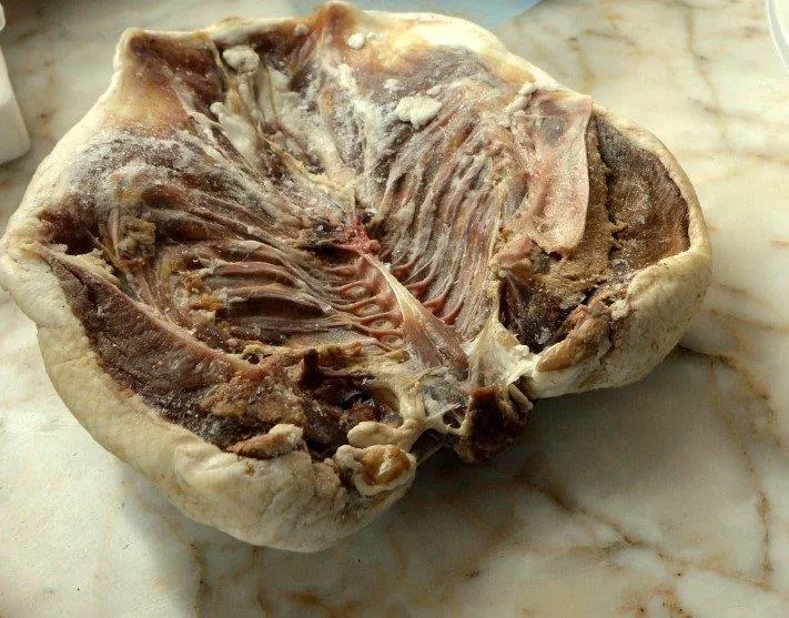
A winter feast of goose, which is cut after the snow falls, salted, dried, and baked over bulgur pilaf.
History: The most prestigious traditional banquet table meal of Ardahan winters.
View Official Geographical Indication Dossier for Ardahan Goose Meat →
5. Ardahan Kavılca Wheat (Diğer ürünler)
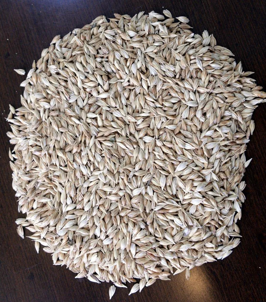
Ardahan Kavılca Wheat is a value with an official Origin Name and geographical indication, specific to the Ardahan region, registered by the Turkish Patent and Trademark Office on 07.02.2024 (with registration number 1537).
View Official Geographical Indication Dossier for Ardahan Kavılca Wheat →
6. Hanak String Cheese (Peynirler)
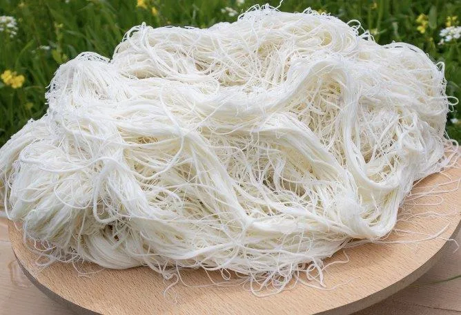
Hanak String Cheese is a product of ours with an official Origin Name and geographical indication, specific to the Ardahan region, registered by the Turkish Patent and Trademark Office on 08.04.2024 (with registration number 1563).
View Official Geographical Indication Dossier for Hanak String Cheese →
Practical Travel & Transit Planning for Ardahan (2026)
| Planning Category | Verified Local Information |
|---|---|
| Region & Administrative Center | Ardahan, Türkiye |
| Best Time to Visit | Spring (April–June) and Autumn (September–November) for ideal sightseeing weather; Summer for highlands and coastal routes. |
| Public Transit & Highway Access | Regular municipal buses and local minibus cooperatives (Dolmuş) depart daily from the Ardahan Intercity Bus Terminal (Otogar) directly to Merkez. |
| Recommended Stay | 1 to 2 full days to explore the main historical landmarks, nature trails, and local culinary stops. |
Frequently Asked Questions About Visiting Ardahan
What are the must-see places to visit in Ardahan?
The top verified attractions in Ardahan include Historical Ardahan Castle, Çıldır Lake and Winter Tourism Area, Historical Ardahan Castle and Kura River Promenade, Historic Russian Baltic Architecture Stone Buildings (Congress Building and Mansions), Historical Bülbülan Plateau and Nature Trail. Each location offers documented historical or natural heritage with clear road access.
How can I get to Ardahan by public transport or car?
You can reach Ardahan easily by car via Ardahan's main provincial highways, or take regular municipal buses and district minibuses departing throughout the day from the Ardahan central bus terminal (Otogar).
What are the famous local dishes and traditional foods to try in Ardahan?
When visiting Ardahan and Ardahan, be sure to taste officially registered specialties such as Posof Apple / Badele Apple, Ardahan Flower Honey, Damal Doll, Ardahan Goose Meat, Ardahan Kavılca Wheat, prepared by local artisans and traditional restaurants.
Are the attractions in Ardahan suitable for families and day trips?
Yes. Most historic monuments, parks, museums, and promenade areas in Ardahan are family-friendly and well-suited for both weekend getaways and full-day cultural itineraries.
When is the best season to visit Ardahan?
Spring and autumn offer the most comfortable temperatures for walking tours and photography in Ardahan, while summer is popular for nature recreation, plateaus, and festivals.