
Planning a journey to Arhavi, Artvin? This comprehensive 2026 History & Culture guide brings together 10 verified landmarks, natural wonders, and cultural heritage sites with official visiting hours, GPS coordinates, public transit connections, and local gastronomy recommendations.
Quick Highlights & Discovery Route in Arhavi, Artvin
- Ciha Castle & Seyir Hill
- Derecik Historical Stone Arch Bridge
- Steephill Historical Stone Arch Bridge
- Historical Çiftekemer Bridges (18th century)
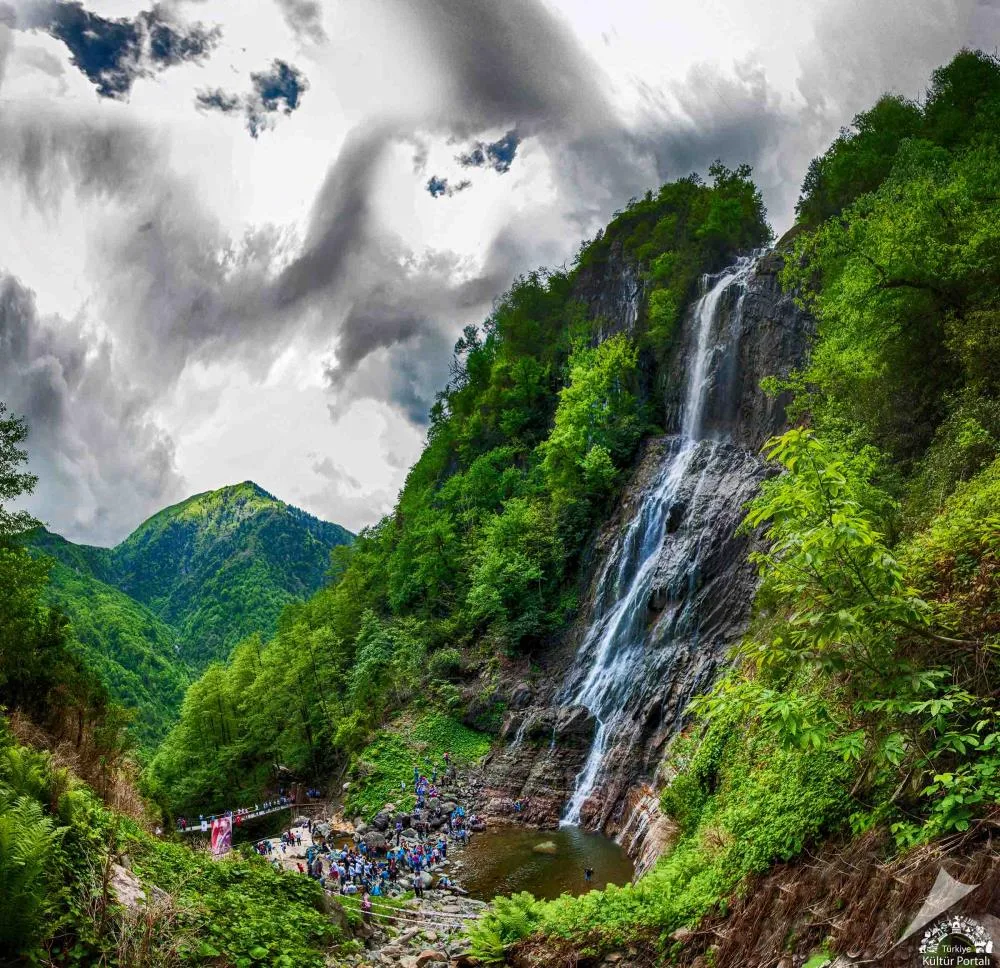
- Mençuna Waterfall (Kamilet Valley 90m)
- Güngören (Gidre) Waterfall & Valley
- Pucuko
- Borcka Iron Apple
Historical Landmarks, Architecture & Cultural Heritage in Arhavi, Artvin
Arhavi, Artvin (Artvin) preserves a multi-layered historical fabric shaped by centuries of Anatolian civilizations, including Roman, Byzantine, Seljuk, and Ottoman eras. Historic castles, stone bridges, caravanserais, civil mansions, and monumental structures reflect the strategic and cultural importance of Arhavi, Artvin.
Walking through the historic quarters of Arhavi, Artvin allows visitors to observe traditional masonry, timber-framed architecture, and restored heritage buildings up close.
- Architectural Details: Pay attention to carved stone portals, historic fountains, courtyard mansions, and defensive bastions across Arhavi, Artvin.
- Best Visiting Hours: Early morning and late afternoon golden light offer the best conditions for architectural photography and crowd-free exploration.
- Cultural Etiquette & Preservation: Respect restoration zones and signage at registered historical monuments in Arhavi, Artvin.
Top Verified History & Culture & Must-See Landmarks in Arhavi, Artvin
1. Ciha Castle & Seyir Hill

Free Public Access • GPS: 41.3566, 41.3274
History and General Information / Local Legends and Folklore
Ciha Castle is a strategic observation castle built during the Middle Ages by the Genoese or the Trebizond Empire to monitor the Black Sea coast and Arhavi valleys. Remains of circular planned stone walls have survived to the present day. Local people say that the castle is an early warning tower against pirate attacks that may come from the sea.
Geographical Structure, Altitude and Natural Features
It is located on a conical hill at an altitude of approximately 380 meters above sea level, completely overlooking Arhavi and the Black Sea coast. Its surroundings are covered with hornbeam and chestnut forests.
Visiting Hours, Days and Entrance Fees
- Entrance Fee: Free.
- Visiting Hours and Days: Open 7 days a week during daylight hours.
- Rules, Safety and Stroller/Disabled Access: The last 150 meters of trail walking up the hill is steep; Sturdy shoes are required.
- Facilities and Facilities: It is a natural viewing point; There are seating benches and a view terrace.
Transportation, Public Transit Routes and Exact Location
- Address / Open Location: Ciha Tepesi Mevkii, Dikyamaç Village Road, Arhavi / Artvin.
- Road Condition and Vehicle Availability: It is 7 km away from the center of Arhavi; After the asphalt and concrete village road, there is a short dirt walking path.
- Real Public Transportation Information: You can reach the foot of the hill by private vehicle or village minibuses.
- Parking Availability: There is an open parking area for 10 vehicles at the foot of the hill.
Contextual Experience Tips, Photography and Local Gastronomy
- Best Photography Spots and Frames: 360 degree panorama of the Black Sea, Arhavi coast and Kamilet Valley from the stone bastion ruins.
- Light and Shooting Hours: Morning sun and evening golden time zone.
- Local Gastronomy Recommendations: It is recommended to take hot tea and Arhavi hazelnuts with you in a thermos.
Explore Full 5-Section Guide & Map for Ciha Castle & Seyir Hill →
2. Derecik Historical Stone Arch Bridge
Free Public Access • GPS: 41.3186, 41.3796
History and General Information / Local Legends and Folklore
Derecik Kemer Bridge is one of the elegant examples of 19th century Ottoman stonemasonry in the region. It was built with rubble and cut stones, with a single eye and pointed arch, on the Derecik Stream. It has connected the villagers' plateau and field roads for centuries.
Geographical Structure, Altitude and Natural Features
It is located at an altitude of 220 meters above sea level, on lush green tea gardens and a lush mountain stream.
Visiting Hours, Days and Entrance Fees
- Entrance Fee: Free.
- Visiting Hours and Days: Open 24 hours a day, 7 days a week.
- Rules, Safety and Stroller/Disabled Access: Pedestrian accessible; Historical fabric should not be damaged.
- Facilities and Facilities: There is a village fountain and recreation area around the bridge.
Transportation, Public Transit Routes and Exact Location
- Address / Open Location: Inside Derecik Village, Arhavi / Artvin.
- Road Condition and Vehicle Suitability: It is 6 km away from Arhavi district center and is a completely asphalt road.
- Real Public Transportation Information: It can be reached by Derecik village minibuses departing from Arhavi center.
- Parking Availability: There is free parking in the village square near the bridge.
Contextual Experience Tips, Photography and Local Gastronomy
- Best Photography Spots and Frames: Frames with water reflections that capture the arch bridge from the stream level up and the lush green slopes behind it.
- Light and Shooting Times: Early morning and late afternoon sun.
- Local Gastronomy Recommendations: Organic tea freshly picked in the village and natural plateau butter.
Explore Full 5-Section Guide & Map for Derecik Historical Stone Arch Bridge →
3. Steephill Historical Stone Arch Bridge
Free Public Access • GPS: 41.2872, 41.3690
History and General Information / Local Legends and Folklore
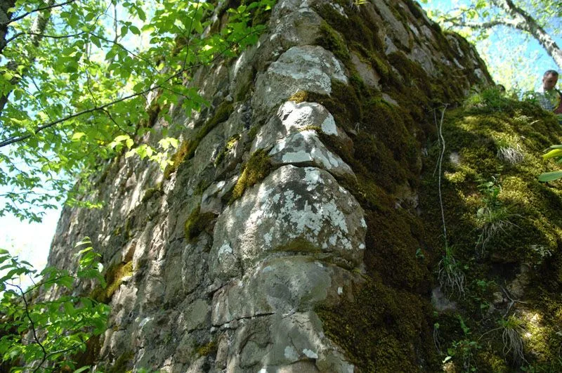
Dikyamaç Historical Stone Arch Bridge, rising on one of the side branches of the Kamilet Valley, right next to the famous Dikyamaç (Kamparna) Village Lifestyle Museum, is one of the outstanding examples of the 18th century classical Ottoman stone arch bridge architecture in the Eastern Black Sea region. It has defied the harsh flood waters of the region for centuries with its single-eyed, round-arched body and cut and rubble stone workmanship, built on the hard bedrock on both sides of the stream bed. Local narratives say that caravans connecting to the Caucasus mountain paths of the historical Silk Road passed through this bridge and that the natural pools under the bridge are full of silver-scaled trout.
Geographical Structure, Altitude and Natural Features
It is located on a deep and green stream canyon, at an altitude of approximately 340 meters above sea level. It is surrounded by centuries-old alders, hornbeams, moss-covered rocks and lush rhododendron bushes.
Visiting Hours, Days and Entrance Fees
- Entrance Fee: Visiting and crossing the historical bridge is completely free.
- Visiting Hours and Days (Mandatory): Open 24 hours a day, 7 days a week; It is recommended to visit it in daylight and combined with a museum visit.
- Rules, Safety and Stroller/Disabled Access: The historic stone arch bridge is paved with original stone; Be careful about slippery surfaces in areas without railings and in rainy weather. The bridge entrance is suitable for walking, but the stepped stone floor is challenging for wheelchairs.
- Facilities and Facilities: Right next to it, there is Dikyamaç Village Museum, countryside cafeteria, fountain and resting benches.
Transportation, Public Transit Routes and Exact Location
- Address / Open Location: Dikyamaç (Kamparna) Village, Next to the Museum, 08200 Arhavi / Artvin.
- Road Condition and Vehicle Availability: It is 15 km away from Arhavi district center; It can be easily reached by any kind of passenger vehicle via the asphalt and concrete covered village road.
- Actual Public Transportation Information (Mandatory): Transportation to the village is provided by Dikyamaç village shuttles departing from Arhavi district center.
- Parking Availability: There is a large and free car parking area in front of the village museum.
Contextual Experience Tips, Photography and Local Gastronomy
- Best Photo Spots and Frames: Postcard-worthy frames that include the sparkling mountain stream flowing under the moss-covered historic stone arch and the wooden serenders in the background.
- Light and Shooting Hours: The light fog moment in the valley in the early morning and the hours when the sun rays filter under the arch in the afternoon.
- Visit Time: Spring, summer and autumn; Especially in autumn, the yellow-red leaf fall creates a magnificent sight.
- Local Gastronomy Recommendations: Arhavi tea brewed over a wood fire in the museum cafe, fresh corn bread and mini cheese pancakes.
Explore Full 5-Section Guide & Map for Steephill Historical Stone Arch Bridge →
4. Historical Çiftekemer Bridges (18th century)
Free Public Access • GPS: 41.2765, 41.3760
History and General Information / Local Legends and Folklore
Çifte Köprü (Çiftekemer) is a unique architectural masterpiece built in the 18th century Ottoman period, using rubble and cut stone, using mortarless keystone technique. It consists of two independent arch bridges positioned at right angles to each other at the point where the Kamilet and Soğucak streams meet. According to local legend, the bridges were built by the joint efforts of two brother stonemasons living in the valley at that time and have been an inseparable symbol of the valley for centuries.
Geographical Structure, Altitude and Natural Features
It is located at an altitude of 180 meters above sea level, in a lush valley gorge where two vigorous mountain streams meet. It is surrounded by steep forested hills and clear watercourses.
Visiting Hours, Days and Entrance Fees
- Entrance Fee: Free.
- Visiting Hours and Days: Open 24 hours a day, 7 days a week.
- Rules, Safety and Stroller/Disabled Access: Open to pedestrian traffic; The historic stone surface can be slippery when wet; Bridge entrances are flat.
- Facilities and Facilities: There are historical wooden cafeterias, local product sections, resting pergolas and WC at the bridge.
Transportation, Public Transit Routes and Exact Location
- Address / Open Location: Ortacalar Village Road 12. km, Arhavi / Artvin.
- Road Condition and Vehicle Suitability: It is 12.5 km away from Arhavi district center and is a fully expanded hot asphalt road; Comfortable transportation is provided by all passenger vehicles.
- Real Public Transportation Information: Ortacalar village minibuses departing from Arhavi center stop right in front of the bridge.
- Parking Availability: There is a free parking area for 50 vehicles at the bridge entrance.
Contextual Experience Tips, Photography and Local Gastronomy
- Best Photography Spots and Frames: The iconic symmetrical angle showing both arch bridges in the same frame from the rock islet where two streams meet.
- Light and Shooting Hours: Foggy misty air rising over the stream in the early morning and soft light in the afternoon.
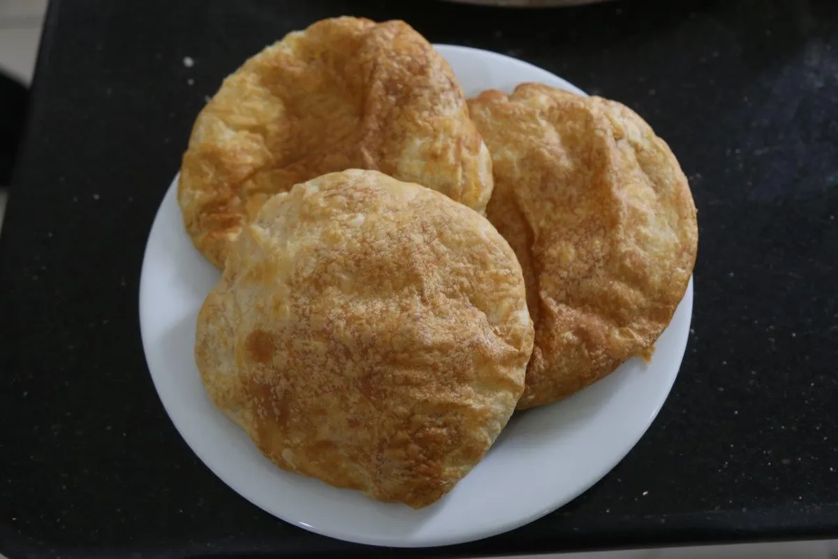
- Local Gastronomy Recommendations: Fresh Black Sea tea brewed over a wood fire in the historical tea garden at the bridge and hot Laz pastry.
Explore Full 5-Section Guide & Map for Historical Çiftekemer Bridges (18th century) →
5. Mençuna Waterfall (Kamilet Valley 90m)

Free Public Access • GPS: 41.2546, 41.3521
History and General Information / Local Legends and Folklore
Mençuna Waterfall is one of the highest flow and most magnificent waterfalls of the Eastern Black Sea Region and Türkiye. It is rumored that it took its name from the Laz word meaning "inaccessible place / steep rock". It flows through the untouched rainforests of the Kamilet Valley and pours in two stages from a huge rock wall of approximately 90 meters. A natural turquoise pond of 200 square meters was formed where the waterfall fell.
Geographical Structure, Altitude and Natural Features
It is located at an altitude of approximately 680 meters above sea level. Its surroundings are covered with temperate zone mixed rainforests, alder, chestnut, boxwood and giant ferns. It offers a unique microclimate with dense water vapor and rich oxygen content.
Visiting Hours, Days and Entrance Fees
- Entrance Fee: The waterfall area is free; Vehicle parking is subject to a symbolic tariff.
- Visiting Hours and Days: It is open to visitors 7 days a week during daylight hours (08:00 - 19:30).
- Rules, Safety and Stroller/Disabled Access: After the suspension bridge, there is an approximately 20-25 minute forest climbing track with wooden steps; Non-slip sports/outdoor shoes are a must; It is not suitable for baby strollers and wheelchairs.
- Facilities and Facilities: At the beginning of the waterfall path, there is a country restaurant, cafeteria, souvenir buffet, WC and resting pergolas.
Transportation, Public Transit Routes and Exact Location
- Address / Open Location: Ortacalar Village Road, Kamilet Vadisi Mevkii, Arhavi / Artvin.
- Road Condition and Vehicle Availability: It is 17 km away from Arhavi district center; It is an asphalt road until Çifte Köprü, after which it is a concrete/hardwood road; It can be easily reached by all passenger vehicles.
- Real Public Transportation Information: Ortacalar - Mençuna minibuses depart from Arhavi District Square and Bus Terminal every hour during the summer season.
- Parking Availability: There is an open parking area for 100 vehicles next to the suspension bridge facilities.
Contextual Experience Tips, Photography and Local Gastronomy
- Best Photo Spots and Frames: Vertical angles showing the entire height of the waterfall from the suspension bridge and rainbow frames created by water particles from the wooden observation deck at the base of the waterfall.
- Light and Shooting Hours: Between 12:00 and 15:00, when the sun hits the valley from its peak and the rainbow becomes evident.
- Local Gastronomy Recommendations: Freshly brewed Rize/Artvin tea with buttered trout, Laz pastry dessert and corn bread on the premises.
Explore Full 5-Section Guide & Map for Mençuna Waterfall (Kamilet Valley 90m) →
6. Güngören (Gidre) Waterfall & Valley
Free Public Access • GPS: 41.2630, 41.3622
History and General Information / Local Legends and Folklore
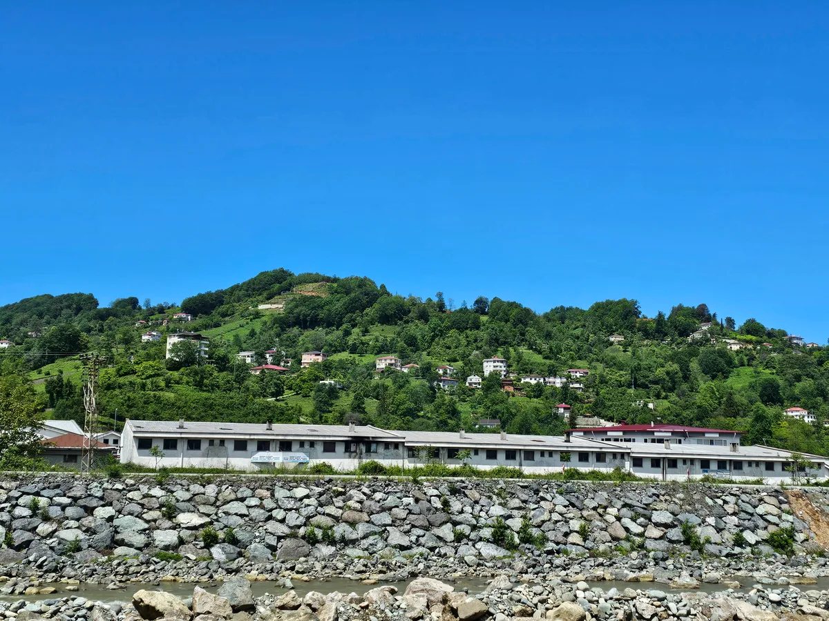
Güngören Waterfall is one of the hidden nature corners of Arhavi and falls enthusiastically from a rock cleft of approximately 20 meters. It is used by the local people as a resting and picnic area on hot summer days.
Geographical Structure, Altitude and Natural Features
It is located on a cool valley floor among hazelnut and alder groves, at an altitude of 310 meters above sea level.
Visiting Hours, Days and Entrance Fees
- Entrance Fee: Free.
- Visiting Hours and Days: Open 7 days a week.
- Rules, Safety and Stroller/Disabled Access: It is a natural stream bed; Be careful about slippery rocks.
- Facilities and Facilities: There is a natural picnic area and water spring.
Transportation, Public Transit Routes and Exact Location
- Address / Open Location: Güngören Köyü Yolu, Arhavi / Artvin.
- Road Condition and Vehicle Availability: It is 8.5 km from the center of Arhavi; It is an asphalt and concrete village road.
- Real Public Transportation Information: Transportation is provided by Güngören village minibuses or private vehicles.
- Parking Availability: There is an open parking area for 10 vehicles on the roadside.
Contextual Experience Tips, Photography and Local Gastronomy
- Best Photography Spots and Frames: In front of the natural rock cauldron where the waterfall falls and the valley perspective.
- Light and Shooting Hours: Afternoon hours (13:00 - 16:00).
- Local Gastronomy Recommendations: Local corn soup and minci (fresh cottage cheese).
Explore Full 5-Section Guide & Map for Güngören (Gidre) Waterfall & Valley →
7. Kamilet Valley & Rainforest Ecotourism Area

Free Public Access • GPS: 41.2714, 41.3723
History and General Information / Local Legends and Folklore
Kamilet Valley is a global biodiversity paradise that has been declared one of the 100 hotspots in Europe that need urgent protection by the World Wildlife Fund (WWF). It is the purest example of the Caucasus temperate rainforest, with its untouched canyons and monumental trees that have been away from human settlement for centuries. Local people remember the valley as the place of thousands of medicinal herbs and legendary water fairies.
Geographical Structure, Altitude and Natural Features
The altitude starts from 150 meters and rises to 2200 meters. It is home to deep canyon crevasses, hundreds of waterfalls, rich lichen and moss-covered boxwood forests, and a population of endemic Caucasian salamanders and brown bears.
Visiting Hours, Days and Entrance Fees
- Entrance Fee: Free.
- Visiting Hours and Days: It is open to visitors 7 days a week.
- Rules, Safety and Stroller/Disabled Access: It is a natural protected area; lighting fires and collecting plants is strictly prohibited; Trekking and canyoning equipment is recommended.
- Facilities and Facilities: There are eco-hostels, nature walking paths and viewing points on the valley route.
Transportation, Public Transit Routes and Exact Location
- Address / Open Location: Kamilet Valley Basin, Arhavi / Artvin.
- Road Condition and Vehicle Suitability: The road from Arhavi center into the valley is asphalt and concrete paved.
- Real Public Transportation Information: There are shuttles and minibuses going from Arhavi district center to the valley.
- Parking Availability: There are parking areas at ecotourism stops.
Contextual Experience Tips, Photography and Local Gastronomy
- Best Photo Spots and Frames: Moss-covered historic stone paths, giant boxwood trees and emerald green river pools.
- Light and Shooting Times: Sun rays filtering through the tree branches in the morning (God rays).
- Local Gastronomy Recommendations: Kamilet chestnut honey and local kale stuffing.
Explore Full 5-Section Guide & Map for Kamilet Valley & Rainforest Ecotourism Area →
8. Ortacalar Historical Center Mosque
Free Public Access • GPS: 41.2792, 41.3800
History and General Information / Local Legends and Folklore
Rising in the center of the historical Ortacalar (Bucak) Village, just above Arhavi's famous Çiftekemer Bridges, the Historical Ortacalar Central Mosque is one of the rarest examples of late 18th century Ottoman woodwork and stone architecture in the Black Sea region. The building is built on masonry rubble stone walls; It is dazzling with its chestnut-carved and painted wooden ceiling core, its altar decorated with geometric flower motifs and its gallery with wooden railings. According to local narrations, it is stated that the timbers of the mosque were selected from the largest chestnut trees of the Kamilet Valley, floated from the streams, and that they remained standing for centuries without a single nail rotting.
Geographical Structure, Altitude and Natural Features
It is located at an altitude of approximately 280 meters above sea level, on the terrace just above the valley floor where the Kamilet and Soğucak streams meet. It is surrounded by lush hazelnut gardens, linden trees, tea fields and historical Black Sea residences.
Visiting Hours, Days and Entrance Fees
- Entrance Fee: Visiting and praying in the historical mosque is completely free.
- Visiting Hours and Days (Mandatory): It is open for worship and visits 7 days a week, from the morning adhan until after the night prayer.
- Rules, Safety and Stroller/Disabled Access: You can enter the mosque without shoes; Care should be taken to preserve historical wood carvings. The mosque courtyard is flat and can be easily entered with baby strollers and wheelchairs.
- Facilities and Facilities: There is a historical fountain, ablution room, WC and a tea garden in the village square.
Transportation, Public Transit Routes and Exact Location
- Address / Open Location: Ortacalar Village Square, Çiftekemer Yolu, 08200 Arhavi / Artvin.
- Road Condition and Vehicle Suitability: It can be easily reached by all passenger vehicles via the 13-kilometer completely asphalt road from Arhavi district center to Kamilet Valley and Çiftekemer direction.
- Real Public Transportation Information (Mandatory): Ortacalar village minibuses, which depart regularly from Arhavi District Bus Terminal and the center, drop off directly at the mosque square.
- Parking Availability: Free car parking is available around the mosque and in the village square.
Spiritual Visiting Etiquette and Commemoration Guidelines
- Spiritual Visit and Prayer Etiquette: Attention should be paid to tranquility during prayer times, and the peaceful wooden atmosphere of the mosque should be contemplated by performing the two-rakat tahiyyatu'l-masjid prayer.
- Documentary & Respectful Shooting: The historical wooden pulpit, the painted ceiling core and the stone inscriptions can be photographed in silent mode without disturbing the congregation.
- Important Commemoration Days: It is the meeting center of the people of the valley with the congregation coming from the surrounding valleys during Friday prayers and holy nights.
- Local Spiritual Tradition: It is a deep-rooted village tradition to offer freshly opened Laz pastry, lokma and strong tea to the congregation in the mosque courtyard after the prayer.
Explore Full 5-Section Guide & Map for Ortacalar Historical Center Mosque →
9. Kapistre Stream and Valley Nature Route
Free Public Access • GPS: 41.3520, 41.2965
History and General Information / Local Legends and Folklore
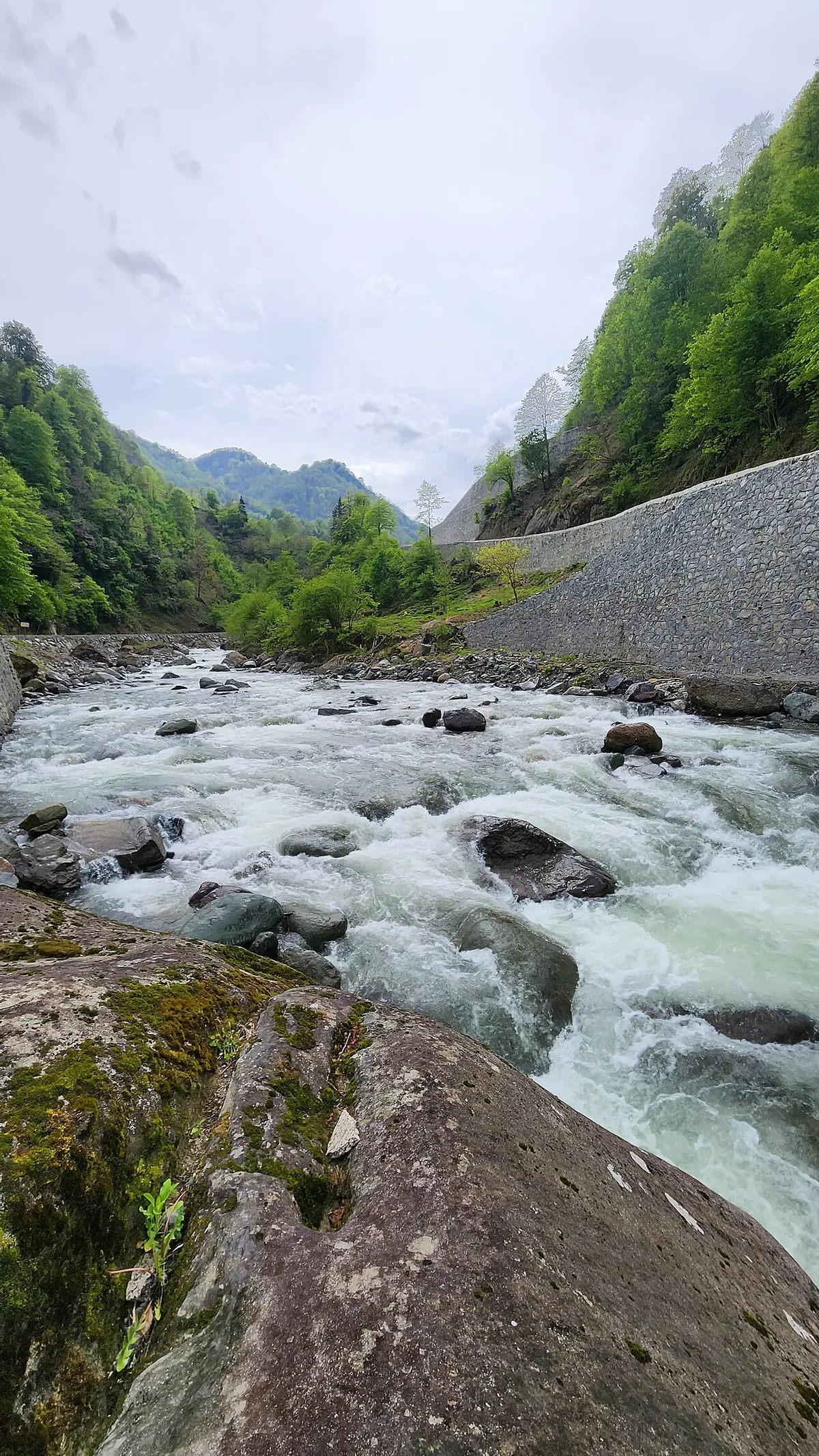
Kapistre Stream (Arhavi Stream), which passes through the heart of Arhavi and flows into the Black Sea, is the main lifeline that has given life to the agriculture, fishing and settlement fabric of the region since ancient times. The stream reaches a huge flow rate with the merger of the Kamilet and Soğucak branches; It is one of Artvin's most popular water sports trails for rafting, canoeing, river walking and coastal recreation. In the narratives of local fishermen, it is said that Black Sea salmon migrating from the sea to the stream in the spring months swim in the enthusiastic waters of Kapistre and that the cool breeze of the stream brings refreshment to the entire city in the summer months.
Geographical Structure, Altitude and Natural Features
It starts from sea level and extends along the valley to an altitude of 150 meters. There are large gravel islands, willow trees, walking trails and coastal parks along the stream bed.
Visiting Hours, Days and Entrance Fees
- Entrance Fee: Walking along the stream, resting and using the observation decks are completely free.
- Visiting Hours and Days (Mandatory): Open 24 hours a day, 7 days a week.
- Rules, Safety and Baby Stroller/Disabled Access: You should not go down to the stream bed during spring flood periods. The walking path along the shore is completely flat and suitable for stroller and wheelchair use.
- Facilities and Facilities: There are walking and cycling paths along the stream, rest benches, illuminated parks, cafeterias and children's playgrounds.
Transportation, Public Transit Routes and Exact Location
- Address / Open Location: Kapistre Creek Kordon Boyu, 08200 Arhavi / Artvin.
- Road Condition and Vehicle Availability: It is right next to Arhavi district center; It can be easily reached from the coastal road and asphalt roads from within the district.
- Real Public Transportation Information (Mandatory): You can reach the stream promenade with a 3-5 minute walk from every point in Arhavi district center.
- Parking Availability: There are large municipal car parking areas along the Kordon.
Contextual Experience Tips, Photography and Local Gastronomy
- Best Photography Spots and Frames: Wide-angle views from pedestrian bridges over the stream, framing the sun setting towards the Black Sea horizon and foggy mountain ranges in the background.
- Light and Shooting Times: Sunset colors in the evening and still water reflections in the early morning.
- Visiting Time: During the four seasons; It is perfect for streamside walks and water sports, especially in the summer months.
- Local Gastronomy Recommendations: Freshly squeezed Black Sea fruit juices, Arhavi pita and Laz pastry in coastal cafes.
Explore Full 5-Section Guide & Map for Kapistre Stream and Valley Nature Route →
10. Arhavi City Square & Atatürk Monument
Free Public Access • GPS: 41.3523, 41.3078
History and General Information / Local Legends and Folklore
Arhavi City Square is the commercial, social and administrative center of the district. The square contains the Ataturk Monument, the historical clock tower motif and the recreation park. It is the main meeting place where Arhavi's famous tulum and horon culture is exhibited with enthusiasm in festivals.
Geographical Structure, Altitude and Natural Features
It is located on a flat area between Kapisre Creek and the sea, at an altitude of 15 meters above sea level.
Visiting Hours, Days and Entrance Fees
- Entrance Fee: Free.
- Visiting Hours and Days: Open 24 hours a day, 7 days a week.
- Rules, Safety and Stroller/Disabled Access: Smooth hardwood floors; It is 100% disabled and stroller accessible.
- Facilities and Facilities: There are benches, tea gardens, bakeries, restaurants, ATMs and WC.
Transportation, Public Transit Routes and Exact Location
- Address / Open Location: İnönü Caddesi, Musazade Mahallesi, Arhavi / Artvin.
- Road Condition and Vehicle Availability: It is in the town center and can be reached by all kinds of vehicles.
- Real Public Transportation Information: It is the central stopping point of all intercity and intra-district minibuses.
- Parking Availability: There are municipal parking lots around the square.
Contextual Experience Tips, Photography and Local Gastronomy
- Best Photo Spots and Frames: Square park, Ataturk Monument and colorful bazaar streets of Arhavi.
- Light and Shooting Hours: Evening lights and hours when the square is illuminated.
- Local Gastronomy Recommendations: Warm Arhavi pita from Meydan bakeries and Laz pastry from a stone oven.
Explore Full 5-Section Guide & Map for Arhavi City Square & Atatürk Monument →
What to Eat in Arhavi, Artvin? Registered Local Delicacies & Gastronomy
A trip to Arhavi, Artvin is incomplete without tasting its officially registered geographical indication products and centuries-old Anatolian recipes:
1. Pucuko (Yemekler ve çorbalar)

Puçuko is a geographically indicated value of ours, specific to the Artvin region and registered by the Turkish Patent and Trademark Office on 26.12.2017 (with registration number 303).
View Official Geographical Indication Dossier for Pucuko →
2. Borcka Iron Apple (İşlenmiş ve işlenmemiş meyve ve sebzeler ile mantarlar)
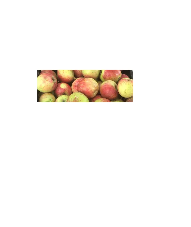
A registered apple grown in the Macahel Valley, with a texture as hard as a stone, juicy, and does not rot on the hanger throughout the winter.
History: UNESCO Biosphere Reserve The durable apple of the Macahel valley.
View Official Geographical Indication Dossier for Borcka Iron Apple →
3. Hopa Anchovy Bread (Fırıncılık ve pastacılık mamulleri, hamur işleri, tatlılar)
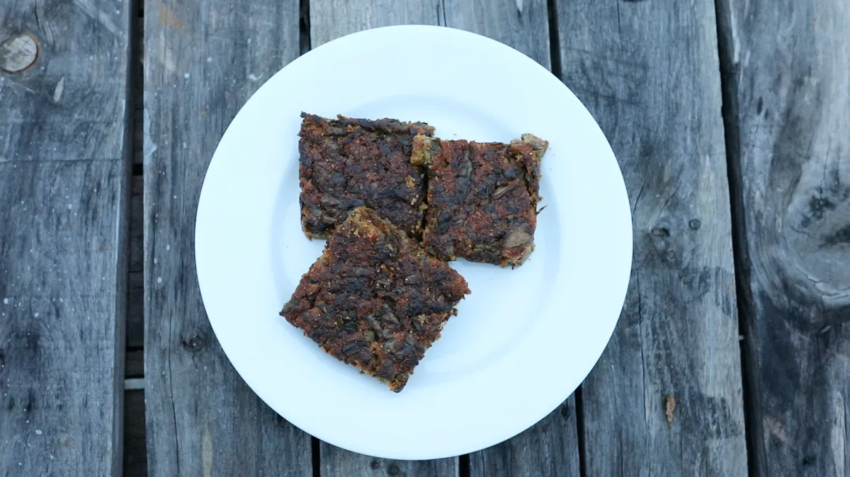
Fresh anchovy, corn flour, leek, chard and mint mixture fried like a pomegranate on a tray in a stone oven.
History: A century-old anchovy bread prepared by Black Sea fishermen after returning from the sea.
View Official Geographical Indication Dossier for Hopa Anchovy Bread →
4. Hatila Honey (Bal)
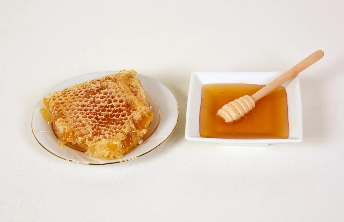
Hatila Honey is a geographically indicated value of ours with an official Origin Name, unique to the Artvin region and registered by the Turkish Patent and Trademark Office on 17.09.2021 (with registration number 893).
View Official Geographical Indication Dossier for Hatila Honey →
5. Arhavi Chestnut Honey (Bal)
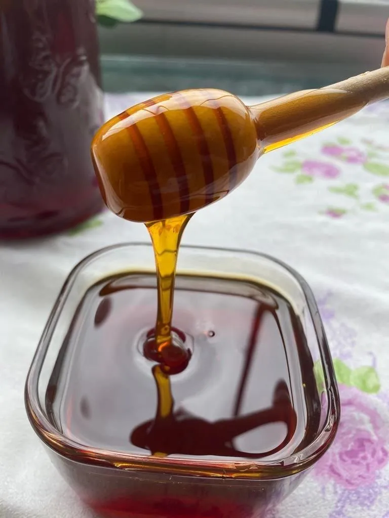
Arhavi Chestnut Honey is a value with a geographical indication of its official Origin Name, unique to the Artvin region, registered by the Turkish Patent and Trademark Office on 10.11.2022 (with registration number 1252).
View Official Geographical Indication Dossier for Arhavi Chestnut Honey →
6. Arhavi Terminus (Fırıncılık ve pastacılık mamulleri, hamur işleri, tatlılar)

Arhavi Terminus is an official Geographically Indicated value specific to the Artvin region, registered by the Turkish Patent and Trademark Office on 05.05.2025 (with registration number 1732).
View Official Geographical Indication Dossier for Arhavi Terminus →
Practical Travel & Transit Planning for Arhavi, Artvin (2026)
| Planning Category | Verified Local Information |
|---|---|
| Region & Administrative Center | Arhavi, Artvin, Türkiye |
| Best Time to Visit | Spring (April–June) and Autumn (September–November) for ideal sightseeing weather; Summer for highlands and coastal routes. |
| Public Transit & Highway Access | Regular municipal buses and local minibus cooperatives (Dolmuş) depart daily from the Artvin Intercity Bus Terminal (Otogar) directly to Arhavi. |
| Recommended Stay | 1 to 2 full days to explore the main historical landmarks, nature trails, and local culinary stops. |
Frequently Asked Questions About Visiting Arhavi, Artvin
What are the must-see places to visit in Arhavi, Artvin?
The top verified attractions in Arhavi, Artvin include Ciha Castle & Seyir Hill, Derecik Historical Stone Arch Bridge, Steephill Historical Stone Arch Bridge, Historical Çiftekemer Bridges (18th century), Mençuna Waterfall (Kamilet Valley 90m). Each location offers documented historical or natural heritage with clear road access.
How can I get to Arhavi, Artvin by public transport or car?
You can reach Arhavi, Artvin easily by car via Artvin's main provincial highways, or take regular municipal buses and district minibuses departing throughout the day from the Artvin central bus terminal (Otogar).
What are the famous local dishes and traditional foods to try in Arhavi, Artvin?
When visiting Arhavi, Artvin and Artvin, be sure to taste officially registered specialties such as Pucuko, Borcka Iron Apple, Hopa Anchovy Bread, Hatila Honey, Arhavi Chestnut Honey, prepared by local artisans and traditional restaurants.
Are the attractions in Arhavi, Artvin suitable for families and day trips?
Yes. Most historic monuments, parks, museums, and promenade areas in Arhavi, Artvin are family-friendly and well-suited for both weekend getaways and full-day cultural itineraries.
When is the best season to visit Arhavi, Artvin?
Spring and autumn offer the most comfortable temperatures for walking tours and photography in Arhavi, Artvin, while summer is popular for nature recreation, plateaus, and festivals.