
Planning a journey to Amasra, Bartın? This comprehensive 2026 History & Culture guide brings together 10 verified landmarks, natural wonders, and cultural heritage sites with official visiting hours, GPS coordinates, public transit connections, and local gastronomy recommendations.
Quick Highlights & Discovery Route in Amasra, Bartın
- Historical Kemere Bridge
- Kuşkayası Road Monument
- Historical Amasra Castle (Zindan and Sormagir Castles)
- Historical Amasra Fatih Mosque (Historical Byzantine Church)
- Gürcüoluk Cave Nature Park
- Historical Kemere Bridge and Boztepe Observation Area
- Bartın Fig Ice Cream Dessert / Bartın Fig Ice Cream
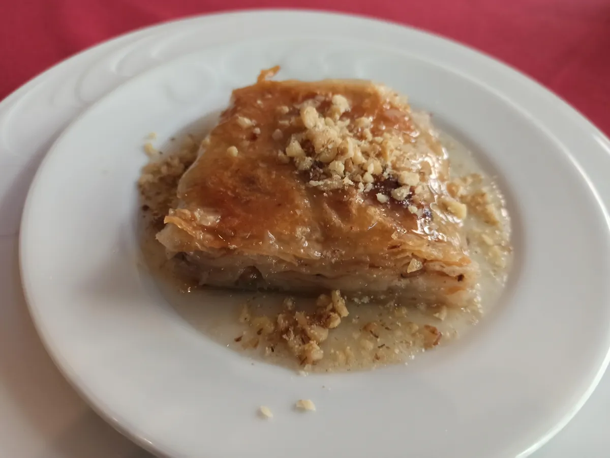
- Bartin White Baklava
Ancient Cities, Archaeological Ruins & Open-Air Heritage in Amasra, Bartın
Amasra, Bartın (Bartın) sits along ancient trade, military, and cultural corridors of Anatolia. Archaeological mounds, rock-cut tombs, necropolises, ancient theaters, and classical settlements around Amasra, Bartın shed light on thousands of years of human settlement.
- MuseumPass & Entry Info: Check MuseumPass Türkiye (Müzekart) validity and seasonal visiting hours before visiting official archaeological sites in Amasra, Bartın.
- Footwear & Sun Protection: Wear non-slip walking shoes, a hat, and carry water when exploring uneven stone streets and hillside ruins.
- Archaeological Context: Combine your visit to the ruins of Amasra, Bartın with the local archaeological museum in Bartın to see excavated artifacts and inscriptions.
Top Verified History & Culture & Must-See Landmarks in Amasra, Bartın
1. Historical Kemere Bridge

Free Public Access • GPS: 41.7510, 32.3855
History and General Information / Local Legends and Folklore
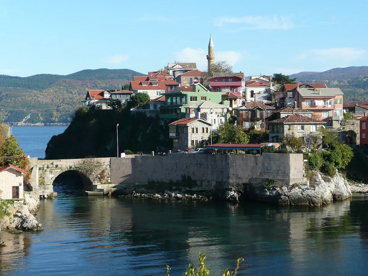
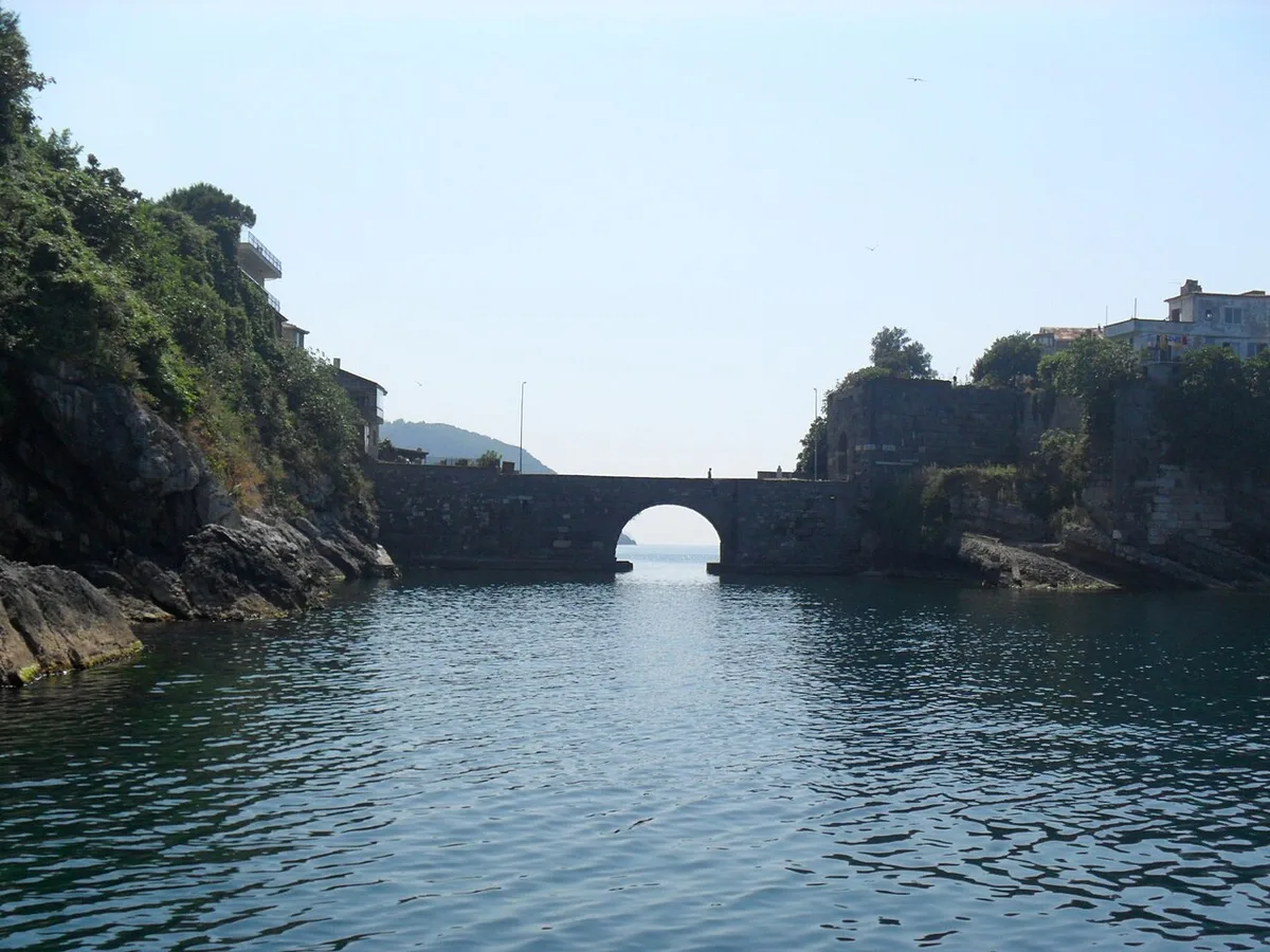
Kemere Bridge is a monumental one-eyed stone arch bridge from the Roman period, connecting Zindan Castle on the Amasra mainland and Sormagir Castle on Boztepe Island. The bridge, which has survived to the present day after undergoing repairs during the Byzantine, Genoese and Ottoman periods, is a unique architectural structure under which sea water flows freely between two bays. Local legend tells that sailors stranded on Boztepe Island during stormy weather took shelter in the castle thanks to this bridge, and that the tunnel under the bridge cleaned the city naturally with sea currents.
Geographical Structure, Altitude and Natural Features
It is located at sea level, on the narrow sea strait between the Small Port and the Big Port. Turquoise sea water flows under the bridge.
Visiting Hours, Days and Entrance Fees
- Entrance Fee: Crossing over the bridge and visiting its surroundings is completely free.
- Visiting Hours and Days: It is open to pedestrians 24 hours a day, 7 days a week.
- Rules, Safety and Baby Stroller/Disabled Access: The bridge is paved and closed to vehicle traffic, safe for pedestrians. It is stroller and disabled chair accessible.
- Facilities and Facilities: There are cafes, fish restaurants, benches and observation steps on both sides of the bridge.
Transportation, Public Transit Routes and Exact Location
- Address / Open Location: Boztepe Road Entrance, Amasra / Bartın.
- Road Condition and Vehicle Availability: It is within walking distance of Amasra town centre; Passenger vehicles are left in port parking lots.
- Real Public Transportation Information: After reaching the town center by Bartın-Amasra minibuses, it can be reached with a 5-minute coastal walk.
- Parking Availability: There are municipal paid and free parking areas around the Small Port and the Big Port.
Contextual Experience Tips, Photography and Local Gastronomy
- Best Photography Spots and Frames: Classic Amasra postcard angle, framing the stone arch of the Kemere Bridge from Küçük Liman beach and the Boztepe walls rising behind it.
- Light and Shooting Hours: Calm sea reflection in the early morning and bridge lighting hours in the evening.
- Local Gastronomy Recommendations: Brewed tea and hazelnut honey yoghurt dessert in the tea gardens just off the bridge.
Explore Full 5-Section Guide & Map for Historical Kemere Bridge →
2. Kuşkayası Road Monument

Free Public Access • GPS: 41.7180, 32.3780
History and General Information / Local Legends and Folklore
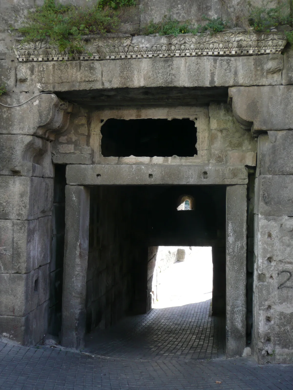
Kuşkayası Road Monument is a unique rock rest monument dating back to the Roman Empire period, which has very few parallels in the world. It was built by the Governor of Bithynia-Pontus, Gaius Julius Aquila, in honor of the Roman Emperor Claudius between 41-54 AD. The monument was built for Roman soldiers and merchants to rest, drink water and pray during their difficult Black Sea mountain journeys; In a niche carved into the rock, there is a headless Roman soldier relief, a double-headed eagle relief symbolizing the Roman legion power, a monument inscription and a water spring trough.
Geographical Structure, Altitude and Natural Features
It is located on the old Amasra-Bartın highway, at an altitude of approximately 280 meters, on a mountain slope covered with dense beech and oak forests. It is carved into the natural limestone cliff.
Visiting Hours, Days and Entrance Fees
- Entrance Fee: The monument area is an open-air protected area and its visit is completely free.
- Visiting Hours and Days: It can be visited freely during daylight hours, 7 days a week.
- Rules, Safety and Stroller/Disabled Access: There are wooden and stone steps leading down to the monument from the highway; Steps can be slippery in rainy weather. Disabled chair and stroller descent is difficult due to the steep steps.
- Facilities and Facilities: There are vehicle pockets, monument information signs and a rest bench on the side of the highway.
Transportation, Public Transit Routes and Exact Location
- Address / Open Location: Bartın-Amasra Old Road 4th km, Amasra / Bartın.
- Road Condition and Vehicle Availability: It is 4 km away from Amasra town centre; It is on the scenic old highway with asphalt winding roads; It can be easily reached by all passenger vehicles.
- Real Public Transportation Information: Minibus drivers using the old Bartın-Amasra road can get off directly at the entrance of the monument by stating that they will get off at Kuşkayası location.
- Parking Availability: There is a free parking lot for 5-6 vehicles on the roadside.
Contextual Experience Tips, Photography and Local Gastronomy
- Best Photography Spots and Frames: Detail shots of the Roman military niche carved into the rock, the eagle relief and the Latin inscription combined with the forest texture.
- Light and Shooting Hours: Morning and noon hours when the sun's rays filter through the tree leaves onto the monument's surface.
- Local Gastronomy Recommendations: After visiting the monument, village pancakes and chestnut honey in the country gardens along the road.
Explore Full 5-Section Guide & Map for Kuşkayası Road Monument →
3. Historical Amasra Castle (Zindan and Sormagir Castles)

Free Public Access • GPS: 41.7495, 32.3860
History and General Information / Local Legends and Folklore
Historical Amasra Castle is one of the most impressive fortifications on the Black Sea coast, bearing traces of the Roman, Byzantine, Genoese and Ottoman periods. The castle consists of two main parts: Zindan Castle on the peninsula extending into the Black Sea and Sormagir Castle on Boztepe Island. These two castles are connected to each other by the historical Kemere Bridge. Stone coats of arms belonging to Genoese families can still be seen today on the castle walls, which the Genoese used as the Black Sea trade colony center. Fatih Sultan Mehmet, who conquered Amasra in 1460, looked at the city from above and said to his lala, "Lala, Lala, is this Çeşm-i Cihan?" The famous rumor saying, "Is this the apple of the world's eye?" was born from the magnificent silhouette of this castle.
Geographical Structure, Altitude and Natural Features
It is located on a rocky peninsula extending towards the Black Sea and on Boztepe Island, at an altitude of approximately 10-60 meters above sea level. It is surrounded by emerald green laurel trees, fig trees and deep blue bays.
Visiting Hours, Days and Entrance Fees
- Entrance Fee: The castle walls and the historical neighborhood within can be visited freely, entrance is completely free.
- Visiting Hours and Days: Open 24 hours a day, 7 days a week; Day and evening walks can be taken along the historical streets.
- Rules, Safety and Stroller/Disabled Access: Be careful on steep steps on the walls and on cliff edges without railings. The historical stone-paved streets are partially sloping and should be navigated carefully with a baby stroller.
- Facilities and Amenities: There are cafeterias, boutique hotels, souvenir shops, fish restaurants and rest benches in the Kaleiçi neighborhood.
Transportation, Public Transit Routes and Exact Location
- Address / Open Location: Kale Mahallesi and Boztepe Mahallesi, Amasra / Bartın.
- Road Condition and Vehicle Availability: It is 17 km away from Bartın city center; The coast can be reached without any problems by all kinds of passenger vehicles via double road.
- Real Public Transportation Information: You can reach the town center by Amasra minibuses and cooperative minibuses, which depart from Bartın Intercity Bus Terminal and the city center every 20 minutes; The castle can be visited on foot.
- Parking Availability: There are large municipal parking lots at the entrance of the castle and at the Amasra port coast.
Contextual Experience Tips, Photography and Local Gastronomy
- Best Photography Points and Frames: The angle where the Boztepe walls meet the sea via the Kemere Bridge, the Genoese stone coat of arms on the castle gate and the open sea view from the Ağlayan Ağaç observation deck.
- Light and Shooting Hours: The afternoon and golden hours when the sun sets over the Black Sea provide the most fascinating shots.
- Local Gastronomy Recommendations: You should try the famous Amasra salad with 27 different ingredients, accompanied by fresh Black Sea whiting or red mullet in Amasra port.
Explore Full 5-Section Guide & Map for Historical Amasra Castle (Zindan and Sormagir Castles) →
4. Historical Amasra Fatih Mosque (Historical Byzantine Church)

Free Public Access • GPS: 41.7490, 32.3850
History and General Information / Local Legends and Folklore
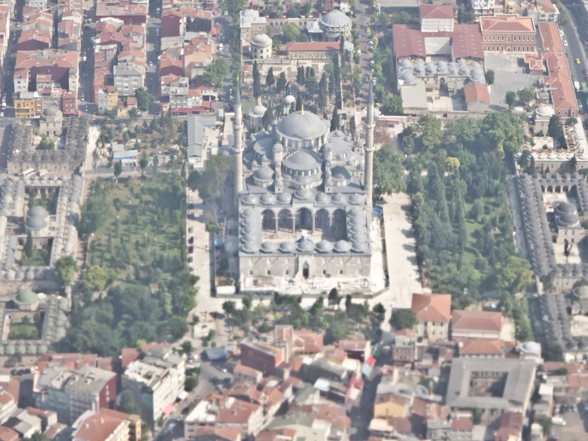
Amasra Fatih Mosque is a magnificent Byzantine church (Panagia Kriniotissa Church) built within Amasra Castle in the 9th century. It was converted into a mosque after the conquest of Amasra by Fatih Sultan Mehmet in 1460. The most important and unique historical tradition of this mosque is the reading of Friday sermons with a sword as a symbol of the Ottoman conquest. This centuries-old tradition, which was started by Sultan Mehmet the Conqueror as a sign of conquest, is still kept alive today, with the imam ascending the pulpit wearing a sword every Friday prayer. The narthex, naos and apse sections and stone masonry of the building, which was converted from a church, carry the Byzantine architectural elegance to the present day.
Geographical Structure, Altitude and Natural Features
It is located within the walls of Amasra Zindan Castle, approximately 35 meters above the sea. It is surrounded by historical narrow streets and centuries-old fig trees.
Visiting Hours, Days and Entrance Fees
- Entrance Fee: It is a historical mosque open for worship and visiting and entrance is completely free.
- Visiting Hours and Days: It is open for worship and visits 7 days a week, from morning prayer to night prayer.
- Rules, Security and Baby Stroller/Disabled Access: Dress code appropriate to mosque etiquette must be followed, and the congregation must be respected during prayer times. Since the mosque is accessed via stone stairs inside the castle, disabled chair access requires a companion.
- Facilities and Facilities: There is an ablution room, women's gallery, historical narthex area and resting benches in the courtyard.
Transportation, Public Transit Routes and Exact Location
- Address / Open Location: Kale Mahallesi, Fatih Cami Sokak, Amasra / Bartın.
- Road Condition and Vehicle Suitability: Amasra Castle is a pedestrianized area; Vehicles are left in the parking lots at the entrance of the castle and can be reached with a 3-4 minute walk.
- Real Public Transportation Information: After getting off the minibuses coming to Amasra district center, you can enter the castle gate and walk.
- Parking Availability: Municipal parking lots can be used at the foot of the castle and at the port.
Spiritual Visiting Etiquette and Commemoration Guidelines
- Spiritual Visit and Prayer Etiquette: One should spend time and pray with decorum in this historical temple, which is a 550-year-old legacy of conquest, and experience the tradition of sermons with a sword on Fridays.
- Documentary & Respectful Shooting: Respectful interior shots of Byzantine stonework, apse arches and the Ottoman pulpit.
- Important Commemoration Days: Night of Power, Mawlid Kandili and commemoration events of the conquest of Amasra.
- Local Spiritual Tradition: Serving lokma and sherbet to the congregation in the mosque courtyard after Friday.
5. Gürcüoluk Cave Nature Park

Free Public Access • GPS: 41.7264, 32.4652
History and General Information / Local Legends and Folklore
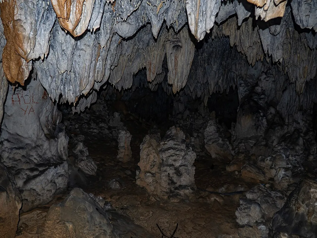
Gürcüoluk Cave Nature Park, formed within the karstic limestone formations of the Küre Mountains by groundwater erosion over millions of years, is one of Türkiye's registered natural wonders. Thousands of colorful stalactites, stalagmites, columns, curtain dripstones and cave needles inside the cave offer a fascinating view of the underground palace. Local people say that the cool air and high humidity of the cave, which was discovered during the years when Georgian immigrants settled in the region during the Ottoman period, were good for respiratory and asthma disorders, and the cave waters were believed to be healing.
Geographical Structure, Altitude and Natural Features
It is located in the Gölyanı area of Makaracı Village, Amasra district center, at an altitude of approximately 280 meters. It is surrounded by a rich Black Sea forest cover consisting of beech, oak, hornbeam and chestnut trees. The temperature inside the cave remains constant around 12-14 degrees in summer and winter.
Visiting Hours, Days and Entrance Fees
- Entrance Fee: Nature park entrance fee or free pass is applied.
- Visiting Hours and Days (Mandatory): It is open to visitors 7 days a week between 09:00 - 18:00.
- Rules, Safety and Baby Stroller/Disabled Access: The stalactites and stalagmites in the cave should not be touched; Since the ground is damp and slippery, non-slip sneakers should be worn and a cardigan should be carried. Not stroller and wheelchair accessible due to step walkways.
- Facilities and Facilities: Nature hiking trails, wooden walking piers, viewing points, seating pergolas and parking are available.
Transportation, Public Transit Routes and Exact Location
- Address / Open Location: Makaracı Village, Gölyanı Mevkii, Amasra / Bartın.
- Road Condition and Vehicle Availability: It is approximately 10 km away from Amasra town center and 22 km away from Bartın city centre; It can be easily reached by all kinds of passenger vehicles via the asphalt road and the asphalt-parquet connection within the forest.
- Real Public Transportation Information (Mandatory): You can reach the nature park in 15 minutes by shuttles from Amasra center to the village or by local taxis.
- Parking Availability: There is a free parking area for vehicles at the entrance of the nature park.
Contextual Experience Tips, Photography and Local Gastronomy
- Best Photography Spots and Frames: The illuminated stalactite columns inside the cave, the stalactite forests and the dense beech forest surrounding the cave entrance should be photographed.
- Light and Shooting Hours: Since the interior of the cave is illuminated with artificial lighting, clear shots can be taken at any time of the day; A tripod is recommended for long exposures.
- Local Gastronomy Recommendations: Chestnut honey, village butter, pancake and freshly brewed mountain thyme tea should be tasted at the village cafe upon your return from the trip.
Explore Full 5-Section Guide & Map for Gürcüoluk Cave Nature Park →
6. Historical Kemere Bridge and Boztepe Observation Area

Free Public Access • GPS: 41.7503, 32.3847
History and General Information / Local Legends and Folklore
The Historical Kemere Bridge, which connects the Zindan District and Boztepe Island in Amasra, the pearl of the Black Sea, is a monumental overwater passage that was built during the Roman Empire and strengthened during the Byzantine, Genoese and Ottoman periods and has survived to the present day. It is the main backbone of Amasra's iconic postcard silhouette.
Architectural Structure and Details
It has a single-eyed, semicircular-shaped, solid cut stone arched architecture. Locked to the steep cliffs on both sides, the bridge creates a natural tunnel under which the rough waves of the Black Sea pass. When you pass to Boztepe Island, the panoramic walking axis leading to the historical city walls and Amasra Lighthouse begins.
Spiritual Visiting Etiquette and Commemoration Guidelines
As you pass over the bridge, you can see the clear waters of the Small Harbor on one side and the endless blue of the Black Sea on the other. Fatih Sultan Mehmet's "Is Çeşm-i Cihan supposed to be here?" It gives him the opportunity to watch the Amasra painting, which he admires, from the most fascinating angle.
Practical Visiting Tips & Transportation / Check-in
It is located at the end of the coastal walking path in Amasra district center. It is closed to vehicle traffic and is only open to pedestrians; It can be visited free of charge at any time of the day. It is flocked by photography enthusiasts, especially during sunset.
Surrounding Routes & Local Gastronomy Discovery
It is directly connected to Amasra Castle, Amasra Museum and Tow Trucks Bazaar. After the visit, you should definitely try freshly panned haddock or mullet and the famous Amasra salad with 27 different ingredients at the fish restaurants in the port.
- Address / Open Location: Historical Kemere Bridge and Boztepe Viewing Area Location, Amasra, Bartın, Türkiye
Explore Full 5-Section Guide & Map for Historical Kemere Bridge and Boztepe Observation Area →
7. Historical Bedesten (Roman State Council Palace)

Free Public Access • GPS: 41.7399, 32.3848
Historical Bedesten (Roman State Council Palace)
History and General Information / Local Legends and Folklore
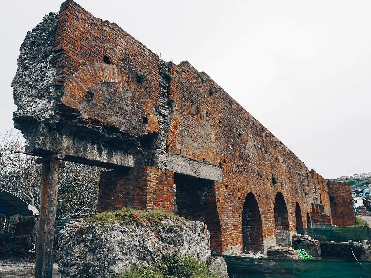
- Built during the Roman Empire at the end of the 1st century and the beginning of the 2nd century AD, in the south of the ancient city of Amastris, the Bedesten is an imposing basilical public structure that was used as the Paphlagonia provincial council palace (Bouleuterion) or a monumental Roman bath/gymnasion.
- The building, which is documented to have been built during the reign of Roman Emperor Trajan or Hadrian, is the most magnificent representative of Roman engineering on the Black Sea coast, with its huge arches made of brick and rubble, niches and vaulted ceiling ruins.
- It was called Bedesten among the public because it was used as an accommodation place for caravans and merchants and a covered bazaar (bedesten) during the Ottoman period. According to local folk tales, it is rumored that the secret tunnels under the structure reach the dungeons of Amasra Castle and the sea.
Geographical Structure, Altitude and Natural Features
- It is located on a fertile slope plain, approximately 45 meters above sea level, on the southern ridge of Amasra district center, surrounded by laurel, chestnut, oak and olive trees.
- Monumental walls built with Roman period opus caementicium mortar and terracotta bricks have survived the centuries and the humid microclimate of the Black Sea.
Visiting Hours, Days and Entrance Fees
- Entrance Fee: It has the status of an open-air archaeological site and the visit is completely free.
- Visiting Hours and Days: It can be examined from the exterior and the archaeological environment track 24 hours a day, 7 days a week.
- Rules and Safety: Climbing and removing stones from archaeological wall ruins is strictly prohibited; Since the ground is a path, flat-soled sports shoes should be preferred.
- Facilities and Facilities: It is 1.5 km away from Amasra town center and cafes, restaurants and parking facilities are located in the center.
Transportation, Public Transit Routes and Exact Location
- Address / Open Location: Kum Mahallesi, Bedesten Mevkii, 74300 Amasra / Bartın.
- Road Condition: It can be easily reached by passenger vehicles via the asphalt and cobblestone connection separated from the old Amasra-Bartın highway.
- Actual Public Transportation Information: After reaching the town center with Amasra minibuses departing every 20 minutes from Bartın Intercity Bus Terminal, you can reach the area with a 15-minute walk or by local taxis.
- Parking Availability: There is a free open parking area for 15-20 vehicles on the roadside around the building.
Featured Rare Works & Exhibition Tips
- The red silhouette of the two-thousand-year-old Roman brick arches at sunset offers unique documentary shots.
- When visited together with the Amasra Archaeological Museum, the ancient splendor of Amastris comes to mind completely; After the trip, you should taste the famous Amasra salad and fresh pancakes in the town center.
Explore Full 5-Section Guide & Map for Historical Bedesten (Roman State Council Palace) →
8. Amasra Archeology Museum

Ticketed / MuseumPass Check • GPS: 41.7460, 32.3875
History and General Information / Local Legends and Folklore
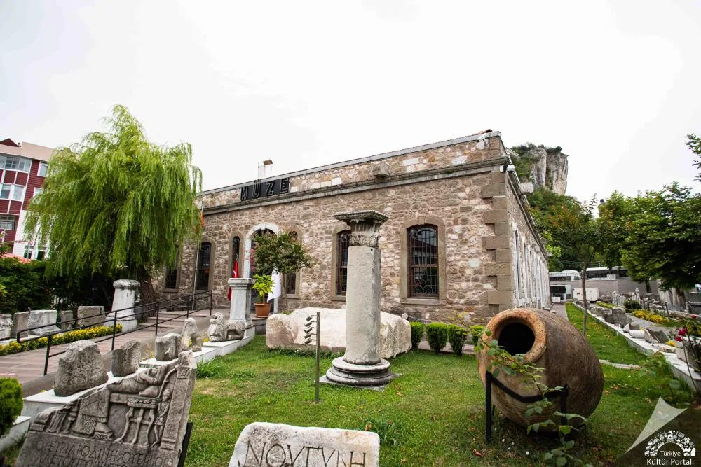
Amasra Archeology Museum is a rich cultural treasure that sheds light on the 3000-year-old history of the Western Black Sea Region. The museum building was started as a naval school by Bolu Governor İsmail Kemal Bey in 1884, and was opened as a modern museum building in 1982. Priceless marble statues, sarcophagi, gold and silver coins, terracotta lamps, glass tear bottles and local handicrafts from the Hellenistic, Roman, Byzantine, Genoese and Ottoman periods are exhibited in the museum. Roman and Byzantine column capitals and sarcophagi exhibited in the museum garden create an open-air archaeological park atmosphere.
Geographical Structure, Altitude and Natural Features
It is located close to sea level in Çamlık, on the Amasra coast. It is in a large garden shaded by centuries-old pine and plane trees.
Visiting Hours, Days and Entrance Fees
- Entrance Fee: Subject to the Ministry of Culture and Tourism ticket tariff; Museum card is valid (is_free: false).
- Visiting Hours and Days: Open 6 days a week between 08:30 - 17:30, except Monday.
- Rules, Security and Stroller/Disabled Access: Flash photography is not allowed in the museum halls. There is a disabled ramp at the museum entrance and the halls are accessible for baby strollers and disabled chairs.
- Facilities and Facilities: Exhibition halls, open-air garden museum, souvenir section, WC and air conditioning equipment are available.
Transportation, Public Transit Routes and Exact Location
- Address / Open Location: Kum Mahallesi, Çankaya Caddesi No:1, Amasra / Bartın.
- Road Condition and Vehicle Suitability: It is on the coastal road in Amasra district center; You can easily reach the door by passenger vehicles.
- Real Public Transportation Information: It can be easily reached with a 5-minute walk from Amasra bus station or port.
- Parking Availability: There are parking areas in front of the museum and on the beach street.
Contextual Experience Tips, Photography and Local Gastronomy
- Best Photography Spots and Frames: Monumental Roman statues in the museum garden, marble sarcophagus reliefs and under the historical plane tree in the garden.
- Light and Shooting Hours: Shadow-light games on the sculptures in the museum garden in the morning and afternoon hours.
- Local Gastronomy Recommendations: Buffalo yogurt with honey and hazelnuts and fresh seafood in the center of Amasra after the museum visit.
Explore Full 5-Section Guide & Map for Amasra Archeology Museum →
9. Historical Boztepe Lighthouse and Rabbit Island Viewpoint
Free Public Access • GPS: 41.7502, 32.3904
Historical Boztepe Lighthouse and Rabbit Island Viewing Point
History and General Information / Local Legends and Folklore
- Amasra Boztepe Lighthouse, built by French lighthouse architects during the reign of Sultan Abdülaziz in 1863, is a registered industrial heritage that has guided sailors among the rough waves of the Black Sea for centuries.
- Located on the extreme steep cliff of Boztepe cape, the lighthouse creates a fascinating historical silhouette with Tavşan Island (Horos Island) lying opposite it and the ancient Genoese monastery ruins on it.
- In the local sailor legends related to the Weeping Tree around the lighthouse, it is told that the captains who went on a voyage saluted the lighthouse for the last time and sent them off from Boztepe with a prayer.
Geographical Structure, Altitude and Natural Features
- It is located at the top of the Boztepe peninsula, 77 meters above sea level, surrounded by steep limestone cliffs.
- The lighthouse tower is 10 meters high and the lighthouse light is visible from a distance of approximately 20 nautical miles; It is surrounded on all sides by the vast blue of the Black Sea and emerald coastal forests.
Visiting Hours, Days and Entrance Fees
- Entrance Fee: The lighthouse surroundings and viewing terraces are completely free.
- Visiting Hours and Days: It is open to the public and photography enthusiasts 24 hours a day, 7 days a week.
- Rules and Safety: One should not go beyond the protection bars on the edges of the cliff, and careful steps should be taken in windy weather; The interior of the lighthouse tower is under the control of the General Directorate of Coastal Safety and is closed to visitors.
- Facilities and Facilities: There are tea gardens, sea view cafes, seating benches and souvenir stands on the Boztepe pathway.
Transportation, Public Transit Routes and Exact Location
- Address / Open Location: Boztepe District, Boztepe Peninsula Tip, 74300 Amasra / Bartın.
- Road Condition: You can cross the historical Kemere Bridge on foot and walk along the cobblestone staircase along the Boztepe slope.
- Real Public Transportation Information: It is a 5-minute walk from Amasra district center to Kemere Bridge; Bartın-Amasra minibuses provide service to the district central square.
- Parking Availability: There are municipal parking lots at the entrance of Kemere Bridge and around the Small Port.
Contextual Experience Tips, Photography and Local Gastronomy
- The moment when the sun melts into the Black Sea waters at sunset from the rocky viewing terrace next to the lighthouse and the Tavşan Island frame opposite is one of the most iconic sunset views of Turkey.
- The famous Amasra honey buffalo yoghurt dessert and crispy walnuts served with strong tea in the Boztepe tea garden during the afternoon sun and golden hour should be experienced.
Explore Full 5-Section Guide & Map for Historical Boztepe Lighthouse and Rabbit Island Viewpoint →
10. Historical Direkli Rock and Küçük Liman Bay
Free Public Access • GPS: 41.7496, 32.3844
Historical Direkli Rock and Küçük Liman Bay
History and General Information / Local Legends and Folklore
- Direkli Rock, rising out of the sea in Amasra Küçük Liman location, is a unique ancient masterpiece with a height of 7 meters, which was created by carving rocks as a harbor control tower, lighthouse and sea pool during the reign of Queen Amastris, who ruled the ancient city of Amastris.
- Stairs carved into the rocks, marble pole sockets and pool-shaped cavities have survived until today.
- According to legend, this is the private sea bath where Queen Amastris, who was famous for her beauty, bathed in the sea; It is also rumored that Genoese sailors tied their galleys approaching the harbor to thick iron rings on this rock.
Geographical Structure, Altitude and Natural Features
- It is located at sea level, in the sheltered Küçük Liman bay in the southwest of the Amasra peninsula.
- The steps carved by hand on the natural limestone rock are surrounded by clear and turquoise sea water; The bay is closed to waves and has a shallow structure.
Visiting Hours, Days and Entrance Fees
- Entrance Fee: Since it is located on the public coastline, entrance is completely free.
- Visiting Hours and Days: It can be visited 24 hours a day, 7 days a week.
- Rules and Safety: Wet rocks and carved stairs can become slippery when moss accumulates; Care should be taken when descending the steps.
- Facilities and Facilities: There are fish restaurants, tea gardens, changing cabins, WC and walking promenade along the Küçük Liman coastline.
Transportation, Public Transit Routes and Exact Location
- Address / Open Location: Kum Mahallesi, Küçük Liman Caddesi, 74300 Amasra / Bartın.
- Road Condition: It is located right on the coast of Amasra town centre, and can be easily reached via the completely asphalt and pedestrian-friendly coastal road.
- Real Public Transportation Information: Bartın-Amasra minibuses drop off passengers at the market stop 200 meters from Küçük Liman.
- Parking Availability: There are paid/free municipal parking areas along the Küçük Liman coastline.
Contextual Experience Tips, Photography and Local Gastronomy
- The view towards the Küçük Harbor promenade from the steps of Direkli Rock and the evening light hitting the rock provide wonderful shots with underwater clarity.
- You should definitely try the famous Amasra salad prepared with 27 types of local herbs accompanied by Black Sea whiting, horse mackerel and fresh red mullet at the registered fishmongers on the coast of Küçük Liman.
Explore Full 5-Section Guide & Map for Historical Direkli Rock and Küçük Liman Bay →
What to Eat in Amasra, Bartın? Registered Local Delicacies & Gastronomy
A trip to Amasra, Bartın is incomplete without tasting its officially registered geographical indication products and centuries-old Anatolian recipes:
1. Bartın Fig Ice Cream Dessert / Bartın Fig Ice Cream (Fırıncılık ve pastacılık mamulleri, hamur işleri, tatlılar)
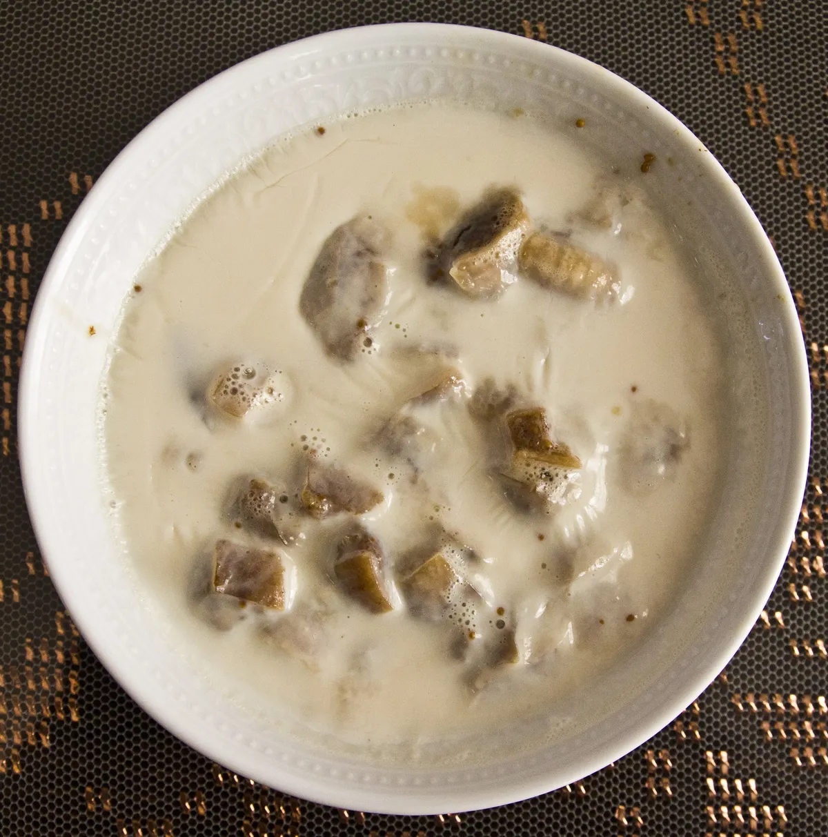
Bartın Fig Ice Cream Dessert / Bartın Fig Ice Cream is a geographically indicated value of ours, unique to the Bartın region and registered by the Turkish Patent and Trademark Office on 09.10.2020 (with registration number 568).
2. Bartin White Baklava (Fırıncılık ve pastacılık mamulleri, hamur işleri, tatlılar)
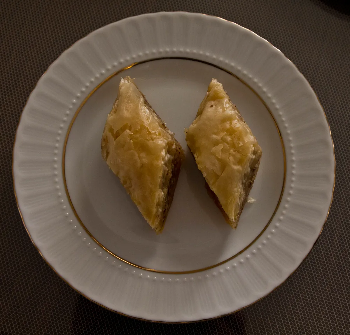
Bartın White Baklava is a geographically indicated value specific to the Bartın region, registered by the Turkish Patent and Trademark Office on 09.10.2020 (with registration number 567).
View Official Geographical Indication Dossier for Bartin White Baklava →
3. Bartın Pumpkin Burma Dessert / Bartın Pumpkin Burma (Fırıncılık ve pastacılık mamulleri, hamur işleri, tatlılar)
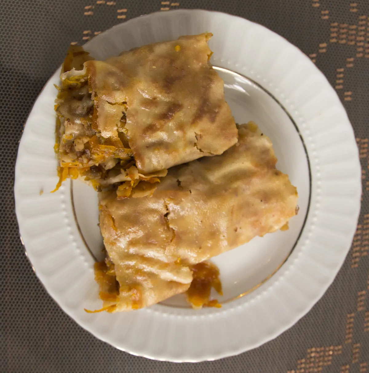
Bartın Kabak Burma Dessert / Bartın Pumpkin Burma is a geographically indicated value specific to the Bartın region, registered by the Turkish Patent and Trademark Office on 09.10.2020 (with registration number 566).
4. Bartin Wax Dessert (Fırıncılık ve pastacılık mamulleri, hamur işleri, tatlılar)
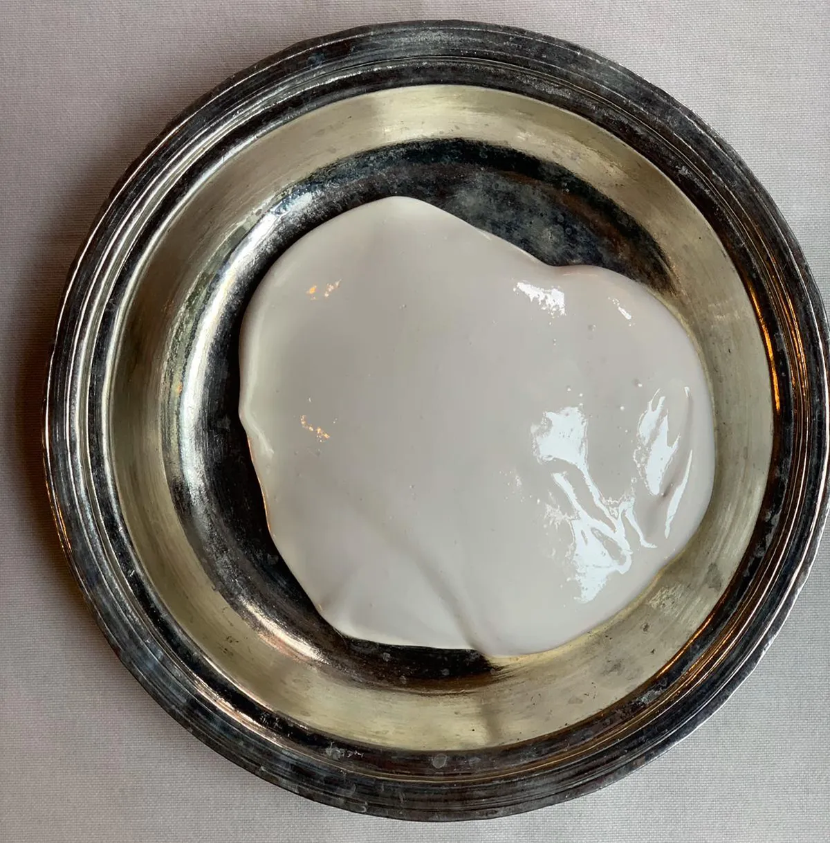
Bright white, fibrous halva made by adding plenty of fresh Bartın walnuts or hazelnuts to the whitened wax prepared with beet sugar sherbet and soapwort juice.
History: Traditional energy source sold in the Bartın market during the winter months for more than 100 years.
Production Method: It is bleached with soapwort water in a copper boiler; does not contain additives.
View Official Geographical Indication Dossier for Bartin Wax Dessert →
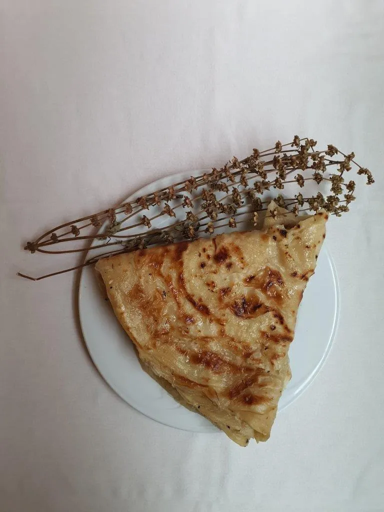
5. Kurucaşile Stone Sheet (Diğer ürünler)
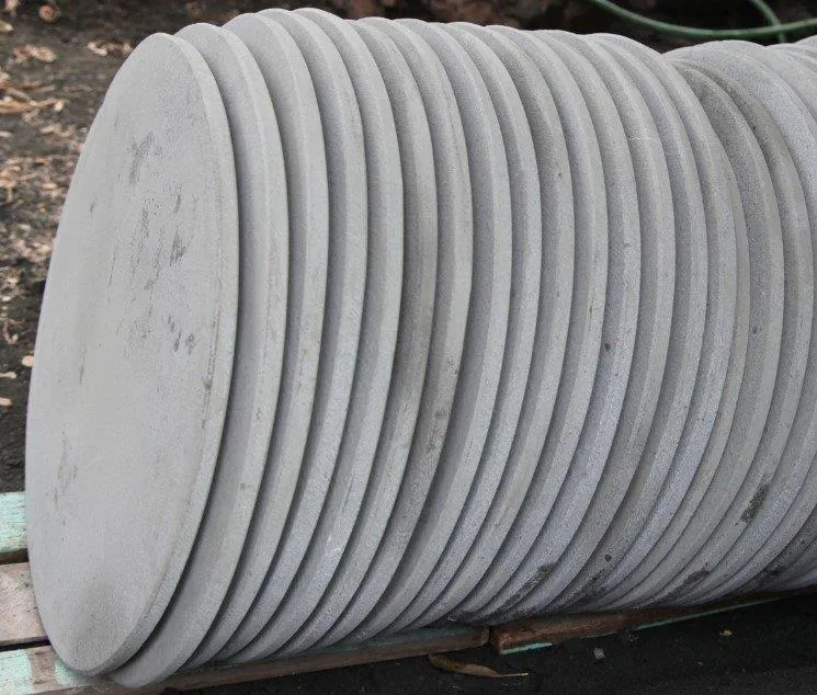
Kurucaşile Stone Sheet is a geographically indicated value of ours, unique to the Bartın region and registered by the Turkish Patent and Trademark Office on 10.03.2021 (with registration number 690).
View Official Geographical Indication Dossier for Kurucaşile Stone Sheet →
6. Bartın Rice Ravioli (Yemekler ve çorbalar)
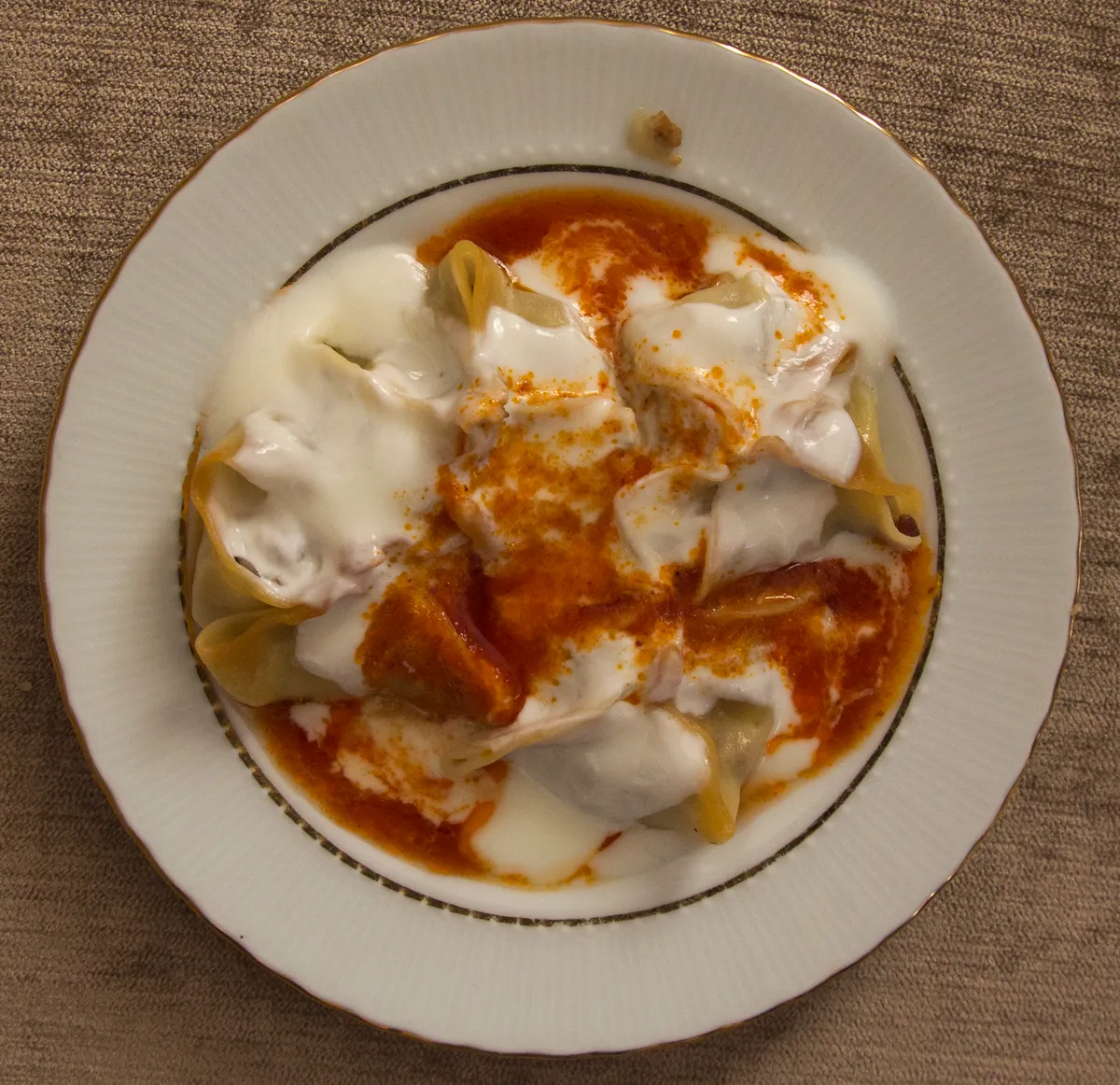
Bartın Rice Ravioli is a geographically indicated value of ours, unique to the Bartın region and registered by the Turkish Patent and Trademark Office on 09.10.2020 (with registration number 569).
View Official Geographical Indication Dossier for Bartın Rice Ravioli →
Practical Travel & Transit Planning for Amasra, Bartın (2026)
| Planning Category | Verified Local Information |
|---|---|
| Region & Administrative Center | Amasra, Bartın, Türkiye |
| Best Time to Visit | Spring (April–June) and Autumn (September–November) for ideal sightseeing weather; Summer for highlands and coastal routes. |
| Public Transit & Highway Access | Regular municipal buses and local minibus cooperatives (Dolmuş) depart daily from the Bartın Intercity Bus Terminal (Otogar) directly to Amasra. |
| Recommended Stay | 1 to 2 full days to explore the main historical landmarks, nature trails, and local culinary stops. |
Frequently Asked Questions About Visiting Amasra, Bartın
What are the must-see places to visit in Amasra, Bartın?
The top verified attractions in Amasra, Bartın include Historical Kemere Bridge, Kuşkayası Road Monument, Historical Amasra Castle (Zindan and Sormagir Castles), Historical Amasra Fatih Mosque (Historical Byzantine Church), Gürcüoluk Cave Nature Park. Each location offers documented historical or natural heritage with clear road access.
How can I get to Amasra, Bartın by public transport or car?
You can reach Amasra, Bartın easily by car via Bartın's main provincial highways, or take regular municipal buses and district minibuses departing throughout the day from the Bartın central bus terminal (Otogar).
What are the famous local dishes and traditional foods to try in Amasra, Bartın?
When visiting Amasra, Bartın and Bartın, be sure to taste officially registered specialties such as Bartın Fig Ice Cream Dessert / Bartın Fig Ice Cream, Bartin White Baklava, Bartın Pumpkin Burma Dessert / Bartın Pumpkin Burma, Bartin Wax Dessert, Kurucaşile Stone Sheet, prepared by local artisans and traditional restaurants.
Are the attractions in Amasra, Bartın suitable for families and day trips?
Yes. Most historic monuments, parks, museums, and promenade areas in Amasra, Bartın are family-friendly and well-suited for both weekend getaways and full-day cultural itineraries.
When is the best season to visit Amasra, Bartın?
Spring and autumn offer the most comfortable temperatures for walking tours and photography in Amasra, Bartın, while summer is popular for nature recreation, plateaus, and festivals.