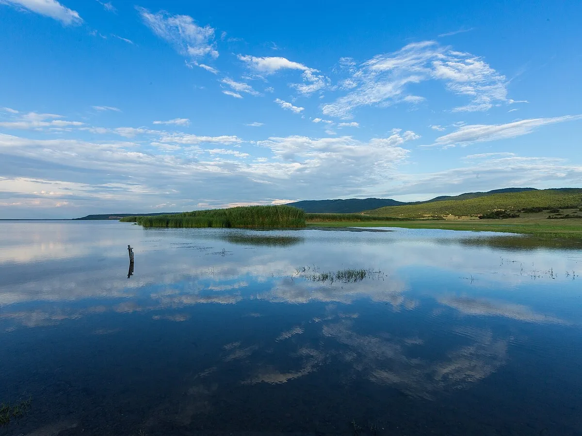

Planning a journey to Enez, Edirne? This comprehensive 2026 Places to Visit guide brings together 10 verified landmarks, natural wonders, and cultural heritage sites with official visiting hours, GPS coordinates, public transit connections, and local gastronomy recommendations.
Quick Highlights & Discovery Route in Enez, Edirne
- Historical Enez Castle & Fatih Mosque
- Gala Lake National Park
- Enez City Square & Harbor Park
- Ancient Enez Roman Aqueducts
- Ancient Ainos King's Daughter Chapel
- Enez Dalyan Lagoon Lake
- Çeribaşı Cherry
- Uzunköprü Meatballs
Natural Wonders, Valleys, Plateaus & Eco-Discovery in Enez, Edirne
Enez, Edirne (Edirne) captivates nature lovers with its unspoiled valleys, lush forests, high plateaus (yaylalar), canyons, and diverse flora. Each season transforms the landscapes of Enez, Edirne, from vibrant spring blossoms to golden autumn foliage.
- Seasonal Highlights: Spring (April–June) brings rushing streams and wildflowers, while autumn (October–November) turns the forests around Enez, Edirne into a photographer's paradise.
- Outdoor Preparedness: Wear layered clothing, carry sufficient drinking water, and download offline maps before venturing into rural trails in Enez, Edirne.
- Eco-Conscious Travel: Protect the natural habitats of Enez, Edirne by leaving zero waste and staying on marked paths.
Top Verified Places to Visit & Must-See Landmarks in Enez, Edirne
1. Historical Enez Castle & Fatih Mosque

Free Public Access • GPS: 40.7241, 26.0812
History and General Information / Local Legends and Folklore
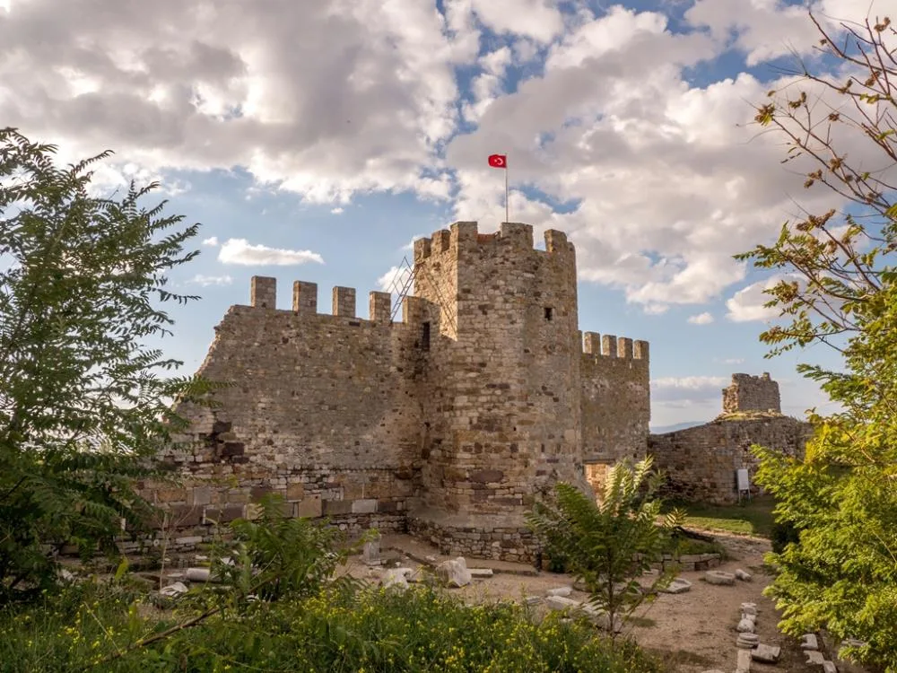
Enez Castle and Fatih Mosque (Enez Hagia Sophia), built on the ancient Ainos acropolis by the Byzantine Emperor Justinianos to protect the mouth of the Meriç River and the Aegean coast, was converted into a mosque after the conquest of the city by Sultan Mehmed the Conqueror in 1456, and is the most magnificent coastal castle of Thrace with its 12th century Byzantine brickwork, dome and huge city walls.
Geographical Structure, Altitude and Natural Features
It is located in the town center of Enez, on a hill with an altitude of 30 meters overlooking Dalyan Lagoon and Saros Bay.
Visiting Hours, Days and Entrance Fees
- Entrance Fee: Free.
- Visiting Hours: Open 7 days a week between 08:30 - 20:00; The mosque is open for worship during prayer times.
- Facilities: There are walking paths inside the historical castle, observation terrace, lighting and landscaping area.
Transportation, Public Transit Routes and Exact Location
- Full Address: Gaziömerbey Mahallesi Kale Caddesi, Enez / Edirne.
- Address / Open Location: Historical Enez Castle & Fatih Mosque Location, Enez, Edirne, Turkey
- Road Condition: Enez is in the district center; It can be easily reached on foot.
- Public Transportation: Enez minibuses departing from Edirne and Keşan drop off at the center.
- Parking: There is a car park at the entrance of the castle.
Contextual Experience Tips, Photography and Local Gastronomy
- Walls and Hagia Sophia: The dome architecture of Enez Hagia Sophia, crowned with the conquest of Mehmed the Conqueror, should be examined and the Aegean Sea sunset should be watched from the walls.
Explore Full 5-Section Guide & Map for Historical Enez Castle & Fatih Mosque →
2. Gala Lake National Park

Free Public Access • GPS: 40.7525, 26.1674
History and General Information / Local Legends and Folklore
Gala Lake National Park, Gala and Pamuklu lakes located in the Meriç Delta wetlands, is a natural wonder national park with international Ramsar protection status, hosting more than 217 bird species, especially Dalmatian pelicans, flamingos, swans and egrets, water hyacinths and water lilies.
Geographical Structure, Altitude and Natural Features
It is a fresh and semi-saline lagoon delta of 6,000 hectares at sea level (0-10 m altitude).
Visiting Hours, Days and Entrance Fees
- Entrance Fee: Free (It has national park status).
- Visiting Hours: Open during the day (Entry 08:00 - 19:30).
- Facilities: Bird observation towers, wooden walking piers, information boards and parking are available.
Transportation, Public Transit Routes and Exact Location
- Address: Gala Lake National Park Road, Enez / Edirne.
- Address / Open Location: Gala Lake National Park Mevkii, Enez, Edirne, Turkey
- Road Condition: 10 km from Enez center and 15 km from İpsala; It can be reached by asphalt highway.
- Public Transportation: Arrived by private vehicle or Enez-İpsala minibuses.
- Parking: There is a car park next to the bird observation tower.
Contextual Experience Tips, Photography and Local Gastronomy
- Observation Tower: Flocks of pink flamingos and crested pelicans on the lake should be photographed with binoculars and a telephoto lens.
Explore Full 5-Section Guide & Map for Gala Lake National Park →
3. Enez City Square & Harbor Park
Free Public Access • GPS: 40.7092, 26.0680
History and General Information / Local Legends and Folklore
Enez City Square and Fisherman's Harbor Park is the heart of the coastal town with its colorful fishing boats, fresh seafood restaurants, tea gardens under plane trees and a local bazaar.
Geographical Structure, Altitude and Natural Features
It is located in the center of Enez, at an altitude of 15 meters.
Visiting Hours, Days and Entrance Fees
- Entrance Fee: Free.
- Visiting Hours: Open 24 hours.
- Facilities: Fish restaurants, cafes, children's playground, rest benches and harbor walking promenade are available.
Transportation, Public Transit Routes and Exact Location
- Full Address: Liman Caddesi, Enez District Center / Edirne.
- Address / Open Location: Enez City Square & Liman Park Mevkii, Enez, Edirne, Turkey
- Road Condition: Located in the district center; Easily connects from any direction.
- Public Transportation: Buses departing from Edirne and Keşan arrive near the port.
- Parking: There is a large parking area around the square and the harbour.
Contextual Experience Tips, Photography and Local Gastronomy
- Local Gastronomy Recommendations: Registered Enez Salted Mullet Fish (fish roe/caviar), grilled Saros sea bass and bream, Enez sweet watermelon and famous Edirne cheese halva should definitely be tasted.
Explore Full 5-Section Guide & Map for Enez City Square & Harbor Park →
4. Ancient Enez Roman Aqueducts
Free Public Access • GPS: 40.7322, 26.0954
History and General Information / Local Legends and Folklore
These are monumental water engineering monuments built during the Roman and Eastern Roman (Byzantine) empires to meet the fresh water needs of the increasing population and navy of the city of Ainos (Enez), which was an important trade and naval base of the period. The aqueduct, which was built with a two-storey arch system of cut limestone to overcome the deep valley passage in the Deveboynu location, carried spring waters from kilometers away to the cisterns of the ancient city through pipes and stone channels. According to local narratives, the aqueducts were meticulously protected by the Roman legions in memory of the legendary Aeneas, the founder of the city; It has provided lifeblood to the city for centuries.
Geographical Structure, Altitude and Natural Features
It is located in the eastern countryside of Enez, in the valley at Deveboynu location. Its height above sea level is 35 meters. It is in a natural valley surrounded by oak bushes, wild olive trees and oleanders.
Visiting Hours, Days and Entrance Fees
- Entrance Fee: Visiting the historical area is completely free.
- Visiting Hours and Days (Mandatory): It can be visited 7 days a week during daylight hours.
- Rules, Safety and Stroller/Disabled Access: Registered Roman ruins; Arch stones should not be climbed or damaged. The valley floor has path ground.
- Facilities and Amenities: There are no facilities in the area; The nearest settlement is the center of Enez.
Transportation, Public Transit Routes and Exact Location
- Address / Open Location: Deveboynu Mevkii, Aqueduct Road, 22700 Enez / Edirne.
- Road Condition and Vehicle Availability: It is 4 km away from Enez town center; After the asphalt road, you can reach the ruins of the arch through a 400-meter field road.
- Real Public Transportation Information (Mandatory): Enez can be reached in 5 minutes by village minibuses or taxi from the center.
- Parking Availability: There is open parking space for 15 vehicles on the roadside.
Contextual Experience Tips, Photography and Local Gastronomy
- Kemer Architectural Details: Cut stone piers, arch curves and traces of ancient water channels should be photographed.
- Trekking: You can trek the 2-kilometer ancient waterway following the traces of the aqueduct throughout the valley.
- Local Gastronomy Recommendations: Fresh black-eyed peas with olive oil and homemade groom's paca pastry should be tasted in the center of Enez.
Explore Full 5-Section Guide & Map for Ancient Enez Roman Aqueducts →
5. Ancient Ainos King's Daughter Chapel
Free Public Access • GPS: 40.7181, 26.0878
History and General Information / Local Legends and Folklore
The Chapel of the King's Daughter, carved into the steep limestone rocky mass overlooking the lagoons of the Meriç Delta and the Aegean Sea, on the southern hills of Ainos (Enez), the legendary port city of ancient times, is a mysterious rock temple dating back to the Early Byzantine period (6th - 10th century AD). The apse, altar niches, candle stands and grave pits carved into the natural rock mass are a sacred place used by early Christian monks as ascetics and ascetic prayer cells. According to the legend told by the local people, the most beautiful daughter of the king of Ainos abandoned the pomp of the palace and worldly pleasures and devoted herself to worship and prayer; He spent his life taking shelter in this steep cave and praying for healing for the poor and the sick; For this reason, the place has been known as the "King's Daughter Chapel" for centuries.
Geographical Structure, Altitude and Natural Features
It is located on the southern slopes of Enez district center, on the hill overlooking the lagoon lakes. Its height above sea level is 45 meters. Its surroundings are covered with wild olive groves, oleanders and Mediterranean maquis; From the top, the lagoons of Gala Lake, the Meriç Delta and the deep blue waters of Saros Gulf can be seen panoramatically.
Visiting Hours, Days and Entrance Fees
- Entrance Fee: It is an open-air protected area and entrance is completely free.
- Visiting Hours and Days (Mandatory): It is open to visitors 7 days a week during daylight hours (08:30 - 18:30).
- Rules, Safety and Stroller/Disabled Access: It is a 1st Degree Archaeological Site; Writing on rocks and digging is strictly prohibited. The rock ground is uneven and walking shoes are a must; Baby strollers cannot enter the cave.
- Facilities and Facilities: There are no commercial facilities in the area; Kordon cafes and museums in Enez center are within walking distance (1 km).
Transportation, Public Transit Routes and Exact Location
- Address / Open Location: Gaziömerbey District, Kral Kızı Hill, 22700 Enez / Edirne.
- Road Condition and Vehicle Suitability: You can reach the foot of the hill by an asphalt road from Enez district center; It can be easily approached by all types of passenger cars.
- Real Public Transportation Information (Mandatory): Enez district minibuses departing from Keşan and Edirne bus terminals and drop off at the center; The chapel on the hill can be reached on foot in 15 minutes.
- Parking Availability: There is an uncontrolled parking lot for 20 vehicles in the open area at the foot of the hill.
History and General Information / Local Legends and Folklore
- Rock Work & Apse: The apse dome, altar niches and rock tomb klines carved into the rock should be photographed.
- Enez Delta View: Flamingos and sunset glows in the lagoon lakes of the Meriç Delta should be watched from the viewing terrace in front of the chapel.
- Local Gastronomy Recommendations: Fresh Saros sea bream, sea bass and the famous salted mullet should be tasted in Enez port restaurants.
Explore Full 5-Section Guide & Map for Ancient Ainos King's Daughter Chapel →
6. Enez Dalyan Lagoon Lake
Free Public Access • GPS: 40.7181, 26.0709
History and General Information / Local Legends and Folklore
Enez Dalyan Lagoon Lake, formed at the point where the Meriç River meets the Aegean Sea, is the symbol wetland of the district with its traditional fishing methods for centuries, eel and mullet fish, reeds and sunset views.
Geographical Structure, Altitude and Natural Features
It is a lagoon lake at sea level; It has a rich fish fauna.
Visiting Hours, Days and Entrance Fees
- Entrance Fee: Free.
- Visiting Hours: Open 24 hours.
- Facilities: There are lakeside fish restaurants, observation benches and a walking track.
Transportation, Public Transit Routes and Exact Location
- Full Address: Dalyan Lagoon Beach, Enez / Edirne.
- Address / Open Location: Enez Dalyan Lagoon Lake Mevkii, Enez, Edirne, Turkey
- Road Condition: It is 1.5 km away from Enez district center.
- Public Transportation: It can be reached by district shuttles and minibuses.
- Parking: There are car parks at the edge of the lagoon.
Contextual Experience Tips, Photography and Local Gastronomy
- Sunset: You should watch the orange reflections of the setting sun on the Dalyan reeds and taste fresh Dalyan eel.
Explore Full 5-Section Guide & Map for Enez Dalyan Lagoon Lake →
7. Enez Altinkum Beach & Beach
Free Public Access • GPS: 40.6672, 26.0658
History and General Information / Local Legends and Folklore
Enez Altınkum Beach is the most popular beach and holiday paradise in Thrace, with the crystal clear turquoise waters of Saros Gulf, one of the few self-cleaning water bodies in the world thanks to underwater currents, a thin golden sandy beach stretching for kilometers, shallow sea and rich underwater reefs.
Geographical Structure, Altitude and Natural Features
It is located on the coast of Saros Gulf, at an altitude of 0 meters; It is a wide beach strip with fine sand.
Visiting Hours, Days and Entrance Fees
- Entrance Fee: Entrance to the public beach is free; Sun lounger and umbrella rental is available.
- Visiting Hours: Open 24 hours.
- Facilities: There is a lifeguard tower, showers, changing cabins, WC, beach cafes, water sports and parking.
Transportation, Public Transit Routes and Exact Location
- Full Address: Altınkum Sahil Caddesi, Gaziömerbey Mahallesi, Enez / Edirne.
- Address / Open Location: Enez Altınkum Sahil & Plajı Mevkii, Enez, Edirne, Turkey
- Road Condition: It is 3 km away from Enez town center; It can be reached entirely via the double coast road.
- Public Transportation: It can be reached by Altınkum beach minibuses, which depart from Enez center every 15 minutes.
- Parking: There are large car parking areas along the beach.
Contextual Experience Tips, Photography and Local Gastronomy
- Sea Enjoyment: Swimming in crystal clear Saros waters, exploring underwater reefs with snorkeling and walking on the beach at sunset.
Explore Full 5-Section Guide & Map for Enez Altinkum Beach & Beach →
8. Historical Ainos Ancient City Castle and Enez Hagia Sophia (Fatih Mosque)
Free Public Access • GPS: 40.7243, 26.0805
History and General Information / Local Legends and Folklore
The ancient city of Ainos, founded by the Aeolians in the 7th century BC, at the point where the Meriç River flows into the Aegean Sea, is the oldest port settlement in Thrace, mentioned as 'Aineia' in Homer's Iliad. Enez Castle, rising on the acropolis of the city rumored to have been founded by the Trojan War hero Aeneas, was fortified during the Roman, Byzantine and Genoese periods. Enez Hagia Sophia, located inside the castle and built in the Byzantine period in the 12th century AD, was converted into a mosque after the conquest of the city by Mehmed the Conqueror in 1455 and was named 'Fatih Mosque'. The building, which remained abandoned for many years as a result of earthquakes, was restored faithfully to the original by the General Directorate of Foundations and was reopened to worship and visit in 2021 after 56 years.
Geographical Structure, Altitude and Natural Features
It is located at an altitude of 25 meters, on the top of the peninsula where Meriç Delta and Dalyan Lagoon Lake meet the Aegean Sea. Located between the turquoise waters of Saros Gulf and the lagoon lakes, the castle offers a panoramic view of the Meriç mouth and the Greek lands on the opposite shore.
Visiting Hours, Days and Entrance Fees
- Entrance Fee: Visiting the historical Enez Castle, Ainos excavation site and Enez Hagia Sophia Mosque is completely free.
- Visiting Hours and Days (Mandatory): It is open for visits and worship 7 days a week, from the morning adhan until after the night prayer (08:30 - 21:00).
- Rules, Security and Baby Stroller/Disabled Access: The castle slope is paved and ramps are arranged for wheelchair and stroller entrance to the castle courtyard.
- Facilities and Facilities: There are ablution facilities, WCs, viewing terraces, information signs and fishermen's tea gardens under the castle around the mosque.
Transportation, Public Transit Routes and Exact Location
- Address / Open Location: Gaziömerbey Mahallesi, Kale Caddesi, Enez / Edirne.
- Road Condition and Vehicle Availability: It can be reached via the 60 km coastal road from Keşan (asphalt road with connection to D110/D550); Suitable for passenger vehicles.
- Real Public Transportation Information (Mandatory): Enez Cooperative minibuses depart every hour from Keşan District Bus Terminal and come directly to the district square and the foothills of the castle.
- Parking Availability: There is a free municipal parking lot for 80 vehicles at the base of the castle walls and on the coastal street.
Contextual Experience Tips, Photography and Local Gastronomy
- Best Photography Spots and Frames: Wide angle frames extending from the walls of Enez Castle to the Meriç Delta, Dalyan Lake and the Aegean Sea painted red at sunset.
- Light and Shooting Hours: The golden yellow hues of the castle stones during the afternoon sun and sunset hours.
- Local Gastronomy Recommendations: Fresh eel caught from Dalyan Lake, murmur and sea bass cooked in Enez salt should be tasted at the local fish restaurants in the harbour.
9. Karaağaç Historical Station & Lausanne Monument

Free Public Access • GPS: 41.6522, 26.5219
History and General Information / Local Legends and Folklore
Karaağaç Historical Train Station, built with cut stone and brickwork by Architect Kemalettin in the style of the First National Architectural Movement, is the main station of the Eastern Railways (Orient Express), and is the city's most popular culture and art campus with its giant Lausanne Peace Monument, Museum and nostalgic steam locomotive in Karaağaç, which was given back to Turkey as war compensation with the Lausanne Peace Treaty.
Geographical Structure, Altitude and Natural Features
It is located in the Karaağaç district, at an altitude of 35 meters, among centuries-old plane trees and green parks.
Visiting Hours, Days and Entrance Fees
- Entrance Fee: The station garden and the monument are free; The museum is open to visitors.
- Visiting Hours: It can be visited 7 days a week between 09:00 - 18:00.
- Facilities: Trakya University Faculty of Fine Arts galleries, Lausanne Museum, cafe, nostalgic train and parking lot.
Transportation, Public Transit Routes and Exact Location
- Full Address: Karaağaç Mahallesi Lozan Caddesi, Merkez / Edirne.
- Address / Open Location: Karaağaç Historical Station & Lausanne Monument Location, Center, Edirne, Turkey
- Road Condition: It is 4 km away via Karaağaç, passing the Meriç Bridge; It can be reached by bicycle and vehicle.
- Public Transportation: Karaağaç minibuses departing from the center arrive at the station gate.
- Parking: There is ample parking in the station garden.
Contextual Experience Tips, Photography and Local Gastronomy
- Bicycle and Cafe: Ride a rental bike from Edirne center to Karaağaç via the Meriç Bridge, photograph the historical railway station and drink coffee in the cafes under the plane tree.
Explore Full 5-Section Guide & Map for Karaağaç Historical Station & Lausanne Monument →
10. Kurtbey Grave Monument & Plane Trees

Free Public Access • GPS: 41.5503, 26.8215
History and General Information / Local Legends and Folklore
Kurtbey Grave Monument and Centuries-Old Plane Trees is a historical place of visit and loyalty, containing the tomb of the famous Ottoman raider lord Kurt Bey, who showed great benefits in the conquest of Rumelia in the 14th century, and the centuries-old registered monumental plane trees around it.
Geographical Structure, Altitude and Natural Features
It is located at an altitude of 75 meters, under shady monumental trees.
Visiting Hours, Days and Entrance Fees
- Entrance Fee: Free.
- Visiting Hours: Open to visitors 24 hours a day.
- Facility Status: It is a registered mausoleum and green recreation area.
Transportation, Public Transit Routes and Exact Location
- Full Address: Fatih Street, Hacıisa District, Havsa / Edirne.
- Address / Open Location: Kurtbey Grave Monument & Çınarları Mevkii, Havsa, Edirne, Turkey
- Road Condition: It is opposite the Sokollu Social Complex.
- Public Transportation: You can reach Havsa center by minibuses.
- Parking: There is car parking on the roadside.
Spiritual Visiting Etiquette and Commemoration Guidelines
- Commemoration and Prayer: The Fatiha should be recited for the soul of Kurt Bey, the conqueror of Rumelia, and one should rest under the shadow of the centuries-old plane trees.
Explore Full 5-Section Guide & Map for Kurtbey Grave Monument & Plane Trees →
What to Eat in Enez, Edirne? Registered Local Delicacies & Gastronomy
A trip to Enez, Edirne is incomplete without tasting its officially registered geographical indication products and centuries-old Anatolian recipes:
1. Çeribaşı Cherry (İşlenmiş ve işlenmemiş meyve ve sebzeler ile mantarlar)
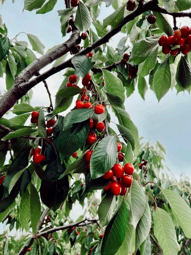
Çeribaşı Cherry is a geographically indicated value of ours, unique to the Edirne region and registered by the Turkish Patent and Trademark Office on 13.11.2025 (with registration number 1790).
View Official Geographical Indication Dossier for Çeribaşı Cherry →
2. Uzunköprü Meatballs (Yemekler ve çorbalar)
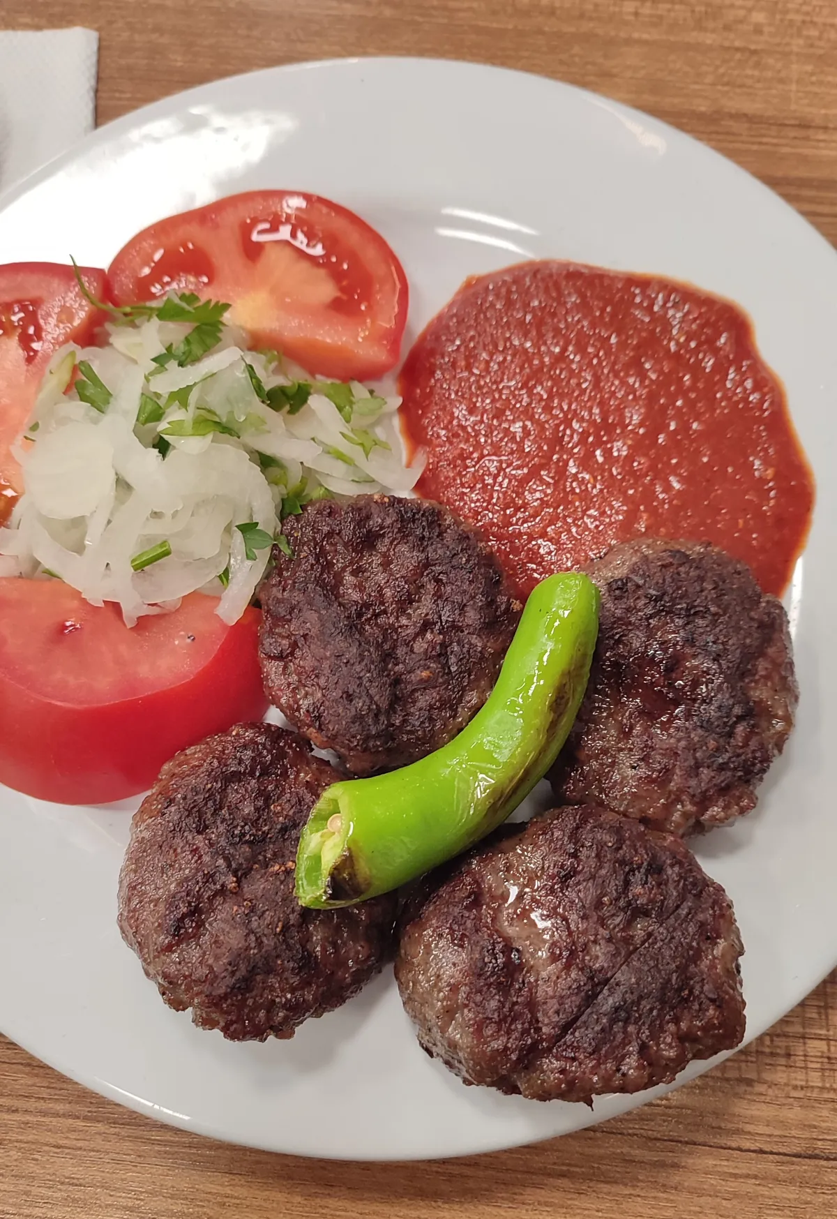
Juicy and elastic Thracian meatballs prepared from the meat of Ergene Plain calves.
History: Half a century of flavor under the shadow of the world's longest stone bridge.
View Official Geographical Indication Dossier for Uzunköprü Meatballs →
3. Edirne Fresh Fruit Soap (Diğer ürünler)

Edirne Mis Fruit Soap is a geographically indicated value of ours, unique to the Edirne region and registered by the Turkish Patent and Trademark Office on 09.09.2019 (with registration number 452).
View Official Geographical Indication Dossier for Edirne Fresh Fruit Soap →
4. Ipsala Rice (Diğer ürünler)
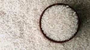
Rice with plump, shiny white grains and high rice yield, obtained from Baldo, Cammeo and Osmancık varieties grown on the fertile alluvial delta of the Meriç River.
History: The success of modern and traditional rice farming in the İpsala Plain, which meets approximately one-third of Turkey's rice production.
Production Method: Irrigated with Meriç water in laser leveled paddy pans; Packaged to zero breakage standard with optical sorters.
View Official Geographical Indication Dossier for Ipsala Rice →
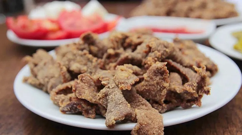
5. Keşan Shredded Meat (Yemekler ve çorbalar)
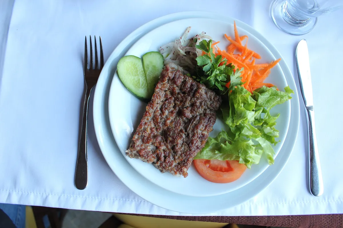
Chopping Southern Thracian lamb meat into rice grain size with a cleaver and cooking it on a wire grill.
History: A registered meatball masterpiece of Keşan roadside gastronomy culture.
View Official Geographical Indication Dossier for Keşan Shredded Meat →
6. Meriç Black Melon (İşlenmiş ve işlenmemiş meyve ve sebzeler ile mantarlar)
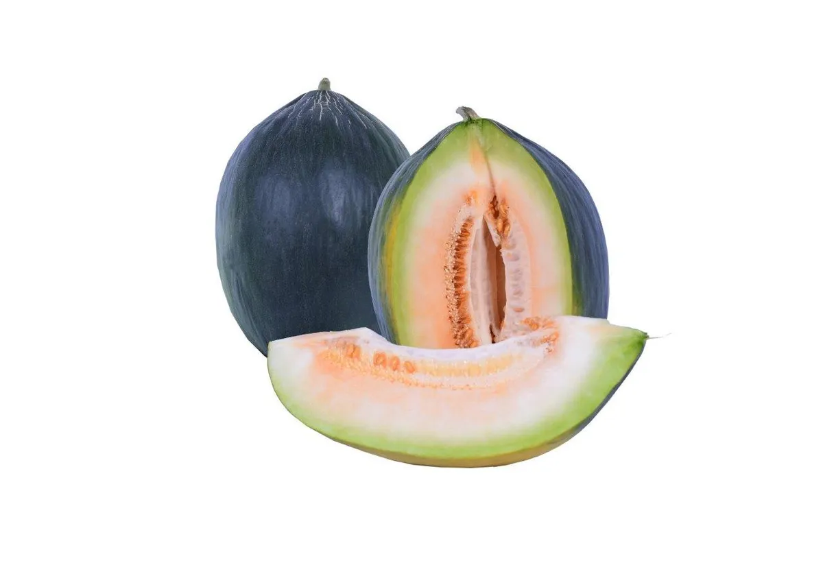
Meriç Black Melon is a value with an official Origin Name and geographical indication, unique to the Edirne region and registered by the Turkish Patent and Trademark Office on 10.03.2021 (with registration number 693).
View Official Geographical Indication Dossier for Meriç Black Melon →
Practical Travel & Transit Planning for Enez, Edirne (2026)
| Planning Category | Verified Local Information |
|---|---|
| Region & Administrative Center | Enez, Edirne, Türkiye |
| Best Time to Visit | Spring (April–June) and Autumn (September–November) for ideal sightseeing weather; Summer for highlands and coastal routes. |
| Public Transit & Highway Access | Regular municipal buses and local minibus cooperatives (Dolmuş) depart daily from the Edirne Intercity Bus Terminal (Otogar) directly to Enez. |
| Recommended Stay | 1 to 2 full days to explore the main historical landmarks, nature trails, and local culinary stops. |
Frequently Asked Questions About Visiting Enez, Edirne
What are the must-see places to visit in Enez, Edirne?
The top verified attractions in Enez, Edirne include Historical Enez Castle & Fatih Mosque, Gala Lake National Park, Enez City Square & Harbor Park, Ancient Enez Roman Aqueducts, Ancient Ainos King's Daughter Chapel. Each location offers documented historical or natural heritage with clear road access.
How can I get to Enez, Edirne by public transport or car?
You can reach Enez, Edirne easily by car via Edirne's main provincial highways, or take regular municipal buses and district minibuses departing throughout the day from the Edirne central bus terminal (Otogar).
What are the famous local dishes and traditional foods to try in Enez, Edirne?
When visiting Enez, Edirne and Edirne, be sure to taste officially registered specialties such as Çeribaşı Cherry, Uzunköprü Meatballs, Edirne Fresh Fruit Soap, Ipsala Rice, Keşan Shredded Meat, prepared by local artisans and traditional restaurants.
Are the attractions in Enez, Edirne suitable for families and day trips?
Yes. Most historic monuments, parks, museums, and promenade areas in Enez, Edirne are family-friendly and well-suited for both weekend getaways and full-day cultural itineraries.
When is the best season to visit Enez, Edirne?
Spring and autumn offer the most comfortable temperatures for walking tours and photography in Enez, Edirne, while summer is popular for nature recreation, plateaus, and festivals.