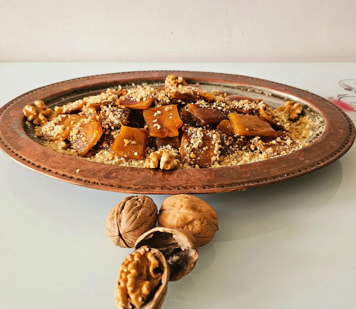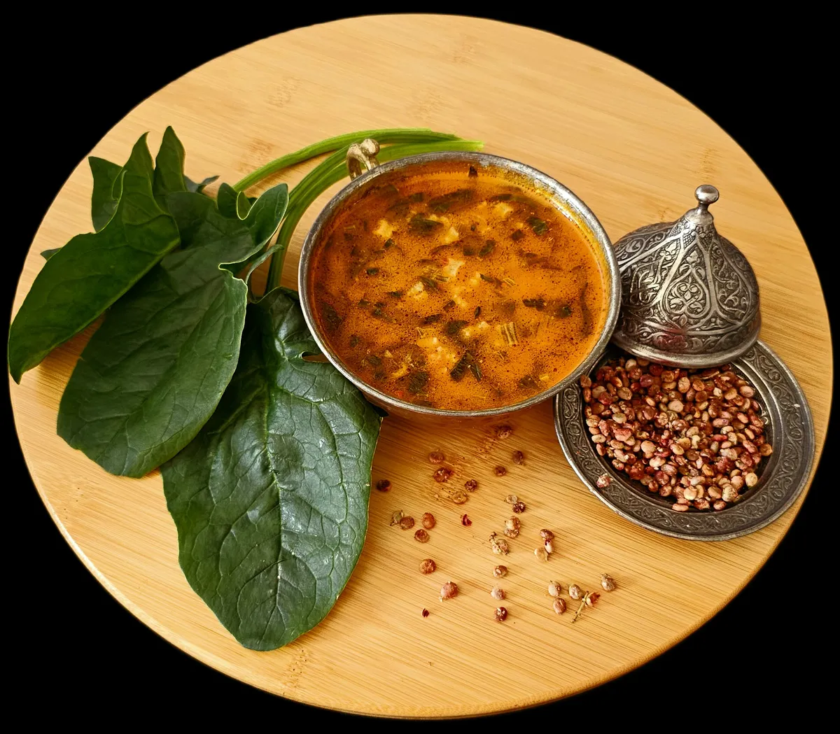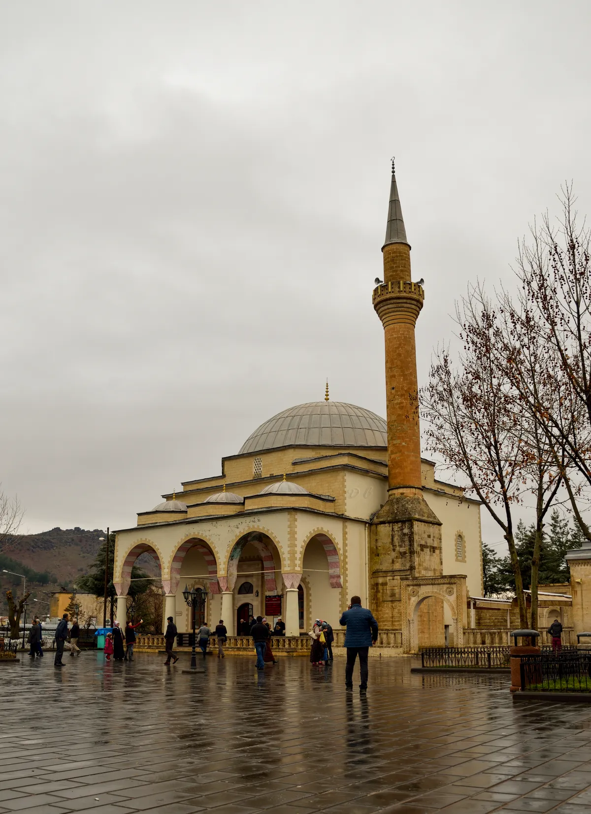

Planning a journey to Baykan, Siirt? This comprehensive 2026 History & Culture guide brings together 10 verified landmarks, natural wonders, and cultural heritage sites with official visiting hours, GPS coordinates, public transit connections, and local gastronomy recommendations.
Quick Highlights & Discovery Route in Baykan, Siirt
- Veysel Karani Complex and Tomb
- Tomb of Sheikh Osman
- Historical Derzin (Adakale) Castle
- Atabağı Town Historical Square and Spring
- Baykan Martyrs Park and Government Square
- Historical Multipliers (Four Nations) Stone Bridge
- Siirt Blanket
- Pervari Honey
Historical Landmarks, Architecture & Cultural Heritage in Baykan, Siirt
Baykan, Siirt (Siirt) preserves a multi-layered historical fabric shaped by centuries of Anatolian civilizations, including Roman, Byzantine, Seljuk, and Ottoman eras. Historic castles, stone bridges, caravanserais, civil mansions, and monumental structures reflect the strategic and cultural importance of Baykan, Siirt.
Walking through the historic quarters of Baykan, Siirt allows visitors to observe traditional masonry, timber-framed architecture, and restored heritage buildings up close.
- Architectural Details: Pay attention to carved stone portals, historic fountains, courtyard mansions, and defensive bastions across Baykan, Siirt.
- Best Visiting Hours: Early morning and late afternoon golden light offer the best conditions for architectural photography and crowd-free exploration.
- Cultural Etiquette & Preservation: Respect restoration zones and signage at registered historical monuments in Baykan, Siirt.
Top Verified History & Culture & Must-See Landmarks in Baykan, Siirt
1. Veysel Karani Complex and Tomb

Free Public Access • GPS: 38.1320, 41.7140
History and General Information / Local Legends and Folklore
Our Prophet Hz. The mausoleum of the great Islamic saint Veysel Karani (Üveys el-Karani), whom Muhammad (pbuh) praised as "the best of the followers" and whose cardigan (Hırka-i Şerif) was given as a gift when he died, is one of the most sacred places of pilgrimage in the Islamic world. Veysel Karani, known for his unique respect and obedience to his elderly and blind mother in Yemen's Karen village, is the supreme example of maternal consent in Islam. Hz. The tomb of the great man, who is believed to have been martyred in the Battle of Siffin in the ranks of Ali (r.a.), in Siirt Baykan, is a great spiritual center to which millions of believers have flocked for centuries since the Seljuk and Ottoman periods. The tomb, which was reorganized with a domed modern social complex architecture in 1967, is the heart of religious tourism with its large courtyard, mosque and guesthouse.
Geographical Structure, Altitude and Natural Features
It is located in Veyselkarani (Ziyaret) Town of Baykan district, at the Bitlis-Diyarbakır-Siirt highway junction, at an altitude of approximately 680 meters. It is located at the bottom of a spiritual valley surrounded by centuries-old plane and poplar trees at the foothills of the mountains.
Visiting Hours, Days and Entrance Fees
- Entrance Fee: Worship and visiting the tomb are completely free.
- Visiting Hours and Days: It is open to visitors and worship 24 hours a day, 7 days a week.
- Rules, Safety and Stroller/Disabled Access: The courtyard of the social complex is level; Disabled ramps and wheelchair access are available. The rules of dress, reverence and silence in accordance with the tomb etiquette must be strictly observed.
- Facilities and Facilities: There is a historical fountain, a large mosque, ablution facilities, men's and women's lounges, a condolence house, a car park, a halvah and souvenir market.
Transportation, Public Transit Routes and Exact Location
- Address / Open Location: Katılım Mahallesi, Veysel Karani Caddesi, Veyselkarani Town, Baykan / Siirt.
- Road Condition and Vehicle Suitability: It is on the Diyarbakır-Bitlis-Van divided state highway; You can reach the social complex gate directly by all vehicles.
- Real Public Transportation Information: Ziraat/Veyselkarani minibuses and intercity buses departing from Siirt, Batman and Bitlis centers stop in front of the complex.
- Parking Availability: There is a free parking area with a capacity of hundreds of vehicles around the complex.
Spiritual Visiting Etiquette and Commemoration Guidelines
- Spiritual Visit and Prayer Etiquette: Fatiha and Ihlas surahs should be read at the sarcophagus, and the love of the Prophet and the awareness of respect for the mother should be contemplated. It is recommended to perform the two-rakat tahiyyatu'l-masjid prayer in the social complex mosque.
- Documentary & Respectful Shooting: The dome and minaret architecture of the social complex can be shot from the courtyard; Flash photography that would disturb the spiritual silence at the tomb inside the tomb should be avoided.
- Important Commemoration Days: Tens of thousands of visitors come together at the traditional Veysel Karani Commemoration and Mother's Day events held in the first week of May every year.
- Local Spiritual Tradition: After the visit, local walnut tulum halva and Siirt pistachios are purchased from the tomb market and distributed to children for charity.
Explore Full 5-Section Guide & Map for Veysel Karani Complex and Tomb →
2. Tomb of Sheikh Osman
Free Public Access • GPS: 38.1317, 41.7119
History and General Information / Local Legends and Folklore
Located in Veyselkarani Town, on a high hill overlooking the Veysel Karani Tomb, Sheikh Osman Tomb is a registered historical monument building that has an exceptional place in the spiritual memory of the region. The tomb, which was registered by the Cultural and Natural Heritage Preservation Board in 1991, is the eternal resting place of Sheikh Osman, one of the great Islamic mystics and the servant of the Veysel Karani dervish lodge, who guided the people in the region with his knowledge and wisdom. This hilltop, which has been visited by visitors to Veysel Karani Complex for centuries, offers a deep serenity with its climate of spiritual peace and its location overlooking the town from a bird's eye view.
Geographical Structure, Altitude and Natural Features
It is located on the hill in the northeast of Veyselkarani Town, at an altitude of approximately 710 meters. It is a spacious visiting hill surrounded by pine and cypress trees on the windy hill plain.
Visiting Hours, Days and Entrance Fees
- Entrance Fee: Entrance and visit are completely free.
- Visiting Hours and Days: It is open to visitors all day long, 7 days a week.
- Rules, Safety and Stroller/Disabled Access: There is a staircase leading to the hill and landscaping. Silence and good manners of dress must be observed inside the tomb.
- Facilities and Facilities: There are resting benches, shady pergolas, ablution area and information sign.
Transportation, Public Transit Routes and Exact Location
- Address / Open Location: Çözüm Mahallesi, Şeyh Osman Tepesi, Veyselkarani Town, Baykan / Siirt.
- Road Condition and Vehicle Availability: It is 400 meters from Veysel Karani Tomb; The hill road can be easily accessed by passenger vehicles or walked.
- Real Public Transportation Information: Veyselkarani town transportation is provided by minibuses and visit minibuses.
- Parking Availability: Free car parking is available on the hillside next to the tomb.
Spiritual Visiting Etiquette and Commemoration Guidelines
- Spiritual Visit and Prayer Etiquette: Fatiha and prayers should be read at the top of the sarcophagus, then Veysel Karani Social Complex should be saluted from the hilltop viewing point.
- Documentary & Respectful Shooting: The stone dome of the tomb and the view of Veyselkarani town from the hill can be photographed with awe.
- Local Spiritual Tradition: Tomb visitors offer Mevlid candy to the children around them, accompanied by blessings.
Explore Full 5-Section Guide & Map for Tomb of Sheikh Osman →
3. Historical Derzin (Adakale) Castle
Free Public Access • GPS: 38.1303, 41.8722
History and General Information / Local Legends and Folklore
Historical Derzin Castle, perched like an eagle's nest on the top of the steep and steep cliffs within the borders of Adakale (Derzin) Village of Baykan, is a well-established military defense structure dating back to the Byzantine Period (6th-10th centuries AD). The castle was built to monitor strategic caravan and mountain passes during the border wars between the Eastern Roman Empire and the Sasanian and Muslim armies; It displays the power of medieval stone architecture with its cut stone towers, cisterns, observation portholes and steep rock walls. Rumors among the local people say that hidden gold treasures are protected in the dungeons of the castle and that during sieges, water is drawn by descending into the valley from hidden rock corridors.
Geographical Structure, Altitude and Natural Features
It rises on a steep rock mass at an altitude of approximately 1100 meters, on the steep slopes of the Southeastern Taurus Mountains range. It has an extremely impressive panorama overlooking Derzin Valley, oak forests and mountain peaks.
Visiting Hours, Days and Entrance Fees
- Entrance Fee: Visiting the open-air ruins is free.
- Visiting Hours and Days: It can be visited 7 days a week in daylight.
- Rules, Safety and Stroller/Disabled Access: The climb to the castle is via a steep mountain path; Professional hiking boots with non-slip soles are a must. Families with children need to be very careful due to the cliffs. Not suitable for strollers and disabled access.
- Facilities and Facilities: It is a natural protected area; There are no facilities in the area. Water and basic needs should be provided in advance.
Transportation, Public Transit Routes and Exact Location
- Address / Open Location: Adakale (Derzin) Village location, Baykan / Siirt.
- Road Condition and Vehicle Availability: It is approximately 14 km away from Baykan town center; There is a stabilized mountain road up to Adakale village; High floor SUV or 4x4 vehicles are recommended.
- Real Public Transportation Information: There is no direct public transportation; You can go there by private car or taxi rented from the town center.
- Parking Availability: Vehicles can be parked in suitable areas at the village entrance and at the beginning of the path.
Contextual Experience Tips, Photography and Local Gastronomy
- Best Photography Points and Frames: The angle where the Yalçın rocky tower ruins meet the sky and the panoramic shots extending from the castle to the depths of Derzin Valley.
- Light and Shooting Hours: Early morning and golden hour at sunset when the rocks turn red.
- Local Gastronomy Recommendations: When visiting the village, you should taste fresh Siirt herb cheese, tandoori lavash and the famous Pervari honey.
Explore Full 5-Section Guide & Map for Historical Derzin (Adakale) Castle →
4. Atabağı Town Historical Square and Spring
Free Public Access • GPS: 38.0632, 41.6588
History and General Information / Local Legends and Folklore
It is the historical square and centuries-old stone spring of Atabağı (formerly known as Komik), one of the two well-established towns of Baykan, whose historical roots date back to the 1700s. In the town, which is the center of agriculture and viticulture culture in the region, the historical stone-corrugated spring from which caravans drank for generations is the symbol of the traditional conversation and collaboration culture of the people of the town.
Geographical Structure, Altitude and Natural Features
It is located on a fertile hill slope at an altitude of approximately 820 meters. It is surrounded by fruit vineyards, pomegranate gardens and centuries-old walnut trees.
Visiting Hours, Days and Entrance Fees
- Entrance Fee: Entrance is completely free and open to the public.
- Visiting Hours and Days (Mandatory): Open 24 hours a day, 7 days a week.
- Rules, Safety and Stroller/Disabled Access: The plaza has a flat footing; It is suitable for strollers and disabled access.
- Facilities and Facilities: Historical stone spring, mosque, rest benches, village coffeehouse and grocery store.
Transportation, Public Transit Routes and Exact Location
- Address / Open Location: Cumhuriyet Mahallesi, Belde Square, Atabağı Town, Baykan / Siirt.
- Road Condition and Vehicle Availability: It is 11 km from Baykan town center and 38 km from Siirt centre; It can be easily reached by all passenger vehicles via asphalt roads.
- Actual Public Transportation Information (Mandatory): Atabağı town minibuses depart regularly from Baykan district center and Siirt directly to the square.
- Parking Availability: There is an open car parking area in the town square.
Best Photo Spots and Frames
- Best Photography Spots and Frames: Spring water flowing from a centuries-old stone spring, traditional town stone houses and vineyard views.
- Light and Shooting Times: Early morning and late afternoon sun illuminates the village texture with warm tones.
- Local Gastronomy Recommendations: Atabağı's famous freshly squeezed pomegranate syrup, dried fruits and village tandoori bread should be tasted.
Explore Full 5-Section Guide & Map for Atabağı Town Historical Square and Spring →
5. Baykan Martyrs Park and Government Square
Free Public Access • GPS: 38.1620, 41.7829
History and General Information / Local Legends and Folklore
It is a monumental park and square located between the Government Mansion and the municipality building in the Baykan district center, perpetuating the memory of our beloved martyrs who died for the indivisible integrity of our country. The square, which is the heart of the historical district located at the Bitlis-Diyarbakır-Siirt junction, is the center of social life and public holidays.
Geographical Structure, Altitude and Natural Features
It is located in the district center on the valley floor, at an altitude of approximately 720 meters. It is a spacious relaxation oasis with centuries-old plane trees, ornamental pool and green grass areas.
Visiting Hours, Days and Entrance Fees
- Entrance Fee: Entrance is completely free and open to the public.
- Visiting Hours and Days (Mandatory): Open 24 hours a day, 7 days a week.
- Rules, Safety and Stroller/Disabled Access: Flat lock has stone floors; It is fully wheelchair and stroller accessible.
- Facilities and Facilities: Rest benches, children's playground, fountain, lighting and cafeterias around.
Transportation, Public Transit Routes and Exact Location
- Address / Open Location: Government Street, District Center, Baykan / Siirt.
- Road Condition and Vehicle Availability: It is 47 km away from Siirt city centre; It is on the Bitlis-Diyarbakır highway and can be easily reached by a double asphalt road.
- Actual Public Transportation Information (Mandatory): All district and intercity buses/minibuses coming from Siirt, Batman and Bitlis stop at the stops in the square.
- Parking Availability: Free municipal parking is available around the square.
Spiritual Visiting Etiquette and Commemoration Guidelines
- Spiritual Visit and Prayer Etiquette: A moment of silence and prayers should be made in front of the martyrs' monument.
- Documentary & Respectful Shooting: The Martyrs' Monument and the historical plane trees in the square provide beautiful shots.
- Important Commemoration Days: 18 March Çanakkale Victory, 30 August and Veterans Day ceremonies are held here.
- Local Gastronomy Recommendations: You can taste the famous Siirt curtain pilaf and lamb stew in the restaurants around the square.
Explore Full 5-Section Guide & Map for Baykan Martyrs Park and Government Square →
6. Historical Multipliers (Four Nations) Stone Bridge
Free Public Access • GPS: 38.1299, 41.7206
History and General Information / Local Legends and Folklore
Rising over the rushing waters of the Bitlis Stream, the Historical Çarpıran Bridge (known locally as the Four Ulular Bridge) is a monumental stone arch bridge dating back to the 13th century Anatolian Seljuk period, according to mortar analysis. The bridge, which is 74.5 meters long and 4.5 meters wide, consists of 6 pointed arches built of two-color smooth cut stones. The bridge piers placed on the natural rock base and the triangular shaped flood spurs against the current reflect the superior hydraulic engineering of the period. The bridge, which is one of the most important caravan crossings of the historical Silk Road between Eastern Anatolia and Mesopotamia, was restored to its original state and taken under protection in 2006.
Geographical Structure, Altitude and Natural Features
It is located at the base of Bitlis Stream Canyon, at an altitude of approximately 670 meters. It is in a wild and impressive canyon geography surrounded by steep mountain gorges, gurgling streams and willow groves along the valley.
Visiting Hours, Days and Entrance Fees
- Entrance Fee: Visiting the bridge is free.
- Visiting Hours and Days: It can be visited 24 hours a day, 7 days a week.
- Rules, Safety and Stroller/Disabled Access: The historic stone-paved bridge base is pedestrian-accessible; It is suitable for disabled people and strollers. Be careful about slippery rocks on the steep slopes along the stream.
- Facilities and Facilities: There is an information sign around the bridge; There are rest pockets.
Transportation, Public Transit Routes and Exact Location
- Address / Open Location: Çukurca location, Bitlis-Baykan Highway 4th km, Baykan / Siirt.
- Road Condition and Vehicle Availability: It is 4 km away from Baykan town center; It is right next to the Bitlis-Baykan main highway and can be easily reached by any passenger vehicle.
- Real Public Transportation Information: Minibuses operating between Baykan and Bitlis pass through the junction near the bridge.
- Parking Availability: Cars can be parked free of charge in the extended pockets on the side of the highway.
Contextual Experience Tips, Photography and Local Gastronomy
- Best Photography Points and Frames: The reflection of the two-colored cut stone arches on the waters of the Bitlis Stream and the perspective framing of the steep valley rocks behind.
- Light and Shooting Hours: 11:00 - 15:00, or sunset golden hour, when the sun illuminates the valley floor.
- Local Gastronomy Recommendations: Siirt büryan kebab made of fresh lamb and the famous curtain pilaf should be tasted in Baykan centre.
Explore Full 5-Section Guide & Map for Historical Multipliers (Four Nations) Stone Bridge →
7. Visit Town City Park and Historical Fountain Square
Free Public Access • GPS: 38.1275, 41.7150
History and General Information / Local Legends and Folklore
It is a city park and historical fountain square located in the center of the Visit Town, which hosts the tomb of Veysel Karani. The square, which hosts hundreds of thousands of visitors from all over Turkey and the Islamic geography throughout the year, is a historical meeting place where Sufi peace and Anatolian hospitality are felt.
Geographical Structure, Altitude and Natural Features
It is located at an altitude of approximately 680 meters, on the plain where the Bitlis Stream valley widens. It has a peaceful atmosphere with centuries-old mulberry and plane trees, roses and a large pool fountain.
Visiting Hours, Days and Entrance Fees
- Entrance Fee: Entrance is completely free and open to the public.
- Visiting Hours and Days (Mandatory): Open 24 hours a day, 7 days a week.
- Rules, Safety and Stroller/Disabled Access: It has smooth marble and keystone floors; It is extremely suitable for disabled and stroller access.
- Facilities and Facilities: Resting pergolas, children's playground, large fountain, WC, tea gardens and souvenir shops.
Transportation, Public Transit Routes and Exact Location
- Address / Open Location: Veysel Karani Mahallesi, Ayrılık Beldesi, Baykan / Siirt.
- Road Condition and Vehicle Availability: It is 8 km from Baykan town center and 40 km from Siirt city centre; It is located on the Diyarbakır-Bitlis main highway and is extremely easy to reach.
- Actual Public Transportation Information (Mandatory): All Seyahat/Veysel Karani buses and minibuses departing from Siirt, Batman, Diyarbakır and Bitlis reach directly to the town square.
- Parking Availability: There is a large bus and car parking lot with a capacity of 500 vehicles in the town.
Spiritual Visiting Etiquette and Commemoration Guidelines
- Spiritual Visit and Prayer Etiquette: Before or after visiting the tomb, one should spend time with decency and dignity and donate to those in need.
- Documentary & Respectful Shooting: The fountain arches, pigeons and the minaret silhouette of the social complex provide impressive shots.
- Important Commemoration Days: Hundreds of thousands of people gather every year on May 16-17, Veysel Karani Commemoration Days.
- Local Gastronomy Recommendations: You should try Veysel Karani tandoori buryani, buttermilk and Siirt pistachios in the restaurants in the square.
Explore Full 5-Section Guide & Map for Visit Town City Park and Historical Fountain Square →
8. Sıralı Village Waterfall and Nature Valley
Free Public Access • GPS: 38.0754, 41.8674
History and General Information / Local Legends and Folklore
Hidden in the steep mountain valleys of Baykan, it is a natural waterfall and green nature valley falling from the rocks on the Sıralı village stream. This clean spring water, which has been turning the village people's mills and irrigating their gardens for centuries, is one of the secret routes for hikers with its untouched nature and peaceful environment.
Geographical Structure, Altitude and Natural Features
It flows between walnut and oak groves at an altitude of approximately 980 meters. The waterfall, which falls from approximately 12 meters into a natural stone pond, creates a cool microclimate around it.
Visiting Hours, Days and Entrance Fees
- Entrance Fee: Entrance is completely free.
- Visiting Hours and Days (Mandatory): Can be visited 7 days a week during daylight hours (08:00 - 18:00); The best time is April-June.
- Rules, Safety and Stroller/Disabled Access: Walk via village path; Be careful about slippery stones. Not stroller accessible.
- Facilities and Facilities: It is a natural village area; There is a village fountain and rest shades.
Transportation, Public Transit Routes and Exact Location
- Address / Open Location: Sıralı Köyü, Baykan / Siirt.
- Road Condition and Vehicle Availability: It is 16 km away from Baykan town center; It is a stabilized village road and transportation is more convenient by high-floor vehicle.
- Actual Public Transportation Information (Mandatory): It can be reached by village shuttles from Baykan district center to Sıralı village.
- Parking Availability: Vehicles can be parked at the village entrance.
Best Photo Spots and Frames
- Best Photo Spots and Frames: The frame where the waterfall pours into the stone pond, mossy rocks and walnut trees along the valley.
- Light and Shooting Hours: The sunlight falling vertically into the valley at noon makes the waterfall water appear clear.
- Local Gastronomy Recommendations: Village breakfast accompanied by fresh honeycomb honey, walnuts and butter provided from the village is an unforgettable experience.
Explore Full 5-Section Guide & Map for Sıralı Village Waterfall and Nature Valley →
9. Çaykaya Canyon and Bitlis Stream Caves
Free Public Access • GPS: 38.0979, 41.7564
History and General Information / Local Legends and Folklore
It is the deep Çaykaya Canyon formed by the Bitlis Stream breaking through the steep volcanic and limestone cliffs, and the natural and human-carved historical shelter caves located on the canyon walls. It is known that in ancient times, it was used as observation points to protect caravans passing through the region and as retreat caves for monks. It is one of the most wild and impressive canyon gorges in the Southeast with its steep nature and flowing river.
Geographical Structure, Altitude and Natural Features
At an altitude of approximately 740 meters, the canyon consists of steep rocky cliffs with a depth of up to 250 meters in places. The sparkling flow of the Bitlis Stream, the canyon microclimate and cave cavities fascinate nature lovers.
Visiting Hours, Days and Entrance Fees
- Entrance Fee: Entrance to the canyon cruise and nature trail is free.
- Visiting Hours and Days (Mandatory): It can be visited 7 days a week during daylight hours (08:00 - 18:30).
- Rules, Safety and Stroller/Disabled Access: Steep and rocky canyon terrain; Do not enter the water as the river flow may be high during flood periods. It is not suitable for a stroller, trekking shoes are a must.
- Facilities and Facilities: There are recreational facilities and village teahouses on the highway.
Transportation, Public Transit Routes and Exact Location
- Address / Open Location: Çaykaya Köyü Mevkii, Bitlis Stream Valley, Baykan / Siirt.
- Road Condition and Vehicle Availability: It is 9 km away from Baykan town center; It lies parallel to the Bitlis highway, and you can reach the viewing points by passenger vehicle.
- Real Public Transportation Information (Mandatory): Minibuses operating between Baykan and Bitlis drop off passengers at the Çaykaya turnoff.
- Parking Availability: Parking is available in the rest pockets on the side of the highway.
Best Photo Spots and Frames
- Best Photography Spots and Frames: Bottleneck cliffs where the canyon narrows, river views from cave windows and steep cliffs.
- Light and Shooting Hours: The moments when the sun rays reach the canyon floor in the early morning hours are the best shooting times.
- Local Gastronomy Recommendations: You can taste samovar tea and village pastry accompanied by the river view at the rest facilities along the way.
Explore Full 5-Section Guide & Map for Çaykaya Canyon and Bitlis Stream Caves →
10. Baykan Ecotourism Road and Nature Trail
Free Public Access • GPS: 38.1563, 41.8108
History and General Information / Local Legends and Folklore
It is a registered hiking and ecotourism route of approximately 15 km, starting from the historical Çarpıran (Four Nations) Bridge and extending along the Bitlis Stream canyon to the Veysel Karani town. Following the route of the ancient Silk Road, this valley trail connects both historical stone bridges and watchtowers and the untouched river ecosystem.
Geographical Structure, Altitude and Natural Features
It extends along the Bitlis Stream valley, at an altitude of approximately 700-850 meters. Riverside willow groves, canyon gorges and steep volcanic rock formations accompany the course.
Visiting Hours, Days and Entrance Fees
- Entrance Fee: Entry to the track is completely free.
- Visiting Hours and Days (Mandatory): Open for walking in daylight 7 days a week.
- Rules, Safety and Stroller/Disabled Access: Low slope dirt and stone path; Suitable for amateur nature lovers. The starting areas are suitable for strollers.
- Facilities and Facilities: There are wooden rest benches, direction signs, fountains and break camellias on the route.
Transportation, Public Transit Routes and Exact Location
- Address / Open Location: Between Obalı Mahallesi - Veysel Karani, Baykan / Siirt.
- Road Condition and Vehicle Availability: It starts 2 km away from Baykan town center; The starting and ending points can be easily reached by passenger vehicle via the double highway.
- Real Public Transportation Information (Mandatory): Baykan-Siirt and Baykan-Ziyaret minibuses drop off passengers at the main entrance points of the track.
- Parking Availability: There is an open car parking area at the entrance of the Çarpıran Bridge and at the beginning of the track.
Best Photo Spots and Frames
- Best Photography Points and Frames: Bitlis Stream's flow under the stone bridge, wooden viewing points placed on the canyon slopes and river reflection.
- Light and Shooting Times: Great contrasts are captured in the canyon depth in the early morning and late afternoon.
- Local Gastronomy Recommendations: At the end of the route, you should drink the famous lamb buryan and samovar tea in Veysel Karani town.
Explore Full 5-Section Guide & Map for Baykan Ecotourism Road and Nature Trail →
What to Eat in Baykan, Siirt? Registered Local Delicacies & Gastronomy
A trip to Baykan, Siirt is incomplete without tasting its officially registered geographical indication products and centuries-old Anatolian recipes:
1. Siirt Blanket (Halılar, kilimler ve dokumalar dışında kalan el sanatı ürünleri)
Natural blanket woven on hand looms from pure angora goat wool and feathered with iron combs.
History: A century-old hand-woven masterpiece that is impermeable to water and cold.
View Official Geographical Indication Dossier for Siirt Blanket →
2. Pervari Honey (Bal)

Product Story & History:
Siirt Pervari Honey is the healing beehive honey of the Ottoman palaces, protected by the Turkish Patent and Trademark Office as a Name of Origin with registration number 59.
View Official Geographical Indication Dossier for Pervari Honey →
3. Siirt Perde Pilaf (Yemekler ve çorbalar)
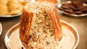
Partridge or chicken meat, almonds and spicy rice wrapped in phyllo and baked in a fez-shaped copper pot.
History: Historical wedding dinner where the mother-in-law gave the bride the message 'keep the house secrets'.
View Official Geographical Indication Dossier for Siirt Perde Pilaf →
4. Siirt Pistachio (İşlenmiş ve işlenmemiş meyve ve sebzeler ile mantarlar)
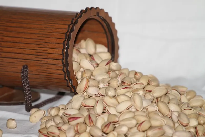
A noble snack peanut that is larger than pistachios, has open and wide cracks, is easy to crack, has a light beige shell and has a high fat content.
History: 'Root Pistachio' of Siirt, grown by grafting on wild bıttım trees on the steep slopes of the Botan Valley.
Production Method: It is grafted onto Bıttım rootstock; It is harvested in September, dried in the sun and roasted with salt.
View Official Geographical Indication Dossier for Siirt Pistachio →
5. Shawl Shepik Fabric (Dokumalar)
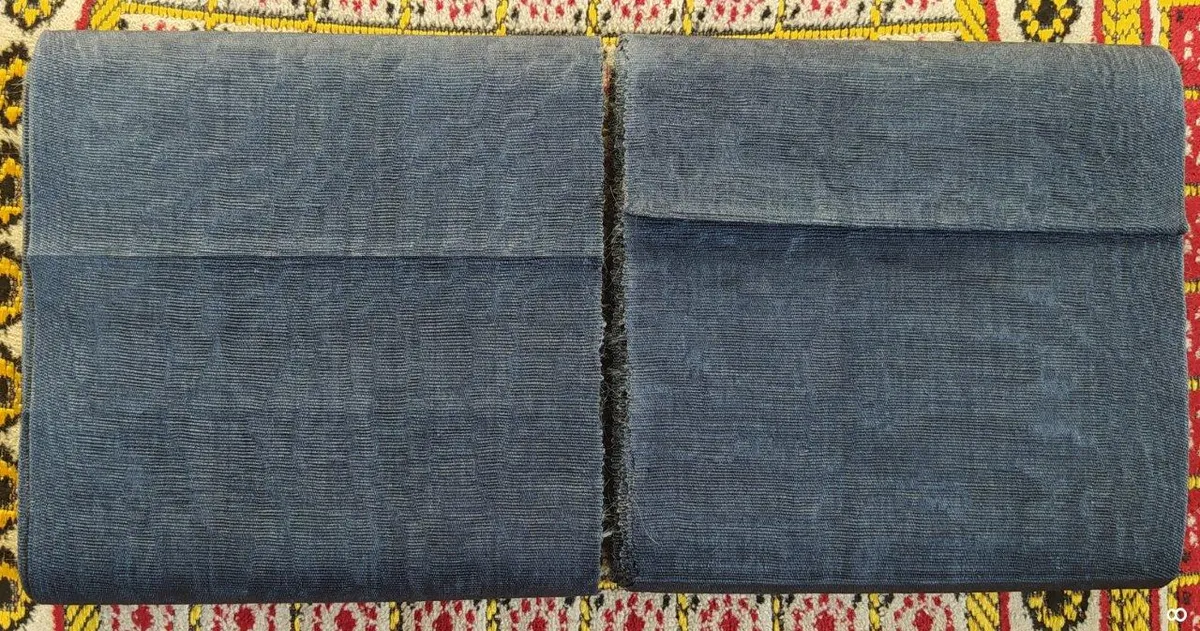
An authentic fabric that is made by hand-spun angora goat wool, coloring it with root dyes, beating and weaving in 10 different stages on narrow shuttle hand looms, and keeping it cool in summer and warm in winter.
History: 3000-year-old heritage of weaving art, known as the clothing of Mesopotamian kings and lords.
Production Method: Mohair wool is used, it is felted by beating in hot water and woven on traditional looms.
View Official Geographical Indication Dossier for Shawl Shepik Fabric →
6. Zivzik Pomegranate (İşlenmiş ve işlenmemiş meyve ve sebzeler ile mantarlar)
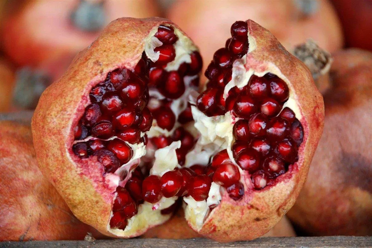
Thin-skinned, large-grained, sweet-tart winter pomegranate grown in the Zivzik village on the slopes of the Botan Stream.
History: Centuries-old medicinal pomegranate gardens that can be hung and stored throughout the winter.
View Official Geographical Indication Dossier for Zivzik Pomegranate →
Practical Travel & Transit Planning for Baykan, Siirt (2026)
| Planning Category | Verified Local Information |
|---|---|
| Region & Administrative Center | Baykan, Siirt, Türkiye |
| Best Time to Visit | Spring (April–June) and Autumn (September–November) for ideal sightseeing weather; Summer for highlands and coastal routes. |
| Public Transit & Highway Access | Regular municipal buses and local minibus cooperatives (Dolmuş) depart daily from the Siirt Intercity Bus Terminal (Otogar) directly to Baykan. |
| Recommended Stay | 1 to 2 full days to explore the main historical landmarks, nature trails, and local culinary stops. |
Frequently Asked Questions About Visiting Baykan, Siirt
What are the must-see places to visit in Baykan, Siirt?
The top verified attractions in Baykan, Siirt include Veysel Karani Complex and Tomb, Tomb of Sheikh Osman, Historical Derzin (Adakale) Castle, Atabağı Town Historical Square and Spring, Baykan Martyrs Park and Government Square. Each location offers documented historical or natural heritage with clear road access.
How can I get to Baykan, Siirt by public transport or car?
You can reach Baykan, Siirt easily by car via Siirt's main provincial highways, or take regular municipal buses and district minibuses departing throughout the day from the Siirt central bus terminal (Otogar).
What are the famous local dishes and traditional foods to try in Baykan, Siirt?
When visiting Baykan, Siirt and Siirt, be sure to taste officially registered specialties such as Siirt Blanket, Pervari Honey, Siirt Perde Pilaf, Siirt Pistachio, Shawl Shepik Fabric, prepared by local artisans and traditional restaurants.
Are the attractions in Baykan, Siirt suitable for families and day trips?
Yes. Most historic monuments, parks, museums, and promenade areas in Baykan, Siirt are family-friendly and well-suited for both weekend getaways and full-day cultural itineraries.
When is the best season to visit Baykan, Siirt?
Spring and autumn offer the most comfortable temperatures for walking tours and photography in Baykan, Siirt, while summer is popular for nature recreation, plateaus, and festivals.