
Curious about what makes the culinary culture of Aydıntepe, Bayburt so special? In this 2026 gastronomy and local flavor guide, we explore 13 officially registered geographical indication delicacies alongside 6 iconic cultural and sightseeing stops you should experience during your visit.
Quick Highlights & Discovery Route in Aydıntepe, Bayburt
- Bayburt Honey
- Bayburt Stuffed Curd
- Bayburt Kete
- Bayburt Sour Cabbage
- Bayburt Kavut Soup
- Bayburt Milk Pastry
- Aydıntepe Underground City
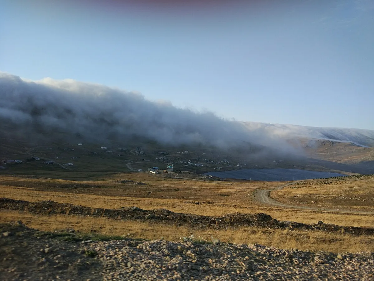
- Aydıntepe Plateau and Pond
- Soğanlı Passage and Martyrs' Monument
Local Culinary Culture, Artisan Restaurants & Traditional Flavors of Aydıntepe, Bayburt
The kitchen of Aydıntepe, Bayburt reflects the authentic agricultural heritage and centuries-old cooking techniques of Bayburt. From slow-simmered wood-fired meat dishes and handmade dough specialties to village breakfasts, organic dairy products, and seasonal syrupy desserts, dining in Aydıntepe, Bayburt is a cultural journey in itself.
- Traditional Artisan Restaurants (Esnaf Lokantaları): Visit central local eateries at lunchtime for daily copper-pot stews, regional soups, and oven-baked specialties.
- Village Breakfast & Natural Produce: Start your morning in Aydıntepe, Bayburt with local cheeses, stone-oven bread, olives, clotted cream, and natural blossom or pine honey.
- Registered Delicacies: Pair your meal with the officially registered geographical indication products of Bayburt listed below.
What to Eat in Aydıntepe, Bayburt? Registered Local Delicacies & Gastronomy
A trip to Aydıntepe, Bayburt is incomplete without tasting its officially registered geographical indication products and centuries-old Anatolian recipes:
1. Bayburt Honey (Bal)
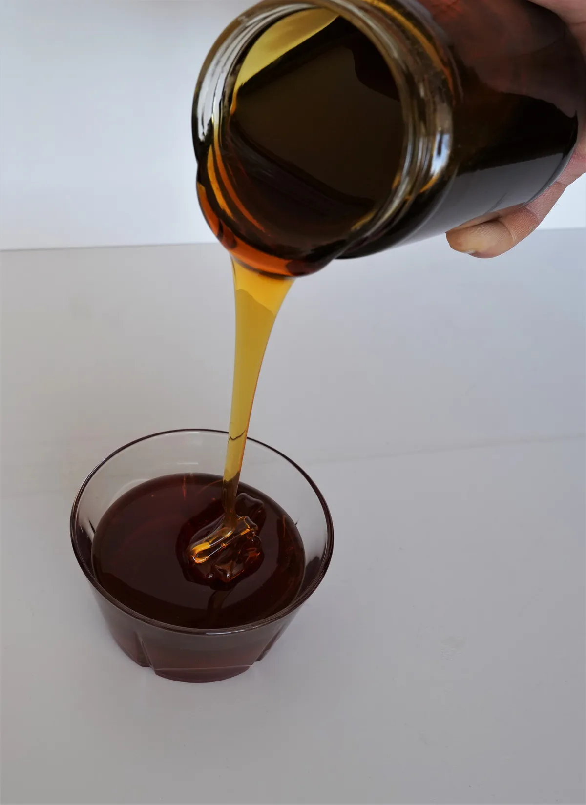
EU registered pure flower honey with high proline, low moisture and intense aroma, collected by Caucasian hybrid bees from the rich endemic astragalus, thyme and hundreds of plateau flowers of the Bingöl mountains.
History: Turkey's most prestigious plateau honey, which won second place in the world at the World Beekeeping Congress (Apimondia) and was registered by the European Union.
Production Method: It is produced in untouched plateaus without industry; Feeding sugar sherbet and chemical drugs is strictly prohibited.
View Official Geographical Indication Dossier for Bayburt Honey →
2. Bayburt Stuffed Curd (Yemekler ve çorbalar)
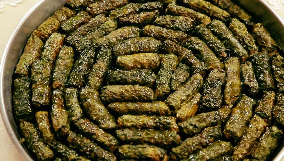
A delicacy made by wrapping a mixture of fresh oiled tulum cheese, bulgur, butter, spring onion and mint in boiled fresh chard (beet) leaves, and baking it in a casserole with butter and milk cream on top.
History: The centuries-old gastronomic heritage of Bayburt, the land of Dede Korkut, which is the main dish of wedding and holiday tables.
Production Method: Fresh chard leaves are boiled; Curd and bulgur mixture is wrapped tightly and fried in the oven like a pomegranate.
View Official Geographical Indication Dossier for Bayburt Stuffed Curd →
3. Bayburt Kete (Fırıncılık ve pastacılık mamulleri, hamur işleri, tatlılar)
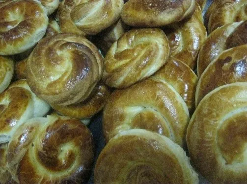
Roasted flour mixture is added to the buttered yeast dough and baked in a stone oven like a pomegranate.
History: An indispensable bakery delicacy next to tea in the mornings in Bayburt.
View Official Geographical Indication Dossier for Bayburt Kete →
4. Bayburt Sour Cabbage (Yemekler ve çorbalar)

Bayburt Sour Cabbage is a geographically indicated value of ours, unique to the Bayburt region and registered by the Turkish Patent and Trademark Office on 11.01.2021 (with registration number 648).
View Official Geographical Indication Dossier for Bayburt Sour Cabbage →
5. Bayburt Kavut Soup (Yemekler ve çorbalar)
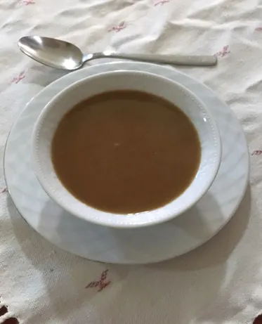
Bayburt Kavut Soup is a geographically indicated value of ours, unique to the Bayburt region and registered by the Turkish Patent and Trademark Office on 08.06.2020 (with registration number 499).
View Official Geographical Indication Dossier for Bayburt Kavut Soup →
6. Bayburt Milk Pastry (Fırıncılık ve pastacılık mamulleri, hamur işleri, tatlılar)
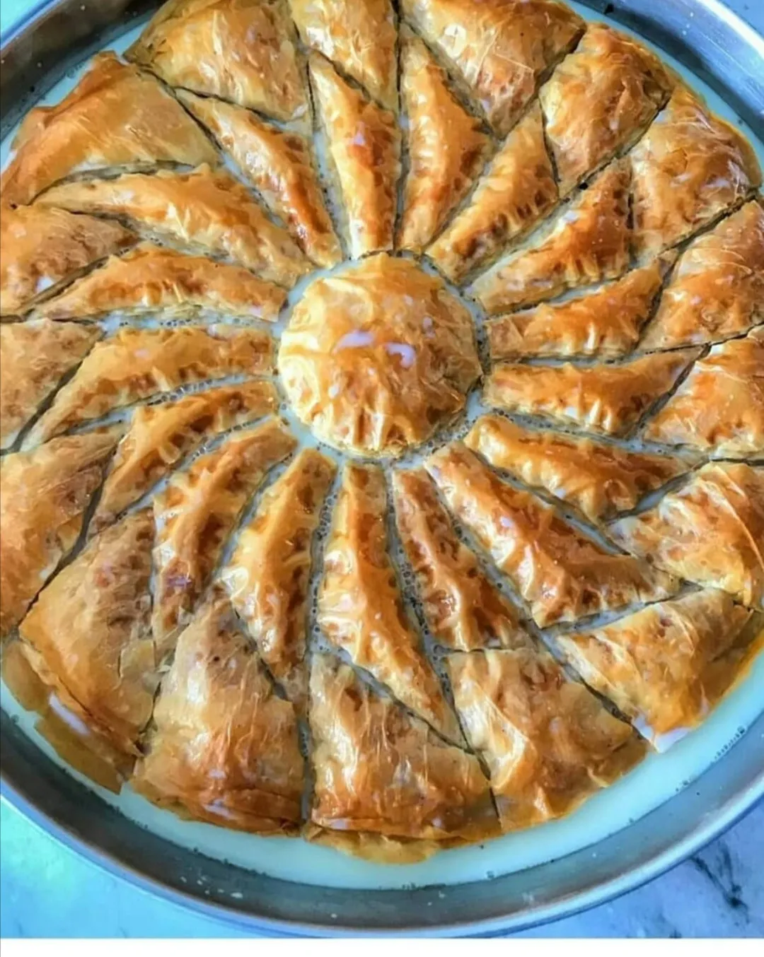
Bayburt Süt Pastry is a geographically indicated value of ours, unique to the Bayburt region and registered by the Turkish Patent and Trademark Office on 11.01.2021 (with registration number 647).
View Official Geographical Indication Dossier for Bayburt Milk Pastry →
7. Aydıntepe Sugar Beans (İşlenmiş ve işlenmemiş meyve ve sebzeler ile mantarlar)

Aydıntepe Sugar Bean is a geographically indicated value of ours, specific to the Bayburt region and registered by the Turkish Patent and Trademark Office on 09.06.2021 (with registration number 780).
View Official Geographical Indication Dossier for Aydıntepe Sugar Beans →
8. Bayburt Stone (Diğer ürünler)
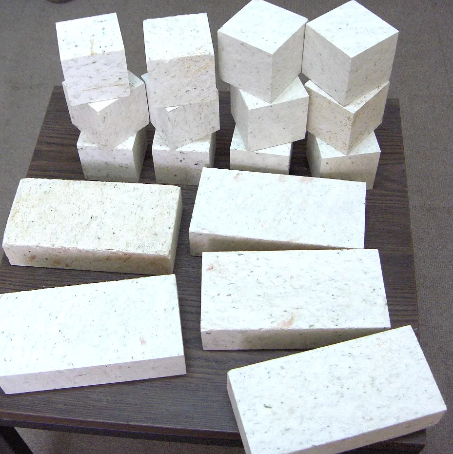
Bayburt Stone is a precious stone with a geographical indication of its official Origin Name, unique to the Bayburt region and registered by the Turkish Patent and Trademark Office on 04.07.2019 (with registration number 442).
View Official Geographical Indication Dossier for Bayburt Stone →
9. Bayburt Black Beet Dish (Yemekler ve çorbalar)
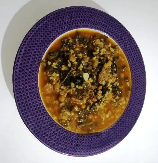
Bayburt Black Beetroot Dish is a geographically indicated value of ours, unique to the Bayburt region and registered by the Turkish Patent and Trademark Office on 18.02.2021 (with registration number 678).
View Official Geographical Indication Dossier for Bayburt Black Beet Dish →
10. Bayburt False Stuffed (Yemekler ve çorbalar)
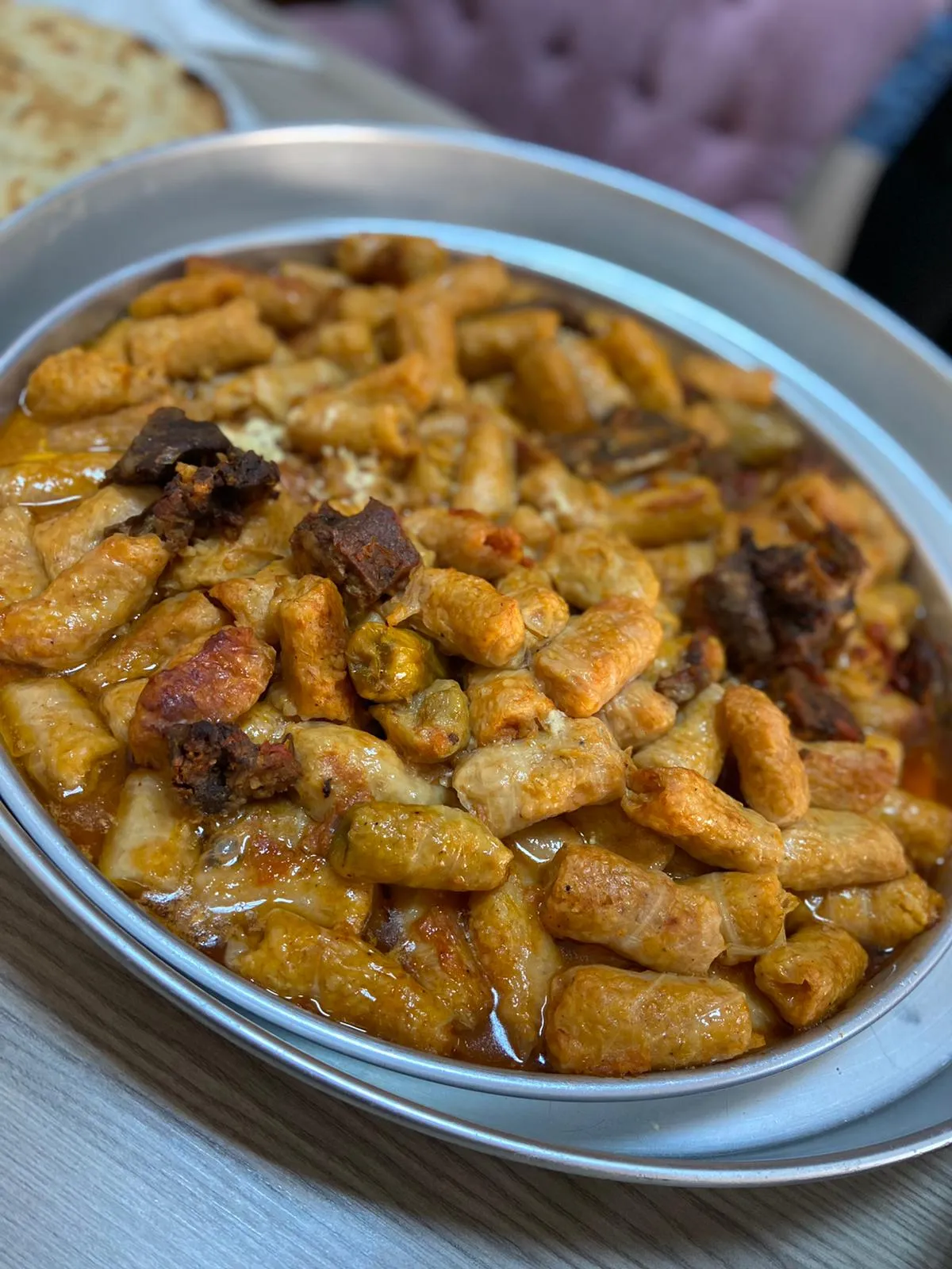
Bayburt False Dolma is a geographically indicated value of ours, unique to the Bayburt region and registered by the Turkish Patent and Trademark Office on 09.08.2021 (with registration number 844).
View Official Geographical Indication Dossier for Bayburt False Stuffed →
11. Bayburt Sweet Soup (Fırıncılık ve pastacılık mamulleri, hamur işleri, tatlılar)

Ashura-like soup cooked with rosehip juice, dried fruits (plums, apricots, figs), cracked wheat and hazelnuts.
History: Historical starter dessert of Bayburt holiday mornings and weddings.
View Official Geographical Indication Dossier for Bayburt Sweet Soup →
12. Bayburt Tarragon (Yiyecekler için çeşni / lezzet vericiler, soslar ve tuz)
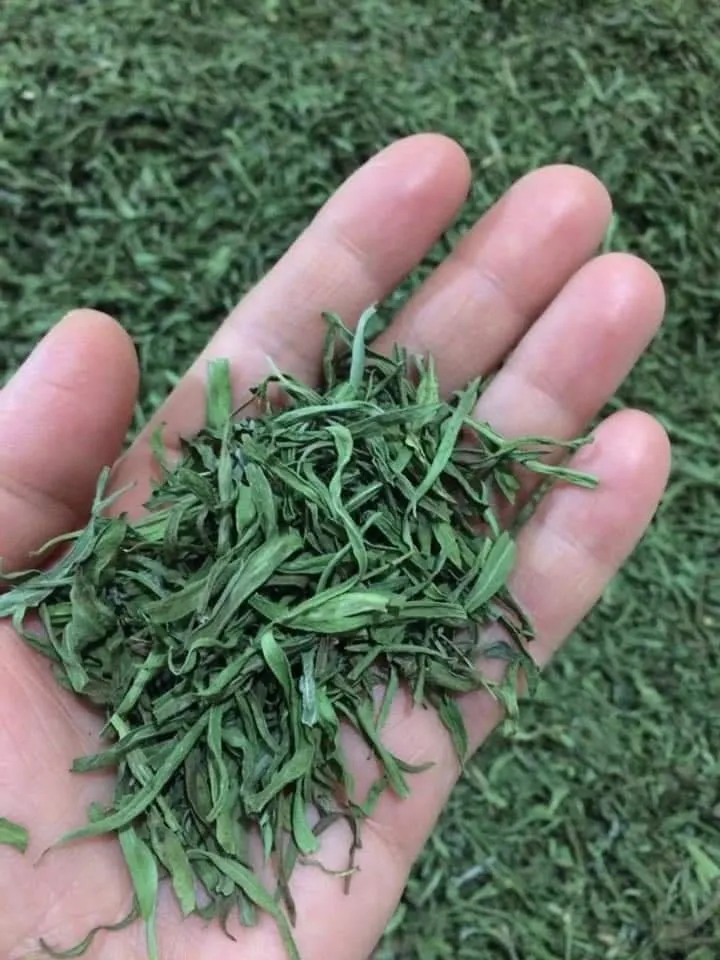
Bayburt Tarragon is a value with a geographical indication of its official Origin Name, unique to the Bayburt region and registered by the Turkish Patent and Trademark Office on 15.04.2025 (with registration number 1722).
View Official Geographical Indication Dossier for Bayburt Tarragon →
13. Bayburt Ehram (Dokumalar)

Product Story & History:
Bayburt Ehram (İhram) is a traditional women's outer garment and weaving art protected by the Turkish Patent and Trademark Office as a Mahrez Mark with registration number 394.
Distinctive Features & Material Profile:
A breathable, natural fabric woven on hand looms with natural sheep wool colors without using any chemical dyes, keeping you warm in winter and cool in summer.
View Official Geographical Indication Dossier for Bayburt Ehram →
Top Verified Local Delicacies & Must-See Landmarks in Aydıntepe, Bayburt
1. Aydıntepe Underground City
Ticketed / MuseumPass Check • GPS: 40.3892, 40.1488
History and General Information / Local Legends and Folklore
Aydıntepe Underground City is a huge underground shelter city of approximately 3,000 years old, created by carving the tuff bedrock at a depth of 2 to 2.5 meters below the district center, without using any mortar or building materials. It was discovered by chance during a construction excavation in the district in 1998. According to historians, the settlement, which was started in ancient times by the Urartians and the indigenous people of the region, the Halibs/Haldes, was expanded by the first believers who escaped religious oppression during the Roman, Early Christian and Byzantine periods. Approximately 1 kilometer long galleries, vaulted rooms, water channels, peepholes and ventilation chimneys reflect an astonishing architectural genius. It is believed among the local people that the secret tunnels that have been lost for centuries in the depths of the city extend to Bayburt Castle and the mountains.
Geographical Structure, Altitude and Natural Features
It is located in Aydıntepe district center, at an altitude of approximately 1,620 meters above sea level. The temperature in the underground galleries remains constant around 10-12 degrees throughout the season; The volcanic tuff structure balances the humidity of the environment.
Visiting Hours, Days and Entrance Fees
- Entrance Fee: Aydıntepe Underground City entrance fee is 30 TL; Museum card is valid.
- Visiting Hours and Days: Open 7 days a week between 08:30 - 18:30 (17:00 in winter).
- Rules, Safety and Baby Stroller/Disabled Access: In underground tunnels, the ceiling is lowered in places, so be careful about head impacts; There should be no smoking inside and the direction arrows should be followed. It is not suitable for strollers and wheelchairs due to the stairs.
- Facilities and Facilities: Museum box office, walking paths, lighting system, information boards and WC are available.
Transportation, Public Transit Routes and Exact Location
- Address / Open Location: Ahmet Yesevi District, Next to Government Office, Aydıntepe / Bayburt.
- Road Condition and Vehicle Availability: It is 24 km away from Bayburt city center; Bayburt-Aydıntepe road is completely double asphalt and can be easily reached by all kinds of passenger vehicles.
- Real Public Transportation Information: Aydıntepe minibuses depart from Bayburt city center every half hour; You get off at the entrance gate of the underground city.
- Parking Availability: There is a large and free municipal parking lot in the square in front of the entrance.
Contextual Experience Tips, Photography and Local Gastronomy
- Featured Rare Artifacts & Exhibition Tips: Vaulted meeting hall carved into a single piece of rock, vertical ventilation chimneys and oil lamp niches.
- Culture & Coffee Stops around the Museum: Tea with samovar and Bayburt kete break in the historical tea garden in Aydıntepe town square.
- Local Gastronomy Recommendations: Bayburt stuffed curd, water pastry, butter kete and false stuffing.
Explore Full 5-Section Guide & Map for Aydıntepe Underground City →
2. Aydıntepe Plateau and Pond

Free Public Access • GPS: 40.4544, 40.1227
History and General Information / Local Legends and Folklore
Aydıntepe Plateau is an authentic Eastern Black Sea-Eastern Anatolian plateau settlement that keeps the ancient tradition of transhumance alive for centuries at an altitude of 2,400 meters at the foothills of the Soğanlı Mountains. It is a land of peace that nature lovers admire with its traditional plateau houses made of stone and wood, meadows adorned with colorful flowers and an artificial pond. Local legends say that the springs in this plateau were called "snow water springs" because of their coldness, and that the yellow plateau butter made from the milk of the cows spread in the plateau was sent to the Ottoman palace kitchens. The traditional Aydıntepe Plateau Festival, held every year in July, brings together thousands of expats.
Geographical Structure, Altitude and Natural Features
It is located at an altitude of approximately 2,400 meters. It is surrounded by alpine meadows, wildflowers, ponds and cold springs. Even in summer, the temperature drops to 5-8 degrees at night.
Visiting Hours, Days and Entrance Fees
- Entrance Fee: Entrance to the plateau area is completely free.
- Visiting Hours and Days: Open 24 hours a day, 7 days a week. The most suitable visit period is June-September.
- Rules, Safety and Stroller/Disabled Access: Natural plateau cover should be protected, garbage should not be left; It is dangerous to enter the pond. You can travel around the plateau plains with a baby stroller.
- Facilities and Facilities: Natural cold water fountains, picnic camellias, tent camping areas and a plateau grocery store open during summer months are available.
Transportation, Public Transit Routes and Exact Location
- Address / Open Location: Soğanlı Mountains Foothills, Aydıntepe Plateau, Aydıntepe / Bayburt.
- Road Condition and Vehicle Availability: It is approximately 16 km away from Aydıntepe town centre; Most of the road is a stabilized mountain road; SUVs or high-floor vehicles should be preferred.
- Real Public Transportation Information: During the summer season, plateau minibuses depart from Aydıntepe center.
- Parking Availability: Free car parking spaces are available in the plateau square and by the pond.
Contextual Experience Tips, Photography and Local Gastronomy
- Best Photo Spots and Frames: Traditional stone plateau houses and misty mountain peaks reflected in the still water of the pond.
- Light and Shooting Times: Early morning hours and sunset redness.
- Local Gastronomy Recommendations: Fresh highland butter, kuymak, highland soup and freshly milked highland milk.
Explore Full 5-Section Guide & Map for Aydıntepe Plateau and Pond →
3. Soğanlı Passage and Martyrs' Monument
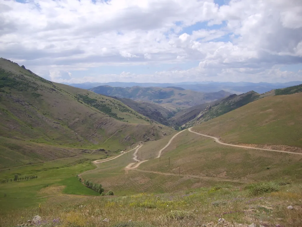
Free Public Access • GPS: 40.5281, 40.2319
History and General Information / Local Legends and Folklore
Soğanlı Pass (D-915 Highway) is a legendary mountain pass that connects the Eastern Black Sea Mountains to the Çoruh Basin, registered as the "World's Most Dangerous Road" by international automobile and adventure platforms, with its steep cliffs and 13 sharp hairpin bends (Derebaşı Curves). In these mountains, where Turkish soldiers heroically resisted the Russian occupation during the Caucasus Front of World War I in 1916, thousands of sons of the country marched to martyrdom under freezing blizzards and bullets. The Soğanlı Martyrs Monument, rising at the top of the mountain, is the immortal symbol of this holy resistance. In local legends, it is said that the silhouettes of martyred soldiers on duty at night in the Soğanlı mountains under the fog are seen and the mountain flowers are painted red with the blood of the martyrs.
Geographical Structure, Altitude and Natural Features
The summit pass point is located at an altitude of approximately 2,330 meters. Overlooking the lush foggy valleys of the Black Sea on one side and the steppe plateaus of Çoruh on the other side, the Soğanlı Mountains are covered with rich alpine mountain meadows, rhododendrons, ice-cold glacial springs and seas of fog.
Visiting Hours, Days and Entrance Fees
- Entrance Fee: Visiting the parade route and the Martyrs' Monument is completely free.
- Visiting Hours and Days: Open 24 hours a day during summer months. The passage may be closed to transportation during the winter months (November-May) due to heavy snow and blizzards.
- Rules, Safety and Stroller/Disabled Access: The walkway is quite narrow, has no guardrails and has steep cliffs; drivers must drive slowly and with high caution; Headlights should be kept on in foggy weather. Respect and tranquility should be maintained around the martyrdom monument.
- Facilities and Facilities: There is a martyrs' monument, information signs and a summit observation terrace.
Transportation, Public Transit Routes and Exact Location
- Address / Open Location: Soğanlı Mountains Summit, D-915 Road, Aydıntepe / Bayburt.
- Road Condition and Vehicle Availability: It is approximately 22 km away from Aydıntepe district center. The road up to the summit is a stabilized and winding mountain road; high floor vehicle or 4x4 vehicles are recommended.
- Real Public Transportation Information: There is no direct public transportation to the pass, but it is reached by private vehicles or plateau tours.
- Parking Availability: There is a free car parking area next to the martyrdom monument.
Contextual Experience Tips, Photography and Local Gastronomy
- Spiritual Visit and Prayer Etiquette: It is recommended to recite the Fatiha and pay homage to the souls of our Mehmetçik who died by freezing and fighting in the defense of the homeland.
- Best Photo Spots and Frames: Dramatic mountain panoramas from the summit with a sea of clouds and 13 sharp mountain bends.
- Local Gastronomy Recommendations: Mountain thyme tea brewed at the summit and kete with plateau cheese.
Explore Full 5-Section Guide & Map for Soğanlı Passage and Martyrs' Monument →
4. Dumlu Plateau and Nature Walking Track
Free Public Access • GPS: 40.4543, 40.1233
History and General Information / Local Legends and Folklore
Dumlu Plateau, with an altitude exceeding 2,300 meters at the peaks of the Soğanlı Mountains, north of Aydıntepe, is a natural wonder where the authentic Eastern Black Sea and Bayburt transhumance culture has been kept intact for centuries. The plateau is known for its location adjacent to the famous Derebaşı Bends. Local narrations say that in the past, caravanners used to take a breather in the icy Dumlu springs, and that the local tribes met on this plateau and organized festivals during the summer months.
Geographical Structure, Altitude and Natural Features
Its average altitude is 2,320 meters. It has a fascinating natural environment with rich alpine meadows, colorful highland flowers, clear cold water springs and a sea of fog that frequently descends into the valley.
Visiting Hours, Days and Entrance Fees
- Entrance Fee: Free.
- Visiting Hours and Days: Open 24 hours (plateau season between June and October).
- Rules, Safety and Stroller/Disabled Access: It is a high altitude mountain plateau; You should have a windbreaker and warm clothes to protect against sudden fog and cold weather.
- Facilities and Facilities: It is a natural plateau settlement; There are plateau fountains and traditional plateau houses.
Transportation, Public Transit Routes and Exact Location
- Address / Open Location: Dumlu Village Plateau, Aydıntepe / Bayburt.
- Road Condition and Vehicle Availability: It is 16 km away from the center of Aydıntepe; It can be easily reached in summer by passenger cars and high vehicles via the stabilized mountain road.
- Real Public Transportation Information: It can be reached by minibuses departing from Aydıntepe center during the plateau season.
- Parking Availability: There is ample free parking on the plateau plains.
Contextual Experience Tips, Photography and Local Gastronomy
- Best Time: Walking in the first light of the morning over the sea of fog that settles in the valleys.
- Photo: Authentic arrangement of stone and wooden plateau houses on the mountain slopes.
- Local Flavor: Fresh clotted cream, churned butter and highland cheese fermented in the highland camps.
Explore Full 5-Section Guide & Map for Dumlu Plateau and Nature Walking Track →
5. Derebaşı Bends (Soğanlı) Adventure and Viewpoint
Free Public Access • GPS: 40.5524, 40.2484
History and General Information / Local Legends and Folklore
Derebaşı Curves is a legendary engineering and courage route that climbs into the sky with 13 sharp 'U' bends on the steep slopes of the Soğanlı Mountains, known as the 'World's Most Dangerous and Challenging Mountain Road' by international automobile and adventure platforms. The historical road, built in 1914 during the Ottoman-Russian War, is the steepest pass between the Black Sea coast and Bayburt plateaus. The cliffside viewing point hosts adventure enthusiasts, motor athletes and photographers from all over the world with its view that makes you feel like traveling above the clouds.
Geographical Structure, Altitude and Natural Features
It stretches along steep rock cliffs, starting from 1,800 meters above sea level and climbing up to 2,450 meters. The depth of the canyon is breathtaking with its wild topography, where the Black Sea forests and the alpine mountain range intersect.
Visiting Hours, Days and Entrance Fees
- Entrance Fee: Free.
- Visiting Hours and Days: It is recommended to visit during daylight hours in summer and autumn (the passage may be closed due to snow and avalanches in winter).
- Rules, Safety and Baby Stroller/Disabled Access: Since there are no guardrails on the edges of the cliff, utmost care should be taken and drive slowly in foggy weather. Children should be controlled in the vehicle or by holding them by hand.
- Facilities and Facilities: It is a natural adventure route; There are rest areas around the Soğanlı Martyrs' Monument.
Transportation, Public Transit Routes and Exact Location
- Address / Open Location: Soğanlı Geçidi, Derebaşı Mevkii, Aydıntepe / Bayburt (Trabzon Çaykara border).
- Road Conditions and Vehicle Availability: It is 25 km away from the center of Aydıntepe; It is a stabilized mountain road, 4x4 or careful passenger vehicle driving is recommended.
- Real Public Transportation Information: Transportation by private vehicle or safari tours is recommended.
- Parking Availability: There are safe car parking areas in the observation terrace pockets.
Contextual Experience Tips, Photography and Local Gastronomy
- Drone Shot: Drone and wide-angle shots showing the 13 bends winding on the steep mountainside from a bird's eye view are world-famous.
- Landscape: Sunrise and sunset views over the sea of fog with clouds beneath you.
- Recommendation: Soğanlı Martyrdom should be visited and the heroes who fell martyrs in defense of the homeland should be commemorated.
Explore Full 5-Section Guide & Map for Derebaşı Bends (Soğanlı) Adventure and Viewpoint →
6. Kopuz Village Historical Rock Chapel and Settlement
Free Public Access • GPS: 40.3885, 40.1508
History and General Information / Local Legends and Folklore
Kopuz Village Historical Rock Chapel and Settlement is a mysterious atomic temple and shelter area carved into the steep tuff rocks of Kopuz Village in Aydıntepe district of Bayburt during the Early Christian and Medieval Byzantine periods. The settlement built by the first Christian communities escaping from Roman oppression by taking shelter in safe mountain valleys; It consists of rock chapels, monk cells, water cisterns and vaulted rock rooms. In village legends, the existence of secret corridors extending from under these steep rocks to Aydıntepe Underground City has been whispered from generation to generation, and it is rumored that the sun hitting the rocks points to the hidden treasures on the mountain.
Geographical Structure, Altitude and Natural Features
It is located at an altitude of approximately 1,720 meters, on steep rocky slopes overlooking the Kopuz Village valley. Volcanic tuff layers on the southern slopes of the Black Sea mountains present a geological structure that can be easily carved with hand tools. Spring waters, oak groves and untouched mountain flora lie around it.
Visiting Hours, Days and Entrance Fees
- Entrance Fee: Visiting the rock chapel and historical ruins is completely free.
- Visiting Hours and Days (Mandatory): Open to visitors 7 days a week during daylight hours; It is recommended to go in spring and summer due to snowfall in winter.
- Rules, Safety and Baby Stroller/Disabled Access: Since it is reached through steep rocks and steep paths, it should be climbed carefully and the niches in the rock walls should not be damaged. Not stroller or disabled chair accessible; Walking shoes are required.
- Facilities and Facilities: There are no commercial facilities in the area where the ruins are located; There is a mosque, fountain and village grocery store in Kopuz village centre.
Transportation, Public Transit Routes and Exact Location
- Address / Open Location: Kopuz Village Kayalık Mevkii, Aydıntepe / Bayburt.
- Road Condition and Vehicle Availability: It is 8 km from Aydıntepe town center and approximately 28 km from Bayburt centre; Most of the village road is asphalt and the last 500 meters is a path walk; Passenger vehicles can go to the village square.
- Actual Public Transportation Information (Mandatory): You can take Aydıntepe district minibuses from Bayburt Center; You can reach the village by shuttle vehicles or local taxis from Aydıntepe.
- Parking Availability: Vehicles can be parked safely and free of charge in Kopuz Village square.
Contextual Experience Tips, Photography and Local Gastronomy
- Best Photography Points and Frames: Frames overlooking the panoramic view of the valley from the apse of the rock chapel and the light-shadow play created by the rock windows should be photographed.
- Light and Shooting Hours: The moments when the sun hits the rocks in the early morning hours reveal the handcraft marks on the rock surfaces most clearly.
- Local Gastronomy Recommendations: On your return from Aydıntepe, you should try the local stuffed kale, ziron, galacoş and delicious yayla butter.
Explore Full 5-Section Guide & Map for Kopuz Village Historical Rock Chapel and Settlement →
Practical Travel & Transit Planning for Aydıntepe, Bayburt (2026)
| Planning Category | Verified Local Information |
|---|---|
| Region & Administrative Center | Aydıntepe, Bayburt, Türkiye |
| Best Time to Visit | Spring (April–June) and Autumn (September–November) for ideal sightseeing weather; Summer for highlands and coastal routes. |
| Public Transit & Highway Access | Regular municipal buses and local minibus cooperatives (Dolmuş) depart daily from the Bayburt Intercity Bus Terminal (Otogar) directly to Aydıntepe. |
| Recommended Stay | 1 to 2 full days to explore the main historical landmarks, nature trails, and local culinary stops. |
Frequently Asked Questions About Visiting Aydıntepe, Bayburt
What are the must-see places to visit in Aydıntepe, Bayburt?
The top verified attractions in Aydıntepe, Bayburt include Aydıntepe Underground City, Aydıntepe Plateau and Pond, Soğanlı Passage and Martyrs' Monument, Dumlu Plateau and Nature Walking Track, Derebaşı Bends (Soğanlı) Adventure and Viewpoint. Each location offers documented historical or natural heritage with clear road access.
How can I get to Aydıntepe, Bayburt by public transport or car?
You can reach Aydıntepe, Bayburt easily by car via Bayburt's main provincial highways, or take regular municipal buses and district minibuses departing throughout the day from the Bayburt central bus terminal (Otogar).
What are the famous local dishes and traditional foods to try in Aydıntepe, Bayburt?
When visiting Aydıntepe, Bayburt and Bayburt, be sure to taste officially registered specialties such as Bayburt Honey, Bayburt Stuffed Curd, Bayburt Kete, Bayburt Sour Cabbage, Bayburt Kavut Soup, prepared by local artisans and traditional restaurants.
Are the attractions in Aydıntepe, Bayburt suitable for families and day trips?
Yes. Most historic monuments, parks, museums, and promenade areas in Aydıntepe, Bayburt are family-friendly and well-suited for both weekend getaways and full-day cultural itineraries.
When is the best season to visit Aydıntepe, Bayburt?
Spring and autumn offer the most comfortable temperatures for walking tours and photography in Aydıntepe, Bayburt, while summer is popular for nature recreation, plateaus, and festivals.